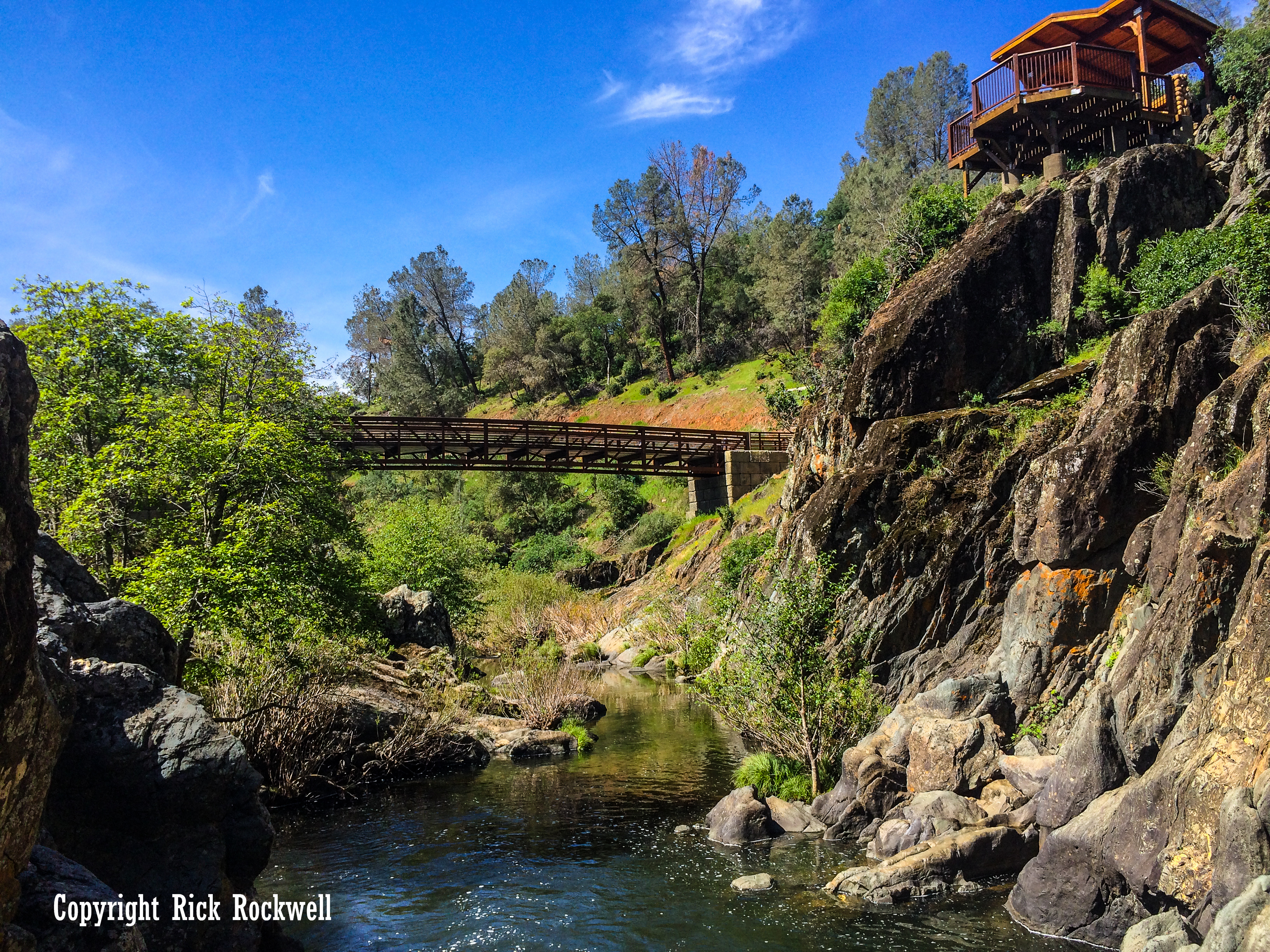
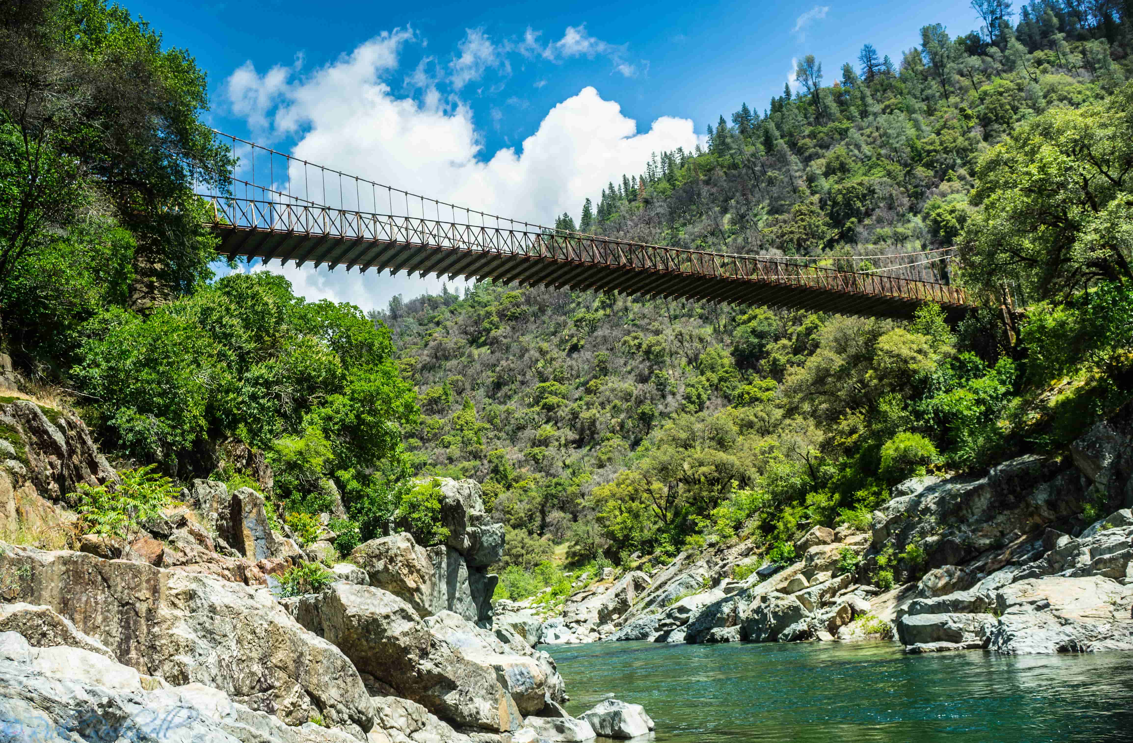
At first glance, Yankee Jims Bridge looks like a quiet backcountry crossing suspended above the North Fork American River. But this narrow bridge in Placer County stands on a route with roots deep in California’s Gold Rush era, when the nearby mining camp of Yankee Jim’s helped turn the surrounding canyon into an important transportation corridor. Built in 1930, the bridge is only one chapter in a much longer story of miners, toll roads, wagon travel, and the struggle to keep this rugged route open.
What makes the bridge especially compelling is that it sits at the overlap of several California histories at once: mining, river travel, rural engineering, wildfire access, and historic preservation. Today, even as a new bridge is being built nearby, the original span is being kept in place because of its historic significance.
Quick Facts About Yankee Jims Bridge
- Location: Yankee Jims Road over the North Fork American River in Placer County, between the Colfax and Foresthill.
- Current bridge built: 1930
- Bridge type: Cable suspension bridge with steel-stiffening truss, corrugated-metal deck, steel towers, and reinforced-concrete abutments.
- Historic status: Determined eligible for the National Register of Historic Places in 1986.
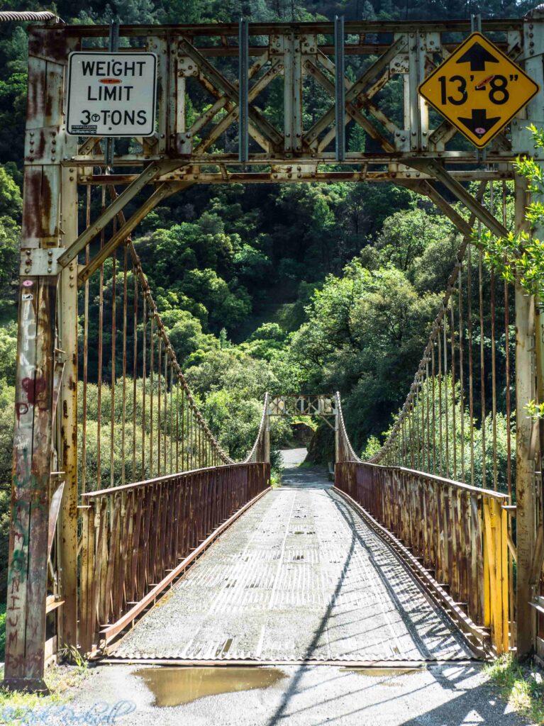
- Load limit: 3 tons, or 6,000 pounds.
- Why it matters: The road dates to the Gold Rush era and once served as a main route for regional activity.
- What is happening now: A new two-lane arch suspension bridge is being built downstream
Where Is Yankee Jims Bridge?
Yankee Jims Bridge stands on Yankee Jims Road, where the road drops into canyon country and crosses the North Fork American River before climbing again toward Foresthill.
Placer County has described Yankee Jims Road as a vital link between the Foresthill community and Interstate 80 near Colfax, as well as an evacuation and emergency access route. The bridge provided a necessary path through this rugged, river terrain. However, modern transportation demands a new bridge be built down river from the current one-lane, historic bridge.
From Sacramento:
- I-80 toward Colfax
- Exit on Canyon Way (Colfax/Grass Valley)
- Turn right onto Canyon Way
- Drive 2.2 miles and turn left onto Yankee Jim Road
- Drive about 5 miles on YJR
Why Yankee Jims Bridge Mattered During the Gold Rush
The bridge takes its name from Yankee Jim’s, an early mining camp that grew rapidly after gold was discovered there by 1850. The town took its name from a character equally as rough as the surrounding terrain – Yankee Jim Robinson.
By 1857, Yankee Jims was one of the most important locations in Placer County. The first mining ditch in the county was constructed there by H. Starr and Eugene Phelps, and that Colonel William McClure introduced hydraulic mining to the area in June 1853.
That background matters because growing mining camps needed strong transportation routes. While Yankee Jims might have started as an isolated dot on a map, the town’s quick success sprung new camps and settlements throughout the Divide.
The crossing at Yankee Jim’s was important not because it was picturesque, but because it helped make the mining district work.
The Early Road, Turnpike, and River Crossings at Yankee Jim’s
Long before the current bridge went up, this route had already entered the era of formal toll roads and canyon travel. An 1859 notice in the Daily Alta California listed the Yankee Jim’s Turnpike Company among Placer County toll road and bridge operators, showing that the route had already become a recognized transportation corridor by the late 1850s.
That is a useful historical detail because it shows the crossing was not just an informal miners’ trail. By the late Gold Rush period, traffic through this country had become organized enough to support turnpike companies and fee-based infrastructure.
In practical terms, that meant the road had real regional value. It connected mining country on the Divide to broader circulation routes and made movement through the canyon more dependable than a seasonal ford or improvised crossing ever could.
Ironically, the town’s success also became its primary reason for declining. Ultimately, the businesses and residents moved to nearby towns like Foresthill after these locations provided easier means for success among the various industries of the times.
Yet, even though the town of Yankee Jims declined, the rest of the Divide kept evolving and still needed a path across the American River towards Colfax and nearby towns. This meant that the Yankee Jims bridge remained useful and valuable to the communities and industries.
The Older Bridge Before the 1930 Yankee Jims Bridge
The current Yankee Jims Bridge was not the first bridge at this crossing. Historical bridge documentation identifies an earlier Howe deck truss toll bridge carrying the Yankee Jims wagon road over the North Fork American River.
That earlier structure dated to 1884 and collapsed in August 1930, leading to the construction of the present bridge.
When Was Yankee Jims Bridge Built?
The existing Yankee Jims Bridge was built by Placer County in 1930. County records and the Caltrans historic bridge inventory both place the bridge’s construction in that year. Caltrans also identifies it as Bridge No. 19C0002 and notes that it is one of the oldest small suspension bridges in its survey population.
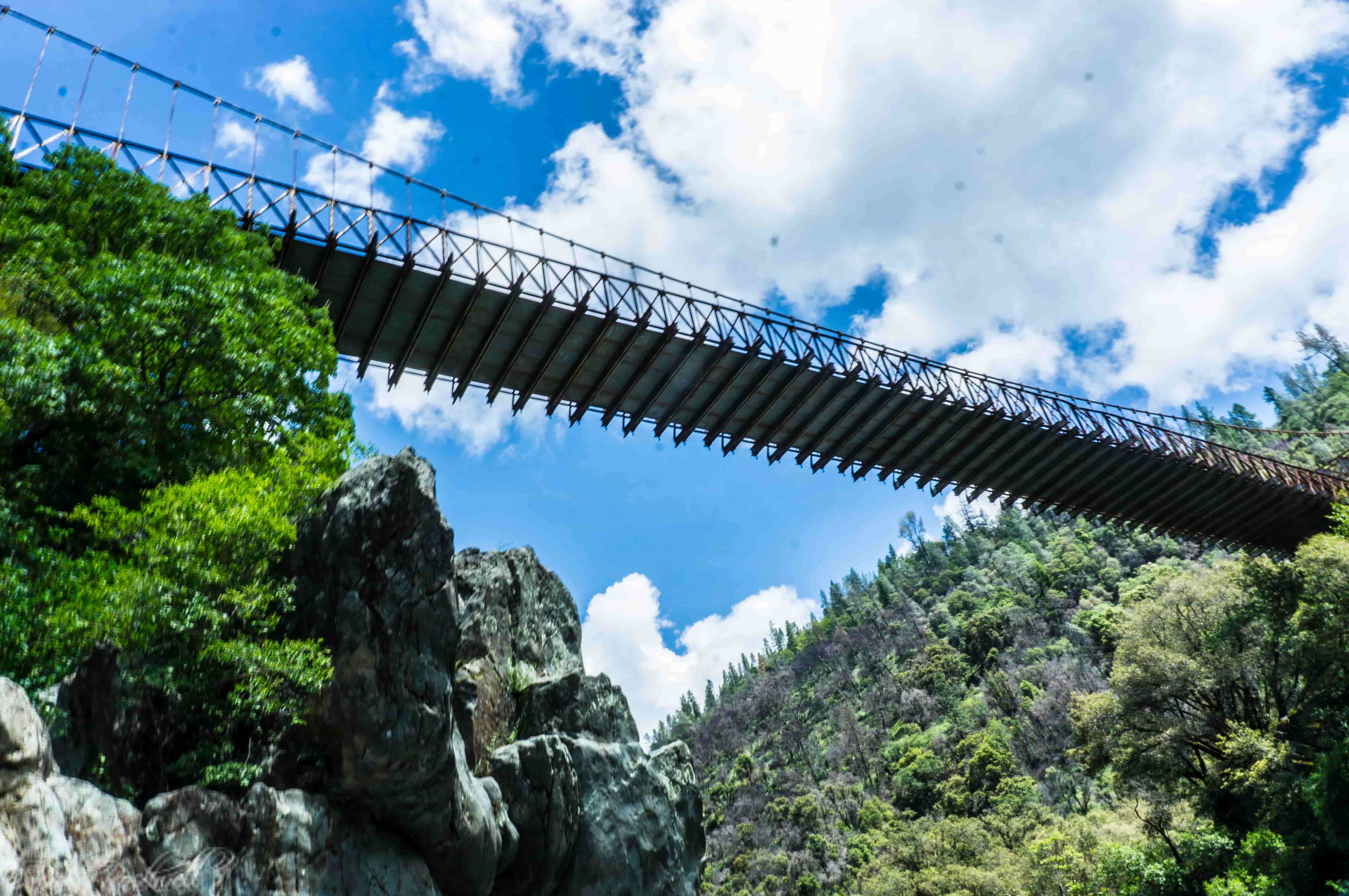
The bridge’s physical design helps explain why it still feels historic. Caltrans describes it as a cable suspension bridge with steel-stiffening truss and a corrugated-metal deck, supported by steel towers on reinforced-concrete abutments.
The deck with is a little more than 11 feet and the longest span of length is 210 feet. The vertical clearance above the deck is just above 13 1/2 feet.
That combination makes it both functional and visually distinctive, especially in a steep canyon setting where the bridge still looks well matched to the landscape it was built to cross.
Why Yankee Jims Bridge Is Historically Significant
Yankee Jims Bridge is historically significant for more than just its age. Caltrans found it eligible for the National Register of Historic Places in 1986, and the 2004 historic bridge inventory update says it retained enough integrity to remain significant within California’s small group of pre-1960 rural suspension bridges.
That matters because not every old bridge gets preserved. Yankee Jims Bridge stands out as both an engineering survivor and a landscape landmark.
Why the Historic Bridge Could Not Meet Modern Safety Needs
As memorable as the bridge is, it was built for a very different era of transportation. Placer County says the historic one-lane bridge has a 3-ton capacity limit and is now considered structurally deficient because it cannot safely accommodate many modern vehicles, especially life-saving emergency equipment.
A 2024 county memorandum says the bridge was deemed “structurally intolerable” and recommended for replacement in the latest Caltrans bridge inspection.
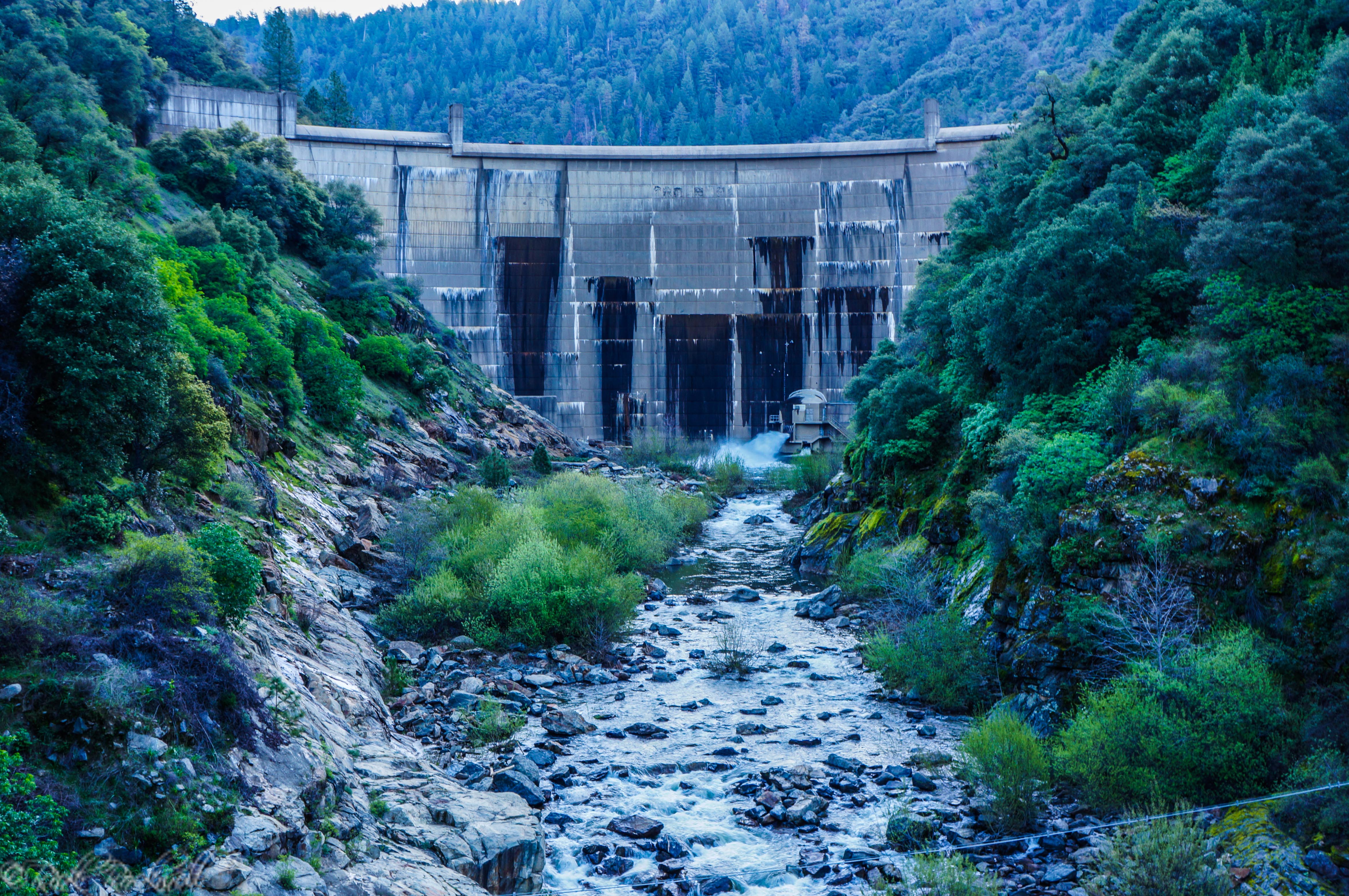
A key turning point came during the 2012 Robbers Fire. County environmental documents stated that fire vehicles deployed from Colfax were unable to cross the bridge to reach the active burn area, delaying emergency response time.
In a wildfire-prone region, that turned an aging infrastructure issue into a public-safety problem. The bridge’s historical value remained clear, but so did the limits of relying on a 1930 one-lane span for modern emergency response.
The New Yankee Jims Bridge Project
Rather than demolish the historic bridge, Placer County approved a plan to build a new two-lane arch suspension bridge downstream while leaving the original in place.
The county certified the project’s final environmental impact report in March 2024, and construction documents approved later that year, described the new span as necessary for emergency access, evacuation, and safer modern travel.
County updates in 2026, indicate that replacement work had ramped up and road closures remained in effect as the project moved forward. The important historical point is that the original bridge is being preserved because of its significance.
Frequently Asked Questions About Yankee Jims Bridge
How old is Yankee Jims Bridge?
The current bridge was built in 1930, which makes it nearly a century old. The route it occupies is older still and dates back to the Gold Rush era.
Why is Yankee Jims Bridge historic?
It is historically significant because it stands on a Gold Rush-era road corridor, represents a rare early rural suspension bridge type, and was determined eligible for the National Register of Historic Places.
Was there another bridge here before the current one?
Yes. Historical documentation identifies at least one earlier bridge – an 1884 Howe deck truss toll bridge at the crossing, which collapsed in August 1930, before the current suspension bridge was built.
Why is a new bridge being built?
The historic bridge has a 3-ton load limit and cannot safely handle many emergency and modern service vehicles. Placer County approved a new bridge downstream to improve safety, emergency access, and evacuation capability.
Is the original Yankee Jims Bridge being torn down?
No. Placer County has said the original bridge will remain in place because of its historic nature, while the new bridge takes over modern traffic.
Is Yankee Jims Bridge connected to the Gold Rush?
Yes. The crossing is tied to the mining settlement of Yankee Jim’s, where gold was discovered by 1850, and the road dates to the Gold Rush era.
Where is Yankee Jims Bridge located?
It is located on Yankee Jims Road over the North Fork American River in Placer County, between Colfax and Foresthill.
Should You Visit Yankee Jims Bridge?
When first hearing of the need for a new bridge, I, like many people, was concerned about the fate of the historic Yankee Jims bridge. So, when the county decided to keep it for future generations to marvel at, I was relieved.
I’ve been to this bridge a number of times and it never ceases to amaze me how it feels like you are crossing back in time. The very first time I saw this bridge, I thought it was something from an Indiana Jones movie.
The bridge itself, captures the essence of the origin of Yankee Jims town and the bandit it was named after. This structure is a must-see point of interest once the Yankee Jims Road is open to traffic again. Just make sure to take your time driving down the YJR as it can be windy and treacherous during inclement weather.
Additionally, locals also enjoy the nearby swimming hole which has been a wonderful reprieve for those lucky enough to swim in it during the hot summer months.
Source Notes for the Article
- California Office of Historic Preservation landmark entry for Yankee Jim’s. https://ohp.parks.ca.gov/ListedResources/Detail/398
- Placer County project and environmental documents for the Yankee Jims Bridge replacement. https://www.placer.ca.gov/9638/Yankee-Jims-EIR-certified
- Caltrans historic bridge inventory update.
https://dot.ca.gov/-/media/dot-media/programs/environmental-analysis/documents/env/truss-suspension-bridges-2004-a11y.pdf)) - Caltrans historical bridge description for Yankee Jim’s Bridge.
dot-ca.contentdm.oclc.org
https://dot-ca.contentdm.oclc.org/digital/collection/p16436coll2/id/338/ - Daily Alta California notice on the Yankee Jim’s Turnpike Company. https://cdnc.ucr.edu/?a=d&d=DAC18591120.2.17