Hiking
Black Hole of Calcutta Falls Guide: Auburn SRA Hike
Black Hole of Calcutta Falls is one of Auburn’s easiest waterfall hikes, but its unique name gives this short trail more character than you might expect. The route starts near the American River Confluence, crosses the historic No Hands Bridge, follows part of the Western States Trail, and leads to a seasonal waterfall hidden in...

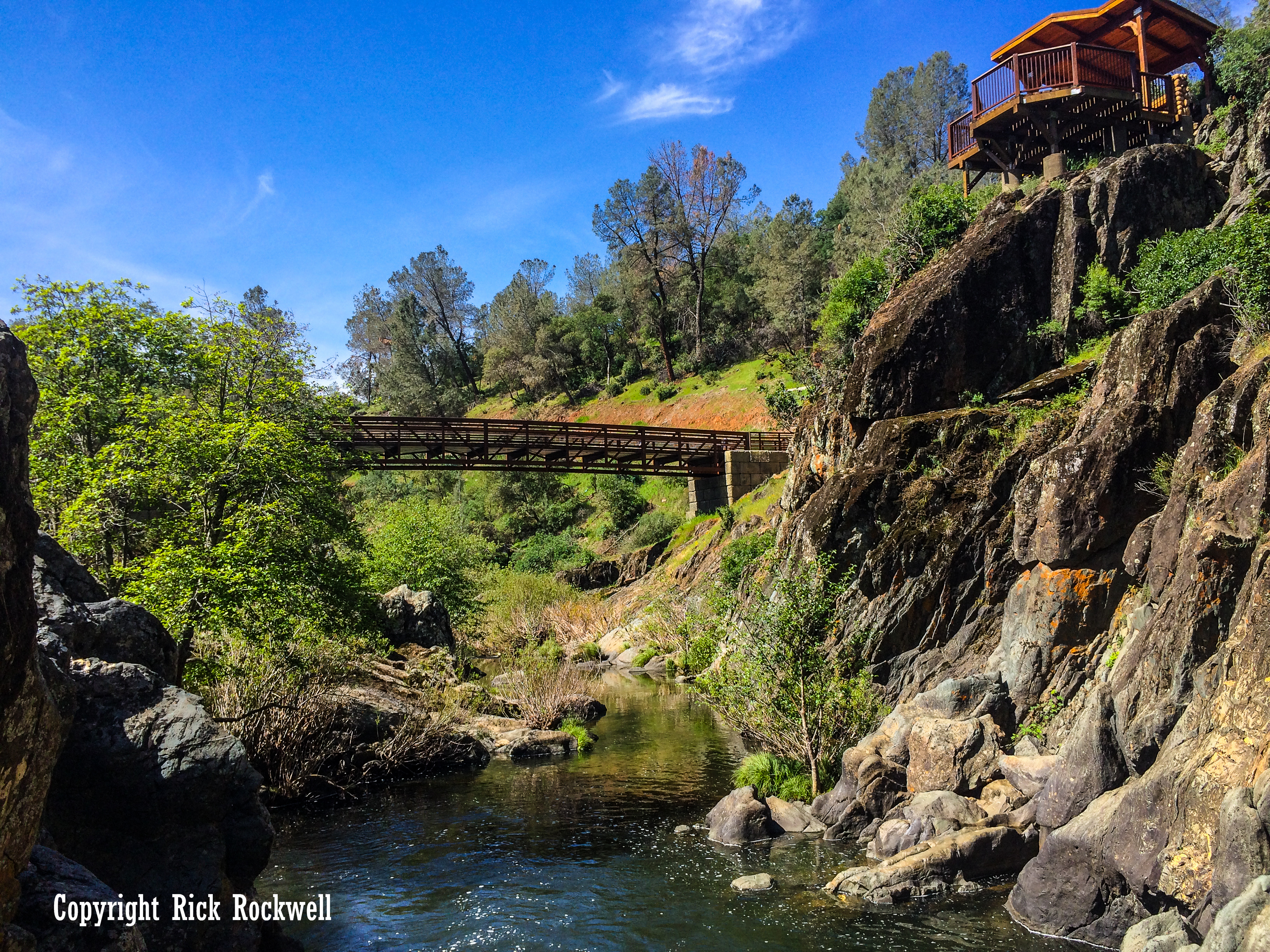
Lake Clementine Trail: A Guide to Auburn’s Best Waterfall Hike
Lake Clementine Trail is one of Placer County’s most rewarding hikes, leading from the North Fork American River canyon to the dramatic spillway of North Fork Dam. Along the way, the route passes beneath the towering Foresthill Bridge, follows a corridor tied to Gold Rush travel, and stops near Clark’s Hole before climbing toward the...

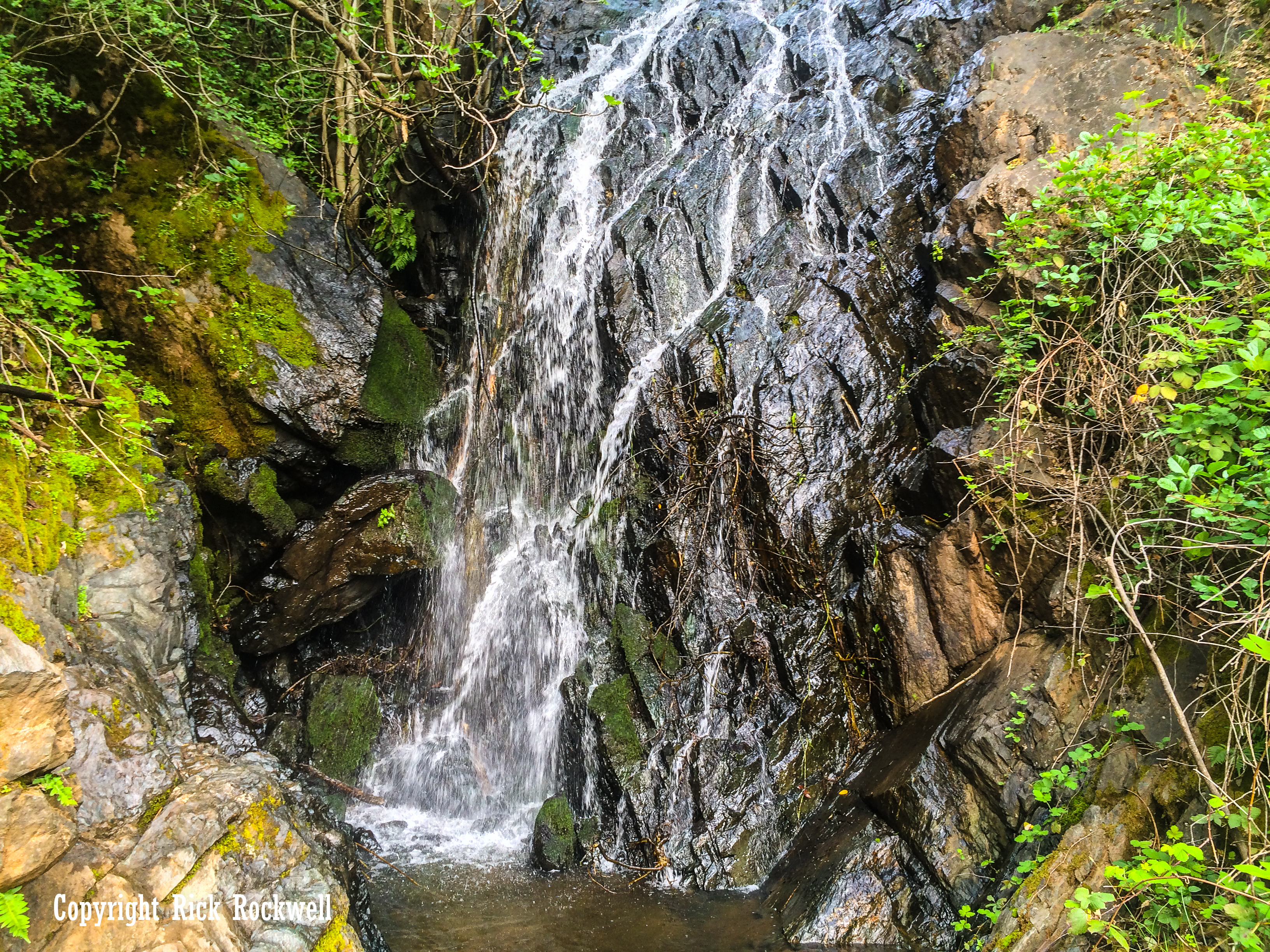
Codfish Falls Trail: Auburn SRA Waterfall Hike
Codfish Falls Trail is one of the easier waterfall hikes in Auburn State Recreation Area, but the drive to the trailhead is what most visitors remember first. The hike follows the North Fork American River before turning up Codfish Creek to a seasonal waterfall, with spring wildflowers, canyon views, river access, and a rough final...
Hidden Falls Regional Park Guide: Trails, Waterfall, Parking, and What to Know Before You Go
If you want a Northern California park that feels both easy to reach and surprisingly wild, Hidden Falls Regional Park is one of the best choices in Placer County. Set in the Auburn foothills, this 1,200-acre park combines rolling oak woodland, creek crossings, broad valley views, and a waterfall that gives the whole place its …...
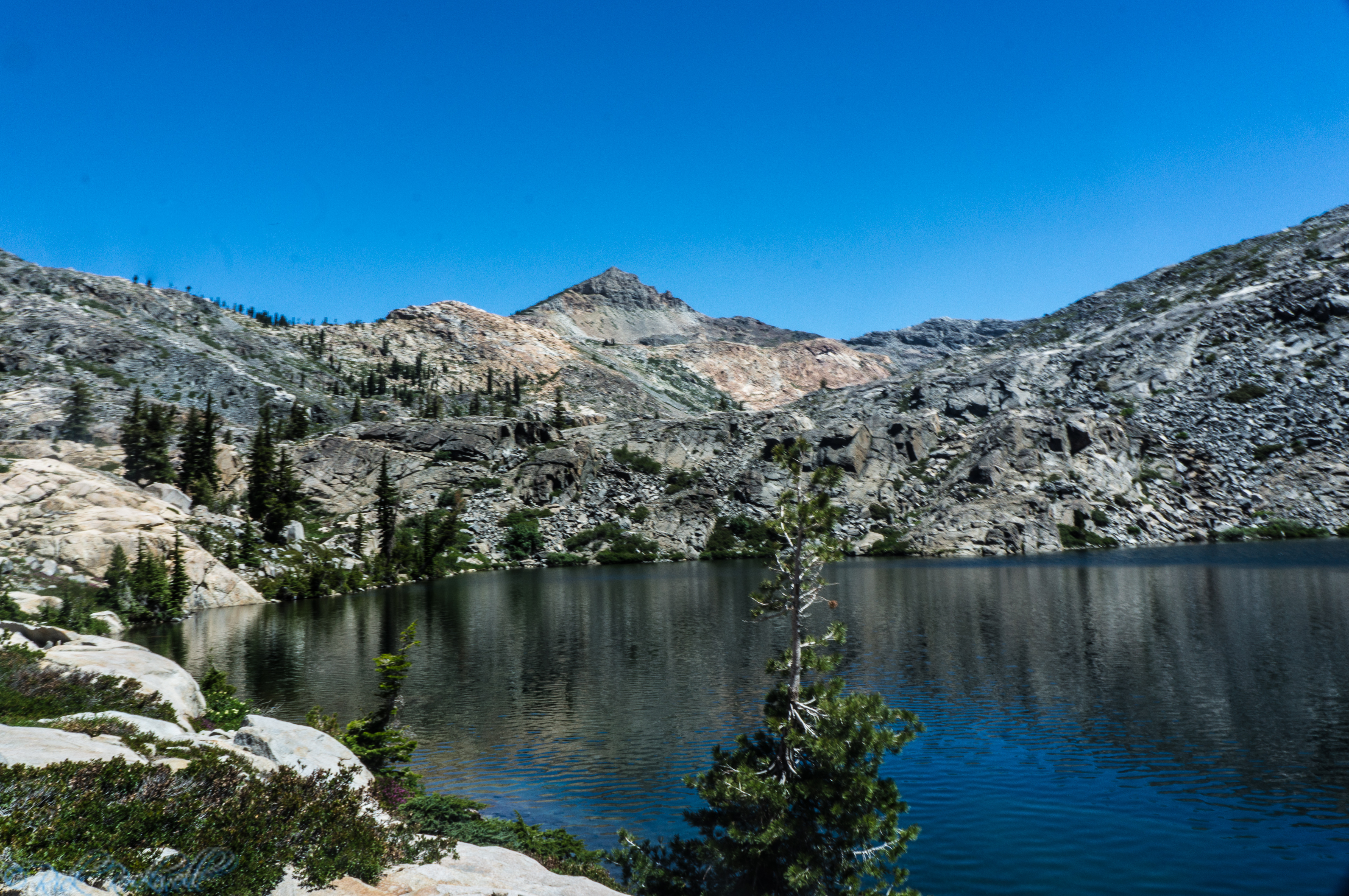
Rockbound Trail Near Wrights Lake: Guide to the Trailhead, Hikes, Fees, Permits, and What to Expect
Rockbound Trail is one of the more challenging Desolation Wilderness routes in the Crystal Basin as it gives hikers direct access to some of the deeper, more rugged scenery and destinations. Located near Wrights Lake, the trail begins at Rockbound Trailhead which offers basic amenities. While there is a quick trail option to Beauty...
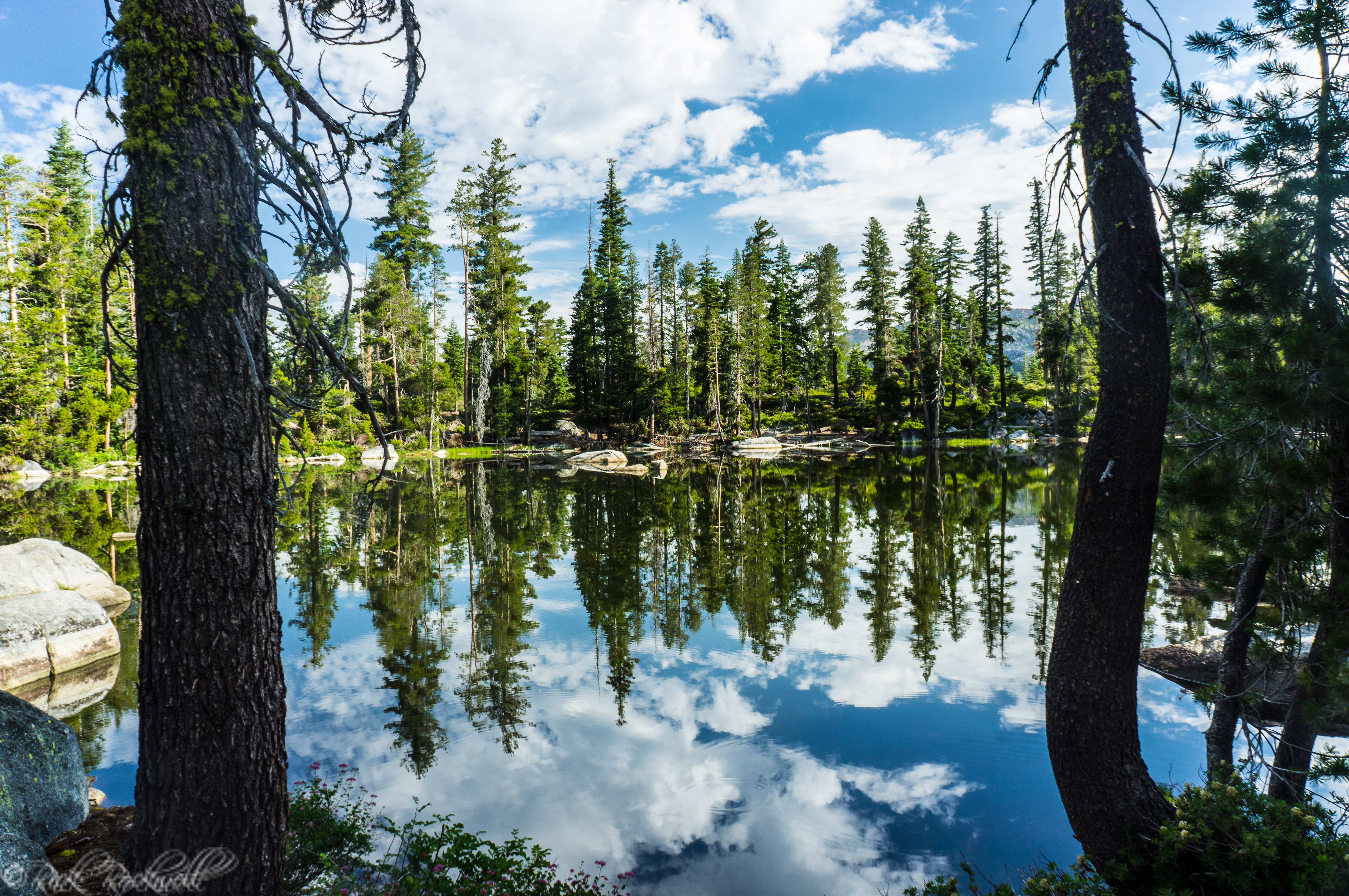
Twin Lakes Trail Near Wrights Lake: Complete Hiking Guide, Fees, Permits, and What to Expect
Twin Lakes Trail is one of the most popular trailheads in the entire Crystal Basin. Located near Wrights Lake, this trail gives hikers a straightforward path to reaching alpine lakes, granite landscapes, and Desolation Wilderness without starting from one of the busier Tahoe access points. Starting at the Twin Lakes Trailhead, this trail...
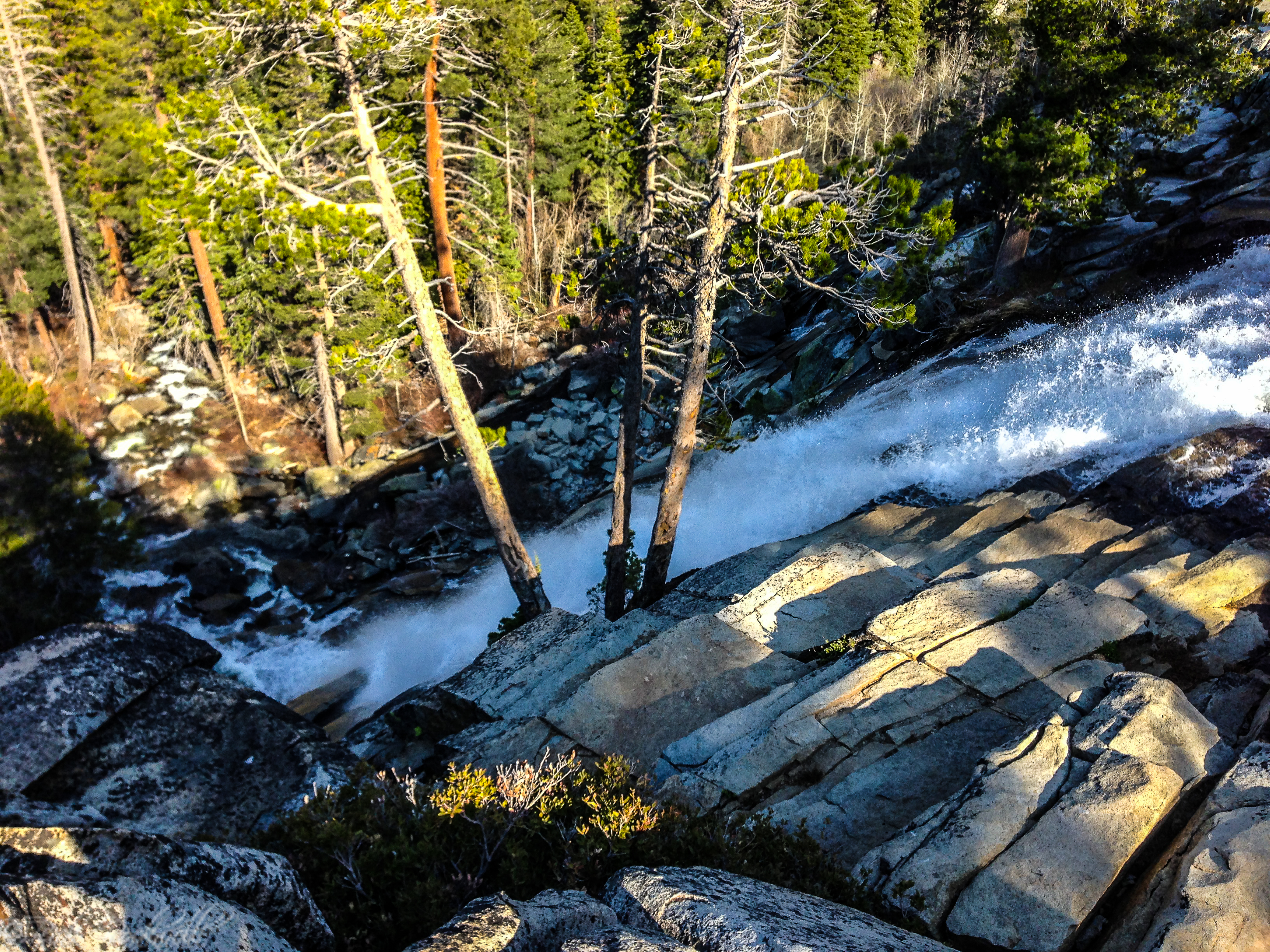
Cascade Falls in Lake Tahoe: What to Know Before You Go
If you are looking for one of the best short hikes in Lake Tahoe, Cascade Falls Trail belongs near the top of the list. In fact, this hike rivals Eagle Falls Trail as a short distance trek to a fantastic payoff. Cascade Falls Trail feels accessible enough for casual visitors but scenic enough to …...
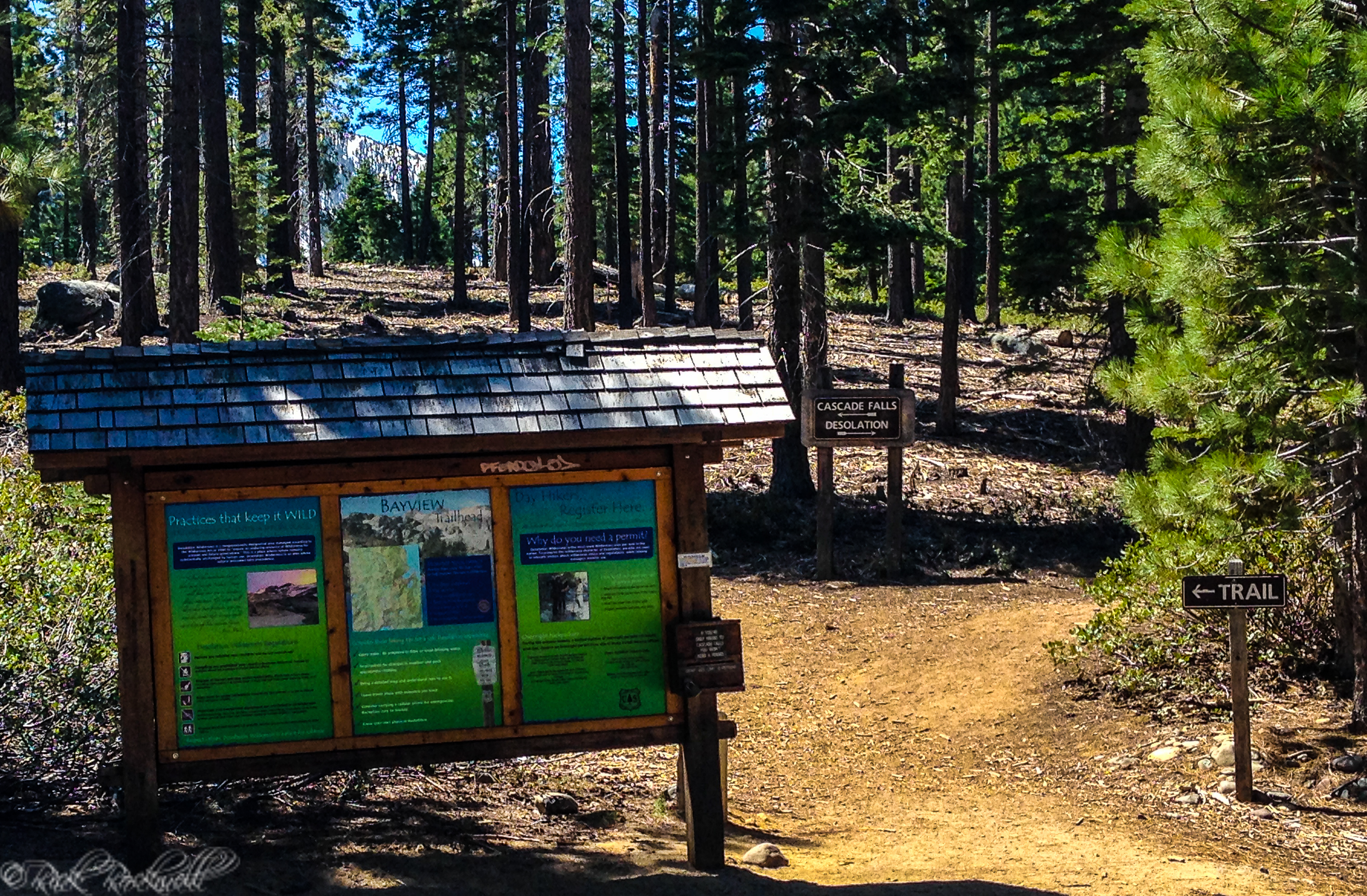
Bayview Trailhead in Lake Tahoe: Parking, Permits, and What to Know Before You Go
Bayview Trailhead is one of those Tahoe access points that does a lot of work. For many visitors, it is simply where the Cascade Falls hike begins. But Bayview is more than that. It is also a practical jumping-off point for day hikes, Desolation Wilderness access, and some of the best high-scenery terrain near Emerald Bay. If …...
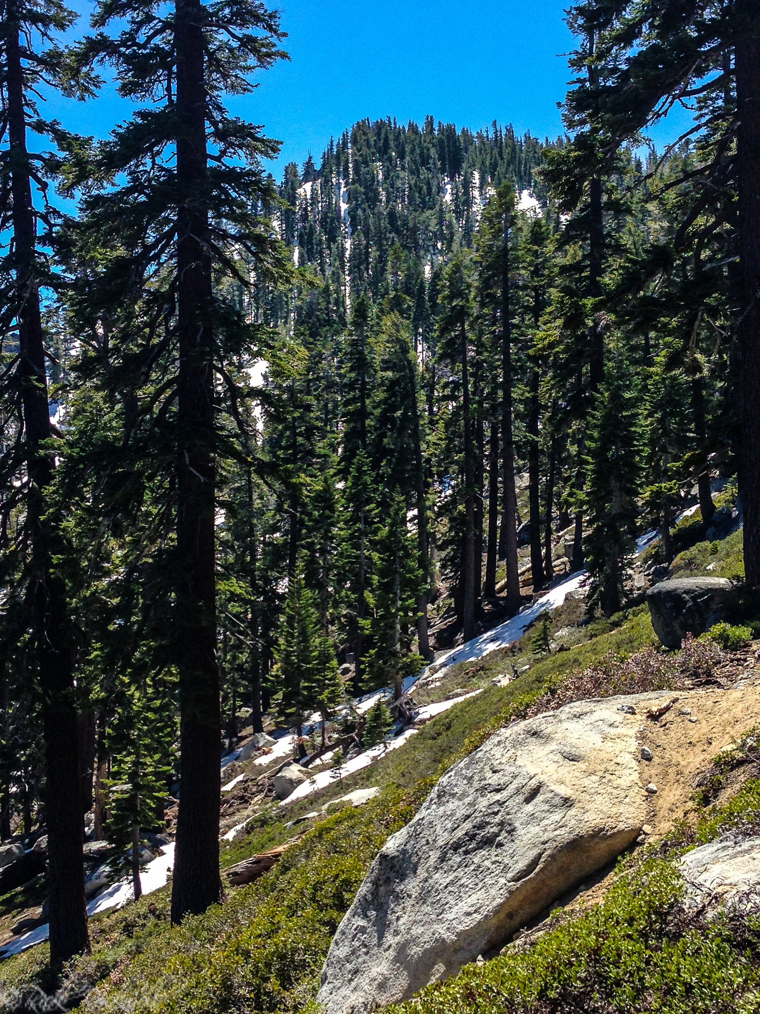
Maggie’s Peaks Hike in Lake Tahoe: What to Know Before You Go
If there is one hike near Emerald Bay that makes you feel like you earned the view, it is Maggie’s Peaks. This is not the quick, easy payoff of Cascade Falls, which begins at the same starting point – Bayview Trailhead. It is a steeper climb that pulls you up through granite terrain to one …...
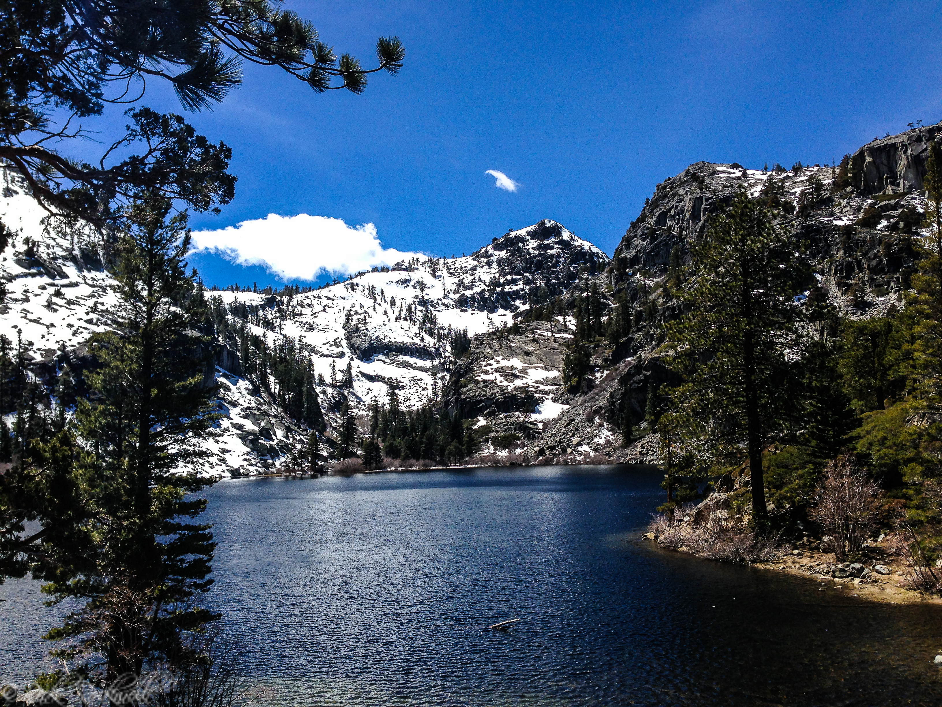
Eagle Falls Trail to Eagle Lake and Beyond: Hiking Guide Near Emerald Bay
Eagle Falls Trail is one of the most popular hikes in the Lake Tahoe area, but it is also one of the most misunderstood. Many visitors know it as the trail to Eagle Lake, and that short alpine hike is easily the route’s biggest draw. But the trailhead is more than just the start of …...
