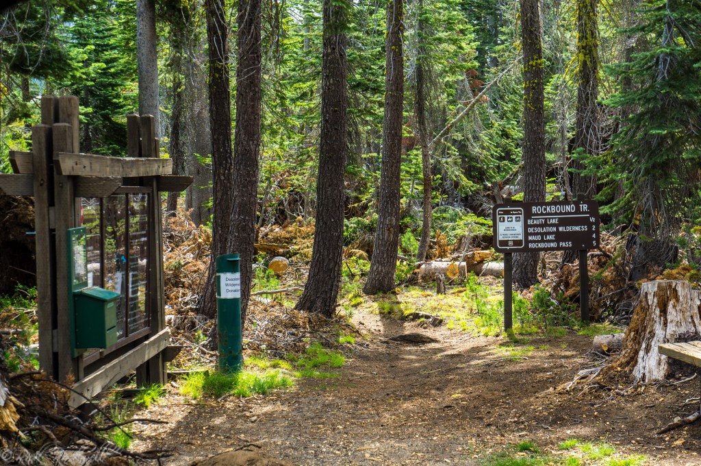
Rockbound Trail is one of the more challenging Desolation Wilderness routes in the Crystal Basin as it gives hikers direct access to some of the deeper, more rugged scenery and destinations. Located near Wrights Lake, the trail begins at Rockbound Trailhead which offers basic amenities.
While there is a quick trail option to Beauty Lake, the payoffs for this trail come at four miles and beyond. In fact, it heads out 10 miles to the furthest official destination in Camper Flat.
With that in mind, the Rockbound Trail is a great option for serious hikers with good physical conditioning and who love to backpack or camp out in Desolation Wilderness.
Rockbound Trail Quick Facts
- Location: Wrights Lake area, Eldorado National Forest
- Primary use: Access to Desolation Wilderness
- Trailhead: Rockbound Trailhead
- Parking fee: $10 per vehicle per day
- Permits: Day-use permit required
- Restrooms: Vault toilets at the trailhead
- Best season: Summer into early fall, depending on snow and road access
Where Is Rockbound Trail?
Rockbound Trail begins at Rockbound Trailhead in the Wrights Lake area of Eldorado National Forest. The Forest Service places the trailhead about 39 miles east of Placerville on Highway 50, then 24 miles north on Wrights Lake Road.
Why Rockbound Trail Stands Out
What makes Rockbound Trail different from many other Desolation Wilderness routes is how clearly it works in levels. The first level is a relatively quick payoff with Beauty Lake, which is just 0.5 miles one way from the trailhead.
After that, the trail steadily becomes more strenuous, reaching Gertrude and Tyler Lakes at 4.2 miles, Maude Lake at 4.7 miles, and Rockbound Pass at 6.4 miles, before continuing even farther to Doris Lake, Lake Lois, Lake Schmidell, and Camper Flat.
That steady progression makes Rockbound a trail to choose your own distance and difficulty. You can use it for a short lake hike, a moderate alpine day hike, a fishing trip, or a longer overnight trip into the western side of Desolation Wilderness.

Rockbound Trailhead: Amenities, Fees, and Rules
Rockbound Trailhead is where this trail begins. It’s a simple, yet functional trailhead with decent parking, vaulted toilets, and Desolation permits.
There is a $10 fee per vehicle for day-use. Overnight permits must be registered ahead of time. However, the overnight wilderness permits will qualify you for a waiver of the day-use fee.
If you want more amenities like picnic tables, grills and more toilets then head over to Wrights Lake Campground.
Permits: Do You Need One at Rockbound?
Yes. For Desolation Wilderness, permits are required regardless if it’s a day trip or an overnight camping excursion.
For day hikers, users can obtain a free day-use permit at the trailhead. Overnight trips require an overnight-wilderness permit which you can find online or at the Placerville Ranger Station. There will be a fee for this permit. Also, there’s a quota for overnight permits. So, make sure they’re available before making official plans.
Rules and Restrictions to Know Before You Go
Rockbound Trail is a true wilderness trail, and no mechanical, wheeled or motorized machines are allowed on the trail. That means you can travel along this trail only on horseback or foot. Campfires are not allowed in Desolation Wilderness.
Rockbound Trail Destinations and Distances
Rockbound Trail is the type of hike where the payoff comes on the backend more so than in the beginning. Hikers tend to use this trail for the long-distance destinations:
Destination | Miles (one way) | Difficulty |
Beauty Lake | 0.5 | Easy |
Gertrude and Tyler Lakes | 4.2 | Moderate/Difficult |
Maude Lake | 4.7 | Moderate |
Rockbound Pass | 6.4 | Moderate/Difficult |
Doris Lake | 6.6 | Moderate/Difficult |
Lake Lois | 7.6 | Moderate/Difficult |
Lake Schmidell | 8.4 | Moderate/Difficult |
Camper Flat | 10.2 | Moderate/Difficult |
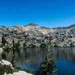
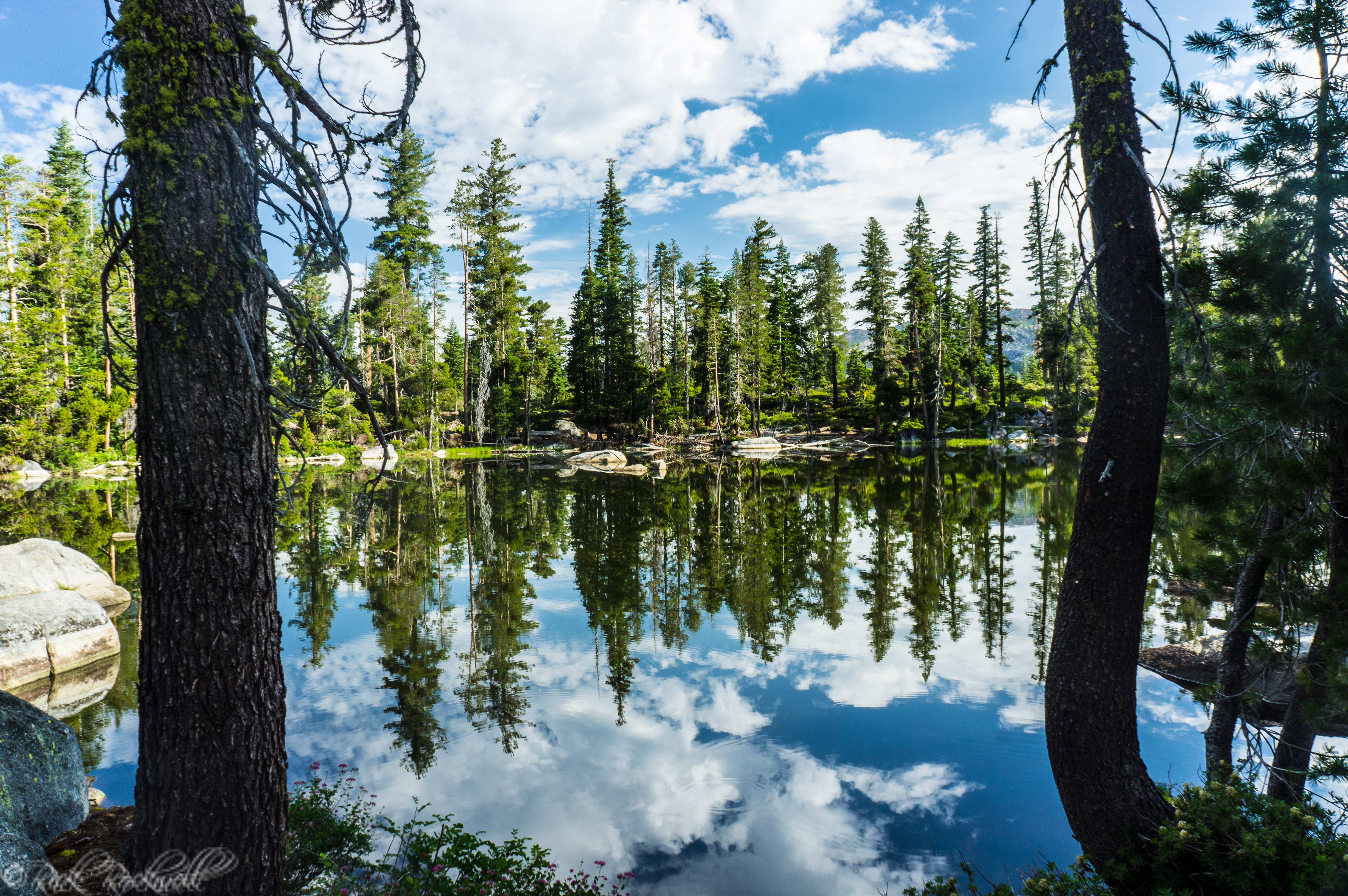
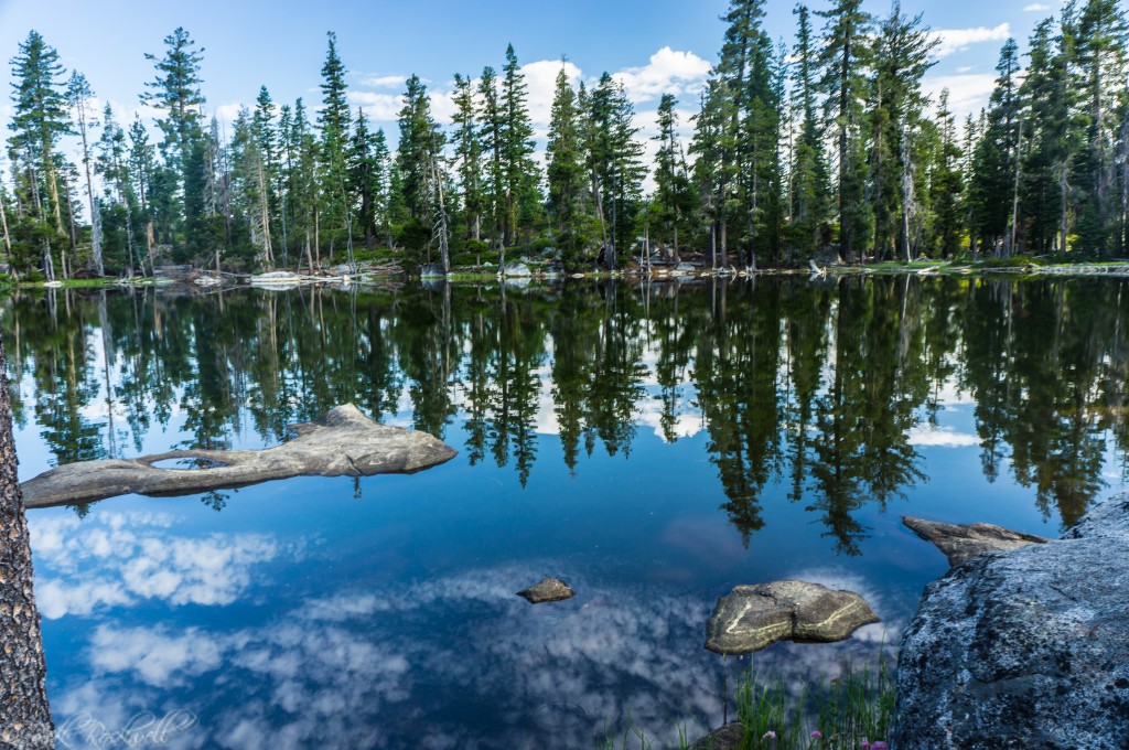
Beauty Lake
Beauty Lake is the quickest destination at just 0.5 miles one way. It’s a very easy stroll to a nice-looking lake. It’s the only short-payoff option on this trail.
Gertrude and Tyler Lakes
Gertrude and Tyler Lakes sit 4.2 miles one way from the trailhead and are rated moderate-to-difficult. These lakes are a good option for hikers who want a real alpine day without pushing all the way to Rockbound Pass or beyond.
Maude Lake
Maude Lake is 4.7 miles one way from Rockbound Trailhead and is officially rated moderate. It stands out as one of the more approachable mid-range objectives on this trail for hikers who want a more substantial outing.
Rockbound Pass
Rockbound Pass is 6.4 miles one way and rated moderate-to-difficult, making it one of the major milestones on the route. This is the point where the trail starts to feel much more like a serious Desolation Wilderness journey than a simple day hike from Wrights Lake.
Doris Lake
Doris Lake sits 6.6 miles one way and shares the same moderate-to-difficult rating. For many hikers, Doris is the kind of destination that turns Rockbound into an all-day alpine mission or a backpacking trip rather than a casual lake hike.
Lake Lois
Lake Lois is 7.6 miles one way from Rockbound Trailhead and is also rated moderately difficult. At this point, the trail is clearly rewarding stronger hikers and backpackers.
Lake Schmidell
Lake Schmidell is 8.4 miles one way, again with a moderate-to-difficult rating. It is one of the farther official destinations on the trail and better suited to hikers treating Rockbound as a deep backcountry route.
Camper Flat
Camper Flat is the farthest official destination listed from Rockbound Trailhead at 10.2 miles one way, with a difficult rating. This is often treated as an overnight, wilderness trip.
Things to Do Near Rockbound Trailhead in Crystal Basin
Rockbound Trail is one of the more challenging hiking options for the Crystal Basin. However, it can be a wonderful option to add with one of these nearby attractions for an adventurous Crystal Basin trip:
- Wrights Lake — Wrights Lake is the clear-cut choice for an add-on to this trail. It makes for a great starting point before a longer hike.
- Bassi Falls — Bassi Falls is the best waterfall of the Crystal Basin and provides a wonderful addition to any adventure in this region especially at peak flow.
- Union Valley Reservoir — Union Valley Reservoir is the biggest Crystal Basin lake and the ideal choice for a summer weekend with the wide range of recreation options.
- Ice House Reservoir — Ice House Reservoir a nice mid-size reservoir that offers similar activities to Union Valley but without the larger crowds.
- Loon Lake — Loon Lake stands out from the rest of the reservoirs due to its rugged scenery, off-road adventures and wilderness gateway. It would pair well with Rockbound as a weekend of Desolation Wilderness.
- Gerle Creek Reservoir — Gerle Creek Reservoir is similar to Wrights Lake with the smaller camping options and calm waters. Both prohibit motorized vehicles on the water and give Crystal Basin visitors wonderful options for peaceful experiences.
- Robbs Hut — Robbs Hut is a backcountry shelter that symbolizes a deeper history and a fun place to stay the night.
- Jones Place — Jones Place is another example of the Basin’s pioneer days with a nod to the old-ways and settlements.
How Rockbound Trail Compares to Twin Lakes Trail
Rockbound Trail is the more challenging adventure compared to Twin Lakes Trail. While both options have trailheads that charge a $10 day-use fee, Rockbound’s appeal is the deeper wilderness destinations and payoffs.
Twin Lakes offers more early and mid-distance destinations. Additionally, there are two paths on Twin Lakes Trail which provides more versatility.
Rockbound’s versatility is the long-distance options as hikers can decide how far they really want to adventure. It’s also more suitable for overnight trips than Twin Lakes Trail is.
Is Rockbound Trail Good for Families or Casual Hikers?
If the goal is Beauty Lake, then yes. It’s only a one-mile round trip hike and a very easy destination to reach. However, anything beyond Beauty Lake requires hikers with more long-distance and wilderness experience. Additionally, physical fitness is a must for these deep destinations. And, this means that Rockbound Trail is not ideal for families or casual hikers.
Is Rockbound Trail Worth Visiting?
Yes, especially if you want one of the best wilderness routes in the Crystal Basin. I have yet to make it all the way to Rockbound Pass and beyond. But is on my bucket list. With that said, Beauty Lake definitely earns its name as it’s a great place for photos, relaxation and a picnic.
Beyond this point, it’s best that you have Desolation Wilderness experience and are fit enough to hike long distances as the Rockbound Trail will test your level of conditioning.
If you are a serious hiker or backpacker, this trail is perfect for you.

Rockbound Trail and Trailhead FAQ
Where is Rockbound Trailhead?
Rockbound Trailhead is in the Wrights Lake area of Eldorado National Forest..
Is there a parking fee at Rockbound Trailhead?
Yes. Rockbound Trailhead charges $10 per vehicle per day for parking.
Do you need a permit for Rockbound Trail?
Yes. Day hikers need a free day-use permit when permit boxes are installed, and overnight users need a Desolation Wilderness overnight permit year-round.
What is the easiest destination from Rockbound Trailhead?
Beauty Lake is the easiest official destination from Rockbound Trailhead at 0.5 miles one way.
How far is Rockbound Pass from the trailhead?
Rockbound Pass is 6.4 miles one way from Rockbound Trailhead and is rated moderate/difficult by the Forest Service.
Is Rockbound Trail harder than Twin Lakes Trail?
Generally, yes. Twin Lakes Trail offers several closer lake options in the 2 to 3.5 mile range, while Rockbound’s more notable wilderness destinations tend to start farther out.
What is the best time of year to hike Rockbound Trail?
Summer into early fall is the most dependable and enjoyable time.
Sources
U.S. Forest Service, Rockbound Trailhead: https://www.fs.usda.gov/r05/eldorado/recreation/rockbound-trailhead
U.S. Forest Service, Desolation Wilderness Trails & Trailheads: https://www.fs.usda.gov/r05/eldorado/wilderness/desolation-wilderness-trails-trailheads
U.S. Forest Service, Desolation Day Use Permits & Parking: https://www.fs.usda.gov/r05/eldorado/wilderness/desolation-day-use-permits-parking
U.S. Forest Service, Desolation Wilderness map / zones: https://www.fs.usda.gov/media/238604
U.S. Forest Service, Wrights Lake Area: https://www.fs.usda.gov/r05/eldorado/recreation/wrights-lake-area
U.S. Forest Service, Fishing – Eldorado National Forest: https://www.fs.usda.gov/r05/eldorado/recreation/opportunities/fishing
Recreation.gov, Desolation Wilderness Permit: https://www.recreation.gov/permits/233261