Best Stops Along Iowa Hill Road
Iowa Hill Road provides drivers with plenty of stops along the way. The following is a list of interesting, scenic, or historic stops on this road:
Pennyweight Falls
Pennyweight Falls is one of the first memorable stops along Iowa Hill Road when driving from Colfax. It is a short waterfall adventure tucked into the canyon country near the North Fork American River.
Parking is limited, and the area can feel informal, so be careful not to block the road or private access. This is also a good place to remind yourself that Iowa Hill Road is not built for casual roadside wandering.
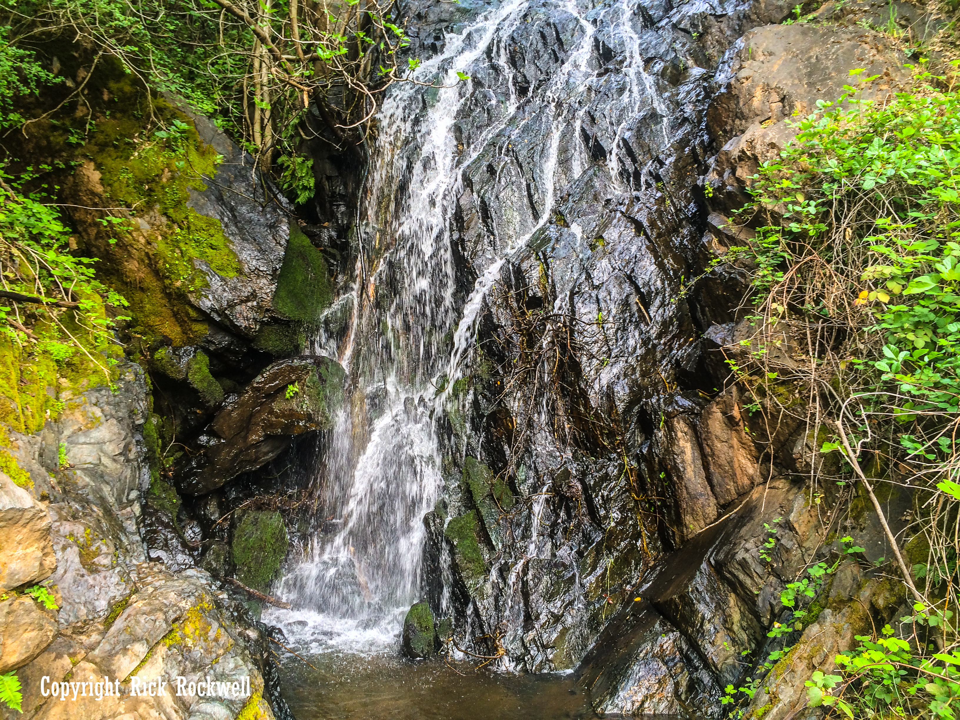
Slaughter Ravine Falls
Slaughter Ravine Falls is another quick waterfall stop along the lower portion of Iowa Hill Road. It sits close to the road near the bridge area, making it one of the easier scenic pauses before the route gets more serious.
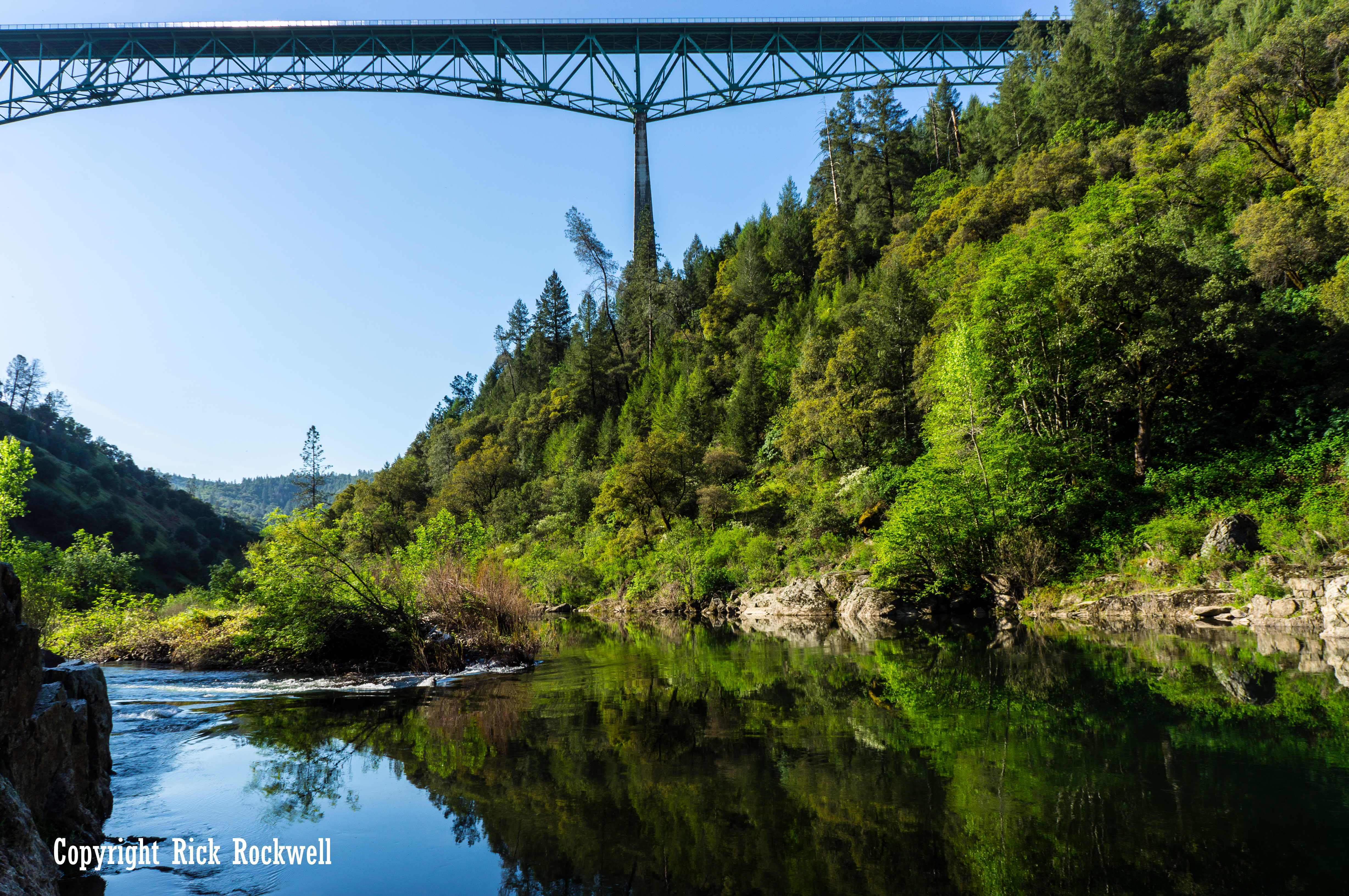
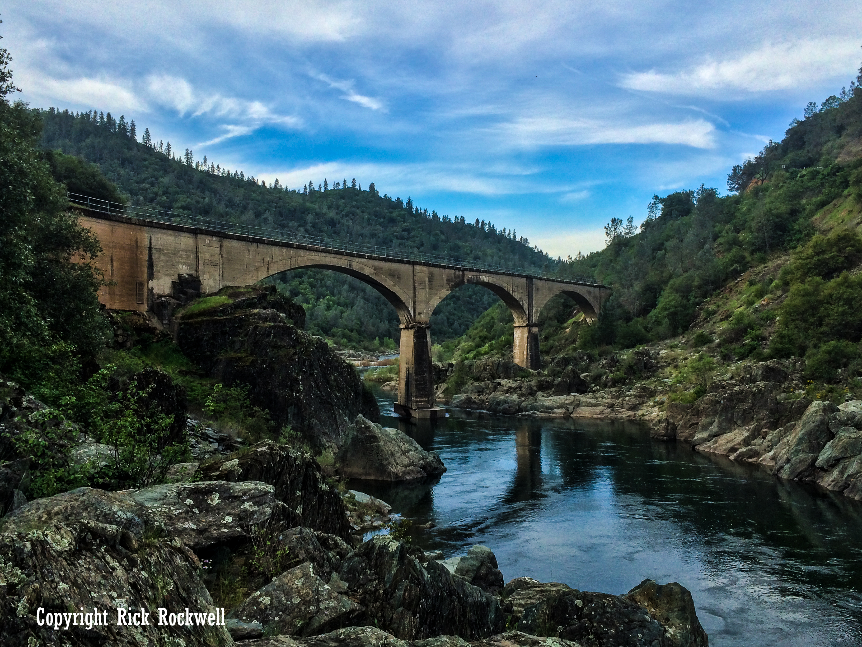
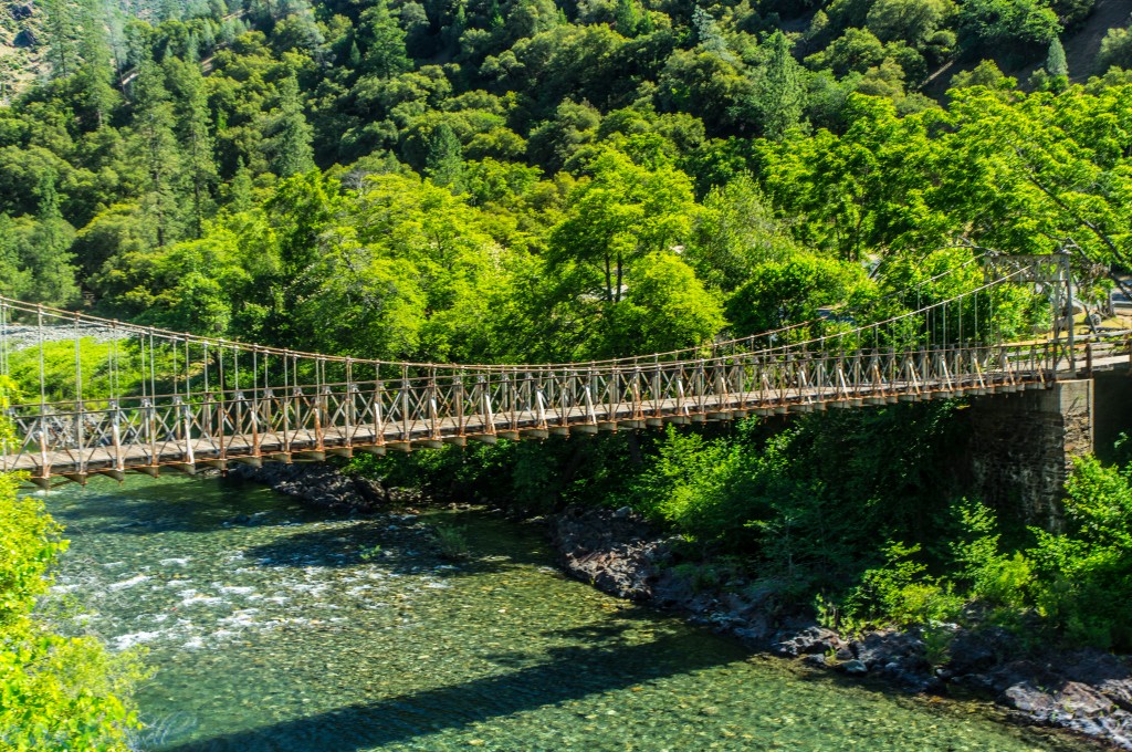
Iowa Hill Bridge and the Old Suspension Bridge
One of the most interesting stops on Iowa Hill Road is the bridge crossing over the North Fork American River. Here, the modern road bridge sits near the old Iowa Hill Road Bridge, also known as the Mineral Bar Bridge.
The old bridge was built in 1928 by Placer County to replace an earlier wooden bridge at the same location. It has steel lattice towers and a wood deck, and after Placer County built a newer automobile bridge in 1985, the old suspension bridge was left in place as a pedestrian bridge.
Mineral Bar Campground and River Access
Mineral Bar is one of the most important recreation stops on Iowa Hill Road. It sits on the east side of the North Fork American River where Colfax-Iowa Hill Road crosses the river.
Mineral Bar is one of the primitive campgrounds found in Auburn State Recreation Area. The campground has 15 designated campsites with picnic tables, garbage receptacles, pit toilets, and fire rings. There is no drinking water, seasonal fire restrictions may apply, and dogs are allowed.
Current Mineral Bar note: California State Parks lists reservations as required during the main summer season from May 15 through September 15, while shoulder-season periods are first-come, first-served.
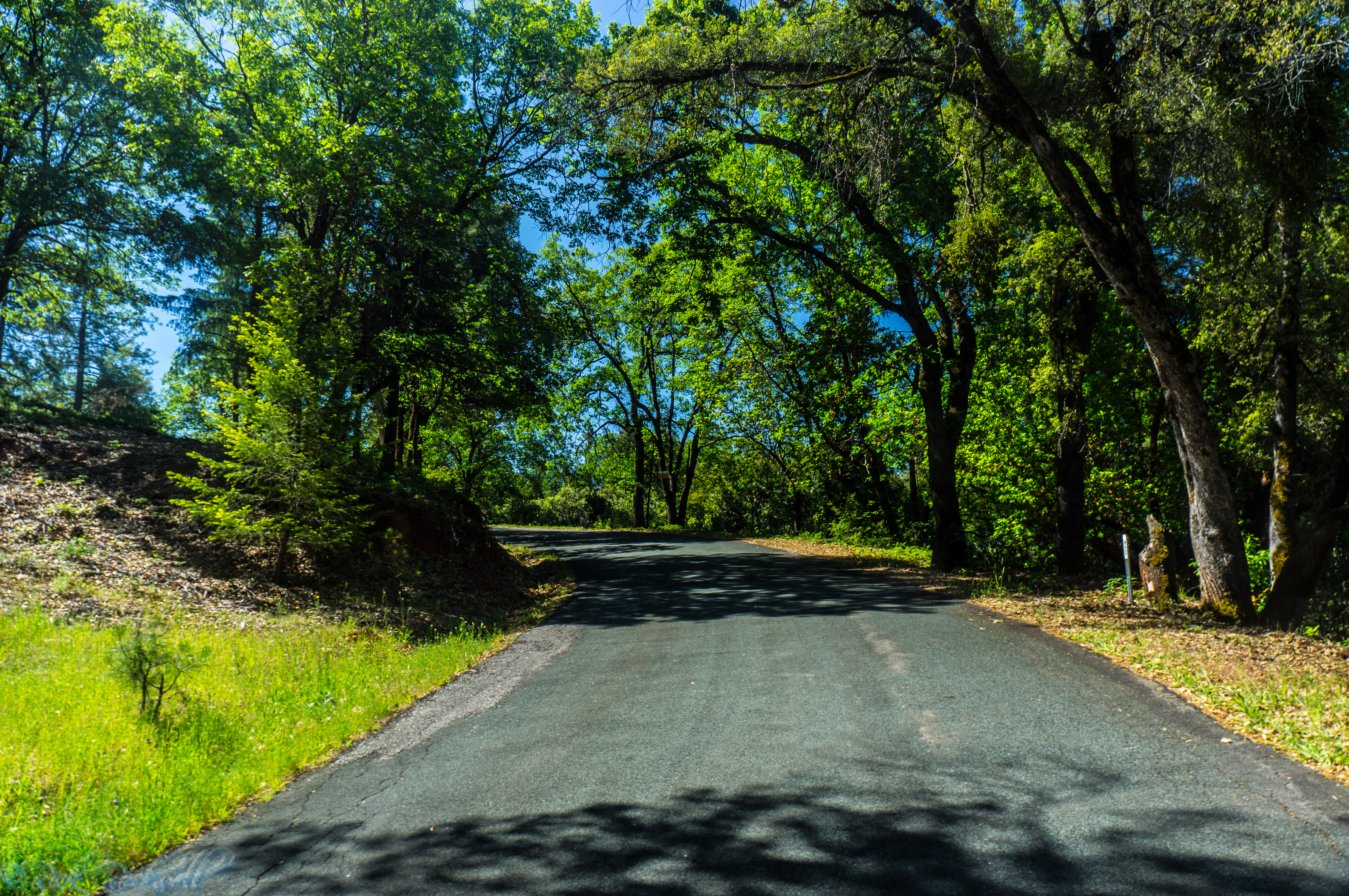
The Narrow, White-Knuckle Climb Toward Iowa Hill
After Mineral Bar, this portion of Iowa Hill Road becomes the drive people remember and talk about.
This is where the road leaves the river corridor and begins climbing toward Iowa Hill. The curves tighten. The canyon feels steeper. The drop-offs become more noticeable. And if you are the passenger, this is probably where you start grabbing the door handle.
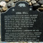
Iowa Hill: A Historic Gold Rush Community at the End of the Climb
Reaching Iowa Hill feels like arriving somewhere that time did not completely erase, but definitely tried to. This is not a constructed or preserved California ghost town. Instead, Iowa Hill is a small mountain community that keeps alive its Gold Rush roots and mining past.
Gold was discovered in 1853, and by 1856, weekly production was estimated at $100,000. The total value of gold produced up to 1880 was placed at $20 million. The town was damaged by major fires in 1857 and 1862, rebuilt each time, and then suffered another major fire in 1922 that destroyed most of the town. At its peak, Iowa Hill was one of the most prominent towns in all of Placer County.
When visiting, remember that Iowa Hill is also a real residential community. Be respectful around homes, private land, the cemetery, and local businesses. The best way to experience Iowa Hill is quietly and curiously, not like you are walking through an abandoned movie set or ghost town like North Bloomfield in Malakoff Diggins Stte Park or Bodie State Park.
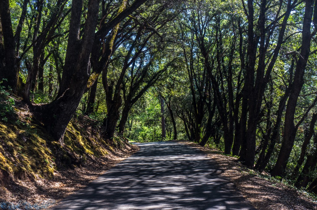
Getting closer to Iowa Hill
The Gold Rush Route That Became Iowa Hill Road
Iowa Hill Road’s history goes deeper than its modern reputation as a narrow, white-knuckle drive. The road follows the old Mineral Bar toll-road corridor, one of the earliest major wagon routes between Illinoistown, now Colfax, and the Iowa Hill mining district.
Before a bridge crossed the North Fork American River at Mineral Bar, travelers used a ferry there as early as 1851. In 1854, Charles Rice built the Mineral Bar and Iowa City Turnpike Road and reportedly spent decades as its superintendent and toll collector.
The route may have been only about 10 miles, but the historic account below, describes it as a four-hour trip, which says plenty about the steep canyon grades, slow freight wagons, and difficult river crossing.
Placer County eventually purchased the road in 1906, and the crossing continued evolving with the 1928 wire suspension bridge and the modern automobile bridge built in 1985.
The 1859 Journey That Defined Iowa Hill Road
In 1859, Bayard Taylor set out from Colfax toward Iowa Hill, expecting a short trip. Instead, he found a canyon route that already had a reputation for difficulty. As he approached the North Fork American River, the land dropped into a vast chasm, with the road clinging to the mountainside above it.
The route involved a long descent to the river followed by a steep climb out, carved into the canyon wall with “infinite labor.” It was narrow enough that wagons could only pass in select spots, sometimes forcing drivers to edge dangerously close to the drop-off. At steeper pitches, passengers walked while horses struggled to control the descent, and on the climb, teams stopped every few dozen yards to recover.
This was not just a dangerous road — it was Iowa Hill’s lifeline. Taylor paid a $2 bridge toll, while earlier Mineral Bar Turnpike rates ranged from 25 cents for a man on foot to $6.50 for six yoke of cattle and a wagon. Building the road cost an estimated $60,000 to $75,000, reflecting its importance as the main freight and travel route into one of Placer County’s richest mining districts.
By the time Taylor reached Iowa Hill around 2 p.m., travelers were dusty, exhausted, and hungry — but the town they arrived at was still active, with hotels, stores, and a broad street. His account captures Iowa Hill at a key moment: still alive, but already beginning its descension into the history pages.
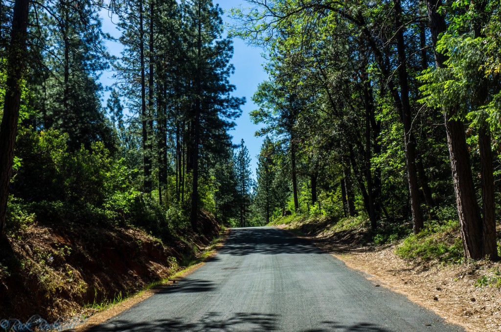
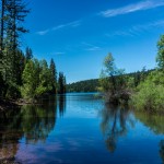
Beginning portions of Iowa Hill Road
FAQ About Iowa Hill Road
Is Iowa Hill Road paved?
Yes, Iowa Hill Road is paved. However, it is narrow, steep, winding, and exposed in places, so it should still be treated like a serious mountain road.
Is Iowa Hill Road dangerous?
Yes, Iowa Hill Road can be dangerous, especially between Mineral Bar and Iowa Hill. The road has sharp curves, steep drop-offs, limited shoulders, and narrow sections that require slow, careful driving.
Can you drive from Colfax to Iowa Hill?
Yes, Iowa Hill Road connects Colfax with Iowa Hill. The drive is scenic and memorable, but it is not a casual high-speed route.
Are trailers recommended on Iowa Hill Road?
No. The road is narrow, dangerous, and not recommended for trailers.
What can you see along Iowa Hill Road?
Major stops include Pennyweight Falls, Slaughter Ravine Falls, the Iowa Hill bridges, Mineral Bar, the North Fork American River, and the historic community of Iowa Hill.
Is Mineral Bar on Iowa Hill Road?
Yes. Mineral Bar is located off Iowa Hill Road where the road crosses the North Fork American River.
Is Iowa Hill a ghost town?
Iowa Hill is a “living” ghost town, where a small, historic mountain community with Gold Rush roots live fulltime.
When is the best time to drive Iowa Hill Road?
Spring and fall are usually the best seasons. Spring offers better waterfall flow and greener canyon scenery, while fall brings cooler temperatures and a quieter drive. Winter can be risky because of snow, ice, and storm damage.
The Old Iowa Hill Bridge and nearby Mineral Bar Campground