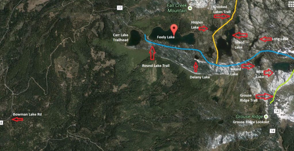
Carr Lake Trailhead is one of the easiest ways to get into the Grouse Lakes area of Tahoe National Forest, but “easy” comes with a Sierra-sized catch: the trail access is excellent once you get there, while the final road can make you second-guess bringing a low-clearance car.
From this trailhead, hikers can reach a chain of alpine lakes without committing to a huge mileage day. Carr Lake sits near the starting point, Feeley Lake comes quickly after, and Island Lake is a major scenic payoff for many day hikers.
If you keep going, Round Lake Trail continues toward Round Lake, Long Lake, Milk Lake, and the Grouse Ridge side of the basin. Another branch leads toward Crooked Lakes and Penner Lake.
This guide focuses on Carr Lake Trailhead as its own destination: how to get there, what the road is like, which lakes you can hike to, what facilities are available, and what to know before planning a trip into this part of Tahoe National Forest.
Quick Facts: Carr Lake Trailhead
- Location: Grouse Lakes Area, Tahoe National Forest, Nevada County
- Main access: Bowman Lake Road to Forest Road 17
- Road condition: Rough final 3 miles on unimproved dirt road
- Best vehicle: High-clearance vehicle recommended
- Best short hike: Carr Lake and Feeley Lake
- Best day hike: Carr Lake Trailhead to Island Lake
- Longer hikes: Round Lake, Long Lake, Milk Lake, Crooked Lakes, and Penner Lake
- Facilities: Vault toilets at Carr Lake Campground
- Water: No potable water; lake water must be purified
- Camping: 11 PG&E-operated sites at Carr Lake Campground
- Best season: Summer to early fall, depending on snow, road, smoke, and fire restrictions
- Last verified: June 2026
Where Is Carr Lake Trailhead?
Carr Lake Trailhead is in the Grouse Lakes area of Tahoe National Forest, north of Highway 20 and west of the main Truckee / Lake Tahoe travel corridor. It is not on Lake Tahoe, even though it sits within Tahoe National Forest.
This is a granite-and-alpine-lake pocket of the northern Sierra, with rough forest roads, small campgrounds, cold lakes, red fir forest, and a network of trails that connect Carr Lake, Feeley Lake, Island Lake, Round Lake, Long Lake, Milk Lake, Crooked Lakes, Penner Lake, and the Grouse Ridge area.
The broader Grouse Ridge landscape is part of a glacier-carved high-country basin of granite, lakes, wet meadows, riparian corridors, fir and lodgepole forest, alder and willow patches, and wildlife habitat. That mix is a big part of what makes Carr Lake Trailhead feel less like a single-destination hike and more like an entrance into a larger Sierra lake basin.
Driving to Carr Lake Trailhead
The drive to Carr Lake Trailhead is part of the experience, and not always the fun part.
From the Highway 20 corridor, you’ll turn onto Bowman Lake Road, also signed as Forest Road 18. Bowman Lake Road is paved for the early stretch, but it is winding, narrow in places, and not the kind of road you want to rush. After several miles, you turn onto Forest Road 17 for the final approach to Carr Lake.
That final stretch is the real filter. Forest Road 17 is dirt, rocky, bumpy, and rough enough that low-clearance vehicles are not recommended. Expect slow speeds, dust, rocks, ruts, and the usual Sierra forest-road uncertainty. Conditions can change after storms, snowmelt, washboarding, or heavy summer use.
On my earlier trip into this area, the road was the hardest part of the outing. The hiking itself felt approachable, scenic, and family-friendly. The drive, by comparison, was three miles of rocks, dirt, bumps, and slow crawling before reaching the trailhead area.
A high-clearance vehicle is the safer call. Four-wheel drive or all-wheel drive can be helpful, especially early in the season or after rough weather, but the key issue is clearance. Download your maps before you leave pavement, check Tahoe National Forest alerts, and be willing to turn around if the road is worse than expected.
Carr Lake Trailhead vs. Grouse Ridge Trailhead
Carr Lake Trailhead and Grouse Ridge Trailhead both access the same broader lake basin, but they do not serve the same type of trip.
Trailhead | Best for | Main lakes/routes | General feel |
Carr Lake Trailhead | Shorter lake hikes, Island Lake, Round Lake Trail, family-friendly lake-hopping, Carr Lake Campground | Carr, Feeley, Island, Round, Long, Milk, Crooked Lakes, Penner | Quick lake access after a rough road approach |
Grouse Ridge Trailhead | Grouse Ridge Lookout, ridge views, longer hikes, Glacier Lake, Sand Ridge, Five Lakes Basin, backpacking loops | Sawmill, Glacier, Sand Ridge, Five Lakes Basin, Grouse Ridge Trail | Better for higher-ridge access and longer routes |
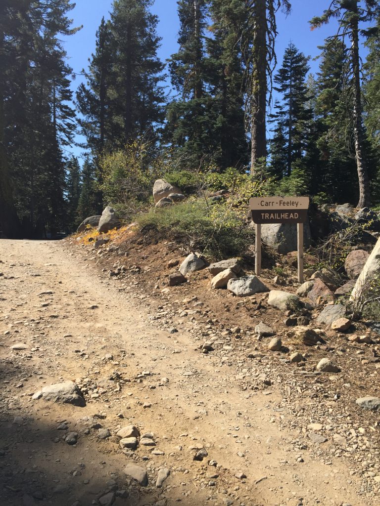
Carr-Feeley Trailhead Sign
Carr Lake Trailhead: Parking, Bathrooms, Water, and Fees
Carr Lake Trailhead is tied closely to Carr Lake Campground, a small hike-in campground operated by PG&E. The campground area also serves as the main access point for several lakes in the Grouse Lakes area.
Carr Lake is also tied to PG&E’s larger Sierra water and power system. The lake is part of the headwaters of Lake Creek, is fed by the outlet of Feeley Lake, and its water level is enhanced and controlled by an earthen dam owned and operated by PG&E for hydropower generation as part of the Drum-Spaulding Hydroelectric Project. That helps explain why a remote-feeling national forest lake also has a PG&E-operated recreation site.
This is not a full-service trailhead, so plan ahead before you drive in.
- Parking: Parking is near the end of Forest Road 17 by the Carr Lake Campground and trailhead area.
- Bathrooms: Vault toilets are available near Carr Lake Campground.
- Water: There is no potable water. Bring drinking water or purify lake water before using it.
- Fees: Tahoe National Forest lists the Carr Lake single-site overnight fee at $15.
- Trash: There are no garbage receptacles, so pack out everything you bring in.
- Boat access: There is no formal boat launch. Any boating is carry-in/non-motorized, and Tahoe National Forest lists a 10 MPH boat speed restriction.
- Cell service: Do not count on reliable service. Download maps before leaving pavement.
The lack of potable water is one of the biggest planning details. Even though you are surrounded by lakes, you should not assume you can drink directly from them. Bring enough water for the drive, hike, and return trip, or carry a reliable filter or purifier.
Camping at Carr Lake Campground
Carr Lake Campground is a small PG&E-operated campground near Carr Lake Trailhead. Tahoe National Forest lists 11 campsites here, making it a convenient base for hiking to Feeley Lake, Island Lake, Round Lake, Long Lake, Milk Lake, Crooked Lakes, and Penner Lake.
The campground is useful, but basic. There is no potable water, no trash service, and no full campground-style amenities beyond the vault toilets and campsites. Bring what you need, purify lake water if you plan to use it, and pack out everything you bring in.
Tahoe National Forest lists the Carr Lake single-site overnight fee at $15. Campground status, fees, road access, and fire restrictions can change, so check the current Forest Service information before planning an overnight trip.
Campfires, Stoves, and Fire Restrictions
Do not assume campfires are allowed just because you see old fire rings. Fire restrictions can change quickly in Tahoe National Forest, especially in summer and fall.
As of the last verification for this article, Tahoe National Forest Stage 1 fire restrictions began on June 26, 2026, and were listed through October 31, 2026, unless rescinded. Under those restrictions, campfires and charcoal fires are prohibited outside provided fire rings or charcoal grills in designated developed recreation sites. Before using a campfire, charcoal fire, grill, or stove, check current Tahoe National Forest restrictions and California campfire permit requirements.
Even when fires are technically allowed in some developed sites, dispersed campfires may be restricted or prohibited. This is a dry Sierra landscape in fire season. Treat fire rules as a current-condition issue, not a one-time fact.
Round Lake Trail Map – Made on Google Maps
Best Hikes From Carr Lake Trailhead
Distances in this area can vary by map source, parking location, spur trail, shoreline wandering, and how many lakes you actually visit. Treat the numbers below as planning estimates, not exact measurements.
Hike | Approx. distance | Lakes reached | Best for |
Carr Lake only | At trailhead | Carr Lake | Campground visit, quick lake stop |
Feeley Lake | Short walk | Carr, Feeley | Easy scenic add-on |
Island Lake via Round Lake Trail | About 3.5-4 miles round trip, depending on start point | Carr, Feeley, Delaney Pond area, Island | Best main day hike |
Round Lake and Long Lake | About 4-5 miles round trip, depending on route | Carr, Feeley, Island, Round, Long | Quieter lake-hopping |
Milk Lake | About 5 miles round trip, depending on route | Carr, Feeley, Island, Round, Long, Milk | Longer lake-hop |
Penner Lake via Crooked Lakes Trail | About 6+ miles round trip, depending on route | Carr, Feeley, Island, Crooked Lakes, Penner | Longer day hike or backpacking |
Glacier Lake / Five Lakes Basin connection | Long route | Multiple Grouse Lakes area lakes | Better for backpacking or experienced hikers |
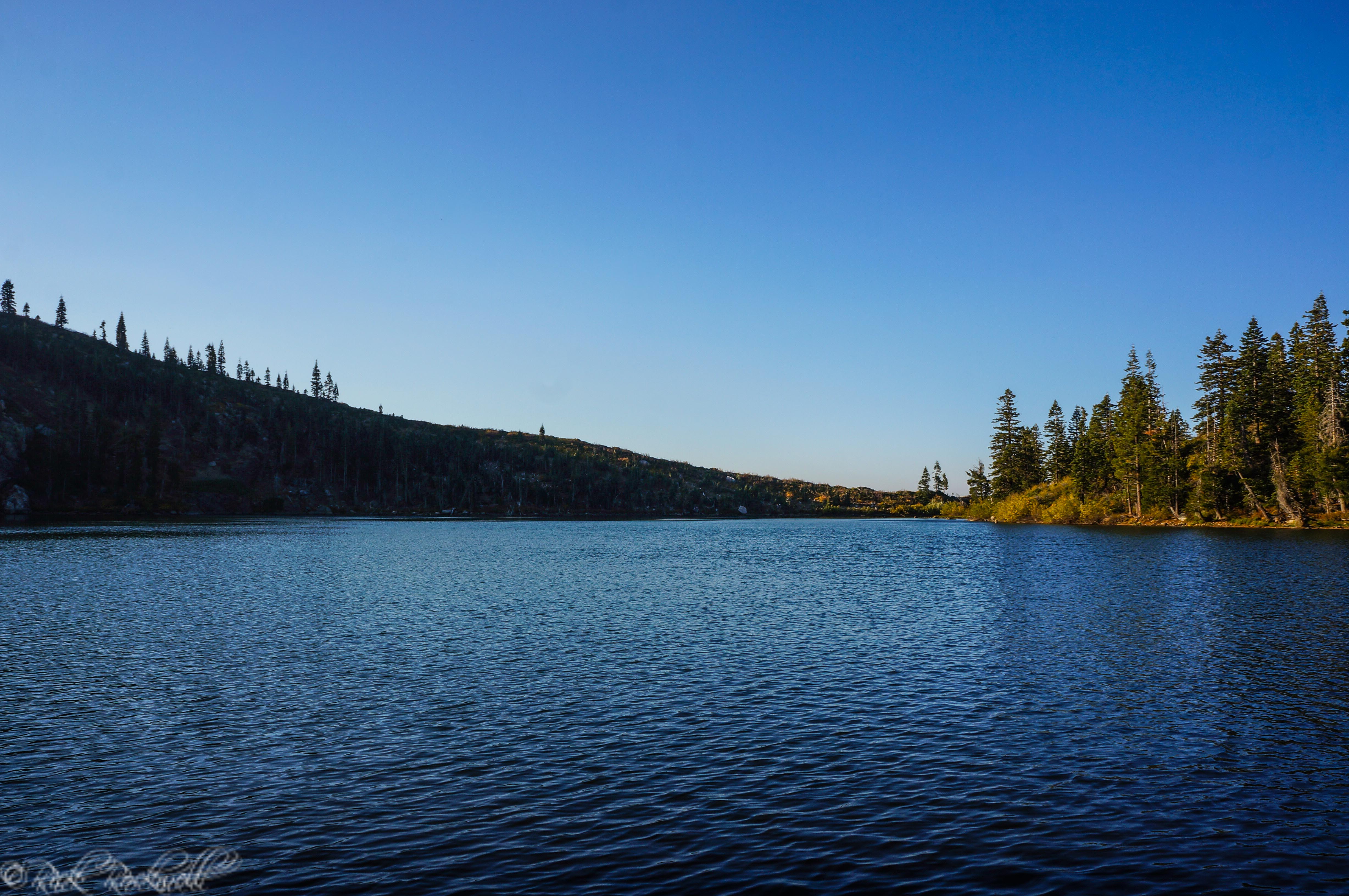
Carr Lake
Carr Lake is the first lake you’ll see from this trailhead, and it sets the tone for the day. It sits at just under 6,700 feet and serves as both a campground area and the practical gateway into the lake basin.
This is where you should handle the basics before hiking farther: use the vault toilet if needed, check your water, make sure you have your map, and get a feel for the route. The Round Lake Trail route begins near the area between Carr Lake and Feeley Lake, close to the dam.
Carr Lake is not necessarily the most dramatic lake on the route, but it is the logistical anchor. It has the campground, the facilities, and the easiest access. For families, campers, or anyone who just wants a short lake visit without committing to a longer hike, Carr Lake can be the destination by itself.
Fishing and swimming are both part of the recreation picture here, but keep the usual Sierra cautions in mind. The water is cold, conditions change, and anyone fishing needs to follow current California fishing regulations.
Carr Lake also has a long fish-stocking history: CDFW notes past Brook Trout, Rainbow Trout, and Brown Trout plants, with Rainbow Trout fingerlings currently planted.
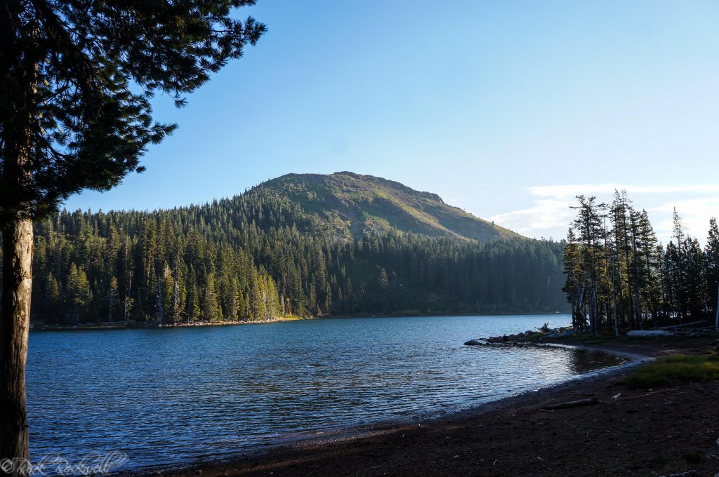
Feeley Lake and Fall Creek Mountain
Feeley Lake comes quickly after Carr Lake and, in my opinion, is where the route starts to feel more scenic. It is larger and more picturesque than Carr Lake, with Fall Creek Mountain rising on the north side and giving the lake a strong granite-and-Sierra backdrop.
From the Carr Lake side, the trail follows much of Feeley Lake’s length. This stretch has a gradual ascent, but it still feels friendly compared with many Sierra hikes. It is a good section for families, photographers, and hikers who want a pretty lake without pushing too far into the basin.
This is also one of the better places to slow down. Carr Lake gets you oriented; Feeley Lake starts to make the trip feel worth the drive.
As you continue beyond Feeley Lake, the route passes smaller water features, including Delaney Lake, which may look more like a pond depending on the season, along with another small unnamed lake before Island Lake comes into view.
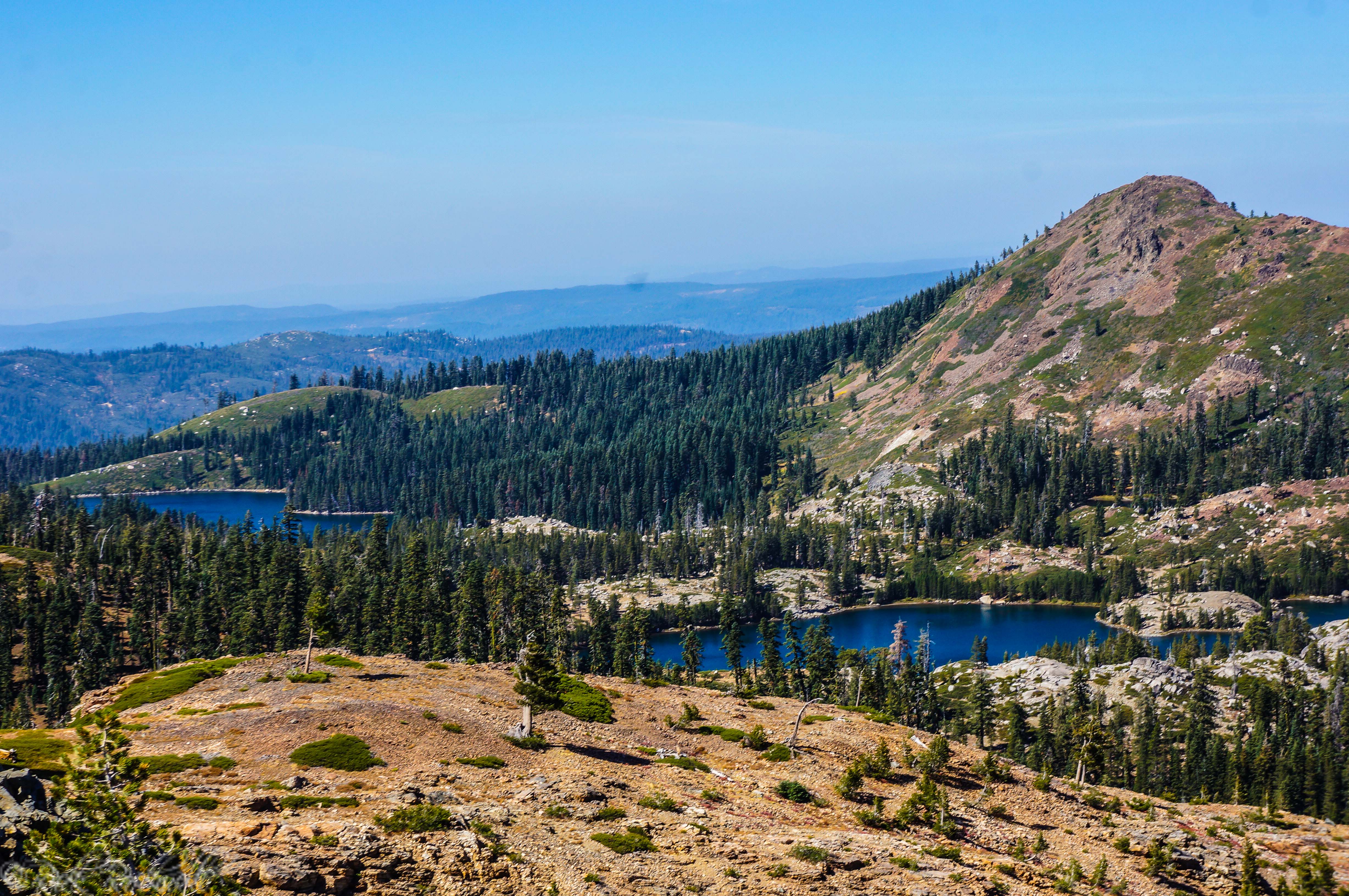
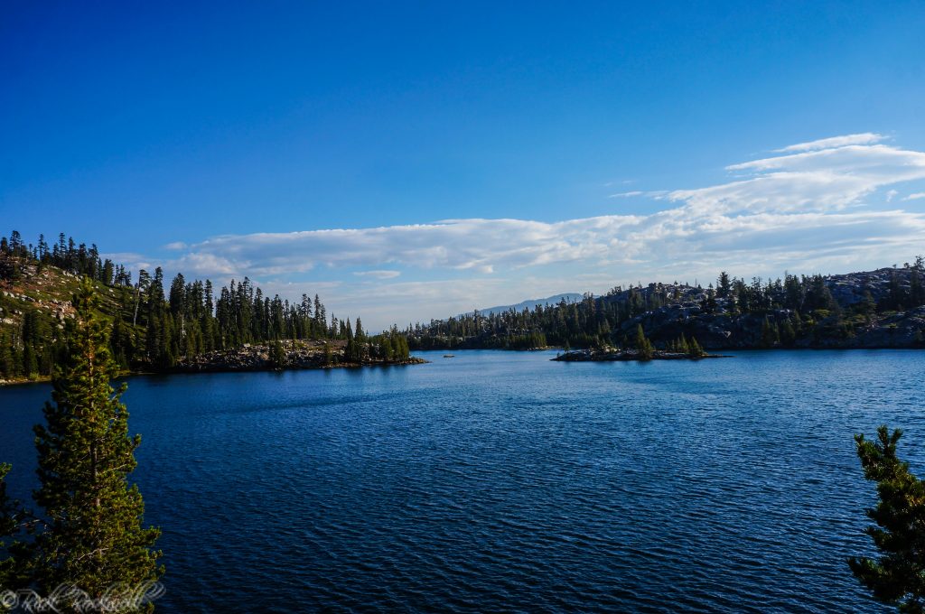
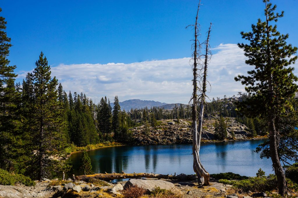
Island Lake
Island Lake is the main payoff for many hikers starting from Carr Lake Trailhead. It is one of the most visually appealing lakes in this part of the Grouse Lakes area, with granite, scattered timber, open shoreline, and small rocky islands that explain the name.
This is the lake that makes many people stop, pull out a camera, sit on the rocks, or decide they don’t need to hike any farther. It has that classic Sierra lake feel: blue water, granite edges, forested shoreline, and enough room to spread out if you are willing to explore beyond the first obvious stopping point.
Island Lake is also a natural junction area. From here, hikers can continue on Round Lake Trail toward Round Lake, Long Lake, and Milk Lake, or branch toward the Crooked Lakes Trail and Penner Lake. Backpackers often use Island Lake as a base for exploring nearby lakes, though camping should always be done carefully on durable surfaces and in line with current forest rules.
You may also be able to spot Grouse Ridge Lookout in the distance from the Island Lake area, which helps connect this lake-focused route with the higher ridge side of the basin.
Swimming is popular here in summer, but treat the water with respect. Cold alpine water, uneven granite, slippery rock, and changing depths make rock jumping risky. Enjoy the islands and shoreline, but do not assume any jump or swim is safe just because other people have done it.
Continuing on Round Lake Trail
After Island Lake, Round Lake Trail becomes the main continuation route deeper into the basin. Hikers who keep going can extend the day toward Round Lake, Long Lake, Milk Lake, and the eventual connection with the Grouse Ridge Trailhead side.
The trail continues through a lake-filled landscape rather than climbing to one single viewpoint. The reward is not one dramatic summit moment. It is the steady rhythm of water, granite, trees, and small route choices.
This is also where you should pay closer attention to your map. Spur paths, lake-shore routes, and junctions can make distances feel less exact than they look on a simple trail table. If you are only planning a casual day hike, Island Lake is a clean turnaround. If you want more solitude and more lakes, keep going toward Round Lake and Long Lake.
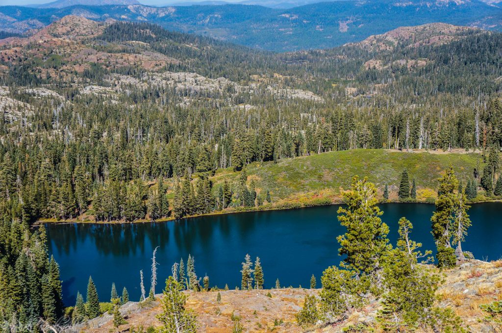
Round Lake and Long Lake
Round Lake is a short continuation beyond Island Lake, and the trail continues to gradually climb as you move through this section. Round Lake and Long Lake sit close enough together that this part of the hike feels like true lake-hopping.
The trail passes between Round and Long Lakes, with small spur paths leading down toward each lake. Compared with Island Lake, this area can feel quieter and more spread out. It is not empty, especially in summer, but it has more of the tucked-away feeling that makes the Grouse Lakes area appealing.
Camping around Round Lake and Long Lake can feel more limited, but also more isolated. These lakes are worth a stop, a few photos, and a quiet break, but they are not necessarily the place to expect a large, obvious campsite zone.
If your goal is a moderate day hike with more than one destination, continuing to Round Lake and Long Lake is a good step up from the basic Island Lake turnaround.
Milk Lake
Milk Lake sits farther along the Round Lake Trail route, near the connection toward Grouse Ridge Trail. It is near the higher end of the Carr Lake lake-hopping route and marks the point where a day hike begins to feel more like a cross-basin trip.
You may need to watch for a spur trail down toward Milk Lake before reaching the Round Lake Trail / Grouse Ridge Trail junction. This is not the same as simply walking along Carr, Feeley, and Island Lakes, where the route feels more obvious. By this point, a real map or downloaded offline route becomes more important.
Milk Lake is also where the Carr Lake route starts to overlap with the broader Grouse Ridge trail network. From Carr Lake, Milk Lake is part of a longer lake-hop. From the Grouse Ridge side, it sits below the higher trailhead and ridge area, with a noticeable elevation change between the lake and the campground/trailhead side.
For most casual day hikers, Milk Lake is a longer turnaround. For backpackers and stronger hikers, it becomes part of the larger Grouse Lakes route network.
Crooked Lakes Trail and the Penner Lake Option
Another strong option from the Island Lake area is the Crooked Lakes Trail, officially listed by Tahoe National Forest as Crooked Lakes Trail No. 12E11. The Forest Service lists the trail at 3.3 miles, which makes it a real route option rather than just a casual lakeside spur.
The Crooked Lakes Trail branches off near the stretch between Island Lake and the smaller unnamed lake. It leaves the western portion of the Island Lake area after a short stretch, then heads north through red fir forest and weaves around the Crooked Lakes before reaching Penner Lake. That gives this hike a different feel from the main Round Lake Trail lake-hop.
Penner Lake is a popular longer destination, and some hikers consider its beauty comparable to Island Lake. That said, this is no longer the easiest version of a Carr Lake Trailhead outing. It is better for hikers who want more mileage, more route-finding awareness, and a stronger sense of where they are going.
If this is your first time at Carr Lake Trailhead and you want a straightforward day, Island Lake is the simplest target. If you want a longer hike and are comfortable using a map, Crooked Lakes and Penner Lake are worth considering.
Dogs, Swimming, Fishing, and Boating
Carr Lake Trailhead is popular because it offers several types of recreation from one access point. Still, each activity comes with a few practical cautions.
Activity | What to Know |
Dogs | Allowed, but must stay under direct owner control; leashes are required in developed recreation sites |
Swimming | Popular in summer, but water is cold and granite hazards vary |
Fishing | Bring a valid California fishing license and check current regulations |
Boating | No formal boat launch at Carr Lake; any boating is carry-in/non-motorized |
Campfires/stoves | Check current restrictions before using fire or stove equipment |
Swimming at Carr, Feeley, and Island Lakes is part of the appeal during warm summer weather. These are the kind of lakes people want to jump into after a dusty drive and a warm hike. Just keep the tone realistic: alpine water is cold, rocks are slippery, and conditions are not managed like a swimming pool.
Best Time to Visit Carr Lake Trailhead
The best time to visit Carr Lake Trailhead is usually summer into early fall, once snow has melted from the road and trails. Exact timing changes year to year.
Early summer can bring lingering snow, muddy patches, high water, mosquitoes, and rough road conditions. Mid-summer usually offers the most reliable access, but it can also bring crowds, bugs, heat on exposed granite, and fire restrictions. Early fall can be excellent if the road is still open and smoke or storms are not an issue.
Weekends are busier, especially around Carr Lake, Feeley Lake, and Island Lake. If you want a quieter experience, start early, go on a weekday, or continue beyond the most popular lake stops.
Safety Notes Before You Go
A Carr Lake Trailhead trip rewards preparation:
- Check Tahoe National Forest alerts, road conditions, and fire restrictions before going.
- Use a high-clearance vehicle if possible.
- Do not take a low-clearance car lightly onto Forest Road 17.
- Download offline maps before leaving cell service.
- Bring more water than you think you need, or carry a reliable water filter.
- Do not drink untreated lake water.
- Bring bug spray in summer.
- Wear sturdy shoes for granite, dirt, rocks, and uneven trail sections.
- Watch children and dogs around cold water, slick granite, and shoreline drop-offs.
- Pack out all trash.
- Turn around if the road, weather, smoke, or trail conditions feel wrong.
The hardest part of this hike may be getting to the trailhead. Once you are there, the route can be a wonderful lake-hopping day in the Sierra.
Is Carr Lake Trailhead Worth Visiting?
Carr Lake Trailhead is absolutely worth visiting if you want a high-reward Sierra lake hike without committing to a massive mileage day. Few trailheads give you this many lake options so quickly: Carr, Feeley, Island, Round, Long, Milk, Crooked Lakes, and Penner are all part of the surrounding route network.
It is especially good for hikers who want flexibility. You can make it a short lake visit, a family-friendly hike to Island Lake, a quieter extension to Round and Long Lakes, or a longer adventure toward Penner Lake.
The catch is the road. If you are not comfortable with rough dirt-road driving, or if your vehicle sits low, Carr Lake Trailhead may be more stressful than fun. But if you come prepared, this is one of those Tahoe National Forest areas that can make you want to come back again and again.
That was my feeling after visiting the region the first time. The Grouse Lakes area has the right mix of lakes, granite, forest, and trail options to reward repeat trips. Carr Lake Trailhead is the easiest place to being your journey into this region.
FAQ About Carr Lake Trailhead
Is Round Lake Trail a trailhead?
No. Round Lake Trail is the route. Carr Lake Trailhead is one of the main access points for reaching Round Lake Trail, Island Lake, Round Lake, Long Lake, Milk Lake, and nearby lakes.
Do you need a high-clearance vehicle for Carr Lake Trailhead?
Yes, high clearance is strongly recommended. The final 3 miles on Forest Road 17 are rough, rocky, and not recommended for low vehicles.
How far is Island Lake from Carr Lake Trailhead?
Island Lake is commonly treated as a short day hike from Carr Lake Trailhead, roughly 3.5 to 4 miles round trip depending on where you start, how you measure the route, and whether you explore shoreline spurs.
What lakes can you hike to from Carr Lake Trailhead?
The main lakes covered from Carr Lake Trailhead include Carr Lake, Feeley Lake, Island Lake, Round Lake, Long Lake, Milk Lake, Crooked Lakes, and Penner Lake.
Can you camp at Carr Lake?
Yes. Carr Lake Campground has a small number of PG&E-operated campsites. Check current opening dates, fees, fire restrictions, and campground status before planning an overnight stay.
Are campfires allowed at Carr Lake?
Do not assume campfires are allowed. Fire restrictions change by season and conditions. As of the last verification for this article, Tahoe National Forest Stage 1 fire restrictions were active for the 2026 fire season, so check the current forest alerts before using any campfire, charcoal fire, grill, or stove.
Are dogs allowed at Carr Lake Trailhead?
Dogs are allowed in this part of Tahoe National Forest, but rules depend on where you are. In Nevada County national forest areas, dogs do not generally have to be leashed, but they must stay under direct owner control. Leashes are required in developed recreation sites.
Is Carr Lake Trailhead better than Grouse Ridge Trailhead?
Carr Lake Trailhead is better for shorter lake hikes and quick access to Island Lake, Round Lake Trail, and several nearby lakes. Grouse Ridge Trailhead is better for the lookout, ridge views, Glacier Lake, Sand Ridge, Five Lakes Basin, and longer backpacking routes.
Sources
Tahoe National Forest – Carr Lake Campground: https://www.fs.usda.gov/r05/tahoe/recreation/carr-lake-campground
Tahoe National Forest – Bowman Road: https://www.fs.usda.gov/r05/tahoe/recreation/bowman-road
Tahoe National Forest – Crooked Lakes Trail: https://www.fs.usda.gov/r05/tahoe/recreation/trails/crooked-lakes-trail
Tahoe National Forest – Alerts: https://www.fs.usda.gov/r05/tahoe/alerts
Tahoe National Forest – Current Conditions: https://www.fs.usda.gov/r05/tahoe/conditions
Tahoe National Forest – Stage 1 Fire Restrictions: https://www.fs.usda.gov/r05/tahoe/alerts/stage-1-fire-restrictions-0
Tahoe National Forest – Recreation Permits and Campfire Permits: https://www.fs.usda.gov/r05/tahoe/permits
Tahoe National Forest – Dogs in Tahoe National Forest: https://www.fs.usda.gov/media/235607
California Department of Fish and Wildlife – Pre-Stocking Evaluation at Carr Lake, Nevada County: https://nrm.dfg.ca.gov/FileHandler.ashx?DocumentID=211001
California Department of Fish and Wildlife – Sport Fishing Licenses and Regulations: https://wildlife.ca.gov/Fishing
Bear Yuba Land Trust – BYLT Secures Protection of 857 Acres in Grouse Ridge: https://www.bylt.org/bylt-secures-protection-of-857-acres-in-grouse-ridge/
Hiking Project – Round Lake Trail: https://www.hikingproject.com/trail/7005309/round-lake-trail