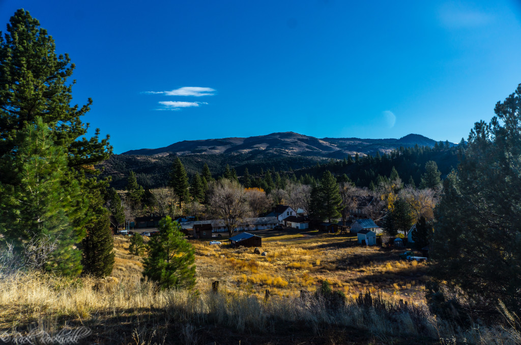
Markleeville is easy to underestimate. The Alpine County town sits southeast of Lake Tahoe, close to Grover Hot Springs State Park, scenic Sierra highways, and a stretch of California mountain country that feels much quieter than the Tahoe Basin.
I first visited Markleeville after trying to time a fall-color trip around the weather. Rain and snow in the Sierra had pushed the visit back more than once, but once I finally saw a clear opening, I took it. What I found was a small mountain town with history, quiet scenery, hot springs nearby, and enough character to make the drive feel worthwhile.
This guide covers what to know before visiting Markleeville, including its history, things to do, Grover Hot Springs, road conditions, ghost stories, and why this Alpine County town can be worth the drive.
Markleeville Quick Facts
- Location: Alpine County, southeast of Lake Tahoe
- Best for: Small-town exploring, hot springs, history, scenic drives, fall color, quiet Sierra scenery
- Main nearby attraction: Grover Hot Springs State Park
- Best season: Late Spring through fall; winter travel depends on road and pass conditions
- Services: Limited food, gas, lodging, visitor information, and county services
- Road caution: Check current highway conditions before visiting, especially in winter, spring, or stormy weather
- Good side trips: South Lake Tahoe, Hope Valley, Woodfords, Carson River, Monitor Pass, Ebbetts Pass
Where Is Markleeville?
Markleeville is the county seat of Alpine County and sits southeast of Lake Tahoe. It is near the junction of several scenic Sierra routes, including Highway 89, Highway 88, and the roads leading toward Monitor Pass, Ebbetts Pass, and Grover Hot Springs State Park.
Directions To Markleeville
Markleeville can be reached from several Sierra routes, but the best way in depends on where you are coming from, the season, and current mountain road conditions.
From Sacramento
From Sacramento, take Highway 50 east toward South Lake Tahoe. After crossing Echo Summit and passing into the Meyers area, turn right onto Highway 89.
Continue on Highway 89 until it meets Highway 88 near the Woodfords area. At the junction, continue with the Highway 89 route toward Markleeville.
From South Lake Tahoe
From South Lake Tahoe or Meyers, take Highway 89 south toward Luther Pass and Woodfords. Continue toward Markleeville from the Highway 88/89 junction.
This is one of the more natural ways to visit Markleeville if you are already staying in the Tahoe area.
From the Eastern Sierra or Nevada Side
Depending on the season and road conditions, travelers may reach the area via Monitor Pass or routes connecting through Highway 395 and Topaz Lake. However, Monitor Pass is seasonal and can close due to snow, storms, or road conditions, so check Caltrans before relying on this route.
From Pioneer, CA
From Pioneer, take Highway 88 east through the upper Amador County mountains toward Kirkwood and Carson Pass. Continue over the pass area, then follow Highway 88 toward Woodfords, where you can connect with Highway 89 toward Markleeville.
This is a scenic mountain route, but it can be heavily affected by snow, chain controls, storms, and seasonal conditions. Check Caltrans before leaving, especially in winter, spring, or after recent weather.
Road Conditions, Winter Access, and Mountain Passes
Road conditions matter in Markleeville because the town sits near seasonal Sierra routes, high passes, and mountain highways that can change quickly with weather.
That dependence on roads and weather is not new. From Jacob Markley’s toll bridge to the newspaper routes that connected Markleeville with Silver Mountain, Bodie, and Bridgeport, travel here has always depended on mountain access, timing, and conditions.
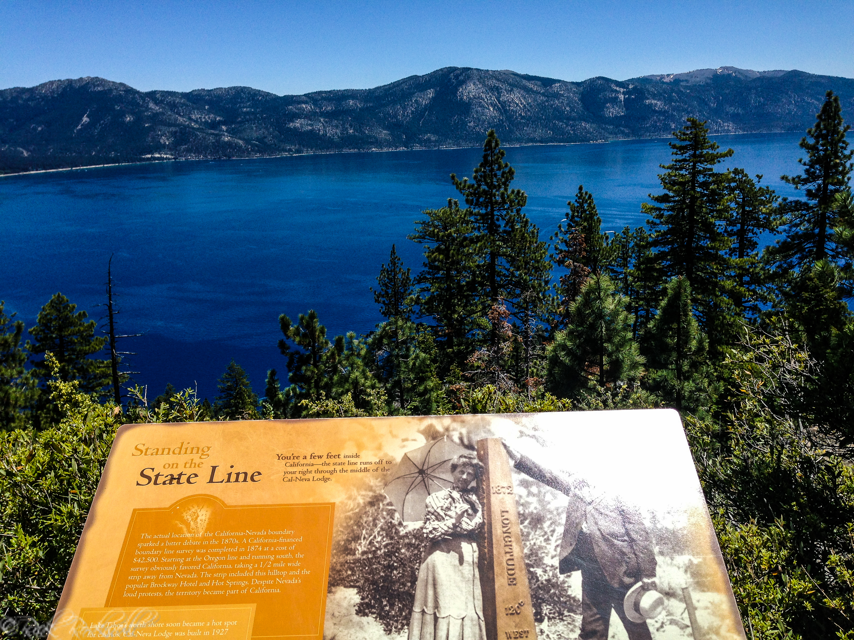
Caltrans District 10 manages seasonal Sierra passes in this region, including Ebbetts Pass on State Route 4 and Monitor Pass on State Route 89. Caltrans says winter pass closures are affected by weather, snow levels, public safety, and road conditions, and it recommends checking QuickMap for real-time highway updates.
During my June 9, 2026 source check, Caltrans reported that Monitor Pass reopened for the season on March 5, 2026, and Ebbetts Pass reopened on May 6, 2026. Those dates can change from year to year, so do not rely on old trip reports or last year’s opening dates when planning a visit.
Before you go, check current conditions for Highway 89, Highway 88, Highway 4, Monitor Pass, Ebbetts Pass, and any route you plan to use. Caltrans also has a road information page where travelers can check current highway conditions or call 1-800-427-7623.
Markleeville History at a Glance
The Markleeville area is part of the ancestral homeland of the Washoe people. Alpine County’s official history notes that the Washoe are the original inhabitants of Lake Tahoe and the lands around the Great Basin and Sierra Nevada, including Alpine County.
The town’s later name comes from Jacob Markley. According to Alpine County, Markley staked a 160-acre claim near the river on September 12, 1861, built a crude toll bridge, and began selling lots in what became the Markleeville townsite. His bridge allowed him to profit from travelers heading toward the mines at Silver Mountain City, which helps explain why roads, routes, and mountain access are such an important part of Markleeville’s story.
Markley’s story ended violently. Alpine County says he was shot and killed by Henry W. Tuttle on May 14, 1863, after an argument over profits from land sales. The same county history notes that Markleeville became the official county seat in 1875.
Markleeville was not just a mining stop. In 1864, R.M. Folger moved to town and opened The Alpine Chronicle, which the Historical Society of Alpine County describes as the first newspaper on the eastern slope of the Sierra. Its office stood on the north side of Montgomery Street, opposite the town armory.
Folger was soon joined by his younger brother Alex, and later observers called them “the long and the short of it.” When the Silver Mountain Bulletin folded in 1867, the Folgers moved the Chronicle to Silver Mountain, where they spent the next eleven years publishing weekly news before relocating to Bodie at the end of 1878 and later to Bridgeport.
The brothers were remembered for their “impeccable manners” and conservative dress, but their paper was not timid. It took on local issues, criticized mining-stock hype, and reflected the rough-edged politics of Alpine County’s mining years.
Markleeville’s surrounding history also has a darker side. Nearby Hangman’s Bridge, along the East Fork Carson River, is tied to the 1874 vigilante hanging of Ernst Reusch. It is a story better suited for its own Alpine County history article, but it adds another layer to the rough-edged mining-era world that surrounded early Markleeville.
That history still gives the town some of its character today. Markleeville does not feel like a recreated tourist town. It feels more like a county seat, mountain stop, and historic Sierra community all mixed together.
Markleeville Ghost Stories and Local Lore
Markleeville’s history also comes with a few ghost stories. Karen Dustman’s Markleeville Ghost Tales collects local tales from in and around town, and the Historical Society of Alpine County has described these urban legends as part of a local tradition and that residents have been telling and retelling for years.
The best-known stories seem to center on the haunted place – Cutthroat Tavern; the historic building that has also been known as the Cutthroat Saloon and Wolf Creek Restaurant. Local ghost lore includes stories of a waitress feeling a tap on her shoulder in an empty dining room, a horse’s whinny heard from the cellar, and wooden chairs reportedly found arranged in a circle in the attic.
More recent stories connected to the reopened Cutthroat Tavern mention a woman seen in an upstairs window and a strange tennis-ball incident reported by paranormal investigators.
Another Markleeville ghost story is tied to the Alpine County Administration Building. According to local-history writer Karen Dustman, today’s building stands near the site of an old Alvin Grover house that was built around 1899 with lumber from a former schoolhouse in Monitor.
The stories connected to that site include cold chills, footsteps, doors closing by themselves, and a postage machine that reportedly reset to the year 1929. One theory connects the story to Mary Gray, a longtime county Clerk, Auditor, and Recorder who lived in the old Grover home in the 1920s.
These stories are best treated as local lore rather than proven fact, but they add another layer to Markleeville’s personality. Between the old hotels, saloons, county buildings, mining-era roads, and darker stories like Hangman’s Bridge, the town has more folklore than its quiet size might suggest.

Entering The Charming Town of Markleeville
As you enter Markleeville, the speed limit drops and the town quickly comes into view. The Alpine County Visitor Center is near the entrance to town, with a gas station on the opposite side. A little farther in, you reach the main part of town, where you will find a small cluster of restaurants, businesses, lodging, the post office, and county buildings.
The main area is only about a block, but that is part of the charm. Markleeville does not feel like a polished resort town. It feels practical, rural, and lived in.
Each time I visit, I like to walk around the downtown area and get a better feel for the community. The town seemed to serve a mix of travelers, locals, county workers, and people passing through on scenic drives. It never fails, every time I visit, I get to meet locals who are welcoming and proudly talk about the town. There’s been a few times when they’ve almost sold me on living there.
My favorite quiet spot in town was the creek near the courthouse. I thought the sign said Markleeville Creek, but maps identify the small creek in that area as Millberry Creek. Either way, it’s a peaceful little place for fall photos and a few minutes of mountain-town solitude.
Things to Do in Markleeville
Markleeville is not a town with big attractions. You do not come here with a packed itinerary. Instead, you come for history, hot springs, quiet scenery, and the slower rhythm of Alpine County.
Walk the Small Downtown Area
The downtown area is small enough to explore casually. You can stop by the visitor center, walk the main block, look at the county buildings, grab food if businesses are open, and get a feel for the town.
Before planning around the visitor center, check current hours. Like many small-town visitor centers, hours can change by season, staffing, and local conditions.
Walking around matters here because Markleeville’s appeal is in the quiet details: old buildings, mountain views, seasonal colors, a small creek, and the feeling that you have stepped into a much less crowded corner of California.
Visit the Alpine County Historical Complex
The Alpine County Historical Complex is one of the best stops in Markleeville if you care about local history. It sits above town on School Street and includes the Alpine County Museum, Old Log Jail, Webster School House, Stamp Mill, Basque Bread Oven, Blacksmith Exhibit, antique machinery, and other historical features.
The museum’s official page says normal operating hours are Memorial Day weekend through the end of October, Thursday through Sunday, 10 a.m. to 4 p.m., but readers should verify current hours before planning around it.
Stop by the Markleeville Library
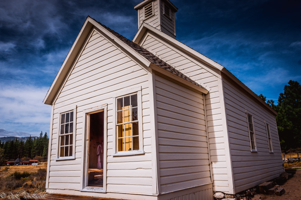
On my way back from Grover Hot Springs, I passed the Markleeville Library near the split in the road. It is housed in an older building that was once the New Webster School and is one of the historic-looking buildings that helps give the town its character.
It is a small stop, but it is the kind of detail that makes Markleeville feel different from a typical mountain pass-through town.
Enjoy the Carson River and Woodfords Area
On a few different trips to Markleeville, I make it a point to stop near Woodfords and the West Fork of the Carson River, close to the Highway 88 and Highway 89 junction.
This area is worth including in a Markleeville trip because it gives you a broader sense of Alpine County’s landscape. The river, open meadows, and surrounding peaks make the drive feel bigger than the town itself. And the landscape views are wonderful to experience at least once.
Grover Hot Springs State Park: What to Know Before You Go
Grover Hot Springs State Park is close enough to Markleeville that it should be treated as part of a Markleeville trip. Still, it is a state park with its own rules, hours, fees, seasonal conditions, and occasional status changes.
As of June 9, 2026, California State Parks list vehicle day use at $8, adult pool entry at $10, and child pool entry at $5. Additionally, prices can change without notice, so treat those fees as planning guidance, not a permanent guarantee.
The hot springs pool needs the most careful planning. California State Parks’ official Grover Hot Springs page can include changing or mixed status language for the pool complex, pool sessions, tickets, and current restrictions. Before driving to Markleeville specifically to soak, check the official park page or call the park at (530) 694-2248.
Dogs are allowed in the park on leash, but not in the hot springs pool complex and should not be left unattended.
Day-use parking is listed as sunrise to sunset, and the park warns that weather can change quickly, with conditions ranging from dry heat to storms, wind, snow, and cold nights.
The park also has hiking, picnicking, wildlife viewing, fishing, mountain scenery, and day-use areas. Hikes range from an accessible meadow boardwalk to a moderate waterfall hike and longer routes toward Burnside Lake or Charity Valley.
Before visiting, check:
- Current pool status
- Pool hours and ticket availability
- Day-use fees
- Camping availability
- Fire restrictions
- Dog rules
- Road conditions
- Weather forecast
- Bear and food-storage requirements if camping
Best Time to Visit Markleeville
Late spring through fall is usually the easiest time to visit Markleeville, especially if you want to include scenic drives, hiking, Grover Hot Springs, or nearby mountain passes.
Fall can be especially nice if you catch the color in the surrounding trees and meadows. That was one of the main reasons I wanted to visit this region in the first place. And, it certainly didn’t disappoint.
Winter is different. The region can get snow, mountain highways may have chain controls, and nearby passes can close for the season. Markleeville can still be visited in winter, but you need to plan more carefully and check current road information before leaving.
Is Markleeville Worth Visiting?
Yes. I have visited Markleeville numerous times since my first trip in 2014. And, every time I return to this charming town, it’s like reconnecting with an old friend.
For me, the appeal of Markleeville is the overall experience: seasonal colors on the drive, quiet roads, the small downtown, the historical complex, the creek near the courthouse, and the feeling of being in a part of California that many people only pass near, not through.
Every visit to Markleeville leaves me wanting more: more time at Grover Hot Springs, more time at the Historical Complex, more time in Alpine County, and more time talking with the locals.
My first trip to Markleeville was during the fall season, and I absolutely loved how the town was draped in fall colors. The wide-open landscapes were rich with colors and soothing to the soul.
I brought my oldest child with me on one trip to Markleeville after a visit to Lake Tahoe. While, a day trip from Sacramento to Markleeville may be too far for some people, if you are near Tahoe, Hope Valley or the surrounding Sierra Nevada region, it is worth carving out a few hours to see it. We both loved our time in town and the drive there.
Another notable trip was a spontaneous drive up from a visit to The Maiden’s Grave near Pioneer. This historic point of interest has become one of the most endearing urban legends of the region. And, it was only 40 minutes away from my old friend – Markleeville.
As you can see, whenever I am in this region of the state, I always try to stop by.
Markleeville is worth visiting if you enjoy small mountain towns, quiet scenery, local history, hot springs, scenic roads, and places that still feel a bit removed from California’s busier travel corridors.

FAQ About Visiting Markleeville
Is Markleeville worth visiting?
Yes, Markleeville is worth visiting if you like quiet mountain towns, local history, hot springs, scenic drives, and places that feel far less crowded than Lake Tahoe.
What is Markleeville known for?
Markleeville is known as the county seat of Alpine County and as the small town near Grover Hot Springs State Park. It also has mining-era history, scenic Sierra roads, nearby river access, fall color, local ghost stories, and connections to old Alpine County routes like Monitor Pass and Ebbetts Pass.
How far is Markleeville from Lake Tahoe?
Markleeville sits southeast of Lake Tahoe. From South Lake Tahoe or Meyers, the drive usually follows Highway 89 south toward Woodfords before continuing into Markleeville. Travel time depends on traffic, weather, and road conditions.
Is Grover Hot Springs open?
Grover Hot Springs State Park is near Markleeville, but pool access, hours, tickets, camping, and facilities can change by season, staffing, weather, and park conditions. If the hot springs are the main reason for your trip, check California State Parks before driving there.
Are there ghost stories in Markleeville?
Yes, Markleeville has several local ghost stories and pieces of folklore. Karen Dustman’s Markleeville Ghost Tales collects stories from in and around town, and local lore includes stories connected to the Cutthroat Tavern, the Alpine County Administration Building, and darker Alpine County history like Hangman’s Bridge. These stories are best treated as local lore rather than proven fact.
What is the best time to visit Markleeville?
Late spring through fall is usually the easiest time to visit Markleeville, especially if you want to include Grover Hot Springs, hiking, scenic drives, or nearby mountain passes. Fall can be especially nice for color, while winter visits require more planning because snow, chain controls, and pass closures can affect travel.
Do you need to check road conditions before visiting Markleeville?
Yes. Markleeville sits near mountain highways and seasonal Sierra passes, so road conditions matter. Check Caltrans before leaving, especially if you plan to use Highway 89, Highway 88, Monitor Pass, Ebbetts Pass, or any high-elevation route during winter, spring, or stormy weather.

Sources
California State Parks: Grover Hot Springs State Park
https://www.parks.ca.gov/?page_id=508
California State Parks: Accessible Features at Grover Hot Springs State Park: https://www.parks.ca.gov/AccessibleFeatures/Details/508
Alpine County: Jacob Markley history: https://alpinecountyca.gov/664/Jacob-Markley
Alpine County: Washoe / Native Americans: https://alpinecountyca.gov/662/Native-Americans
Alpine County: Alpine County Historical Complex: https://alpinecountyca.gov/661/Alpine-County-Historical-Complex
Alpine County: Museum hours and contact information: https://alpinecountyca.gov/251/Museum
Alpine County: Webster School House / Markleeville Library history: https://alpinecountyca.gov/663/Webster-School-House
Historical Society of Alpine County / Alpine Review: The Folger Brothers and The Alpine Chronicle: https://www.alpinecountyca.gov/ImageRepository/Document?documentID=4269
Historical Society of Alpine County / Alpine Review: Markleeville Ghost Tales listing: https://www.alpinecountyca.gov/DocumentCenter/View/2133/Alpine-Review-2018-May-1?bidId=
Clairitage Press: Markleeville Ghost Tales: https://www.clairitage.com/book/markleeville-ghost-tales/
Clairitage: Markleeville, A Bit of Haunted History: https://www.clairitage.com/2018/11/23/markleeville-a-bit-of-haunted-history/
Clairitage: Markleeville, Ghost in the Admin Building?: https://www.clairitage.com/2017/06/27/markleeville-ghost-in-the-admin-building/
Tahoe Daily Tribune: Cutthroat Tavern history and ghost stories: https://www.tahoedailytribune.com/news/cutthroat-tavern-an-establishment-soaked-in-alpine-county-history/
Ebbetts Pass Scenic Byway: East Fork Carson River / Hangman’s Bridge: https://scenic4.org/the-route/points-of-interest/east-fork-carson-river/
Caltrans District 10: Mountain Passes: https://dot.ca.gov/caltrans-near-me/district-10/district-10-popular-links/mountain-passes
Caltrans Road Information: https://roads.dot.ca.gov/