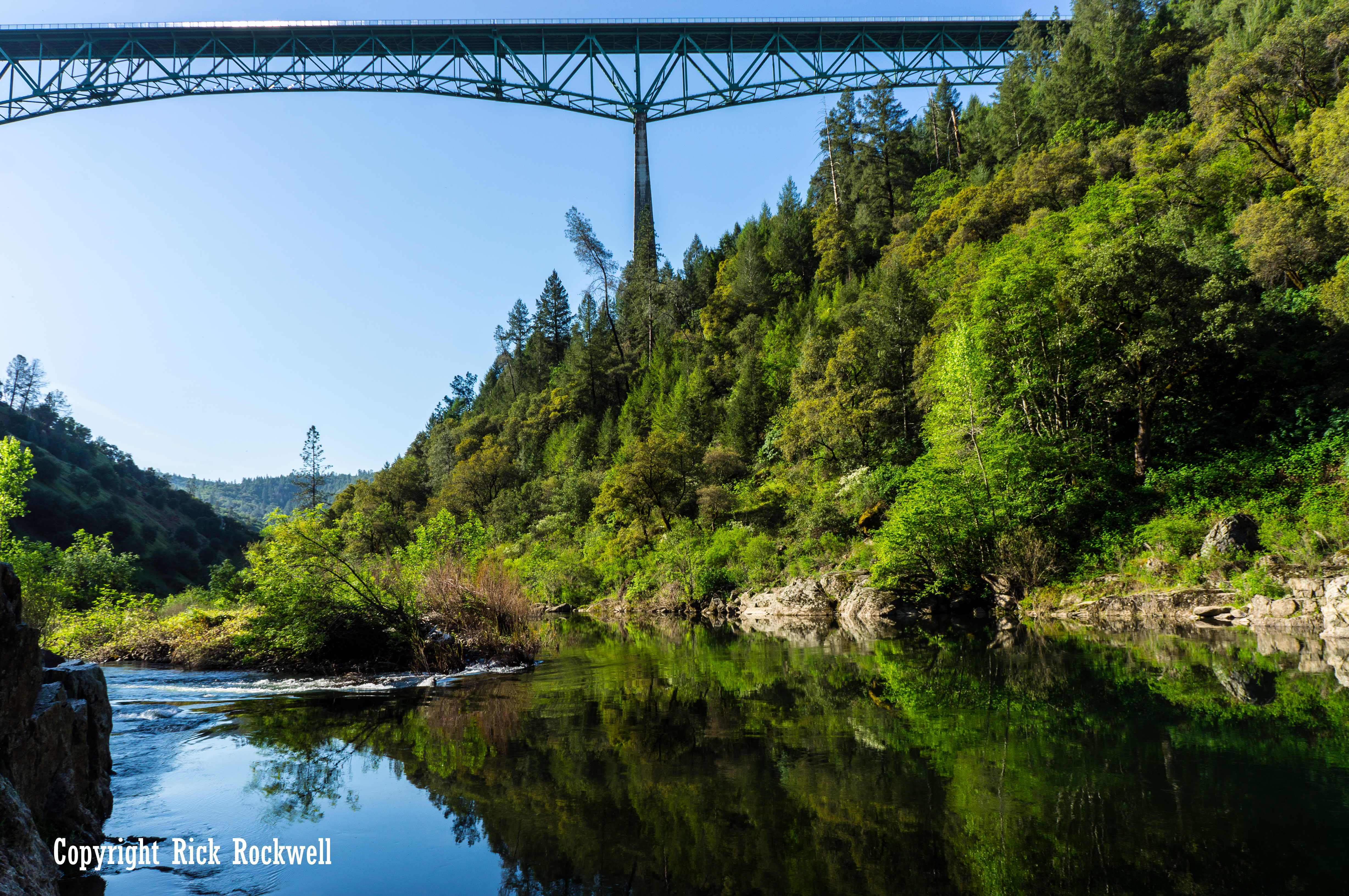
Few landmarks in the foothills make you feel the scale of the American River canyon like Foresthill Bridge. One moment you are driving out of Auburn on Foresthill Road, and the next you are hundreds of feet above the North Fork American River, looking across one of the most dramatic bridge crossings in California.
Also known as the Auburn-Foresthill Bridge, this massive steel span is more than a scenic roadside stop. It is California’s tallest bridge, a popular viewpoint, a gateway to Auburn State Recreation Area, and one of the strangest leftovers from the never-completed Auburn Dam project. It was built for a reservoir that never arrived, leaving behind a towering bridge over a wild canyon and one of the best hikes of the region.
Today, Foresthill Bridge is one of the defining sights of the ASRA. You can walk across it, photograph it from below, hike beneath it, and use it as a starting point for some of the best trails along the North Fork American River.
Foresthill Bridge Quick Facts
- Common Names: Foresthill Bridge, Auburn-Foresthill Bridge, Auburn Bridge
- Location: Foresthill Road near Auburn and ASRA in Placer County, California
- Crosses: North Fork American River
- Height Above River: About 730 feet
- Total Length: 2,428 feet
- Main Span: 862 feet
- Bridge Type: Steel deck truss bridge
- Opened: 1973
- Built for: Auburn Dam / planned Auburn Reservoir road relocation
- Claim to Fame: Tallest bridge in California by deck height
What Is Foresthill Bridge?
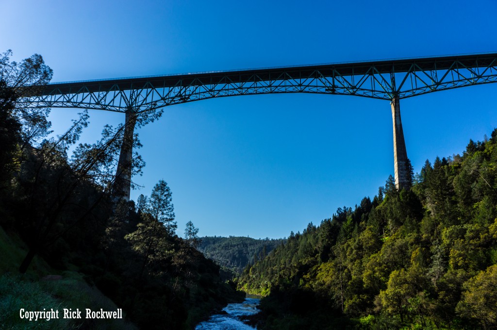
Foresthill Bridge is a tall steel deck truss bridge on Foresthill Road near Auburn, California. It crosses the North Fork American River and connects the Auburn side of the canyon with the Foresthill Divide.
The bridge is often called California’s tallest bridge because its deck rises about 730 feet above the North Fork American River. It is 2,428 feet long, with three major spans of 639 feet, 862 feet, and 639 feet.
Foresthill Bridge sits within the larger Auburn State Recreation Area landscape, which stretches along the North and Middle Forks of the American River.
That setting is what makes the bridge so memorable. It is not just a tall bridge over a road cut or urban valley. It crosses a deep river canyon shaped by mining history, dam projects, rugged trails, and some of the most popular outdoor recreation in all of Placer County.
Where Is Foresthill Bridge?
Foresthill Bridge is located on Foresthill Road northeast of Auburn, just east of the American River Confluence area. The bridge carries traffic between Auburn and the Foresthill Divide, crossing high above the North Fork American River before Foresthill Road continues toward the town of Foresthill.
For most visitors, the easiest approach is from Auburn. From Interstate 80, head toward Highway 49 or Foresthill Road and follow signs toward the Confluence, Lake Clementine, or Foresthill. California State Parks notes that Auburn State Recreation Area’s main access is from Auburn by either Highway 49 or Foresthill Road.
How to Visit Foresthill Bridge
The easiest way to experience Foresthill Bridge is to drive across it on Foresthill Road, then use a legal parking area or nearby trailhead to explore the canyon. Do not stop on the bridge, block traffic, or park in unsafe roadside areas.
For a quick visit, many people walk part or all of the pedestrian walkway and take in the view from the bridge itself. For a fuller trip, combine the bridge with the Confluence area, Lake Clementine Trail, Quarry Trail, Bridgeview Trail, or No Hands Bridge.
Auburn SRA day-use areas are generally managed as sunrise-to-sunset recreation areas. Parking fees vary by access point, but California State Parks lists Auburn SRA day-use fees at $10 for several areas, with some Lake Clementine-related fees differing by use. Fees are subject to change, so check the current State Parks fee page before heading out.
Can You Walk Across Foresthill Bridge?
Yes. Visitors can walk across Foresthill Bridge using the pedestrian walkway. It is one of the most dramatic short walks in the Auburn area because the bridge gives you a straight-down view into the North Fork American River canyon.
The walk itself is not difficult, but the height can feel intense. Wind, traffic noise, vibration, and the open canyon below can make the bridge feel much more exposed than a normal sidewalk walk. Anyone with a fear of heights should know that this is not a casual overlook with a distant view. You are standing directly above the canyon.
Stay on the public pedestrian walkway, keep children close, and do not climb on the railings, girders, catwalks, or restricted bridge areas.
Best Places to See Foresthill Bridge
Foresthill Bridge can be viewed from several angles, and each one gives you a different sense of the bridge’s size.
Viewpoint | Best For | What You’ll See | Good to Know |
Bridge Walkway | Quick visit, height, photos | Direct views down into the North Fork American River canyon | Most exposed viewpoint; stay on the pedestrian walkway |
Confluence Area | Looking up at the bridge from below | Full canyon setting with the bridge high overhead | Easy to pair with river access, Lake Clementine Trail, Stagecoach Trail, or Quarry Trail |
Bridgeview Trail | Short hike with bridge views | Foresthill Bridge from the canyon-side trail network | State Parks lists Bridgeview Trail as a 0.8-mile route |
Lake Clementine Trail | River scenery and a fuller Auburn SRA outing | Bridge views, North Fork American River scenery, and access toward the North Fork Dam viewpoint | Best if you want more than a quick roadside stop |
From the Bridge Walkway
The pedestrian walkway is the easiest way to feel the height of Foresthill Bridge. It gives you open views into the North Fork American River canyon, but it is also the most exposed option, so stay on the walkway and avoid climbing or leaning over for photos.
From the Confluence Area
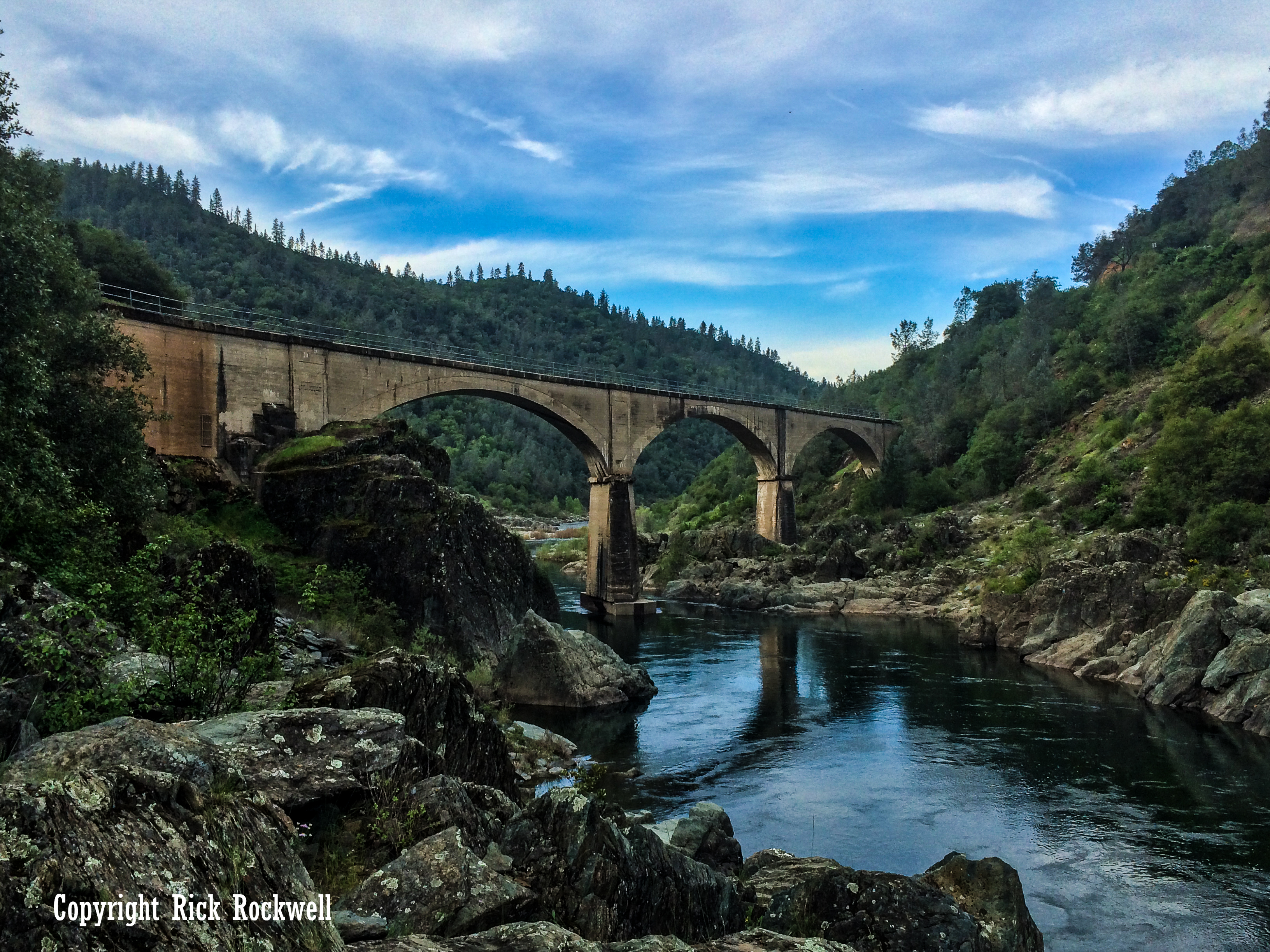
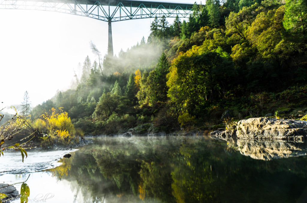
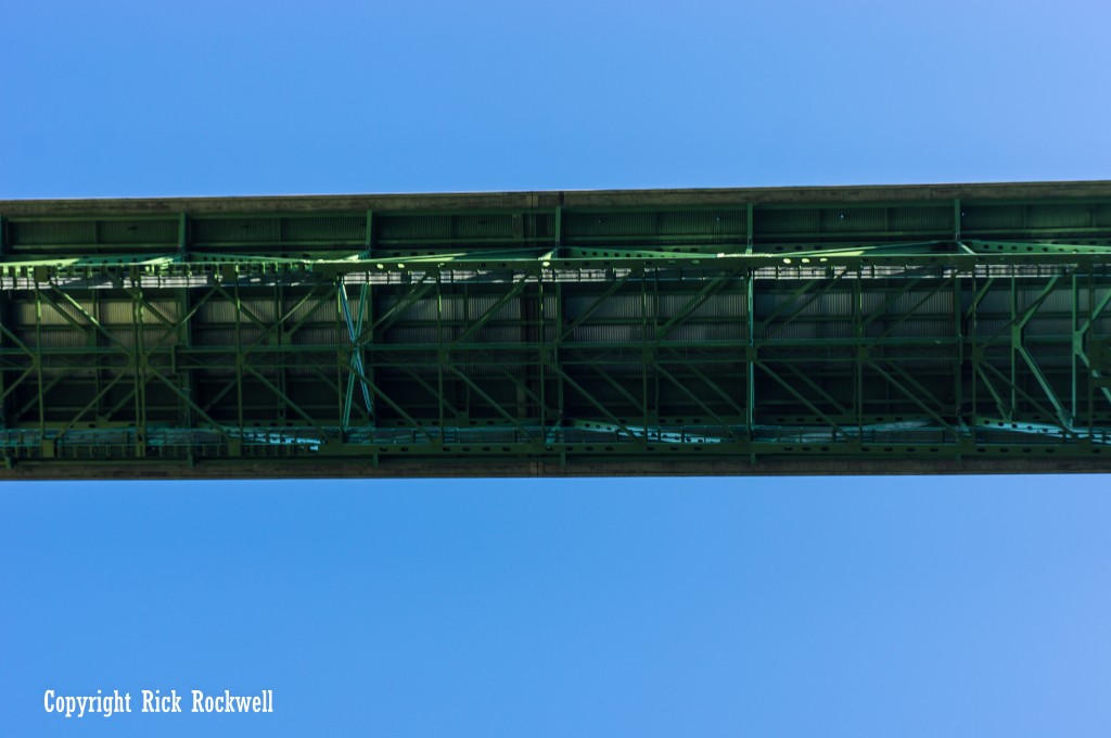
The Confluence area gives you the best look at Foresthill Bridge from below. From the river canyon, the bridge looks massive overhead, and this spot also works well with nearby stops like Lake Clementine Trail, Stagecoach Trail, and Quarry Trail.
From Bridgeview Trail
Bridgeview Trail is a short Auburn SRA route with direct Foresthill Bridge views. California State Parks lists it as a 0.8-mile trail, making it a good choice if you want a trail-based view without committing to a longer hike.
From Lake Clementine Trail
Lake Clementine Trail combines bridge views with one of the best short river hikes in Auburn State Recreation Area. The route follows the North Fork American River and can be extended toward the North Fork Dam viewpoint, making it a better option for visitors who want a fuller outing.
Parking, Fees, and Visitor Tips
Foresthill Bridge itself is a road bridge, so the best parking strategy depends on how you plan to visit. Many visitors use nearby Auburn State Recreation Area access points, especially around the Confluence, Lake Clementine Trail, Quarry Trail, or other official trailheads.
Do not stop on the bridge or pull over in unsafe roadside areas just to take photos. Use legal pullouts, trailhead parking, or official Auburn SRA parking areas where parking is allowed.
California State Parks lists day-use fees for Auburn SRA areas, with $10 day-use fees shown for several locations and different fees for Lake Clementine boat launch or camping uses. Fees are subject to change.
- Arrive early on warm weekends. The Confluence area can get crowded, especially during river season.
- Bring water. The canyon can get very hot in summer.
- Use official parking areas. Avoid unsafe shoulder parking near blind curves or narrow canyon roads.
- Watch for poison oak. It is common around Auburn SRA.
- Expect wildlife. Rattlesnakes, ticks, black bears, and mountain lions are part of the broader foothill environment.
- Do not climb on the bridge. Restricted areas are dangerous and can lead to citations.
- Check current Auburn SRA conditions before visiting. Fees, closures, weather, and access rules can change.
- Check dog rules before planning a dog-friendly hike. California State Parks requires dogs to be controlled on leash in state parks, and dog access can vary by trail, road, developed area, and site-specific rules.

Hiking Near Foresthill Bridge
Foresthill Bridge is surrounded by some of the best hiking options in Auburn State Recreation Area. Some trails give you direct bridge views, while others help you understand the canyon, mining history, river access, and old transportation routes around the bridge.
Trail | Distance | Best For |
Bridgeview Trail | 0.8 miles | Short trail with Foresthill Bridge views |
Lake Clementine Trail | 1.8 miles out and back | River walk, bridge views, North Fork Dam viewpoint |
Stagecoach Trail | 1.8 miles | Canyon views and historic route |
Quarry Trail | 5.6 miles | Easy river-canyon hiking and mining/railroad history |
Foresthill Divide Loop Trail | 10.6 miles | Longer hiking, biking, and canyon views |
Fuel Break Trail | 1.5 miles | Shorter trail east of Foresthill Bridge |
Bridgeview Trail
Bridgeview Trail is the simplest choice if you want a short hike with Foresthill Bridge views. California State Parks lists it as a 0.8-mile route, making it a good add-on if you want more than a quick stop on the bridge walkway.
Lake Clementine Trail
Lake Clementine Trail is probably the most useful hike for first-time visitors to Foresthill Bridge. It starts near the Confluence and follows the North Fork American River through a scenic canyon corridor. The trail is relatively short, but it gives you a strong feel for the river environment beneath the bridge.
The route is especially popular because hikers can continue toward a view of the North Fork Dam, where water spills over the curved dam face when flows are right. If you are already writing or internally linking a Lake Clementine article, this is one of the best nearby sections to connect.
Stagecoach Trail
Stagecoach Trail adds historical depth to a Foresthill Bridge visit. California State Parks says the trail was originally a stagecoach line built in 1852. It connects the Confluence to Russell Road and climbs from the river corridor toward higher canyon views.
This is a good option if you want a more physical hike and a better feel for how steep the canyon walls are around the bridge.
Quarry Trail
Quarry Trail is one of the best easy hikes in Auburn SRA and makes a natural companion to Foresthill Bridge, No Hands Bridge, and the old Mountain Quarries Railroad story. California State Parks describes Quarry Trail as a wide, level, 5.6-mile trail that follows the route of an old Gold Rush-era flume and later part of the Mountain Quarries railroad corridor.
This is the hike to recommend for visitors who want history without too much climbing.
Foresthill Divide Loop Trail
Foresthill Divide Loop Trail is a longer option for hikers, trail runners, mountain bikers, and equestrians. California State Parks lists it as a 10.6-mile loop with views of Lake Clementine and the North and Middle Forks of the American River.
This is not the quick bridge stop. It is better for visitors who want to turn the Auburn-Foresthill area into a half-day or full-day outdoor trip.
Fuel Break Trail
Fuel Break Trail is a shorter trail east of Foresthill Bridge. It is not the main bridge-view hike, but it can work for visitors staying on the Foresthill side who want a brief Auburn SRA trail option without heading all the way down to the Confluence.
Why Foresthill Bridge Was Built So High
Foresthill Bridge was built for a lake that never came.
The bridge was part of the planned Auburn Dam project, which would have flooded much of the North Fork American River canyon behind a large reservoir. To keep Auburn connected with Foresthill, Foresthill Road had to be moved high above the future waterline. That is why the Auburn-Foresthill Bridge was built about 730 feet above the river.
The view was supposed to look very different. A City of Auburn history sheet notes that the planned reservoir would have risen roughly 600 feet, leaving the bridge only about 130 feet above the water. Instead, the dam was never completed, and the bridge still towers above the original canyon.
The bridge opened in 1973, when Auburn Dam still seemed like a real possibility. Its Labor Day weekend dedication even carried a bit of political theater: local-history accounts describe a donkey and an elephant at the ceremony, symbolizing bipartisan support for the bridge and the larger dam project. It was more than a ribbon cutting. It was a public show of confidence in a future reservoir that never arrived.
The project unraveled over decades through seismic concerns, rising costs, environmental fights, water-rights issues, and political debate. The 1975 Oroville earthquake forced new questions about dam safety, and the 1976 failure of Idaho’s Teton Dam further changed public confidence in large federal dam projects.
That unfinished future is what gives Foresthill Bridge its strange power today. It is not just a tall bridge with a great view. It is a working road bridge built for a reservoir that never arrived, leaving visitors with the canyon view that was once expected to disappear.
Foresthill Bridge History and Engineering
The Auburn-Folsom South Unit was authorized in 1965 as part of the Central Valley Project, and construction began in the late 1960s. Foresthill Bridge was completed and opened to traffic in 1973, after a 1972 “Flag Beam” ceremony marked progress on the bridge’s superstructure.
The bridge is a steel deck truss structure measuring 2,428 feet long, with three major spans of 639 feet, 862 feet, and 639 feet. Its deck sits about 730 feet above the North Fork American River, making it California’s tallest bridge by deck height.
The Auburn Dam project was halted in 1975 after seismic concerns led to a design re-evaluation. The dam was never completed, but the bridge remained in service as the main road connection between Auburn and Foresthill.
Because of its height, age, steel construction, and seismic setting, Foresthill Bridge has required major inspection and retrofit work. Placer County announced in 2024 that the bridge would undergo federally funded ultrasonic testing of 282 weld points, while noting that the bridge was safe and would remain open during the inspection process.
Foresthill Bridge and the Old Gold Rush Road Network
Foresthill Bridge also belongs to an older Placer County travel story. Long before the high bridge and the Auburn Dam project, this part of the American River canyon was tied together by rough roads leading to Gold Rush communities such as Foresthill, Yankee Jims, Todd Valley, Michigan Bluff, and Iowa Hill.
Those routes were slower, narrower, and much closer to the river canyons. Foresthill Bridge changed that experience completely. Instead of dropping deep into the canyon and climbing back out, drivers could cross hundreds of feet above the North Fork American River on the modern Foresthill Road alignment.
Foresthill Bridge in Movies and Pop Culture
Foresthill Bridge has also had a second life as a movie landmark.
xXx
The bridge is best known for its appearance in the 2002 action film xXx, starring Vin Diesel. In the film’s opening sequence, a red Corvette is driven off the bridge as part of a stunt scene.
The real bridge is dramatic enough without movie effects, which is probably why the scene stuck with so many people.
The Ugly Truth
Foresthill Bridge is also commonly credited with appearing in the 2009 romantic comedy The Ugly Truth, though xXx is the better-known film reference. This is a smaller pop-culture footnote, but it is still worth mentioning for visitors who like finding California film locations.
Keep this section short in the final article. It is fun, but the real strength of the Foresthill Bridge story is the combination of canyon scenery, Auburn Dam history, and California engineering.
Things to Do Near Foresthill Bridge
Foresthill Bridge works best as part of a bigger Auburn State Recreation Area trip. You can stop for a quick view, but the surrounding canyon has enough trails, river access, history, and nearby attractions to fill a full day.
Lake Clementine Trail
Lake Clementine Trail is one of the best nearby hikes for first-time visitors. It starts near the Confluence and follows the North Fork American River toward Lake Clementine Road and the North Fork Dam viewpoint. This is a strong internal link opportunity if you have a dedicated Lake Clementine Trail guide.
Clark’s Hole
Clark’s Hole is a popular swimming and river-access area near the North Fork American River corridor. It pairs naturally with a Foresthill Bridge visit in warmer months, especially for readers looking for Auburn-area swimming holes and scenic river stops.
No Hands Bridge
No Hands Bridge, officially known as Mountain Quarries Bridge, is another must-see bridge in the Auburn area. It sits much lower in the canyon and has a completely different feel from Foresthill Bridge. One bridge is a towering Auburn Dam-era road span; the other is a historic railroad bridge tied to limestone quarrying and endurance-trail culture.
This is one of the most important internal links for the article.
Quarry Trail
Quarry Trail is one of the easiest and most rewarding hikes near the Confluence. It follows the North Fork American River and includes Gold Rush, flume, quarrying, and railroad history. California State Parks notes that the route follows an old Gold Rush-era flume and later part of the Mountain Quarries railroad corridor.
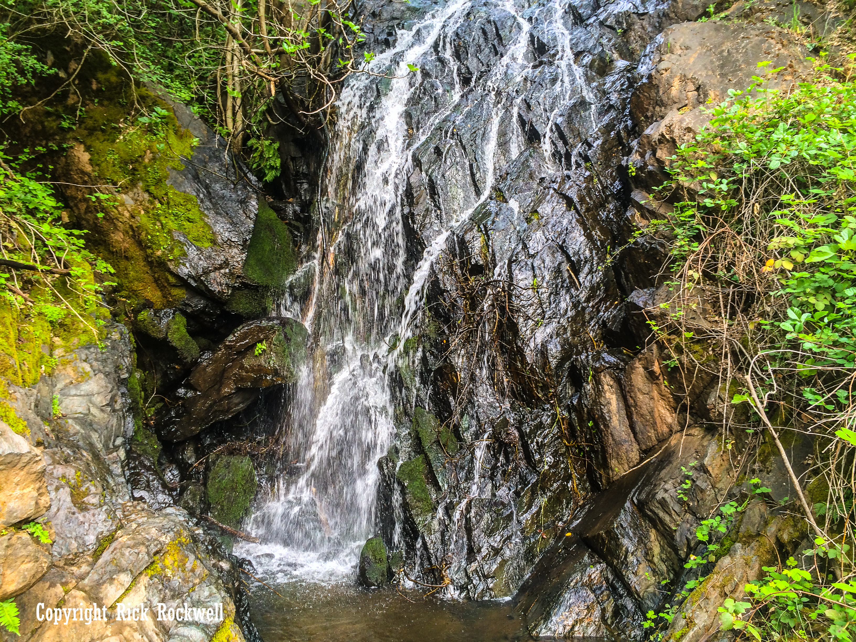
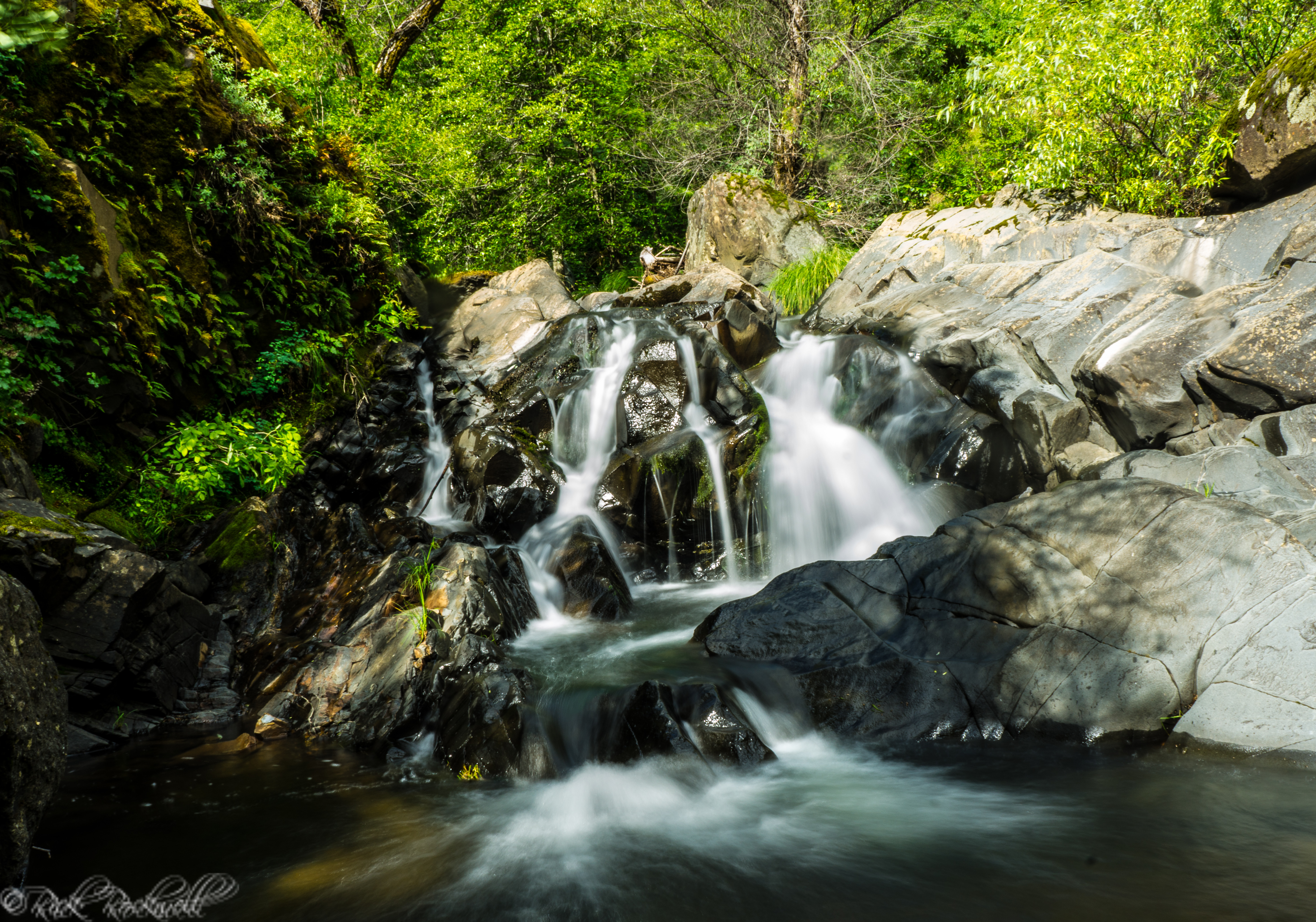
Black Hole of Calcutta Falls
Black Hole of Calcutta Falls is another nearby Auburn SRA stop that can pair well with a bridge-focused trip, especially in the wetter months when the waterfall is more active. It is also closely tied to the same broader trail and canyon landscape around No Hands Bridge and the Mountain Quarries Railroad.
Auburn State Recreation Area
Foresthill Bridge sits in one of the richest outdoor recreation zones in the Sierra foothills. Auburn SRA offers hiking, river access, boating, fishing, camping, mountain biking, horseback riding, gold panning, whitewater recreation, and more across the North and Middle Forks of the American River.
Is Foresthill Bridge Worth Visiting?
Yes, Foresthill Bridge is one of those places where the view is impressive on its own, but the story makes it better.
It is quick enough for a roadside stop but interesting enough to anchor a full article. The bridge gives visitors a rare mix of scenic drama and historical depth: California’s tallest bridge, a massive American River canyon view, a direct connection to the unfinished Auburn Dam project, nearby hiking trails, movie history, and easy access to several of the best outdoor stops in the Auburn area.
The best way to experience it is not to simply drive across and leave. My favorite view of the bridge is walking underneath it along the Lake Clementine Trail. It’s an incredible view of the structure and the entire landscape.
Foresthill Bridge FAQ
Is Foresthill Bridge the tallest bridge in California?
Yes. Foresthill Bridge is widely recognized as the tallest bridge in California by deck height. Its deck sits about 730 feet above the North Fork American River.
Can you walk across Foresthill Bridge?
Yes. Pedestrians can walk across Foresthill Bridge using the public walkway. Stay on the walkway, keep children close, and do not enter the catwalks, girders, or other restricted areas.
Where is Foresthill Bridge?
Foresthill Bridge is on Foresthill Road near Auburn in Placer County, California. It crosses the North Fork American River between Auburn and the Foresthill Divide.
Why was Foresthill Bridge built?
Foresthill Bridge was built as part of the Auburn Dam project. It carried the relocated Foresthill Road high above the reservoir that would have formed behind the planned dam.
Was Auburn Dam ever built?
No. Auburn Dam was never completed. Major construction was halted after seismic concerns forced a design re-evaluation, and the planned reservoir was never built.
Where is the best view of Foresthill Bridge?
The bridge walkway gives the most dramatic top-down view. The Confluence area, Bridgeview Trail, and Lake Clementine Trail are also good places to see the bridge from the surrounding canyon.
Do you have to pay to visit Foresthill Bridge?
There is no separate fee just to drive across Foresthill Bridge, but many nearby Auburn State Recreation Area parking areas require a day-use fee. Fees can change, so check current State Parks information before visiting.
Sources
California State Parks — Auburn State Recreation Area
https://www.parks.ca.gov/?page_id=502
California State Parks — Auburn SRA Trails
https://www.parks.ca.gov/?page_id=1345
California State Parks — Auburn SRA Fees
https://www.parks.ca.gov/?page_id=26020
California State Parks — Lake Clementine
https://www.parks.ca.gov/?page_id=1141
California State Parks — Visiting State Parks With Your Dog
https://www.parks.ca.gov/Dogs
Placer County — Foresthill Bridge Weld Inspections
https://www.placer.ca.gov/9812/Foresthill-bridge-weld-inspections
Placer County GovDelivery — Foresthill Bridge Testing Notice
https://content.govdelivery.com/accounts/CAPLACER/bulletins/3a55f56
Associated Press — Foresthill Bridge Rescue
https://apnews.com/article/a4aeb3151f0ed7dd0eab691f0198c4e0
U.S. Bureau of Reclamation — Central Valley Project: Auburn Dam History
https://www.usbr.gov/history//ProjectHistories/Central%20Valley%20Project-Auburn%20Dam%20D2.pdf
City of Auburn — The Foresthill Bridge PDF
https://www.auburn.ca.gov/DocumentCenter/View/1652/The-Foresthill-Bridge
Auburn Journal, Aug. 31, 1973 — California Digital Newspaper Collection
https://cdnc.ucr.edu/?a=d&d=AJ19730831.1.22
Placer County archive / Ralph Gibson PDF
https://www.placer.ca.gov/ArchiveCenter/ViewFile/Item/558
Forest Hill Divide Historical Society / Foresthill Divide history
https://foresthillhistory.net/