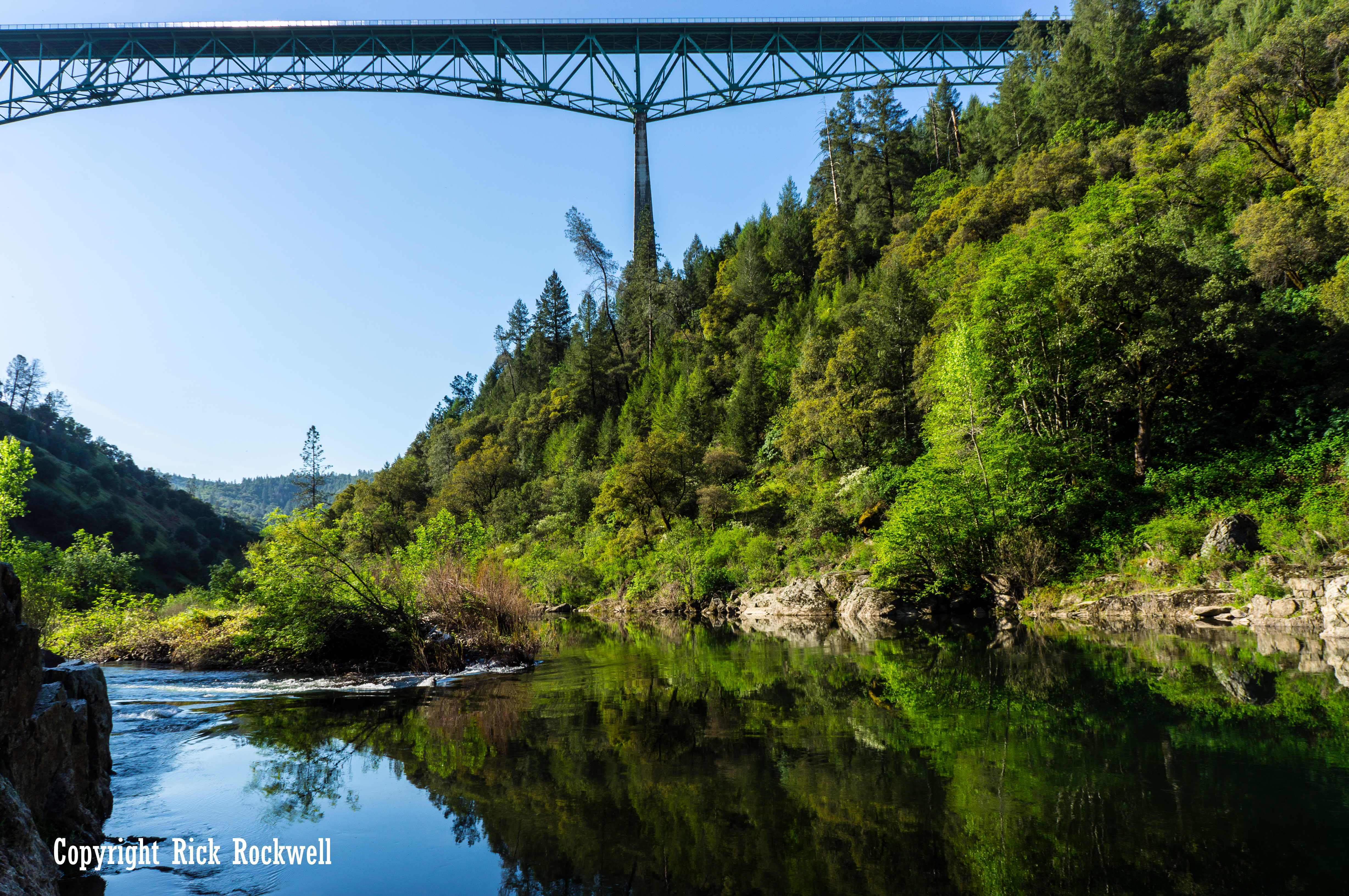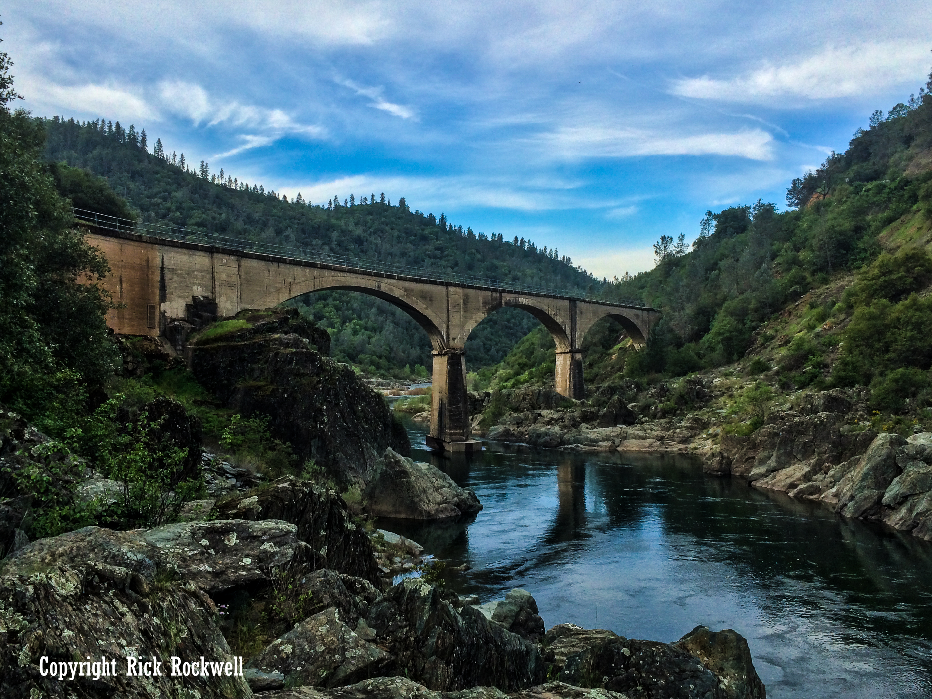
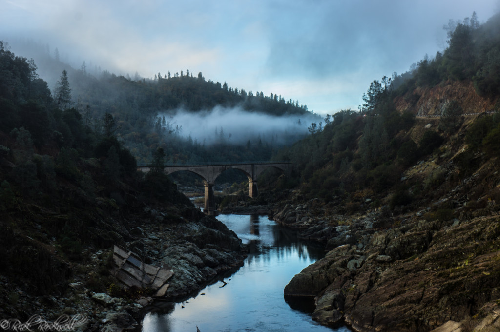
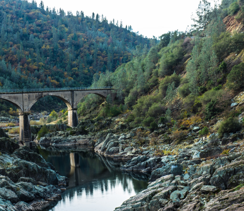
No Hands Bridge is one of Auburn State Recreation Area’s most recognizable landmarks, a historic concrete railroad bridge turned scenic trail crossing in the American River canyon. Its official name is Mountain Quarries Bridge, and it was completed in 1912, for the Mountain Quarries Railroad, which hauled quarry material out of the canyon toward Auburn.
Today, the bridge is a popular stop for hikers, runners, cyclists, equestrians, and photographers exploring the trails near the Confluence. It also carries deeper significance as an early reinforced-concrete railroad bridge designed by John B. Leonard, an important figure in California engineering history.
Quick Facts About No Hands Bridge
- Official Name: Mountain Quarries Bridge
- Common Name: No Hands Bridge
- Location: Auburn State Recreation Area
- Nearest City: Auburn, California
- Counties: Placer and El Dorado
- River: American River / North Fork American River canyon area
- Built: 1912
- Original Use: Railroad bridge for Mountain Quarries Railroad
- Designer: John B. Leonard
- Historic Status: National Register of Historic Places; California Historical Landmark No. 1051
Where Is No Hands Bridge?
No Hands Bridge is located in Auburn State Recreation Area, near the American River Confluence area below Auburn. It sits in the river canyon near Highway 49, where the recreation area draws hikers, runners, cyclists, equestrians, swimmers, and history-minded visitors throughout the year.
Directions From Sacramento:
- Drive east on Interstate 80 for about 33 miles to Auburn.
- Take the exit for CA State Highway 49 (South to Placerville)
- Head through town and follow the signs for Highway 49 South
- It will leave town and wind around the foothills along the North Fork of the American River for about 5 miles
- At the split, make a right to remain on Highway 49 and head over the bridge
- Once you cross the bridge, immediately pull into the small parking area on the right side of the street
Visiting No Hands Bridge Today
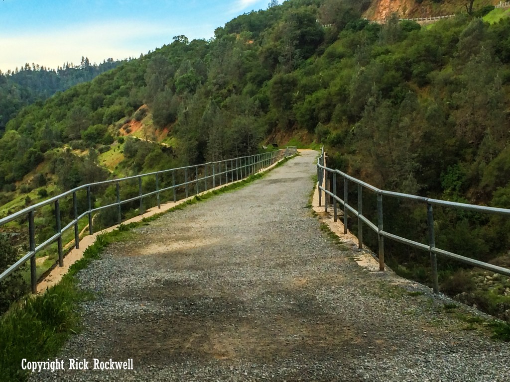
Today, No Hands Bridge is open as a recreation crossing for people exploring Auburn State Recreation Area. Visitors use it for hiking, running, cycling, horseback riding, photography, and access to nearby trails.
The bridge is especially popular because it is relatively easy to reach compared with many canyon landmarks like Yankee Jims Bridge or the wild drive through ASRA to the living ghost town of Iowa Hill. You do not need to commit to a major backcountry hike or journey to see it. Many people visit as a short walk from nearby trail access areas, cross the bridge, take in the canyon views, and return.
That said, this is still the American River canyon. Summer heat can be intense, parking can fill, and trails may be shared with runners, mountain bikers, equestrians, and dogs. Bring water, pay attention to trail traffic, and check current Auburn State Recreation Area notices before you go.
Access around No Hands Bridge can also change because of trail work, road work, river conditions, or canyon restoration projects, so check current park and county updates before combining the bridge with a longer hike.
Why Is It Called No Hands Bridge?
The official name is Mountain Quarries Bridge, but most people know it as No Hands Bridge. The nickname is tied to the bridge’s recreation era, especially the equestrian and endurance-trail culture around the Western States Trail and Tevis Cup.
One commonly repeated explanation, or local urban legend, is that riders crossed the bridge without using their hands or reins. Another explanation points to the bridge’s earlier years before modern safety railings, when the crossing felt exposed enough to earn the nickname.
Trail Options Near No Hands Bridge
No Hands Bridge can be a quick scenic stop, a short walk, or part of a longer Auburn State Recreation Area hike. The right route depends on whether you want a simple bridge visit, a short waterfall add-on, or a longer canyon hike using the Western States Trail and Quarry Trail system.
Distances can vary depending on where you park, which trailhead is open, and how far you continue beyond the bridge. Use the mileage below as a planning estimate.
Trail or Route | Approx. Distance | Best For |
Short No Hands Bridge Walk | About 2 miles round trip | Quick bridge visit, photos, casual sightseeing |
Western States Trail to Black Hole of Calcutta Falls | About 2.2 miles round trip | Short waterfall add-on |
Quarry & Western States Loop | 6.3 miles | Longer loop hike |
Western States / Pioneer Express Route | About 8.7 miles out and back | Longer hike, trail running, horseback riding |
Middle Fork American River Quarry Trail | About 11.1 miles out and back | Longer river canyon hike |
Short No Hands Bridge Walk
For the simplest visit, treat No Hands Bridge as a short out-and-back walk. One common route is about 2 miles round trip, making it a good choice if you want the bridge experience without committing to a longer canyon hike.
This shorter walk gives you the main payoff quickly: the historic bridge, the American River canyon setting, and the chance to cross a landmark that once carried trains instead of hikers. You can walk to the bridge, take in the views, continue across for a different angle, and return the way you came.
This is the best option for families, casual hikers, photographers, and visitors who want to pair No Hands Bridge with another Auburn stop like Lake Clementine, Foresthill Bridge, the Confluence, or downtown Auburn.
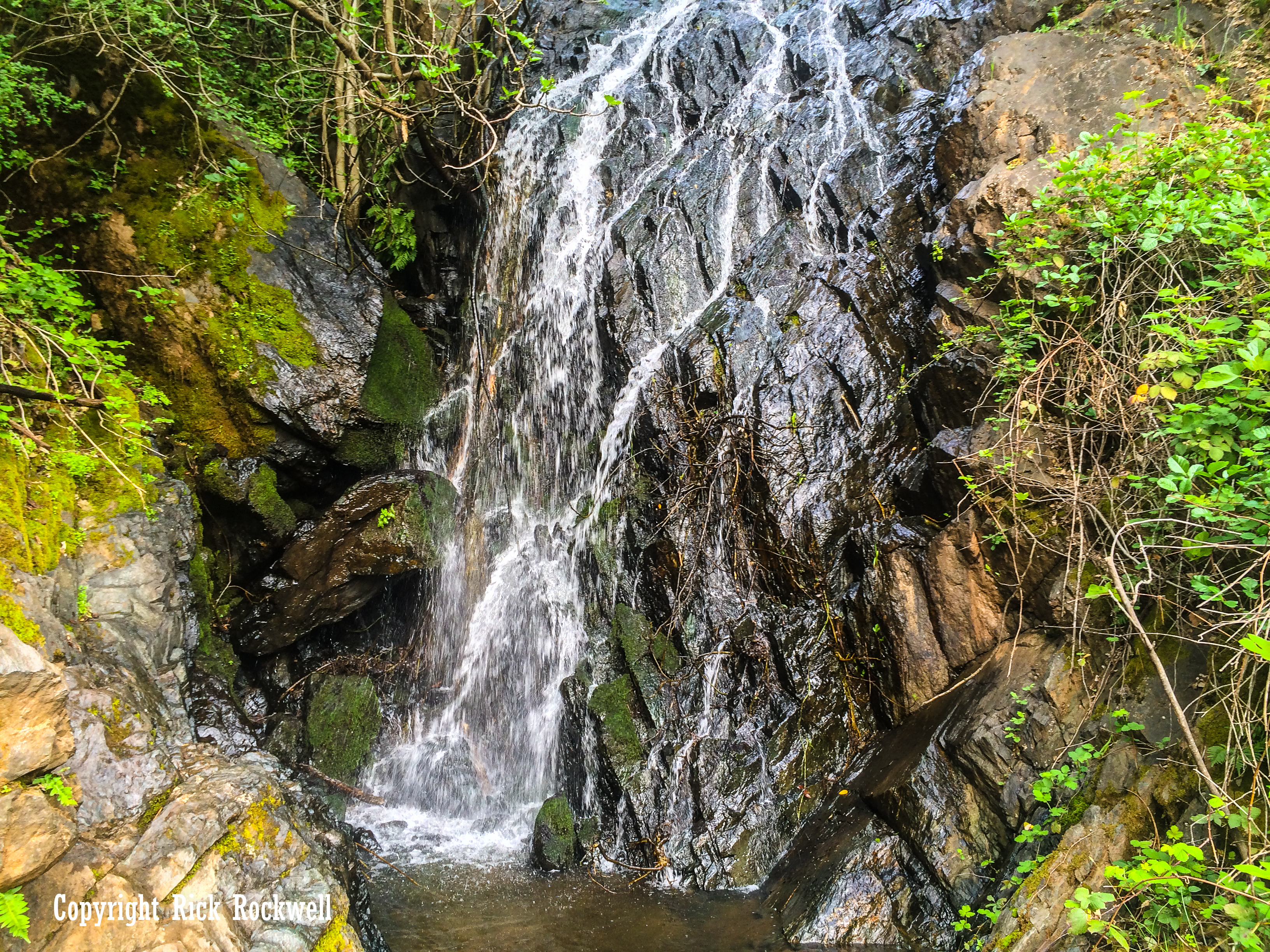
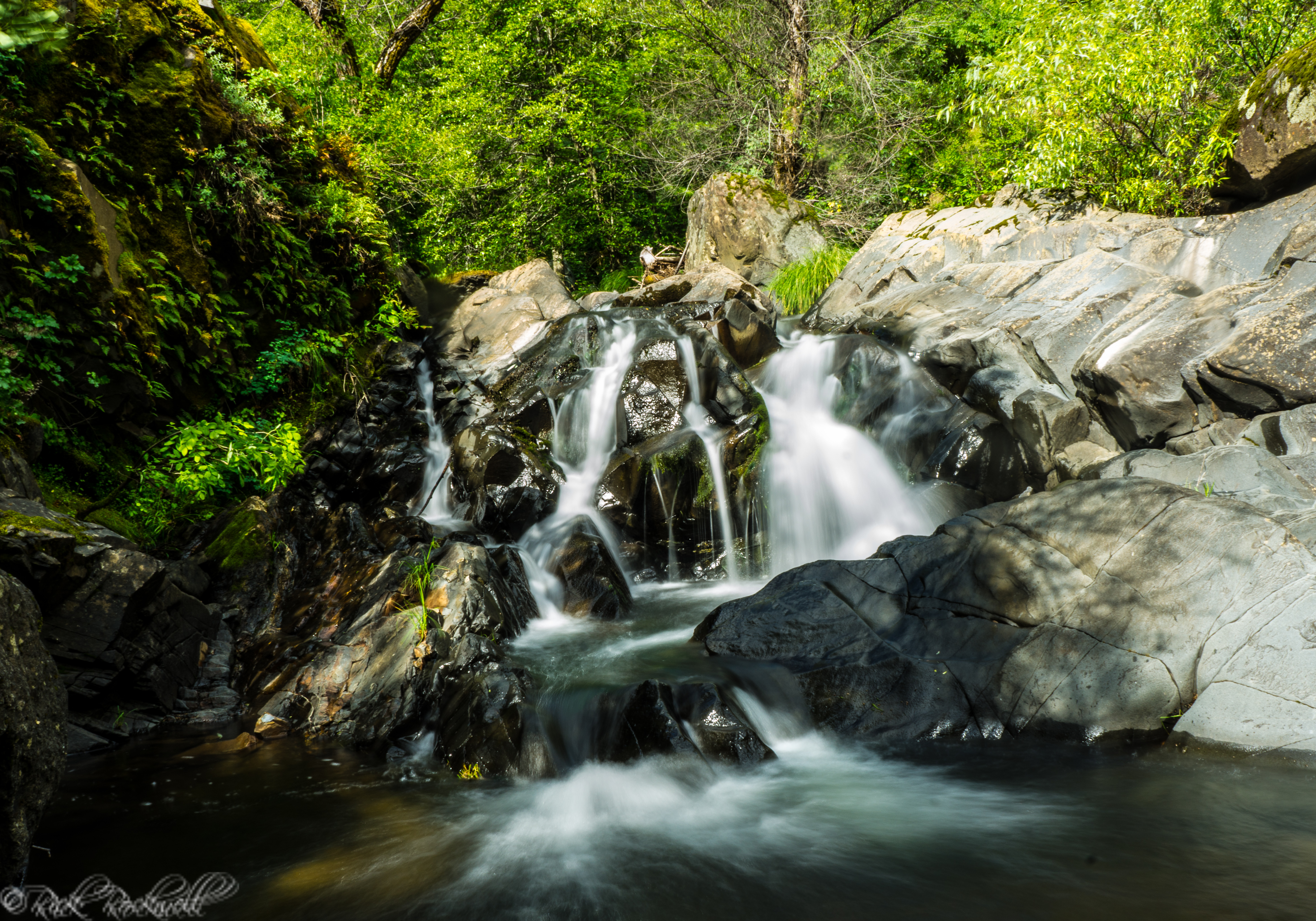
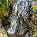
Western States Trail to Black Hole of Calcutta Falls
For a short hike with a second destination, continue toward Black Hole of Calcutta Falls. This route is commonly listed at about 2.2 miles round trip, making it a manageable add-on if you want more than a quick bridge visit.
No Hands Bridge works well as part of this outing because it sits along the same general trail corridor near the Auburn Confluence. The bridge gives you the history and canyon views; Black Hole of Calcutta Falls gives you the seasonal waterfall payoff.
This route is different from simply walking to the bridge and turning around. Late winter and spring are usually better for waterfall flow, while summer and fall may bring low water or a dry chute.
If the waterfall is your main goal, check the full Black Hole of Calcutta Falls guide before going so you know the route, current access situation, and best time of year to visit.
Quarry & Western States Loop
For a longer route near No Hands Bridge, the Quarry & Western States Loop gives you a fuller Auburn canyon hike. This loop is commonly listed at about 6.3 miles, making it a better fit for hikers who want more than a short bridge stop.
The route combines pieces of the Quarry Trail and Western States Trail, giving you a longer look at the American River canyon and the old railroad landscape connected to Mountain Quarries Bridge. It is a good option if you want to understand the bridge as part of a larger historic corridor rather than a single landmark.
Expect a more involved hike than the short No Hands Bridge walk. Bring water, check current trail conditions, and be ready for shared use with hikers, runners, cyclists, and equestrians.
Western States / Pioneer Express Route
The Western States / Pioneer Express Route is a longer out-and-back option for hikers, trail runners, and equestrians who want a bigger Auburn State Recreation Area outing. This route is commonly listed at about 8.7 miles out and back, though exact mileage may vary by starting point and turnaround point.
This option is best for people who want to spend more time on the broader Western States Trail corridor rather than only visiting the bridge. No Hands Bridge is one of the landmark features in this trail system, but the longer route gives you more canyon scenery, more distance, and a better sense of the endurance-trail landscape around Auburn.
This is also where the bridge’s Western States identity becomes especially meaningful. No Hands Bridge sits in a trail network tied to the Tevis Cup, the Western States Endurance Run, and Auburn’s long-distance trail culture.
Middle Fork American River Quarry Trail
The Middle Fork American River Quarry Trail is a longer river canyon route connected to the old Mountain Quarries Railroad corridor. It is commonly listed at about 11.1 miles out and back, though many visitors turn around earlier and only use a portion of the trail.
This is the best option if you want to connect No Hands Bridge with the area’s railroad history. The Quarry Trail follows part of the old rail corridor, helping you picture how Mountain Quarries Bridge once fit into a working railroad line that moved quarry material out of the canyon toward Auburn.

Things To Know Before You Go To No Hands Bridge
No Hands Bridge is easy to visit compared with many Auburn State Recreation Area destinations, but it still helps to plan ahead. Heat, parking, trail traffic, and seasonal conditions can all affect the experience.
Best Time to Visit No Hands Bridge
No Hands Bridge can be visited throughout much of the year, but the experience changes by season.
Spring is one of the best times to visit. The foothills are greener, temperatures are usually more comfortable, and the river canyon tends to feel more alive. This is also a good time to combine the bridge with nearby wildflower walks or waterfall hikes.
Summer can be beautiful, but the canyon gets hot. Go early, bring more water than you think you need, and avoid treating this as a casual midday stroll during heat waves. The Confluence area can also be crowded.
Fall is a strong season for hiking near Auburn. Temperatures are usually more comfortable than summer, and the bridge can be a good stop before or after exploring downtown Auburn, Lake Clementine, or other nearby trails.
Winter, my favorite time to visit this bridge, can be quiet and atmospheric, but storms, slick trails, and high river flows can change the experience. Always check current park conditions before heading into the canyon.
What to Bring
For a short visit, you do not need much, but it is still smart to bring:
- Water
- Comfortable walking shoes
- Sun protection
- A camera or phone
- A leash if bringing a dog
- A small day pack if continuing onto longer trails
- A parking pass or payment method if required at your chosen access point
For longer hikes, bring more water, snacks, navigation, and layers. The canyon can feel very different at the river than it does up near Auburn.
Photography Tips
No Hands Bridge is photogenic from several angles and is worth shooting throughout the year with the different seasons providing different backdrops.
The best photos usually come from the approach to the bridge, looking across the bridge toward the canyon, and from safe river-level perspectives below or near the bridge. Golden-hour light can give the canyon a warmer look, while spring greenery after winter rains adds more color to the landscape.
Avoid blocking the trail when taking photos. This is an active multi-use route, and you may encounter runners, cyclists, equestrians, and families crossing the bridge.
Things to Do Near No Hands Bridge
No Hands Bridge is easy to pair with other Auburn-area stops. Whether you want another hike, a scenic overlook, or a casual downtown stop, there are several good options nearby.
Black Hole of Calcutta Falls
Black Hole of Calcutta Falls is one of the best nearby hikes if you want to turn the bridge visit into a longer canyon outing.
Lake Clementine Trail
Lake Clementine Trail is one of the most popular hikes in Auburn State Recreation Area, with river views, canyon scenery, and access toward the Lake Clementine area.
Foresthill Bridge
Foresthill Bridge is another major Auburn landmark and one of the most dramatic bridge viewpoints in the region. It pairs well with No Hands Bridge because the two bridges show very different eras of canyon engineering.
Auburn Confluence
The Confluence area is the main recreation hub near the bridge, where the North Fork and Middle Fork American River corridors come together near Highway 49.
Downtown Auburn
After visiting the bridge, downtown Auburn makes an easy food, coffee, or history stop. It also helps round out the trip for readers who want more than a short hike.
A Short History of Mountain Quarries Bridge
Mountain Quarries Bridge was completed in 1912 for the Mountain Quarries Railroad, a short rail line built to move quarry material out of the American River canyon toward Auburn. From there, the material connected with the Southern Pacific Railroad, tying this rugged canyon crossing to a much larger industrial network.
The bridge’s official history is one reason No Hands Bridge is more than a scenic trail stop. It was built during a period when reinforced concrete was still proving itself for major railroad structures, and it remains one of the most important historic landmarks in Auburn State Recreation Area.
Built for the Mountain Quarries Railroad
The bridge was originally part of the Mountain Quarries Railroad, which served quarry operations connected to the Pacific Portland Cement Company. Trains carried stone out of the canyon toward Auburn, giving the bridge a practical industrial purpose long before hikers, runners, and equestrians used it as a recreation crossing.
That railroad era did not last forever. The line was eventually abandoned, the tracks were removed, and the bridge’s purpose changed. What remained was the massive concrete span, pieces of the old rail corridor, and a canyon route that later became part of Auburn’s trail culture.
An Early Concrete Engineering Landmark
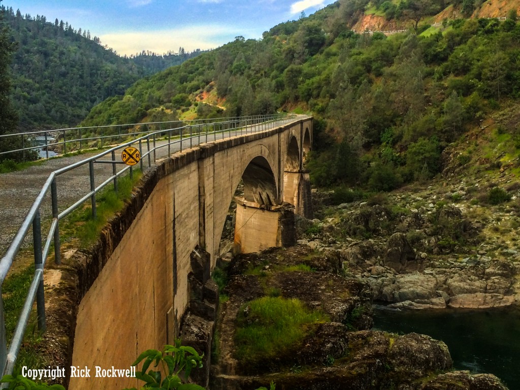
Mountain Quarries Bridge was designed by John B. Leonard, an important figure in early reinforced-concrete engineering. The bridge measured roughly 482 feet long, 15 feet wide, and 70 feet high, with three large concrete arch spans.
At the time, the bridge was ambitious. It showed how reinforced concrete could be used for a major railroad crossing in difficult canyon terrain. That engineering significance is a major reason the bridge is listed on the National Register of Historic Places and recognized as California Historical Landmark No. 1051.
The 1911 Construction Accident
The bridge also has a darker chapter. During construction in November 1911, part of the temporary wooden support structure collapsed while concrete work was underway. Later local history accounts say the accident killed three workers and injured five others.
The Bridge That Survived the 1964 Flood
One of the bridge’s most memorable survival stories came during the 1964 Hell Hole Dam failure, when floodwaters and debris tore through the American River system. Mountain Quarries Bridge survived while newer nearby infrastructure was damaged or destroyed.
After the flood, the old railroad bridge was even used temporarily for vehicle traffic between Placer and El Dorado counties while repairs were made elsewhere.
Saving No Hands Bridge
By the 1990s, No Hands Bridge had become a beloved trail landmark, but erosion threatened part of the structure. The bridge was closed in 1996, followed by a preservation effort that included federal repair funding, private fundraising, and restoration work.
That effort helped preserve the bridge for the hikers, runners, cyclists, equestrians, and visitors who use it today. Its story now stretches from railroad construction and quarry work to flood survival, preservation, and modern recreation.
Is No Hands Bridge Worth Visiting?
Yes, No Hands Bridge is worth visiting, especially if you enjoy places that combine scenery, history, and easy access. The appeal of this bridge is different than anything else in the Auburn State Recreation Area.
While the ASRA has a few historic bridges like Yankee Jims Bridge and Iowa Hill Bridges, the Mountain Quarries Bridge gives you a historic railroad bridge, American River canyon views, Gold Country engineering history, flood-survival lore, and Western States Trail culture in one compact stop.
For casual visitors, it is one of the easiest historic landmarks to see near Auburn. For hikers and trail runners, it is a gateway into a much larger trail network. For history lovers, it is one of the most interesting surviving pieces of early 20th-century infrastructure in the American River canyon.
FAQ: No Hands Bridge and Mountain Quarries Bridge
Where is No Hands Bridge?
No Hands Bridge is in Auburn State Recreation Area near Auburn, California. It spans the American River canyon on the boundary between Placer and El Dorado counties.
Is No Hands Bridge the same as Mountain Quarries Bridge?
Yes. Mountain Quarries Bridge is the official historic name. No Hands Bridge is the common nickname used by hikers, runners, equestrians, and local visitors.
Why is it called No Hands Bridge?
The nickname is commonly connected to local equestrian and Western States Trail culture, especially stories of riders crossing the bridge without using their hands or reins. Another version points to the bridge’s earlier, more exposed condition before modern railings.
When was No Hands Bridge built?
The bridge was built in 1912 for the Mountain Quarries Railroad. It was designed by John B. Leonard and used to carry quarried material toward Auburn and the Southern Pacific Railroad connection.
Was No Hands Bridge built for trains?
Yes. Mountain Quarries Bridge was originally a railroad bridge built for the Mountain Quarries Railroad. It carried quarry material from the American River canyon toward Auburn.
Can you walk across No Hands Bridge?
Yes. Today the bridge is used as a recreation crossing for hikers, runners, cyclists, and equestrians in Auburn State Recreation Area.
How long is the hike to No Hands Bridge?
The shortest visit can be done as a relatively short walk from nearby Auburn State Recreation Area access points. Longer routes can connect the bridge with the Western States Trail, Quarry Trail, or the hike toward Black Hole of Calcutta Falls.
Is No Hands Bridge part of the Western States Trail?
Yes, No Hands Bridge is strongly associated with the Western States Trail and the endurance-riding and running culture around Auburn.
What else is near No Hands Bridge?
Nearby places include Black Hole of Calcutta Falls, Lake Clementine Trail, Foresthill Bridge, the Auburn Confluence area, Quarry Trail, and downtown Auburn.
Sources
California Office of Historic Preservation — Mountain Quarries Railroad Bridge
https://ohp.parks.ca.gov/ListedResources/Detail/1051
National Park Service / National Register of Historic Places — Mountain Quarries Bridge nomination
https://npgallery.nps.gov/NRHP/GetAsset/NRHP/04000014_text
Placer County — American River Bridge Debris Removal
https://www.placer.ca.gov/10393/American-River-Bridge-Debris-Removal
Placer County — American River Bridge Debris Removal Project completion notice
https://www.placer.ca.gov/10650/AR-Debris-completion
Visit Placer — Quarry & Western States Loop Trail
https://www.visitplacer.com/discover/quarry-western-states-loop-trail/
Western States Endurance Run — How It All Began
https://www.wser.org/how-it-all-began/
California Office of Historic Preservation — Mountain Quarries Railroad Bridge
https://ohp.parks.ca.gov/ListedResources/Detail/1051
National Park Service / National Register of Historic Places — Mountain Quarries Bridge Nomination
1986, and broader historic setting.
https://npgallery.nps.gov/NRHP/GetAsset/NRHP/04000014_text
Style Magazine — “In History: Cemented in Time, Mountain Quarries Bridge”
contract.
https://www.stylemg.com/2018/01/29/165406/in-history-cemented-in-time-mountain-quarries-bridge
Foothill Rails — “No Hands Bridge: Closeup”
https://www.trainweb.org/foothill/mqnhbcloseup.html
Placer County — American River Bridge Debris Removal
https://www.placer.ca.gov/10393/American-River-Bridge-Debris-Removal
UC Davis Engineering — Failure of Hell Hole Dam
https://research.engineering.ucdavis.edu/gpa/erosion-piping/failure-of-hell-hole-dam/
Association of State Dam Safety Officials — Lower Hell Hole Dam Failure PDF
https://damsafety.org/sites/default/files/files/LowerHellHoleDamFailure.pdf
Placer County — American River Bridge Debris Removal Completion Notice
https://www.placer.ca.gov/10650/AR-Debris-completion
California Digital Newspaper Collection — Auburn Daily Journal, “Mountain Quarries Ships 660 Million Pounds”
https://cdnc.ucr.edu/?a=d&d=ADJ19160115.2.16
Placer Herald — “Mountain Quarries Co.” — May 20, 1911
Placer Herald — “Mountain Quarries Railroad” — 1911 entries
Placer Herald — “Bridge Falls” — Nov. 11, 1911
Placer Herald — “Crossing Will be Safe” — March 2, 1912
Placer Herald — “Mt. Quarries Cut Off” — July 6, 1916