If there is one hike near Emerald Bay that makes you feel like you earned the view, it is Maggie’s Peaks. This is not the quick, easy payoff of Cascade Falls, which begins at the same starting point – Bayview Trailhead.
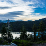
It is a steeper climb that pulls you up through granite terrain to one of the most spectacular vantage points on the south shore, where Emerald Bay, Cascade Lake, and the blue backdrop of Lake Tahoe all seem to converge into one unforgettable and breathtaking view.
Quick Facts: Maggie’s Peaks
- Location: Near Emerald Bay on the southwest side of Lake Tahoe
- Trailhead: Bayview Trailhead
- Route Type: Out-and-back
- Distance: About 4.1 to 4.5 miles round trip
- Elevation Gain: About 1,700 to 1,800 feet
- Difficulty: Difficult
- Estimated Time: About 3 to 3.5 hours
- Best Season: June through October, depending on snowpack
- Dogs Allowed?: Yes, on leash
Where Are Maggie’s Peaks?
Maggie’s Peaks rises above the horizon on the southwest side of Lake Tahoe and is most commonly reached from Bayview Trailhead off Highway 89.
The hike sits in the same scenic zone as Cascade Falls and the Bayview access routes into Desolation Wilderness, but Maggie’s is the more demanding objective, aimed at hikers who want a summit rather than a short sightseeing walk. The peaks are usually discussed as a pair, with hikers most often targeting South Maggie’s Peak.
How Long Is the Maggie’s Peaks Hike?
The hike is estimated to clock in at 4.1 to 4.5 miles roundtrip, depending on the source. I had it at 4.2 miles like AllTrails. But other sources have it as low as 4.1 or as high as 4.5 miles.
This hike can take anywhere from three to seven hours depending on how often you stop, physical limitations, how many people are on the trail, and the weather.
How Hard Is Maggie’s Peaks?
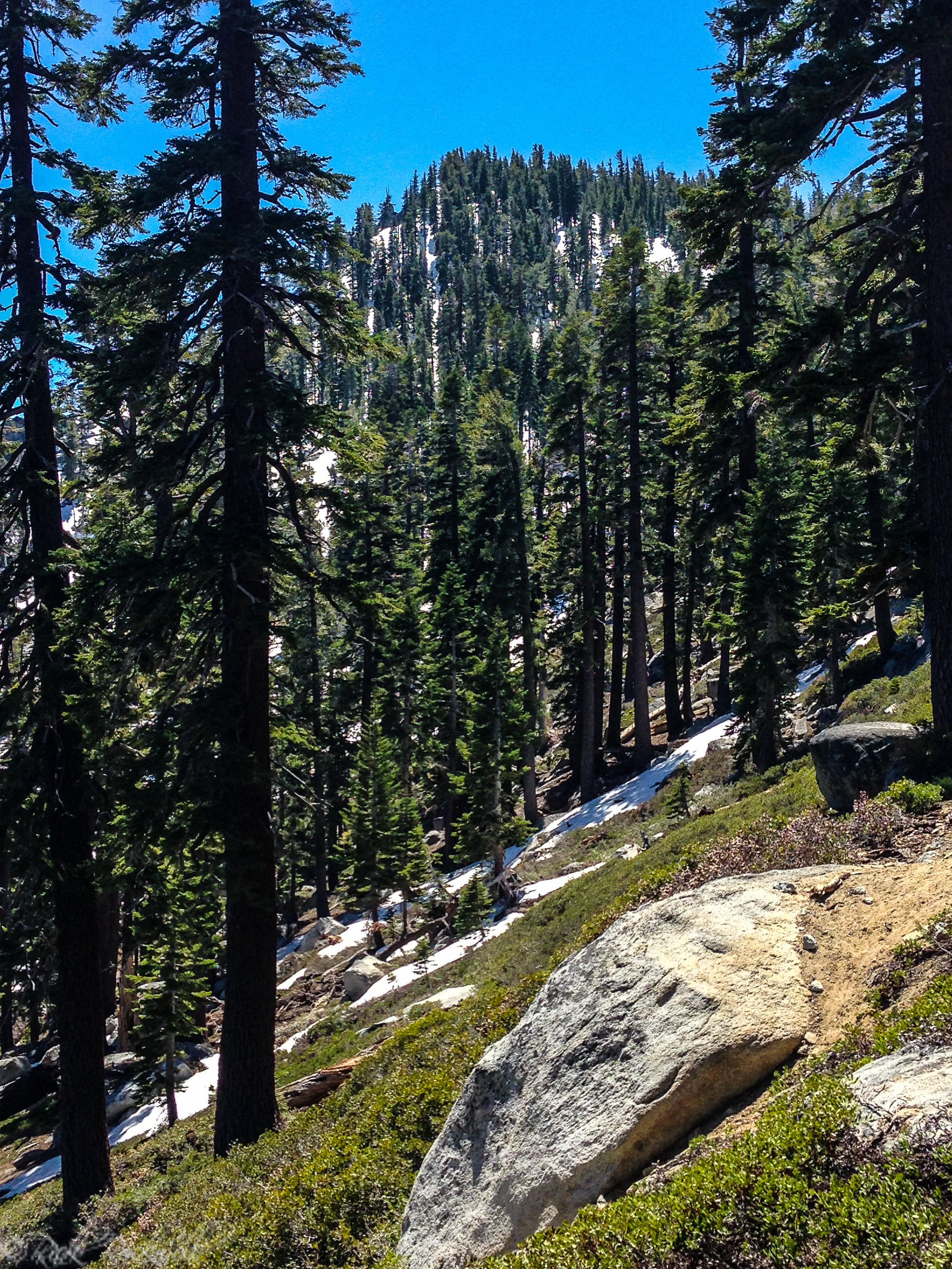
Maggie’s Peaks is best described as a difficult hike. It’s a challenging trail, particularly once you start climbing up to the saddle. You must be an advanced hiker or snowshoer to go during the winter.
This trail will surprise visitors if they only look at the mileage. The elevation gain of 1,700 to 1,800 feet makes this hike very challenging. If you aren’t experienced hiking in high elevations, it’s best that you get conditioned by trying other trails that are less difficult like the Cascade Falls Trail or the Eagle Falls Trail.
The Route From Bayview Trailhead
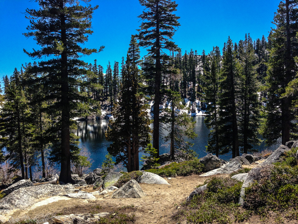
The hike starts from Bayview Trailhead, with the route to Maggie’s Peaks heading away from the Cascade Falls direction and climbing toward Granite Lake and the saddle below the peaks. You will find a sign at a split in the trail, which points towards Bayview Trail or Cascade Falls Trail.
Both trails provide a steady climb out of Bayview up to this split. Additionally, you will see some incredible views of Emerald Bay and Fannette Island at this juncture.
From there, things will level out as you reach Granite Lake and the nearby meadow. Then, the hard part begins as the trail steepens all the way up to the saddle. At the top of the saddle, you can hike towards either of the peaks.
The Route From Eagle Falls Trail
Maggie’s Peaks can also be reached from the Eagle Falls Trail, but this is a bigger undertaking than the standard out-and-back to Eagle Lake. Starting from the Eagle Falls / Eagle Lake Trailhead near Emerald Bay, hikers first follow the main trail to Eagle Lake, then continue beyond the usual turnaround point into the connected trail network linking the Eagle Lake basin with the Bayview and Granite Lake side of the route.
From there, the hike climbs toward the saddle below Maggie’s Peaks before making the final push to the summit.
This approach works best as a loop or crossover hike rather than a simple side trip. Keep in mind, this route will put the outing at 6 to 7 miles with an estimated 1,900 to 2,000 feet of elevation gain.
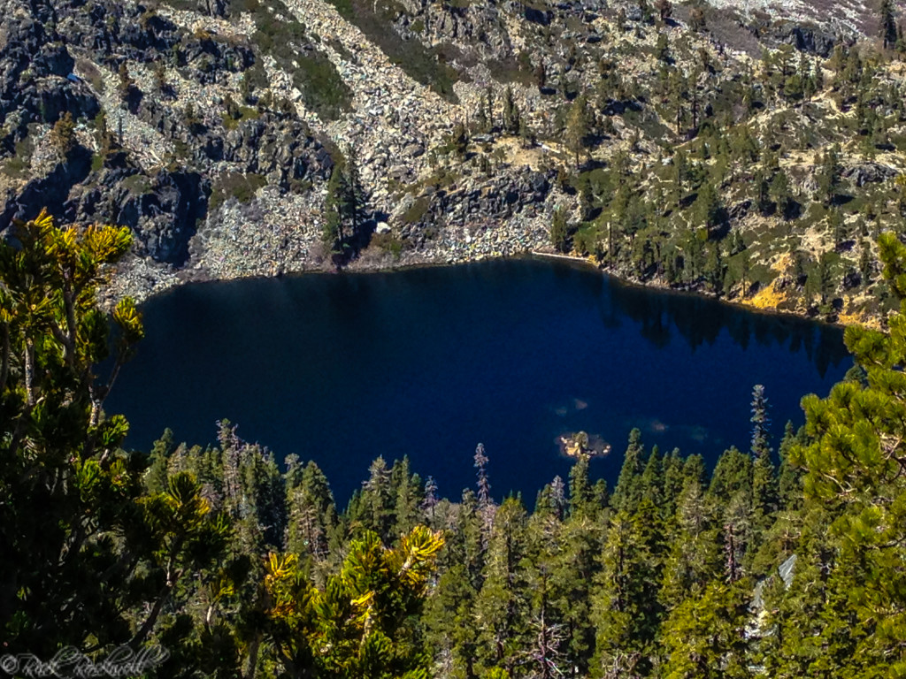
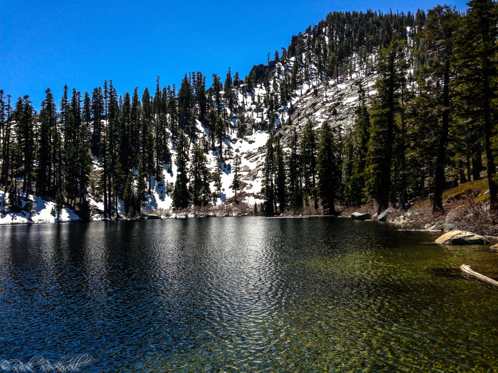
Granite Lake: A Beautiful Bonus on the Way to Maggie’s Peaks
Granite Lake is one of those places that makes the Maggie’s Peaks hike feel like more than just a summit chase. Tucked below the peaks in the Desolation Wilderness landscape, it adds another scenic reward to the route and gives hikers a reason to slow down before the final climb. If you are not quite up for the full Maggie’s Peaks push, Granite Lake also works beautifully as a destination in its own right.
From Bayview Trailhead, Granite Lake is about 1.3 miles one way, which makes it feel surprisingly close on paper. In reality, the trail climbs enough to remind you that this is still a proper Tahoe hike, not just a casual lakeside stroll. That is part of the appeal. You get the satisfaction of earning an alpine lake without having to commit to a much longer backcountry outing.
What makes Granite Lake so appealing is the contrast. On a hike that is often talked about for its big summit views, the lake adds something quieter and more intimate. It feels tucked into the granite landscape, almost like a hidden pause in the middle of a tougher climb. For some hikers, it is the perfect turnaround point. For others, it is the scenic middle chapter before continuing upward to Maggie’s Peaks.
What the Views Are Like
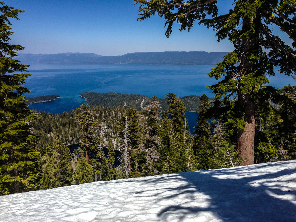
This is where Maggie’s Peaks really earns its reputation. The hike might be difficult, but the views are absolutely incredible. In fact, you would be hard-pressed to find better views than from Maggie’s Peaks. From the summit area, hikers can look out over Emerald Bay, Lake Tahoe, Cascade Lake, Granite Lake, and vast stretches of Desolation Wilderness.
That mix of landmarks is what makes the climb so satisfying. You are not just getting one postcard angle. You are seeing the layered geography of this part of Tahoe all at once: the blue sweep of the big lake, the tucked-away private waters of Cascade Lake, the granite basin around Granite Lake, and the more rugged wilderness. It is one of the best summit payoffs in the Tahoe basin.
Best Time to Hike Maggie’s Peaks
For most hikers, the best window is June through October, depending on the snow year. Since you aren’t going to see a waterfall, the summer months make it the perfect time to hike up Maggie’s Peaks.
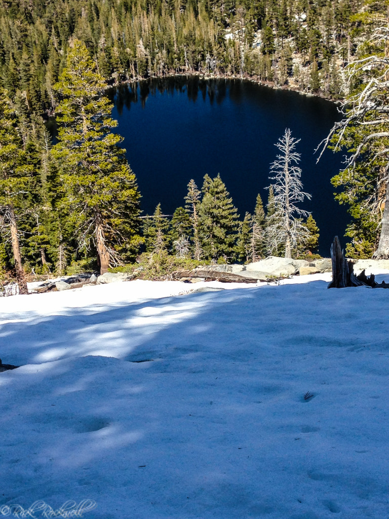
I went in late-Spring and there was still snow patches the closer we got to Maggie’s Peaks. However, they made it easier to trek back down as I used some of the snow patches to slide down instead of walking.
Snow, Safety, and Trail Conditions
Maggie’s Peaks is the kind of hike where conditions matter almost as much as fitness. In dry summer weather, it is a tough but straightforward climb. In spring or after storms, steep slopes, leftover snow, and slick granite can make the route much more serious.
Bring more water than you think you need, wear shoes with good traction, and avoid treating this like a casual stroll just because it starts from a busy trailhead. On hot summer days, the climb can feel exposed and strenuous. In the winter and early spring, traction or snow awareness matter more than mileage.
Bayview Trailhead, Permits, and Planning
Because the traditional hike starts at Bayview Trailhead, Maggie’s Peaks naturally connects to the broader Bayview and Desolation Wilderness system. The trailhead provides parking, bathrooms, picnic tables, and permits to head into the wilderness. It does not provide potable water.
Maggie’s Peaks vs. Cascade Falls
Cascade Falls is the easier, shorter, more family-friendly scenic walk from the same trailhead. Maggie’s Peaks is the harder summit climb for hikers who want a bigger workout and a broader payoff.
If you want waterfall views and a shorter outing, head to Cascade Falls. If you are more ambitious, consider yourself an experienced hiker, and have the stamina to hike up a summit, then head to Maggie’s Peaks. You can always stop at Granite Lake if you feel that the rest of the trail up to the peaks is too difficult.
Why Are They Called Maggie’s Peaks?
One of the more colorful California urban legends of the Tahoe region, says the peaks were named after a well-known barmaid named Maggie who worked at the Tahoe Tavern. It’s believed that she was a well-endowed woman who inspired the locals to name mountain peaks after her.
Why Maggie’s Peaks Is Worth The Climb
Maggie’s Peaks is the kind of Tahoe hike that makes you earn the view, and that is exactly why it stands out. The climb is steeper and tougher than nearby crowd-pleasers like Cascade Falls, but the payoff feels much bigger too.
From the summit area, Emerald Bay, Cascade Lake, Lake Tahoe, and the wild granite country of Desolation Wilderness all seem to come together in one remarkable view.
In short, this is one of the best panoramic rewards in all of Tahoe. The workout and the scenery, make this dramatic hike a must-see for anyone physically fit enough to handle the challenges.
FAQ About Maggie’s Peaks
How long is the Maggie’s Peaks hike?
Most trail sources put it at about 4.1 to 4.5 miles round trip, depending on route description and measurement.
Is Maggie’s Peaks hard?
Yes. It is commonly described as a difficult or challenging hike because of the steep climb and roughly 1,700 to 1,800 feet of elevation gain.
What trailhead do you use for Maggie’s Peaks?
The traditional starting point is Bayview Trailhead near Emerald Bay. And alternate option is Eagle Falls Trail.
What can you see from Maggie’s Peaks?
Views commonly include Emerald Bay, Lake Tahoe, Cascade Lake, Granite Lake, and parts of Desolation Wilderness.
Are dogs allowed on Maggie’s Peaks?
Dogs are welcome on the trail, but must be on a leash.
When is the best time to hike Maggie’s Peaks?
The most reliable season is generally June through October, though exact timing depends on snow conditions.
Sources
Tahoe Trail Guide, Hiking Maggies South Peak: https://tahoetrailguide.com/hiking-maggies-peaks-south-peak/
AllTrails, Granite Lake and Maggie’s Peaks: https://www.alltrails.com/trail/us/california/granite-lake-maggies-peaks
Visit Lake Tahoe, Maggie’s Peaks: https://visitlaketahoe.com/things-to-do/hikes/maggies-peaks/
Sierra Nevada Geotourism, Maggies Peaks: https://sierranevadageotourism.org/entries/maggies-peaks/ba48e55e-1e3e-4a8c-a59f-192b2276d172
Visit Lake Tahoe, The Origins of Lake Tahoe’s Most Popular Places: https://visitlaketahoe.com/attractions/the-origins-of-lake-tahoes-most-popular-places/