Angora Fire Lookout gives you a little bit of everything that makes this corner of South Lake Tahoe interesting: a high ridge above Fallen Leaf Lake, a surviving fire-lookout site, a road with seasonal access, and a natural connection to Angora Lakes.
Also known as Angora Ridge Lookout or Angora Lookout, the site is no longer staffed as an active fire lookout, and the buildings are generally closed to visitors. Still, the ridge remains a rewarding stop for Tahoe views, forest-history context, and a quieter overlook away from the busiest lakefront crowds.
Think of it as a seasonal scenic stop, a short walk or snowshoe when the road is gated, or an easy add-on to an Angora Lakes outing when road conditions allow.
Angora Fire Lookout at a Glance
- Location: Angora Ridge above Fallen Leaf Lake near South Lake Tahoe
- Also called: Angora Ridge Lookout or Angora Lookout
- Elevation: 7,256 feet
- Best for: scenic views, Tahoe history, photography, hiking, snowshoeing, and Angora Lakes add-ons
- Road access: seasonal via Angora Ridge Road / Forest Road 1214
- Typical access season: mid-May to mid-November, conditions and weather permitting
- Nearby highlight: Angora Lakes is about 1 mile beyond the lookout
- Historic timeline: original lookout built in 1924; newer lookout added in 1935
- Fee note: the U.S. Forest Service lists Angora Ridge as a parking-fee site
- Water: potable water is not available at the Angora Ridge site
- Facilities: picnic tables are not listed as available at Angora Ridge; check the current Forest Service page before visiting
- Last verified: June 24, 2026; check current Forest Service status before visiting
Where Is Angora Fire Lookout?
Angora Fire Lookout sits on Angora Ridge above Fallen Leaf Lake in the South Lake Tahoe area. At 7,256 feet, it works as both a fire-lookout history stop and a ridge viewpoint over the Tahoe Basin.
The lookout is not directly on the lakefront. It sits above the Fallen Leaf Lake area, west of South Lake Tahoe, along the seasonal road system that leads toward Angora Lakes. Because of that location, many visitors treat it as part of a larger Angora Ridge outing rather than a standalone destination.
The drive climbs away from the busier Highway 89 corridor into a more tucked-away part of the Tahoe Basin, where the road narrows and the landscape still carries reminders of the 2007 Angora Fire.
Directions to Angora Fire Lookout
From South Lake Tahoe, take Highway 89 northwest toward Emerald Bay and turn left onto Fallen Leaf Road. Continue toward Tahoe Mountain Road, then follow the route onto Angora Ridge Road, also signed as Forest Road 1214, when the road is open seasonally.
This is mountain-road access, not a wide highway approach. Expect narrow stretches, limited room in places, and changing seasonal conditions. Use turnouts when needed, drive slowly, and avoid relying only on old trip reports or older directions.
Parking is seasonal, and the U.S. Forest Service lists Angora Ridge as a parking-fee site. Bring water before heading up the ridge, since potable water is not available at the Angora Ridge site.
Road Conditions and Seasonal Access for Angora Fire Lookout
Angora Ridge Road is seasonal. The U.S. Forest Service says Angora Ridge, Fallen Leaf, and Tahoe Mountain roads are closed in winter, with access typically available from mid-May to mid-November, depending on weather and conditions.
That window can shift from year to year, and the current Forest Service status may still show the site as closed depending on conditions. Snowpack, road damage, maintenance, wildfire conditions, or Forest Service closures can all affect access, so check the current Forest Service Angora Ridge page before you go.
When the road is open, Angora Fire Lookout can work as a relatively easy scenic stop on the way to Angora Lakes. When the gate is closed, visitors may hike, bike, or snowshoe the road depending on conditions, but snow, ice, elevation, and gated-road travel can make the outing more demanding than the mileage suggests.
Campfires, including wood, charcoal, and other solid-fuel fires, are not permitted at Angora Ridge. Pets must be leashed and kept out of the lake at all times. Respect posted signs, seasonal closures, and the historic structures at the lookout.
What to Expect at Angora Fire Lookout Today
Today, Angora Fire Lookout feels more like a preserved historic remnant than a developed attraction. The buildings are generally closed and locked, but visitors can still enjoy the setting, read interpretive signs, and take in the views from the ridge.
Most visits are short unless you pair the lookout with Angora Lakes or a broader Fallen Leaf Lake outing. For many people, the stop is about pausing on the ridge, walking around the old lookout structures, taking photos, and getting a better sense of how fire detection once worked in the Tahoe Basin.
The lookout structures give the site more character than a standard roadside viewpoint. Even if you only spend a few minutes here, it is worth slowing down to imagine how this ridge once functioned as part of a fire-watch network scanning the surrounding forest for smoke.
Angora Ridge Lookout is one of the surviving historic fire-lookout sites in the Tahoe region, alongside places such as Zephyr Cove and Martis Lookout. On the opposite side of Lake Tahoe, the Stateline Lookout Trail preserves another piece of Tahoe fire-lookout history in a very different North Shore setting.
Views From Angora Fire Lookout
The ridge-top view is the main reason many visitors stop here. From the lookout area, Fallen Leaf Lake sits below the ridge, framed by forested slopes, granite terrain, and the broader Tahoe Basin beyond.
Because the lookout sits high above the Fallen Leaf Lake area, the view feels different from a lakeshore overlook. You are looking down and across the landscape rather than standing beside the water. The elevation gives the scene more depth, with the basin opening below and the surrounding Sierra ridges layered in the distance.
Clear days are best, especially for photography. Morning and late-afternoon light can bring out more contrast on the ridges, while smoky, stormy, or hazy conditions can quickly flatten the view.
The landscape around the ridge also tells a more complicated story. In places, the scenery includes burn scars, regrowth, and forest shaped by the 2007 Angora Fire. That mix of lake view, old lookout site, and recovering terrain gives the stop more meaning than a simple scenic pullout.
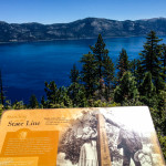
History of the Angora Lookout
The story of Angora Fire Lookout begins before the lookout itself was built. From 1910 to 1914, the U.S. Forest Service in California went through major changes, and Coert DuBois was one of the key figures behind that shift. Frustrated by earlier fire-management failures, DuBois pushed for a stronger fire-prevention system and helped reshape how forests in California were protected.
DuBois also played a role in the 1911 passage of the Weeks Law, which expanded federal involvement in forest protection and fire prevention. His work helped build momentum for California’s State Legislature to appropriate money for fire prevention in 1919. According to CAL FIRE, the first state-funded lookout in California was built in 1922.
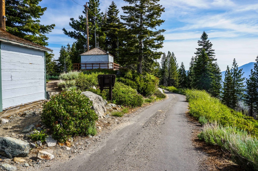
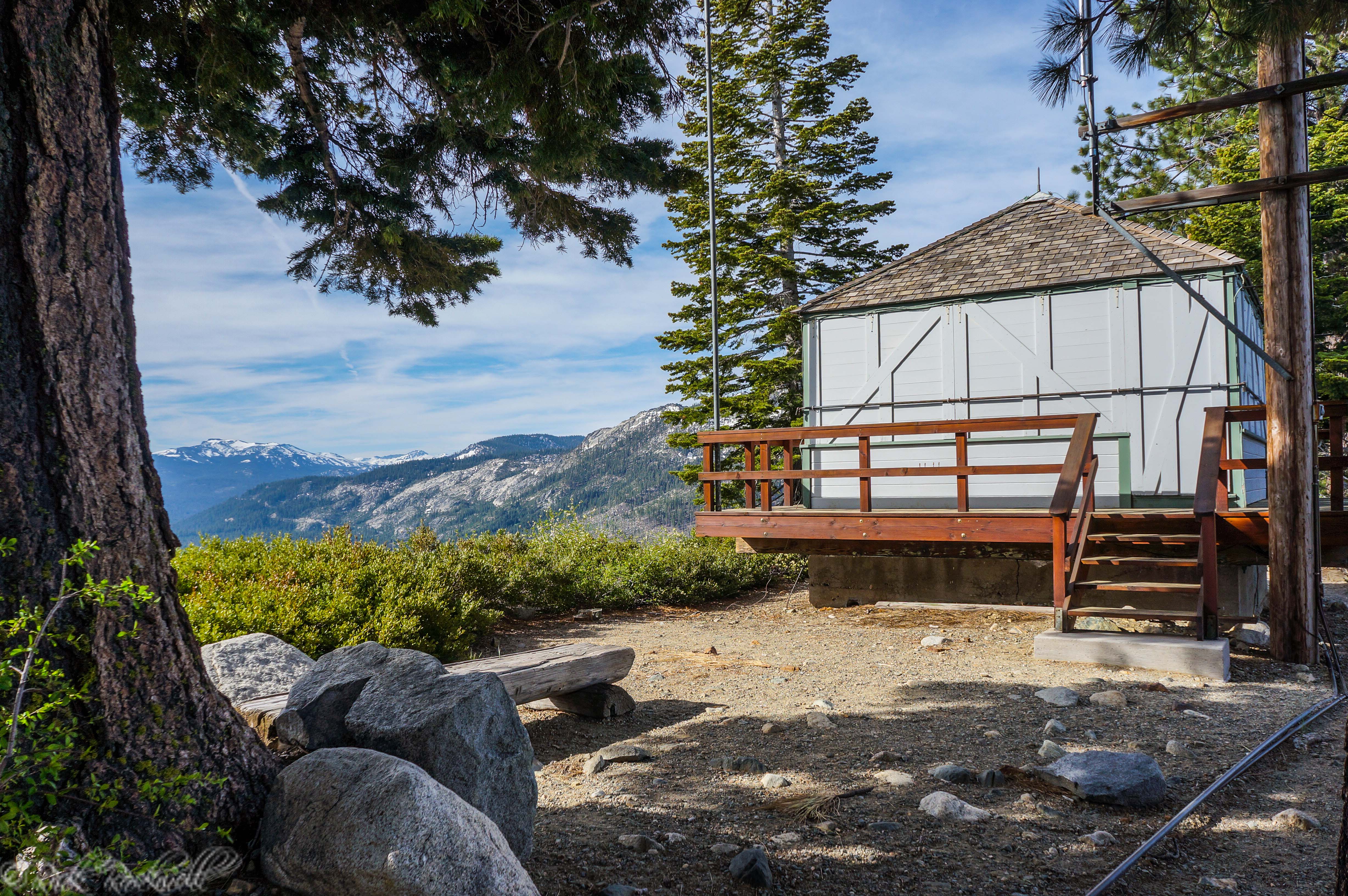
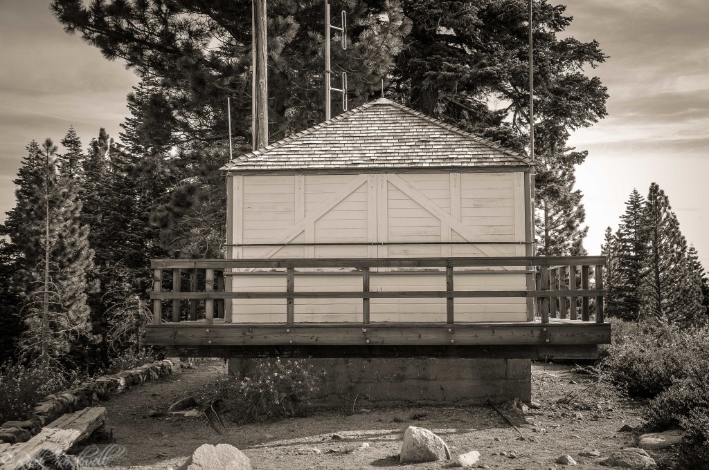
Two years later, the original Angora Lookout was built on Angora Ridge in 1924. At the time, fire lookouts were practical tools: high-elevation stations where watchers could scan for smoke, report fire starts, and help crews respond before small fires spread.
Construction on Angora Ridge Road began shortly after the lookout was built, but the road was not completed until 1929. One source describes the work as a nearly five-year effort done mostly by hand, using “a pick and shovel and crowbar, a very small amount of dynamite and a very great amount of sweat.” That detail helps explain why the ridge still feels somewhat tucked away today, even though it is not far from South Lake Tahoe.
The original Angora Lookout has also been described as a DuBois-inspired structure. Some sources suggest it may have followed the general model of a Dwelling 1D, a type of lookout building included in DuBois’s 1917 Improvement Circular. According to the Forest History Society, these 1D-style structures were believed to cost about $112 in labor, plus materials.
Newspaper and lookout-log excerpts show that Angora began drawing visitors almost as soon as the lookout was established. A 1924 Mountain Democrat item described Angora Lookout as an important Lake Valley fire station and noted that visitors received fire-prevention literature and route maps. By 1925, Lookout Waterhouse reported more than 600 registered visitors in July alone.
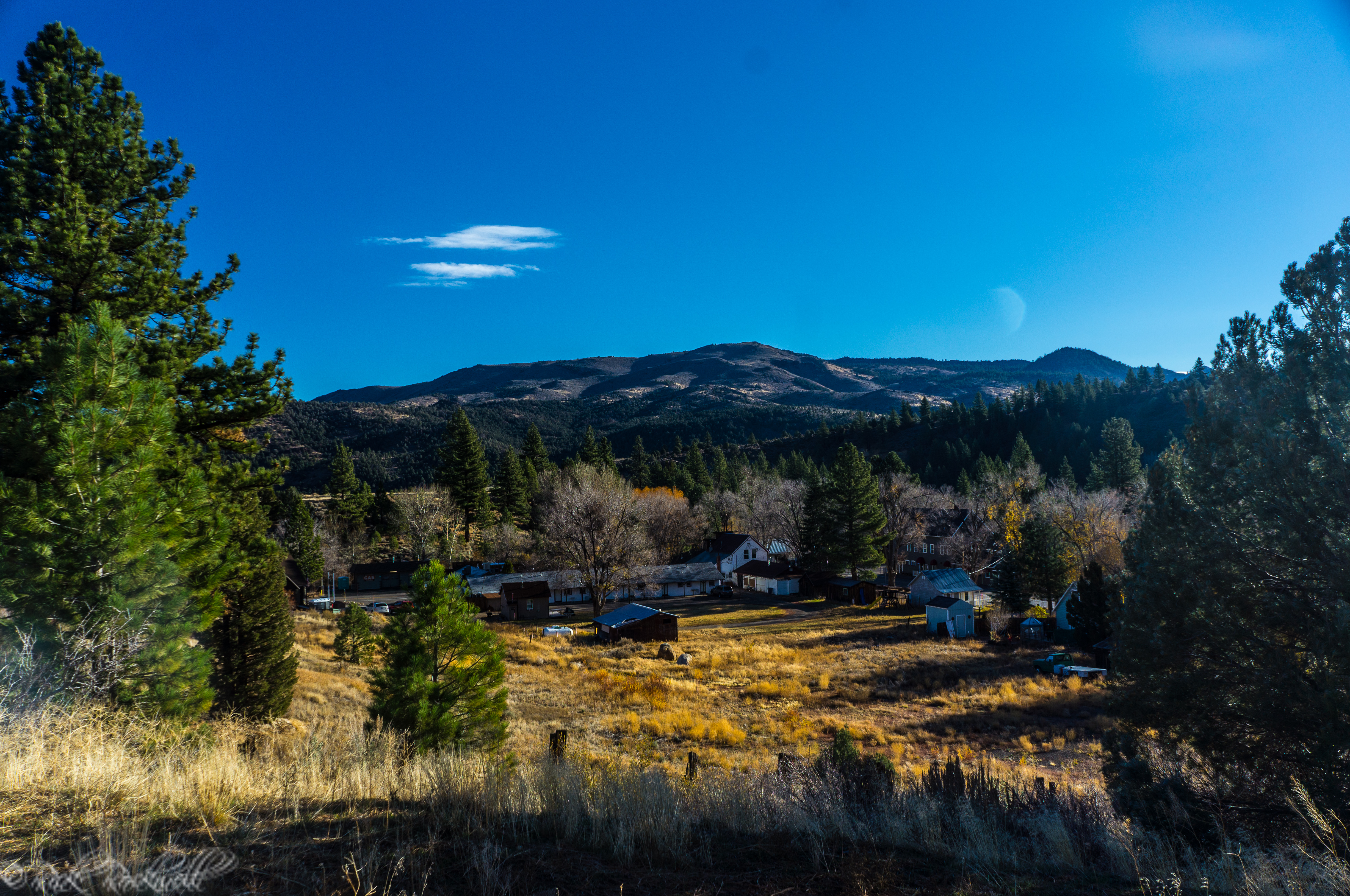
The visitor numbers kept growing. A 1936 Mountain Democrat report counted hundreds of registered visitors, more than a thousand automobiles, and hundreds of saddle horses passing the lookout during a busy summer month. Those details show that Angora was not only a fire-watch station. It was also becoming a scenic stop, a fire-education site, and a gateway toward the lakes beyond the ridge.
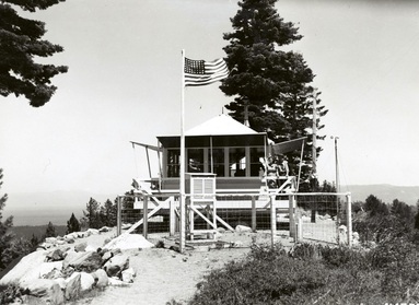
The CCC and the New Lookout
In 1933, President Franklin D. Roosevelt formed the Civilian Conservation Corps, a work-relief program that operated from 1933 to 1942. The CCC became one of the most visible New Deal forces on public lands, building roads, trails, campgrounds, firebreaks, and fire lookouts across the country.
California saw a major wave of lookout construction during this period. According to California Lookouts, an estimated 250 lookouts were built in the state during the CCC era, helping expand the fire-detection network across forests, ridges, and remote mountain terrain.
At Angora Ridge, that work arrived in 1935, when the CCC built a new Angora Fire Lookout next to the original 1924 structure. The older lookout was then converted into a small residence for the people staffing the station.
A garage structure was added next door in the early 1940s. During this same era, fire lookouts also took on an additional wartime role, doubling as spotters for enemy aircraft during World War II.
The road to the lookout changed more slowly. For decades, Angora Ridge Road remained a rugged, steep dirt road. The ridge portion was not paved until 1963, and the full road was not paved until 2005. That long road timeline helps explain why Angora Fire Lookout still feels a bit removed from the busier South Lake Tahoe corridor, even though it sits close to Fallen Leaf Lake and Angora Lakes.
By the early 1970s, many fire lookouts throughout California had been retired or reduced in importance as aircraft, radio systems, and other fire-detection methods changed how agencies monitored the landscape. Angora Ridge Lookout was decommissioned during that period, but the structures remained as reminders of an older era of wildfire detection.
The 2007 Angora Fire and the Landscape Today
The Angora name also carries a more sobering modern meaning because of the 2007 Angora Fire. The fire began west of South Lake Tahoe on June 24, 2007, and became one of the most significant modern wildfires in the Tahoe Basin.
CAL FIRE lists the Angora Fire at 3,100 acres in El Dorado County, with 254 structures destroyed. The fire forced evacuations, damaged neighborhoods, and left a visible mark on the landscape around Angora Ridge, Meyers, Fallen Leaf Lake, and nearby communities.
This history changes how the drive and overlook feel today. Angora Fire Lookout is not just a scenic viewpoint with an old building. It is a place tied to Tahoe’s long relationship with fire: early detection, forest management, community risk, and recovery after a major wildfire.
The lookout’s survival has required attention in more recent fire seasons, too. During the 2021 Caldor Fire, South Tahoe Now reported that crews protected the historic Angora Lookout buildings with aluminized structure wrap as the fire threatened the Tahoe Basin.
For visitors, the surrounding landscape is part of the story. The ridge views are beautiful, but they also look across terrain shaped by fire, regrowth, and the continuing wildfire reality of the Sierra Nevada.
Pairing Angora Fire Lookout With Angora Lakes
Angora Fire Lookout works especially well when paired with Angora Lakes. The lakes are about 1 mile beyond the lookout, making the two a natural combination when Angora Ridge Road is open and conditions are good.
Visitors have been combining the lookout and lakes for decades. A 1936 Mountain Democrat report noted that visitors continued beyond the lookout to reach Angora Lakes, showing that the ridge-and-lakes outing was part of the area’s appeal long before modern Tahoe travel guides started describing it that way.
A simple outing might include the scenic drive up Angora Ridge Road, a stop at the lookout for views and history, and then continuing toward Angora Lakes for a longer visit. That pairing gives the day more variety: a historic lookout, ridge views, alpine lake scenery, and a closer look at one of the South Lake Tahoe area’s well-known summer destinations above Fallen Leaf Lake.
This combination is best for visitors who want more than a quick photo stop but do not necessarily want a long, strenuous hike. It is also a good fit for photographers, Tahoe history fans, and travelers who like scenic side roads with a bit of a story behind them.
If you want to turn the outing into a fuller Fallen Leaf Lake and Glen Alpine day, nearby stops like Glen Alpine Falls and the historic Glen Alpine Springs Resort can add more scenery and local history to the trip.
Check road access before you build a day around this route. Angora Ridge Road is seasonal, and shoulder-season conditions can change quickly.
Is Angora Fire Lookout Worth Visiting?
Angora Fire Lookout is worth visiting if you enjoy Tahoe views, historic sites, fire lookout history, photography, or quieter scenic stops near South Lake Tahoe. It is especially worthwhile when Angora Ridge Road is open, the weather is clear, and you are already planning to visit Angora Lakes or Fallen Leaf Lake.
I always try to stop here when I’m in this part of Lake Tahoe. The views from the lookout are excellent, and the way it pairs with Angora Lakes makes the two feel like a natural one-two combo for anyone exploring the Fallen Leaf Lake region.
It is not the right stop for everyone. If you are expecting an open tower, a staffed visitor center, picnic facilities, or a long developed hike, this may feel too simple. The buildings are usually closed, facilities are limited, and the main rewards are the setting, the views, and the history.
That simplicity is also what makes the place interesting. Angora Fire Lookout still feels connected to the ridge it was built to watch. You get a Tahoe viewpoint, a surviving fire-watch site, a natural pairing with Angora Lakes, and a landscape shaped by one of the basin’s most memorable modern wildfires.
With the newer Lily Lake Trail connection between the Angora Lakes parking area and the Glen Alpine trailhead near Lily Lake, the area feels more connected than it used to, especially for hikers and mountain bikers looking for a bigger outing.
Casual visitors can still keep it simple with the lookout-and-Angora-Lakes combo, while stronger trail users can tie Angora into a broader Glen Alpine and Fallen Leaf Lake day.
FAQ About Angora Fire Lookout
What is Angora Fire Lookout?
Angora Fire Lookout is a historic former fire lookout on Angora Ridge above Fallen Leaf Lake near South Lake Tahoe.
Where is Angora Fire Lookout?
It is located on Angora Ridge above Fallen Leaf Lake in the South Lake Tahoe area.
Can you drive to Angora Fire Lookout?
Yes, when Angora Ridge Road / Forest Road 1214 is open seasonally.
Is Angora Ridge Road open year-round?
No. The U.S. Forest Service says Angora Ridge, Fallen Leaf, and Tahoe Mountain roads are closed in winter. Check the current Forest Service page before heading out.
When was Angora Fire Lookout built?
The original Angora Lookout was built in 1924. A newer lookout was built in 1935 by the Civilian Conservation Corps.
Is Angora Fire Lookout near Angora Lakes?
Yes. Angora Lakes is about 1 mile beyond the lookout.
What can you see from Angora Fire Lookout?
Visitors can see Fallen Leaf Lake, parts of the Tahoe Basin, surrounding Sierra ridges, and fire-shaped landscape around Angora Ridge.
Is there a fee to visit Angora Fire Lookout?
The U.S. Forest Service lists Angora Ridge as a parking-fee site.
Are dogs allowed at Angora Ridge?
The Forest Service says pets must be leashed and kept out of the lake at all times.
Is there water at Angora Fire Lookout?
No. Potable water is not available at the Angora Ridge site.
What happened in the Angora Fire?
The 2007 Angora Fire burned 3,100 acres in El Dorado County and destroyed 254 structures, according to CAL FIRE.
Sources
U.S. Forest Service, Lake Tahoe Basin Management Unit. “Angora Ridge.” https://www.fs.usda.gov/r05/laketahoebasin/recreation/angora-ridge
CAL FIRE. “Angora Fire.” https://www.fire.ca.gov/incidents/2007/6/24/angora-fire/
National Historic Lookout Register. “Angora Ridge Lookout.” http://nhlr.org/lookouts/us/ca/angora-ridge-lookout/
California Lookouts. “Angora.” https://californialookouts.weebly.com/angora.html
South Tahoe Now. “Historic Angora Lookout saved from Caldor fire with aluminized wrap.” https://southtahoenow.com/09/16/2021/historic-angora-lookout-saved-caldor-fire-aluminized-wrap
CAL FIRE. “About CAL FIRE History.” https://www.fire.ca.gov/about/about-calfire-history/
Forest History Society. “Architecture of the Forest Service: Chapter 1A.” http://www.foresthistory.org/ASPNET/Publications/architecture/chap1a.htm
TAMBA. “Lily Lake Trail.” https://tamba.org/projects/lily-lake-trail/
