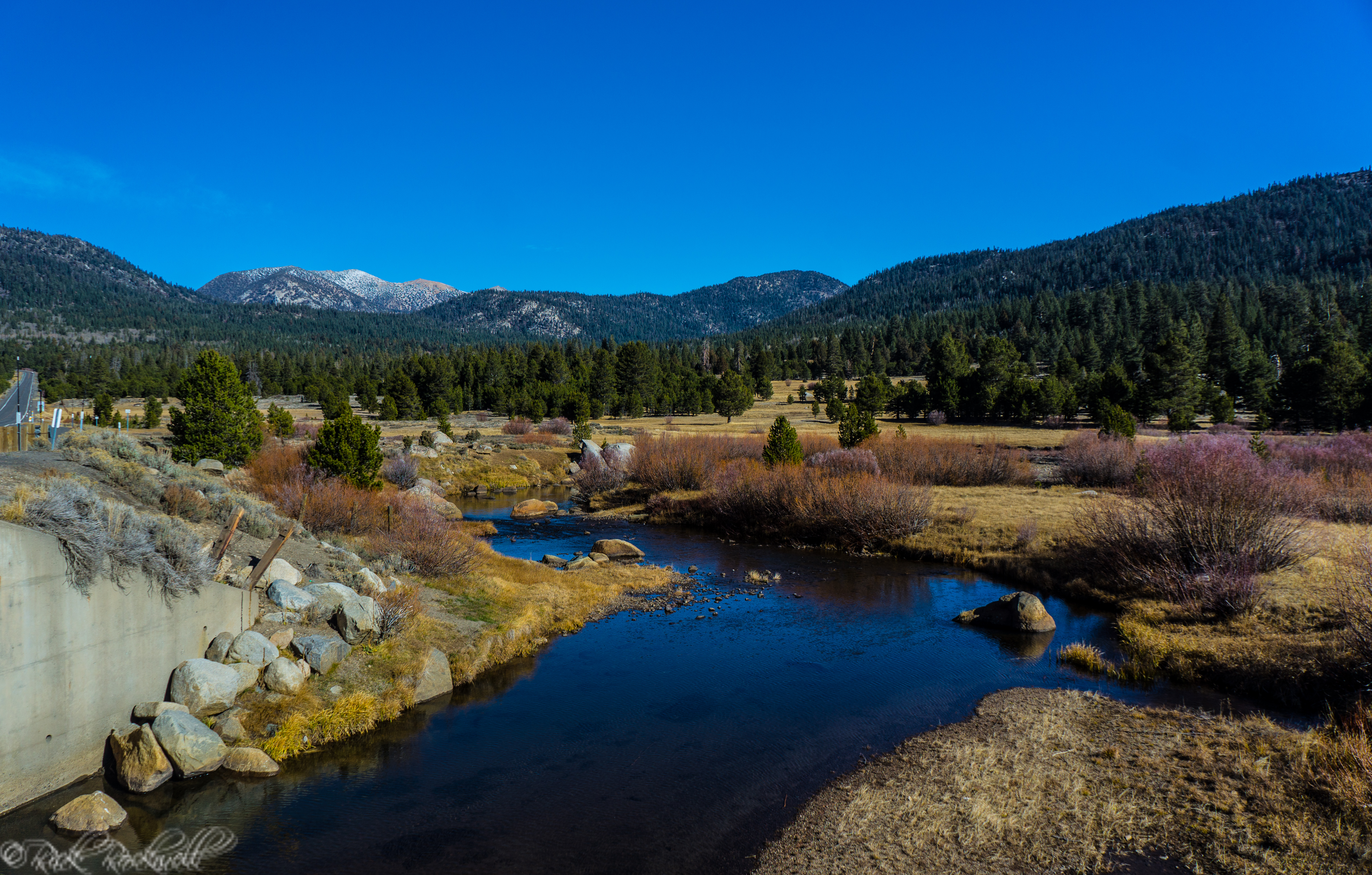
The Sierra Nevada mountain range, also called the Sierra Nevadas, runs roughly 400 miles north-to-south along the eastern border of California. It’s home to some of the state’s most beautiful locations like: Lake Tahoe, Sequoia and Kings Canyon National Parks, and Yosemite National Park.
Sierra Nevada is Spanish for snowy mountains and if you have ever been in these mountains during winter season, then you know why this name is extremely accurate. The mountains are categorized as being mostly granitic and provide a buffer between California’s Central Valley to the west and the Basin and Range Province to the east.
These mountains played a huge role in the Gold Rush era and were a vital component to the Native Americans that lived here long before the Europeans came over. It wasn’t until roughly 1777 that the term “sierra nevada” was applied to this mountain range.
Nowadays, most of the Sierra Nevada mountains are owned and protected by the U.S. Government. Additionally, some of California’s most cherished natural landmarkscan be found in this region. Check out my content of the places I have visited in this region.
Also, check out at the bottom of the page, some interesting facts about the Sierra Nevada mountain range.
[tddivider height=”5″ style=”ridge” color=”#1e73be”]
My Explorations:
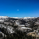
 Crystal Range and Crystal Basin
The Crystal Range is a subrange of the spectacular Sierra Nevada mountains. Located in Desolation Wilderness, west of Lake Tahoe and east of the Crystal Basin, the Crystal Range mountains run roughly 25 miles north-to-south and 62 miles east-to-west. Read More
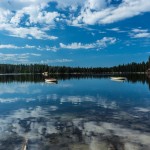
Desolation Wilderness
Desolation Wilderness is roughly 64,000 acres of alpine and sub-alpine forest, magnificent granite landscapes and stunning glacially formed lakes. At an estimated 12.5 miles long and 8 miles wide, Desolation Wilderness is positioned west of Lake Tahoe and east of the Crystal Basin. Read More
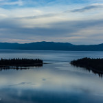 Lake Tahoe
This heavenly, blue body of water is uniquely positioned on the border of California and Nevada, with two thirds of the lake in California. Read More
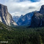 Yosemite National Park
Yosemite National Park is truly a majestic region of the High Sierra. The park is nearly 1,200 square miles of breathtaking views, tranquil landscapes, jaw dropping adventure and an incomparable experience to anywhere else on the planet. Read More
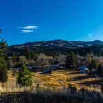 Other Places
[tddivider height=”5″ color=”#1e73be”]
More Sierra Nevada Mountain Range info
[tdaccordions type=”tdbiz-tabs-accordion” style=”tdbiz-tabs-info” align=”left”] [tdaccordion title=”Peaks”]
- Airola Peak – 9942 ft
- Banner Peak – 12947 ft
- Basin Mountain – 13181 ft
- Bear Creek Spire – 13713 ft
- Black Giant – 13330 ft
- Black Kaweah – 13675 ft
- Breckenridge Mountain – 7548 ft
- Bull Run Peak – 9495 ft
- Carson Peak – 10909 ft
- Castle Rock Spire – 7600 ft
- Charlotte Dome – 10700 ft.
- Checkered Demon – 13112 ft.
- Chinese Peak – 8705 ft
- Cirque Peak – 12900 ft
- Clouds Rest – 9926 ft
- Clyde Minaret – 12281 ft
- Clyde Spires – 13267 ft
- Donner Peak – 8019 ft
- Ebbetts Peak – 9160 ft
- Echo Peak – 8895 ft
- El Capitan – 7569 ft
- Folger Peak – 9680 ft
- Garnet Peak – 5900 ft
- Half Dome – 8842 ft
- Henery Peak – 9334 ft
- Hiram Peak – 9795 ft
- Keeler Needle – 14260 ft
- Laurel Mountain – 11812 ft
- Lembert Dome – 9450 ft
- Little Baldy – 8044 ft
- Lone Pine Peak – 12944 ft
- Mammoth Mountain – 11053 ft
- Matterhorn Peak – 12264 ft
- Middle Palisade – 14040 ft
- Milestone Mountain – 13641 ft
- Mount Abbot – 13704 ft
- Mount Agassiz – 13893 ft
- Mount Conness – 12590 ft
- Mount Dade – 13600 ft
- Mount Dana – 13053 ft
- Mount Darwin – 13831 ft
- Mount Gilbert – 13103 ft
- Mount Guyot – 12300 ft
- Mount Haeckel – 13435 ft
- Mount Humphreys – 13986 ft
- Mount Irvine – 13914 ft
- Mount Langley – 14027 ft
- Mount Lyell – 13114 ft
- Mount Morgan (South) – 13748 ft
- Mount Muir – 14012 ft
- Mount Ritter – 13143 ft
- Mount Rose – 10776 ft
- Mount Russell – 14086 ft
- Mount Sill – 14153 ft
- Mount Tallac – 9735 ft
- Mount Thompson – 13494 ft
- Mount Tom – 13652 ft
- Mount Tyndall – 14018 ft
- Mount Whitney – 14494 ft
- Mount Williamson – 14370 ft
- Mount Winchell – 13775 ft
- Mt. Atkinson – 12241 ft
- Mt. Brewer – 13570 ft
- Mt. Gayley – 13510 ft
- Mt. Gibbs – 12773 ft
- Norman Clyde Peak – 13920 ft
- North Palisade – 14242 ft
- North Peak – 12242 ft
- Olancha Peak – 12123 ft
- Point Powell – 13360 ft
- Polemonium Peak – 14200 ft
- Pyramid Peak – 9983 ft
- Red Lake Peak – 10062 ft
- Split Mountain – 14058 ft
- Starlight Peak – 14200 ft
- Temple Crag – 12999 ft
- Tenaya Peak – 10280 ft
- Thunderbolt Peak – 14000 ft
- Tioga Peak – 11526 ft.
- Tryon Peak – 9970 ft
- University Peak – 13632 ft
- Wheeler Peak – 9115 ft
source: Peakware [/tdaccordion][tdaccordion title=”Subranges”]
- Carson Range
- Cathedral Range
- Clark Range
- Crystal Range
- Great Western Divide
- Kaweah Peaks Ridge
- Palisades
- Ritter Range
- Sherwin Range
[/tdaccordion][tdaccordion title=”Counties”]
- Alpine County
- Calaveras County
- El Dorado County
- Fresno County
- Inyo County
- Kern County
- Madera County
- Mariposa County
- Mono County
- Nevada County
- Placer County
- Tuolumne County
[/tdaccordion][tdaccordion title=”Major Rivers”]
- American River
- Cosumnes River
- Feather River
- Kern River
- Kings River
- Merced River
- Mokelumne River
- Sacramento River
- San Joaquin River
- Stanislaus River
- Truckee River
- Tuolumne River
- Yuba River
[/tdaccordion][tdaccordion title=”National Parks”]
- Devil’s Postpile National Monument
- Giant Sequoia National Monument
- Kings Canyon National Park
- Sequoia National Park
- Yosemite National Park
[/tdaccordion][tdaccordion title=”State Parks and Rec”]
- Auburn State Recreation Area
- Bodie State Historic Park
- Burton Creek State Park
- Calaveras Big Trees State Park
- California State Mining and Mineral Museum Park Property
- Columbia State Historic Park
- D. L. Bliss State Park
- Donner Memorial State Park
- Emerald Bay State Park
- Empire Mine State Historic Park
- Folsom Lake State Recreation Area
- Folsom Powerhouse State Historic Park
- Grover Hot Springs State Park
- Indian Grinding Rock State Historic Park
- Kings Beach State Recreation Area
- Lake Valley State Recreation Area
- Malakoff Diggins State Historic Park
- Marshall Gold Discovery State Historic Park
- Mono Lake Tufa State Reserve
- Prairie City State Vehicular Recreation Area
- Railtown 1897 State Historic Park
- South Yuba River State Park
- Stone Lake Park Property
- Sugar Pine Point Light
- Tahoe State Recreation Area
- Ward Creek Park Property
- Washoe Meadows State Park
- Wassama Round House State Historic Park
[/tdaccordion][tdaccordion title=”National Forests”]
- Eldorado National Forest
- Humboldt-Toiyabe National Forest
- Inyo National Forest
- Lake Tahoe Basin Management Unit
- Plumas National Forest
- Sequoia National Forest
- Sierra National Forest
- Stanislaus National Forest
- Tahoe National Forest
[/tdaccordion][tdaccordion title=”Wilderness Areas”]
- Ansel Adams
- Bright Star
- Bucks Lake
- Carson-Iceberg
- Chimney Peak
- Desolation
- Dinkey Lakes
- Domeland
- Emigrant
- Golden Trout
- Granite Chief
- Hoover
- Jennie Lakes
- John Muir
- Kaiser
- Kiavah
- Kings Canyon National Park
- Mokelumne
- Monarch
- Owens Peak
- Sacatar Trail
- Sequoia National Park
- South Sierra
- Yosemite
[/tdaccordion][/tdaccordions]
