Tucked quietly along Highway 49 between Coloma and Lotus, Magnolia Ranch feels like one of those places you almost miss when driving down the highway — and that’s part of its charm.
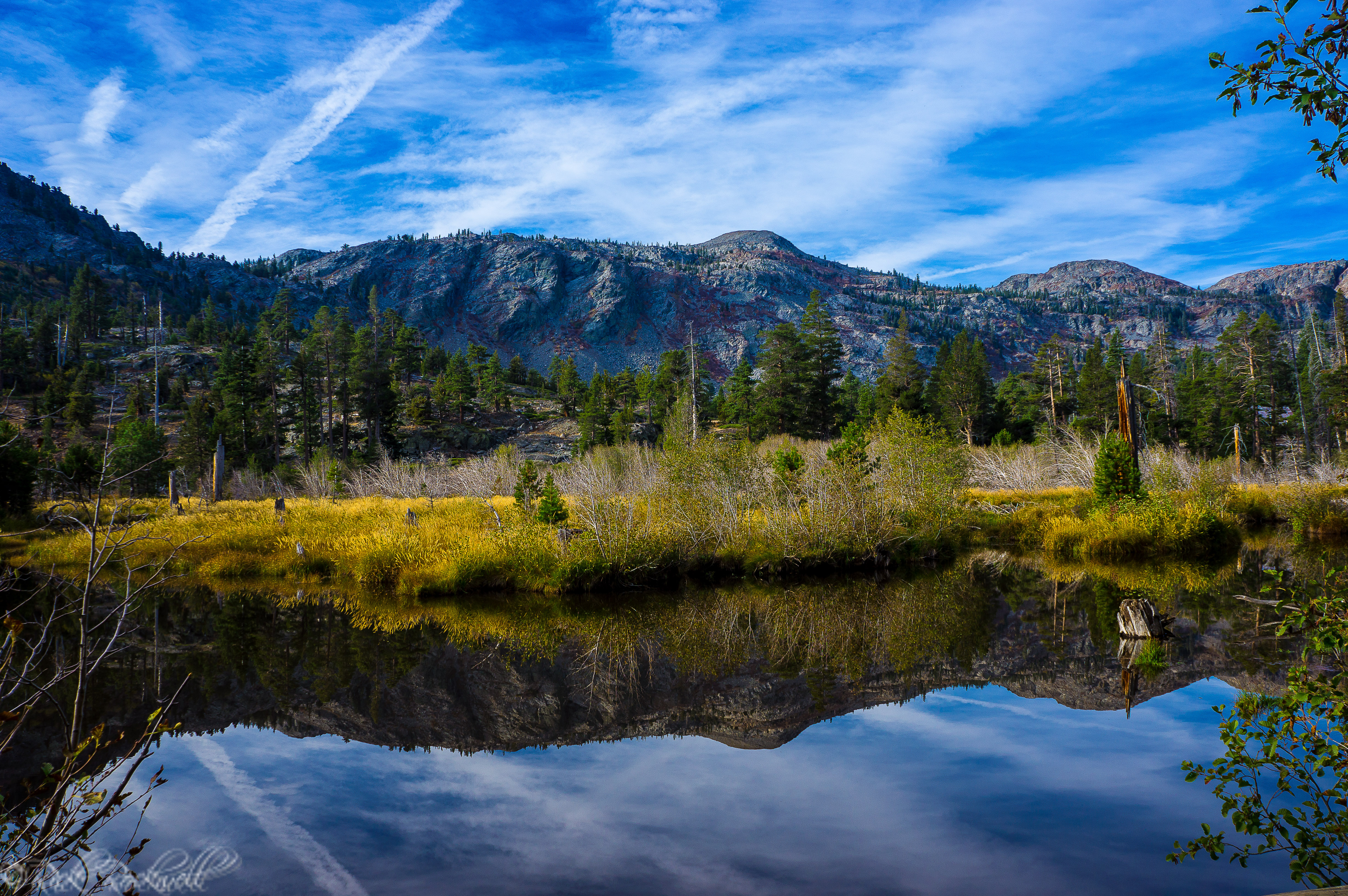
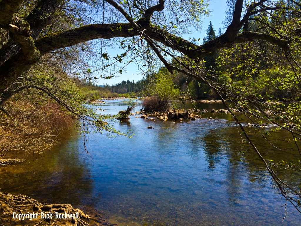
There’s no fanfare here. No crowded parking lots. No souvenir stands. Just rolling oak woodlands, golden foothill grass, and the steady presence of the South Fork of the American River below.
Managed by the U.S. Bureau of Land Management, Magnolia Ranch provides visitors an opportunity to stroll through El Dorado County’s Gold Country foothills while enjoying a peaceful, scenic landscape.
Magnolia Ranch Quick Facts
- Location: Coloma, California (near Lotus)
- Trail Length: 1–2 miles
- Difficulty: Easy
- Elevation Gain: Minimal
- Trail Type: Out-and-back / explore-as-you-go
- Best For: Walking, wildlife viewing, relaxing
- Nearby: American River
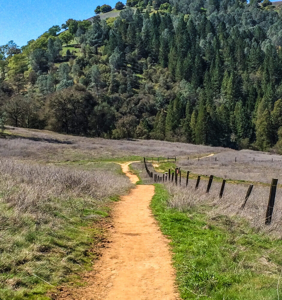
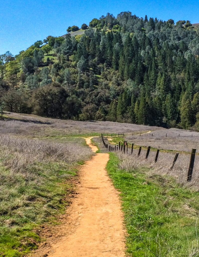
The Gerle Loop Trail
The primary path through the Magnolia Ranch is the Gerle Loop Trail, which is a 2.5-mile trail that’s considered easy to moderate. It’s a wonderful option for casual hikers or beginners as there’s enough of a challenge from the foothill terrain along with variation to keep things intriguing and exciting.
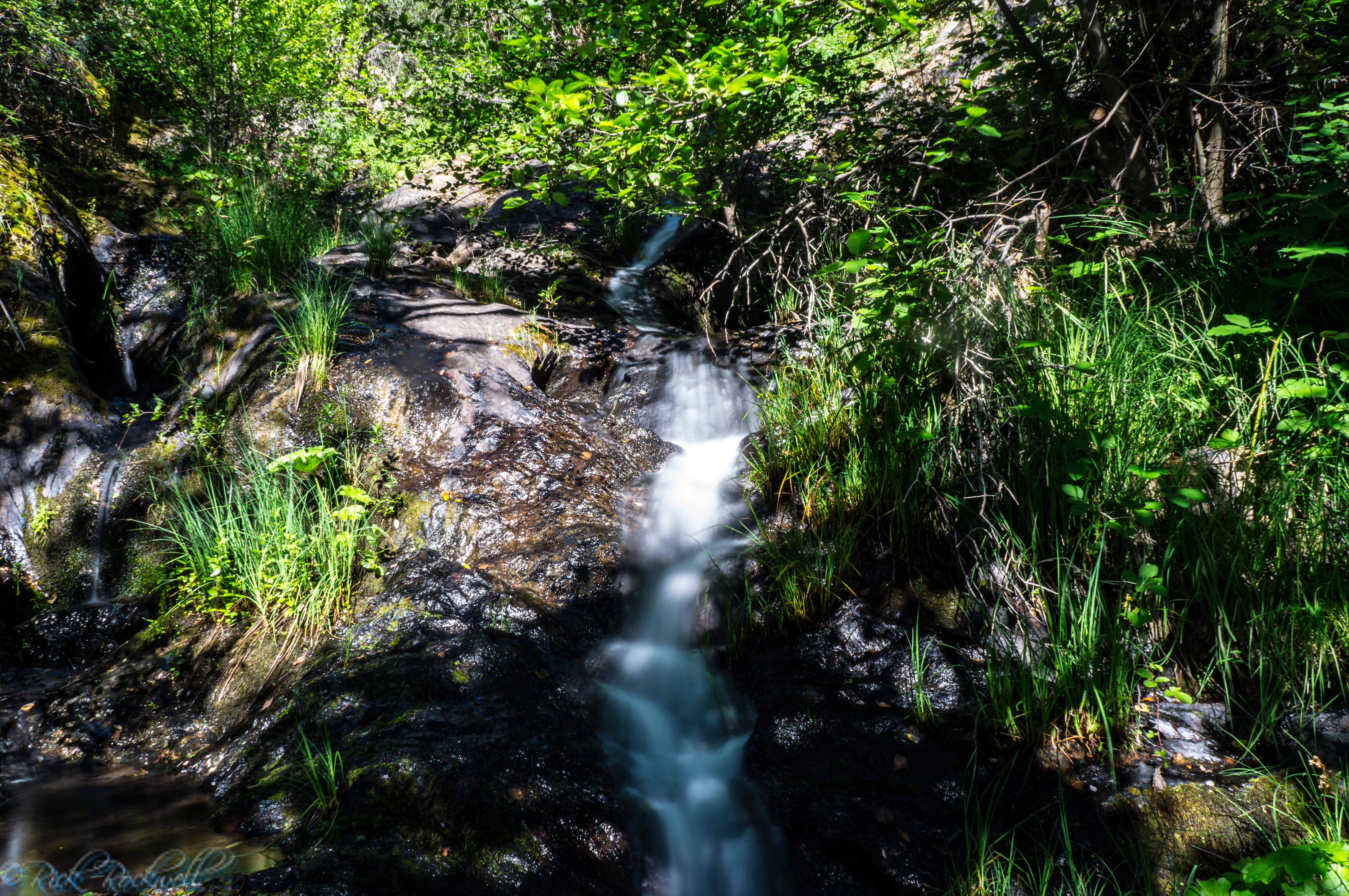
The multi-use trail winds through grassy hillsides and blue oak woodland that winds down towards the American River.
In spring, the variety of wildflowers dot the hilly landscape. It’s arguably the best time of the year to visit the Magnolia Ranch.
The Ranch prohibits motorized vehicles, so you will only share the trail and hills with hikers, mountain bikers, trail runners, and visitors on horseback.
A Network Of Trails
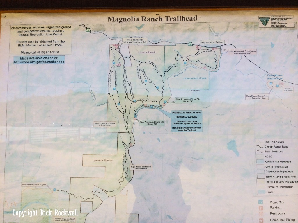
One of Magnolia Ranch’s overlooked attributes is that it interweaves with other trails in the region. While you might feel like you are isolated during sparse usage, the Magnolia Ranch is a gateway to the American River trail system that intersects with neighboring recreation lands.
Just next door is the Cronan Ranch Regional Trails Park. If you add this park to your Magnolia Ranch visit, then you will enjoy a full-day of peaceful adventure and maybe a picnic, as well.
A Landscape Rooted in History
Walking through these hills also means walking through California history, which we are big fan of at CalExplornia. Just a few miles south of Magnolia Ranch lies Coloma, which is the site where an 1848 gold discover changed California forever.
This region was once a busy hub for Gold Rush activity. Now, the Magnolia Ranch feels like an untouched part of one of the state’s most significant chapters.
The nearby communities of Coloma and Lotus still carry remnants of that historic chapter. A few minutes further in each direction, will also bring you to Auburn or Placerville. Two of my favorite towns in the region.
However, pairing a morning stroll through Magnolia Ranch with a visit to Marshall Gold Discovery State Historic Park or an expanded hike through Cronan Ranch can create a fun-filled, historic day in this Gold Country region.
 .
.
Wildlife And Natural Setting
The oak woodland and riparian habitat at Magnolia support a variety of wildlife. Deer are common. And if you are lucky, raptors will circle in the skies above.
Like much of the California foothills experience, the region is home to more imposing animals like mountain lions and rattlesnakes. While both are uncommon, I did pass by a rattlesnake during one of my trips. So, always be mindful that nature is home to more than just us.
What You Should Know Before You Go
The Magnolia Ranch does not allow camping. This is a day-use area only. Parking is available at the trailhead off Highway 49, but amenities are minimal. Make sure you bring plenty of water and other necessities for a day in the sun.
The spring and fall seasons make for comfortable outings among the serene, vibrant landscape. The summer is hot and wide-open to the sun. So, early morning hikes are advised unless you plan on spending time at the river, which has its own set of safety tips.
Always remember to leave no trace of garbage or other non-perishables behind. Stay on the designated trails to avoid any confusion with private property.
Why Magnolia Ranch Stands Out
What makes Magnolia Ranch special isn’t the dramatic landscapes. Instead, it’s the feeling of stepping out of life’s daily grind into a slow-pace stroll through the foothills of El Dorado County. A pace that also allows you to take that deep breath, inhale fresh air, and enjoy the serenity of Coloma-Lotus.
Directions
From Auburn head south on 49 for about 15 miles. From Placerville (Highway 50) head north on 49 for roughly 10 miles.
Sources
Bureau of Land Management. (n.d.). Magnolia Ranch Trailhead. U.S. Department of the Interior. https://www.blm.gov/visit/magnolia-ranch-trailhead
Bureau of Land Management. (n.d.). Cronan Ranch Trailhead. U.S. Department of the Interior. https://www.blm.gov/visit/cronan-ranch-trailhead
California Department of Fish and Wildlife. (n.d.). Fishing in California. https://wildlife.ca.gov/Fishing
California State Parks. (n.d.). Marshall Gold Discovery State Historic Park. https://www.parks.ca.gov/?page_id=484
U.S. Forest Service. (n.d.). Oak Woodland Ecosystems in California. U.S. Department of Agriculture. https://www.fs.usda.gov