Stateline Lookout Trail is one of the easiest scenic hikes in North Lake Tahoe. Starting near Crystal Bay on the Nevada side and climbing to the site of a former California fire lookout, this short uphill walk delivers wide-open lake views, interpretive stops, and a surprisingly big payoff for such a brief trail.
For visitors who want a quick Tahoe hike without committing to a long backcountry route, this trail stands out. The climb is short, the route is easy to follow, and the summit rewards you with sweeping views over Crystal Bay, Agate Bay, Kings Beach, and much of Tahoe’s North Shore.
Stateline Lookout Trail at a Glance
- Location: Crystal Bay near the Nevada-California border above North Lake Tahoe.
- Trail length: 0.5 mile one way.
- Elevation gain: about 400 feet.
- Trail surface: mostly paved old forest road.
- Difficulty: easy to easy-moderate.
- Top elevation: about 7,017 feet.
- Highlights: panoramic North Lake Tahoe views, interpretive signs, historic lookout site, picnic-friendly summit, free telescopes, and a short self-guided nature trail.
- Amenities: restrooms at the top.
- Best for: families, scenic photos, quick hikes, and short Tahoe stops.
Where Is Stateline Lookout Trail?
To reach the Stateline Lookout Trail, take Highway 28 near Crystal Bay and turn north on Reservoir Drive. From there, turn right on Lakeshore Avenue and look for Forest Service Road 1601 near the iron pipe gate.
The hike begins in Nevada and ends at the site of a former fire lookout near the California-Nevada state line, which gives the route a nice mix of scenery and regional history.
This is the North Lake Tahoe Stateline Lookout above Crystal Bay, not the South Lake Tahoe casino corridor near Stateline, Nevada. That distinction matters because “Stateline” can send visitors in the wrong direction if they are thinking of the South Shore.
Stateline Lookout Trailhead, Parking, and Fees
Parking is seasonal and limited near the trailhead area. The Forest Service asks visitors to park near the iron pipe gate at Forest Service Road 1601 and to be respectful of private property between the first and second gates during the walk to the lookout.
This is a residential area, so parking etiquette matters. Do not block driveways, gates, roads, or nearby homes. If the closest roadside parking is full, look for a legal place farther down rather than squeezing into a questionable spot.
There is no fee required to visit Stateline Lookout. The site is day use only, with no camping or overnighting allowed.
Trail Tips and Best Time to Go
The trail is short, but it is still almost all uphill, so comfortable shoes and water are worth bringing. Because much of the route is paved and exposed, warmer months can feel sunny and bright.
The best time to visit is generally late spring through fall when the route is clear of snow and parking is easier to manage. Winter visits may be possible depending on conditions, but do not count on full services during snowy months.
A few practical reminders:
- Go early on summer weekends: Parking is limited and the trail can get busier.
- Bring water: There is no potable water at the lookout.
- Respect nearby homes: The trailhead area sits near private property.
- Pack out what you bring: There is no trash service in winter.
- Keep dogs leashed: This protects pets, wildlife, and other visitors.
- Skip fires entirely: Campfires and solid-fuel fires are not allowed.
Stateline Lookout Trail Difficulty
One of the biggest advantages of the Stateline Lookout Trail is that it gives you a strong scenic return for relatively little effort. The direct paved route to the lookout is about 0.5 mile, with longer mileage if you include the interpretive loop or nearby route variations. Elevation gain is commonly listed around 335-400 feet.
That makes this more of a brief paved climb than a rugged mountain trail. It is not technically difficult, but the grade can still get your heart rate up, especially at Tahoe elevation.
For most visitors, the hike is best described as easy to easy-moderate. Families can do it, but younger kids or anyone not used to uphill walking may want to take a few breaks on the way up.
What to Expect on the Hike
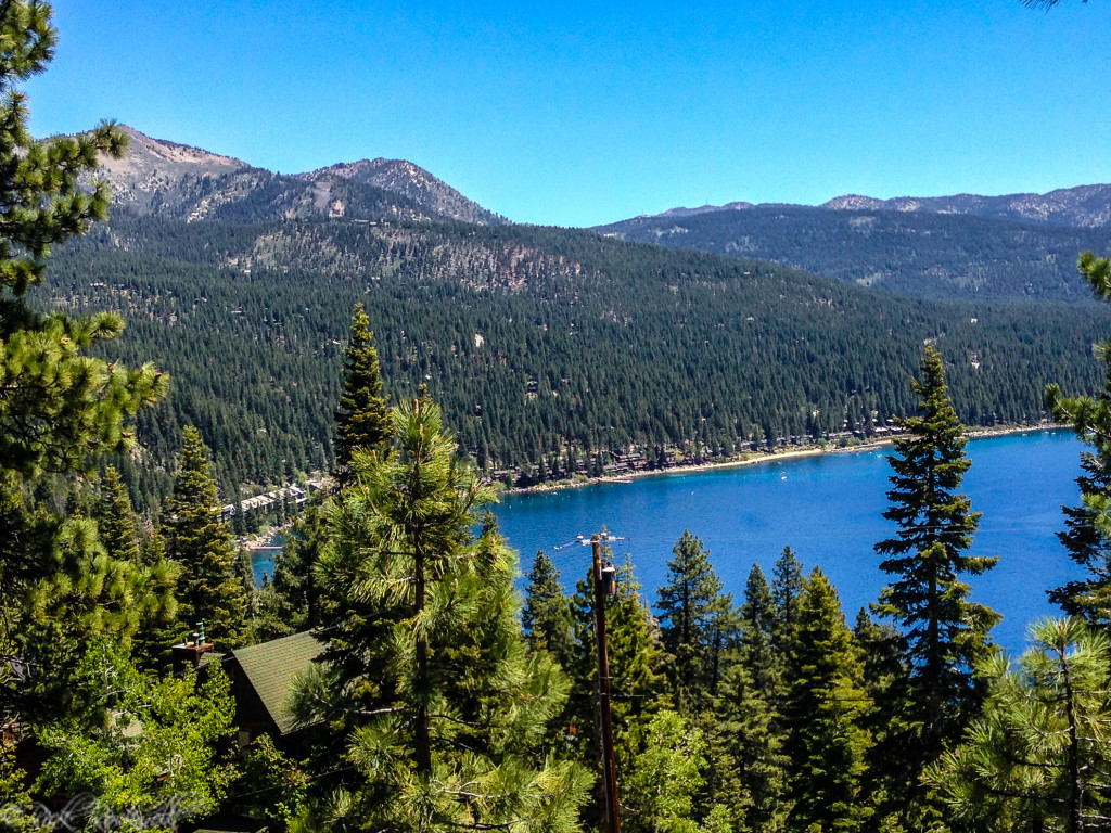
The route follows an old paved forest road uphill from the gate. Early on, you begin to get views of Crystal Bay, and the scenery opens up more as you climb.
Part of the Hike | What You’ll See |
Trailhead gate | Start near Forest Service Road 1601 |
Paved road climb | Short uphill walk with improving lake views |
Water tower area | Route continues toward the lookout area |
Interpretive split | Narrower interpretive trail branches from the road |
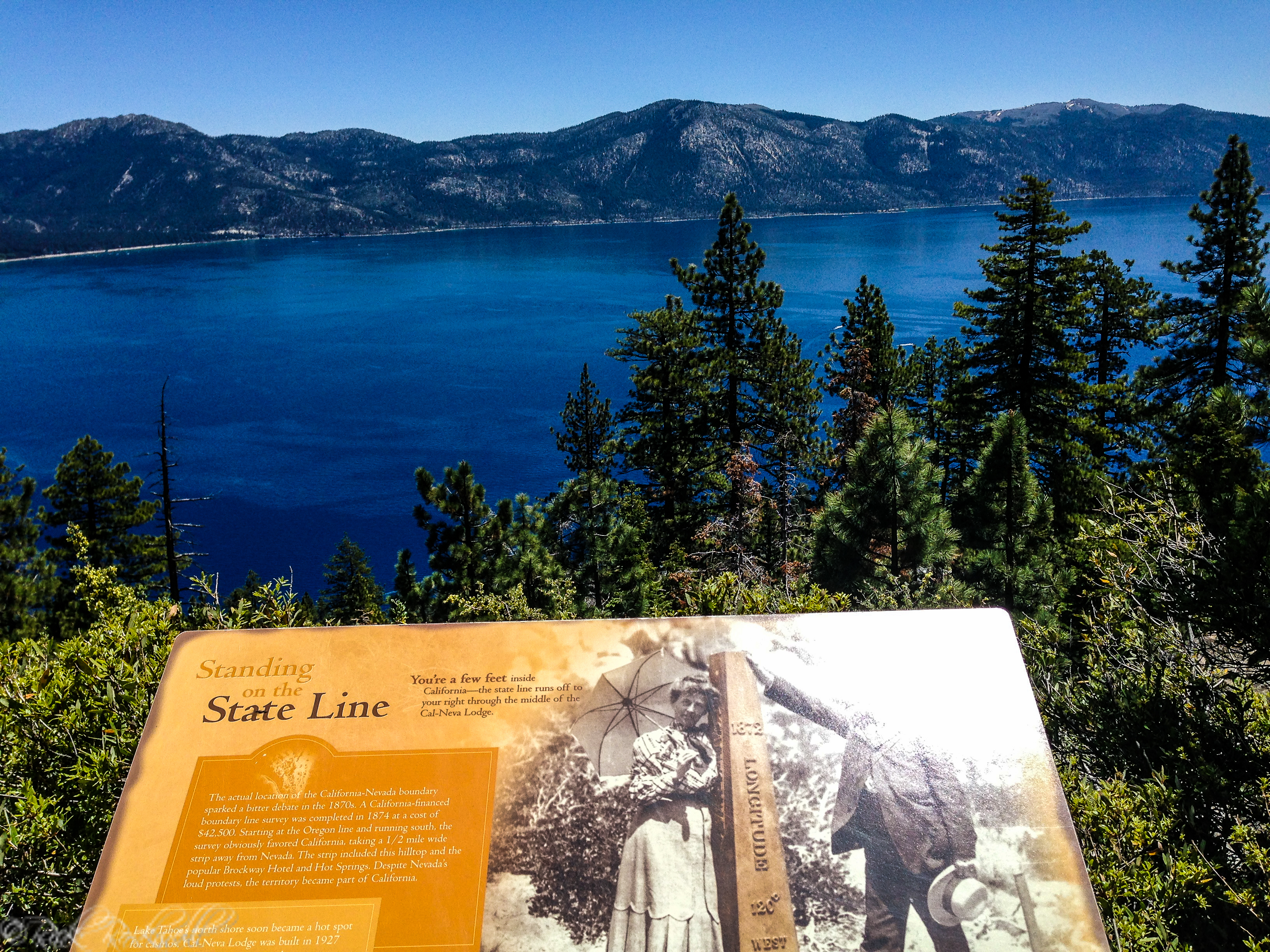
State line marker | A placard marks the Nevada-California state line |
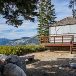
Summit area | Telescopes, picnic tables, restrooms, and wide Lake Tahoe views |
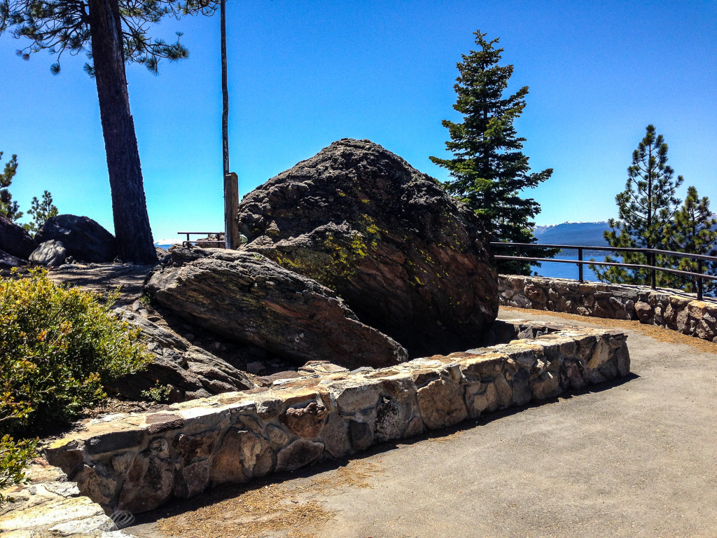
Along the way, interpretive placards explain the history of the area, and there is also a carved wooden bench where hikers can stop and take in the views. A placard marks the actual Nevada-California state line, adding a fun detail that makes the short hike feel a little more memorable.
At the top, visitors can use free telescopes and explore a short self-guided nature trail that explains North Shore history. Those details help the lookout feel like more than just a quick viewpoint.
Views From Stateline Lookout
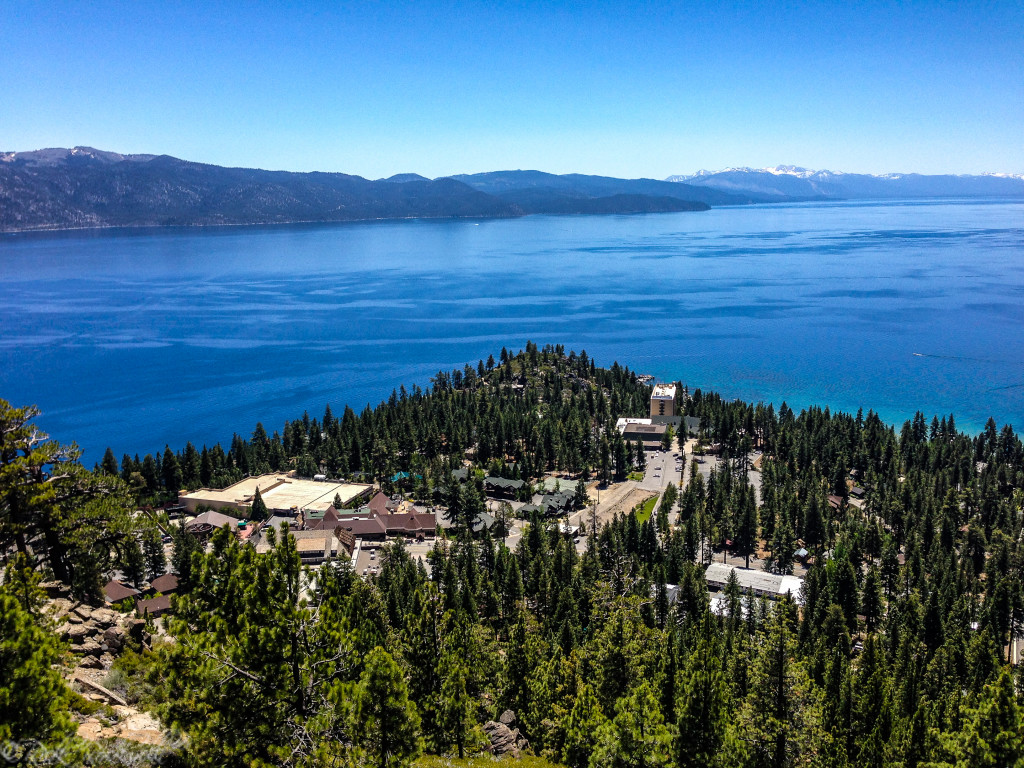
The best reason to do Stateline Lookout Trail is the view. The lookout offers some of the best views in North Lake Tahoe, with sightlines over Crystal Bay, Stateline Point, Agate Bay, and Kings Beach.
One especially interesting view from the trail is toward Stateline Point and the Cal Neva property, long associated with Frank Sinatra, Tahoe celebrity lore and a California urban legend or two as some believe that location is a notoriously haunted place. That gives the stop a little extra character beyond the scenery alone.
The summit area also works well for lingering. Instead of simply tagging a viewpoint and heading back down, visitors can take in the panorama, read interpretive material, and use the picnic tables at the top.
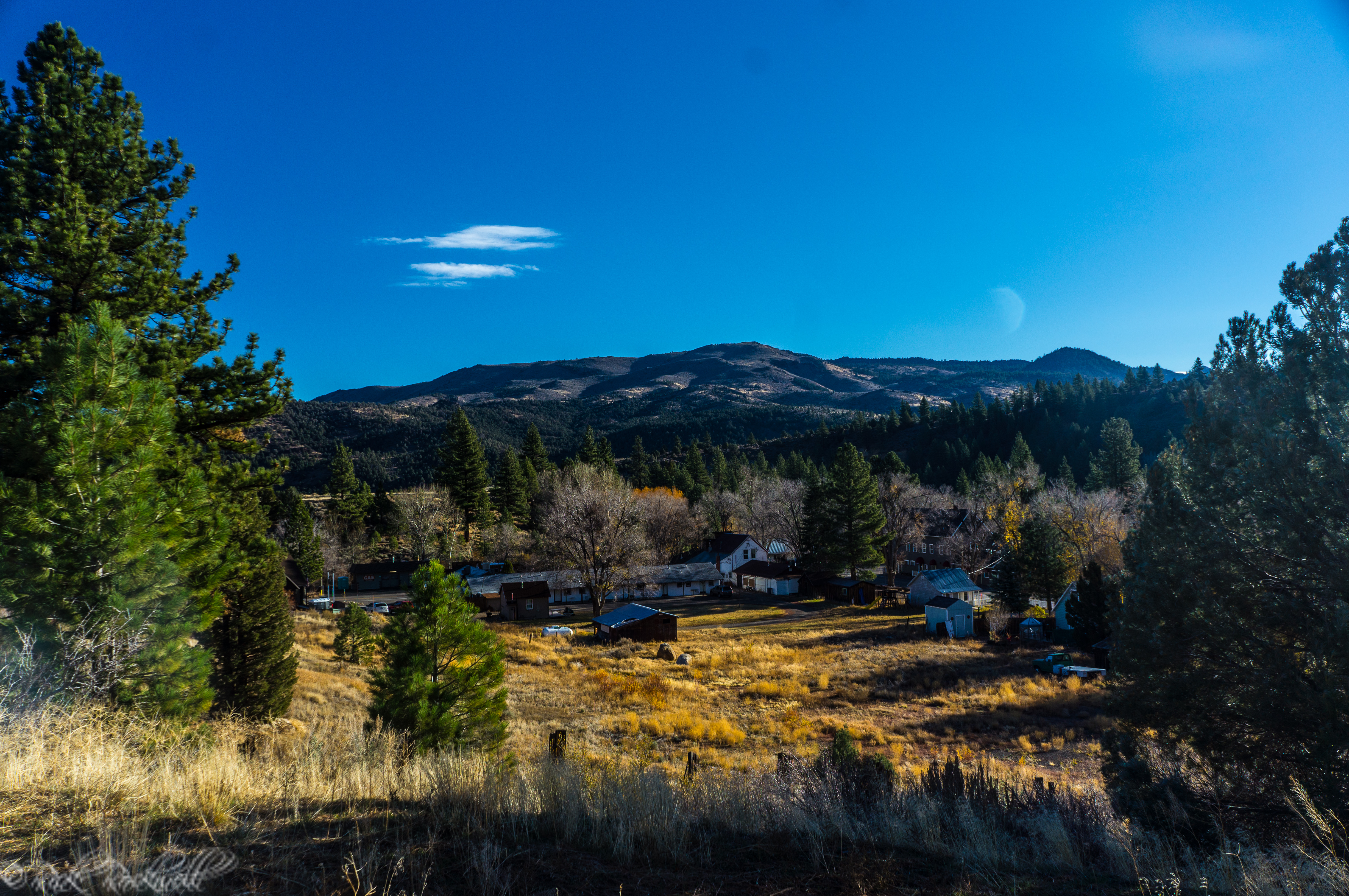
Crystal Bay
History of the Stateline Fire Lookout
The trail ends at the site of what used to be a fire lookout near the California-Nevada state line. The tower was dismantled in 2002, and the summit area now includes bathrooms, picnic tables, interpretive features, and a panoramic overlook instead.
Even without the original tower, the history still gives the hike more identity than a standard viewpoint trail. It connects the route to Tahoe’s broader fire lookout story and helps visitors understand the site as a former working observation point above the lake.
The lookout sits above 7,000 feet, which helps explain how much visual range you get for such a short climb.
Recent Improvements and Current Details
Stateline Lookout has received several recent improvements that make the short hike feel more complete today. Visitors can use free telescopes at the lookout and follow a self-guided nature trail that adds context to the North Shore views.
In 2025, nine new interpretive panels were installed along the Stateline Fire Lookout Trail, replacing older weather-worn signs. The updated panels share information about the fire lookout, local wildlife, Tahoe’s natural history, and the cultural history of the area.
Even the summit facilities have gotten some character. The vault toilets were refreshed as part of a mural project led by local artist Ian Blackhall Scott, with artwork inspired by the Crystal Bay views.
The result is still a simple Tahoe viewpoint hike, but the updated signs, facilities, and interpretive features give you more reason to slow down once you reach the top.
The top of Stateline Lookout Trail
Is the Stateline Lookout Trail Worth Visiting?
Stateline Lookout Trail is one of those rare Tahoe hikes that gives you a lot without asking for much in return. The route is short, easy to follow, and delivers a full payoff of sweeping North Shore views along with interpretive stops, and a summit that feels more substantial than the mileage suggests.
The small upgrades throughout the trail make it even more enjoyable than the first time I hiked it over 15 years ago.
If you are planning a visit to the North Shore of Lake Tahoe, the Stateline Lookout Trail is a must-add stop along your adventure.
If you want to see a fully-intact fire lookout, that’s decommissioned, then head over to the Angora Fire Lookout on the South Shore of Tahoe. It provides a wonderful history along with more amazing views of Lake Tahoe and Fallen Leaf Lake. In fact, pack in a trip to the Angora Lakes as well. You won’t regret it.
FAQ About Stateline Lookout Trail
How long is Stateline Lookout Trail?
Stateline Lookout Trail is about 0.5 mile to the lookout by the direct paved route. The hike is longer if you include the interpretive loop or nearby route variations.
How hard is Stateline Lookout Trail?
It is generally easy to easy-moderate. The trail is short and paved, but the uphill grade adds some effort.
Is Stateline Lookout Trail paved?
Yes. The main route follows an old paved forest road, with an interpretive side trail branching off near the middle.
Are there bathrooms at Stateline Lookout?
Yes. The summit area has vault toilets, but the Forest Service notes that there is no restroom or trash service in winter.
Is there a fee for Stateline Lookout Trail?
No. Stateline Lookout is listed as a no-fee site.
Is there potable water at Stateline Lookout?
No. Bring your own water.
Are dogs allowed on Stateline Lookout Trail?
Leashed dogs are generally allowed. Pack out waste and follow any posted trailhead signs.
Can you hike Stateline Lookout Trail in winter?
Possibly, depending on snow and road conditions. Parking is seasonal, and winter restroom/trash service is not available, so check current conditions before heading out.
Is Stateline Lookout Trail in North Lake Tahoe or South Lake Tahoe?
Stateline Lookout Trail is in North Lake Tahoe above Crystal Bay. It is not the Stateline casino area on the South Shore.
What happened to the fire lookout tower?
The former fire lookout tower was dismantled in 2002. Today, the summit area has picnic tables, restrooms, interpretive signs, free telescopes, and panoramic views of Lake Tahoe.
Where do you park for Stateline Lookout Trail?
Park near the iron pipe gate at Forest Service Road 1601. Do not block nearby homes, driveways, gates, or private-property access.
Is Stateline Lookout Trail good for families?
For many families, yes. The short distance, paved route, interpretive stops, and summit amenities make it approachable, though the uphill climb may still feel strenuous for some visitors.
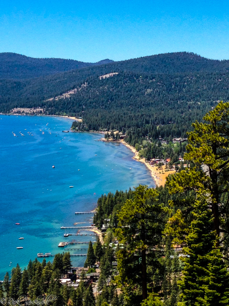
Agate Bay and Kings Beach
Sources
U.S. Forest Service, Lake Tahoe Basin Management Unit — Stateline Lookout https://www.fs.usda.gov/r05/laketahoebasin/recreation/stateline-lookout
U.S. Forest Service, Lake Tahoe Basin Management Unit — Where Can I Take My Dog at Lake Tahoe? https://www.fs.usda.gov/r05/laketahoebasin/recreation/where-can-i-take-my-dog-lake-tahoe
Tahoe Fund — Stateline Fire Lookout Trail
https://www.tahoefund.org/projects/completed-projects/stateline-fire-lookout-trail/
Tahoe Fund — New Interpretive Panels at Stateline Fire Lookout Trail Encourage Visitors to Take Care
https://www.tahoefund.org/news/new-interpretive-panels-at-stateline-fire-lookout-trail-encourage-visitors-to-take-care/
Tahoe Fund — Tahoe Fund Hires Local Artists to Transform National Forest Restrooms
https://www.tahoefund.org/news/tahoe-fund-hires-local-artists-to-transform-national-forest-restrooms/
Lake Tahoe Travel — Stateline Lookout
https://laketahoetravel.com/listing/stateline-lookout/
Tahoe Mountain Sports — Stateline Fire Lookout Lake Tahoe Hiking Trails
https://tahoemountainsports.com/blogs/blog/stateline-fire-lookout-lake-tahoe-hiking-trails
Granlibakken Tahoe — Historic Stateline Fire Lookout
https://www.granlibakken.com/experiences/historic-stateline-fire-lookout