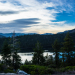
Bayview Trailhead is one of those Tahoe access points that does a lot of work. For many visitors, it is simply where the Cascade Falls hike begins. But Bayview is more than that. It is also a practical jumping-off point for day hikes, Desolation Wilderness access, and some of the best high-scenery terrain near Emerald Bay.
If you are planning to park here, it helps to understand what the trailhead offers and where it leads to because the logistics matter as much as the incredible views.
Quick Facts: Bayview Trailhead
- Location: Highway 89 near Emerald Bay, across from Inspiration Point
- Elevation: About 7,100 feet
- Primary Use: Trailhead and day-use area
- Best Season: Late spring through early fall
- Main Hike Accessed Here: Cascade Falls Trail and Bayview Trail into Desolation Wilderness
- Parking: On-site lot that can fill quickly on busy days
- Restrooms: Vault toilets available when open
- Dogs Allowed? Yes, should be kept on leash
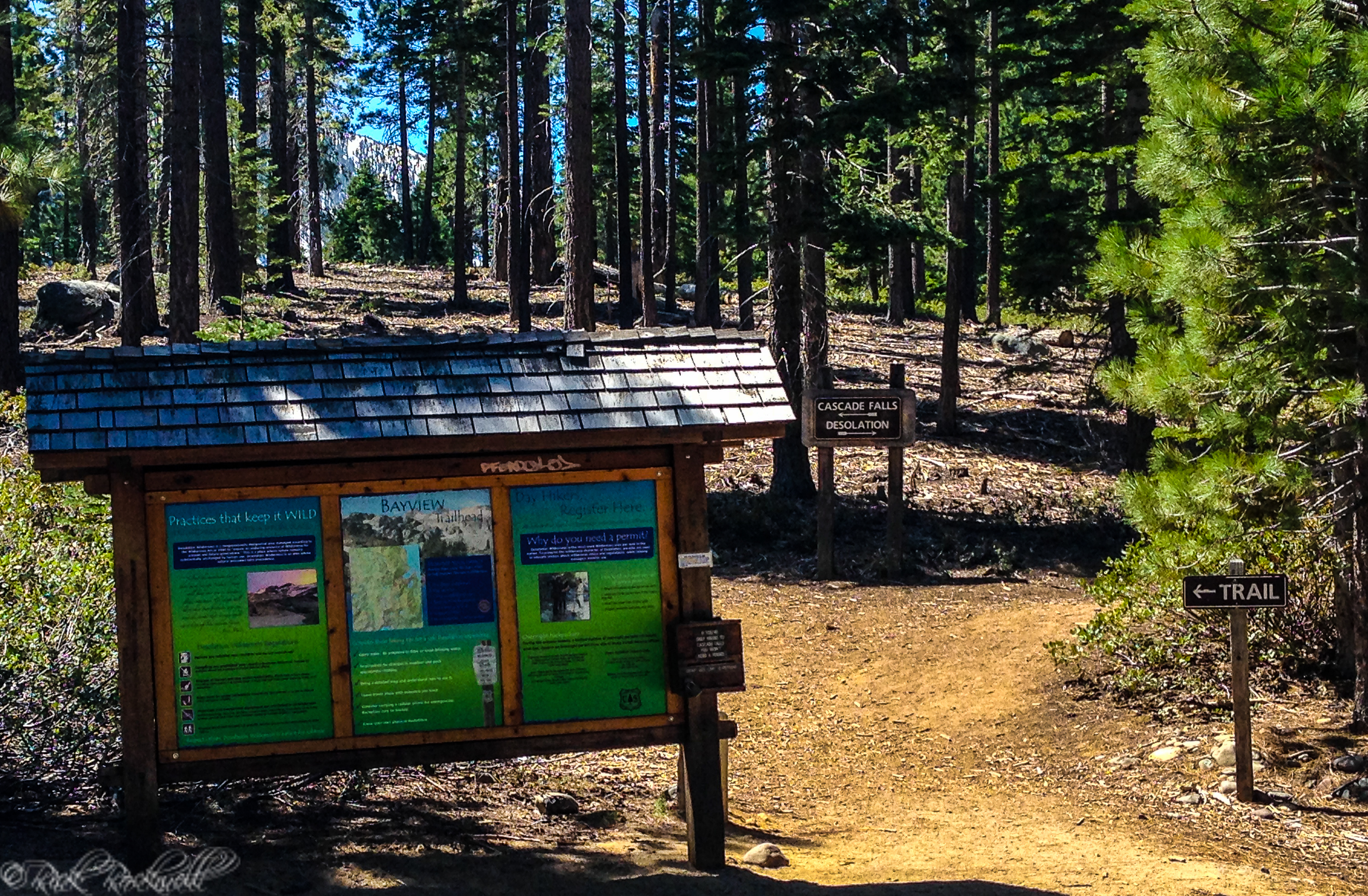
- Day-Use Wilderness Permits: Available at self-serve kiosk for Desolation Wilderness routes
Where Is Bayview Trailhead?
Bayview Trailhead and Day-Use Area sits along Highway 89 near Emerald Bay, across the road from Inspiration Point. It is easy to find for most visitors and well positioned for both short scenic hikes and longer Desolation Wilderness outings.
Take Highway 89 north about 8 miles to the Bayview Trailhead. It’s located across the highway from Inspiration Point. If you are coming up Highway 50 from Sacramento, you will stay straight at the stoplight (the “Y”) instead of making a right that takes you toward Stateline. The trailhead is on the left side of Highway 89.
Parking, Seasonal Access, and Crowds
Bayview Trailhead is popular for good reason, and that means parking can be a real issue. The lot often fills fast on summer weekends, so the best approach is to arrive early if you want a relaxed start or if you are visiting during peak season.
The main season is late spring through early fall. Snow conditions and seasonal operations affect access, so shoulder-season visitors should check current conditions before assuming the trailhead is fully open.
There’s a $10 fee to park at this trailhead, which is higher than the $5 fee I used to pay a handful of years ago.
Amenities at Bayview Trailhead
For a busy Tahoe trailhead, Bayview has a useful set of amenities when the trailhead is open:
- Vault restrooms
- Picnic tables
- Desolation Wilderness self-serve kiosk
It should be noted that this trailhead does not have potable water. So, make sure to bring your own water.
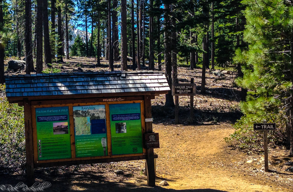
Do You Need a Permit at Bayview Trailhead?
A wilderness permit is required for visitors to enter Desolation Wilderness from Bayview. Day-hikers can use the self-serve kiosk, while overnight visitors need to obtain an overnight permit before arriving. Hard-sided bear canisters are required for overnight visits.
At the same time, the hike to Cascade Falls does not require a permit.
Trail Rules and Bear Safety
Bayview is part of bear country, and visitors should remove scented items from vehicles and lock doors and windows before heading out. Campfires are not permitted, and there is no camping or overnighting at the trailhead. Pets should always be kept on a leash.
Best Hikes From Bayview Trailhead
Destination | Distance (round trip) | Difficulty |
Cascade Falls | Est. 2 miles | Easy |
Granite Lake | Est. 2.6 miles | Moderate |
Maggie’s Peaks | Est. 4.5 miles | Difficult |
Dicks Lake | 10.6 miles | Difficult |
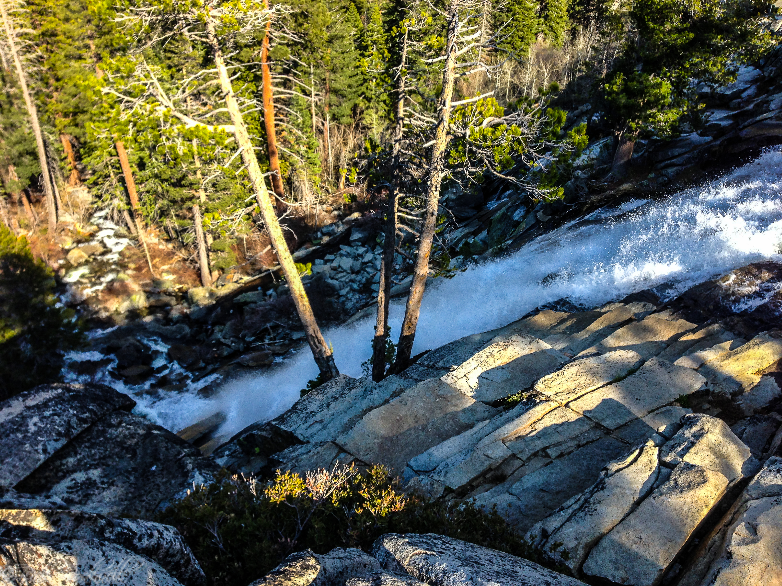
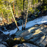
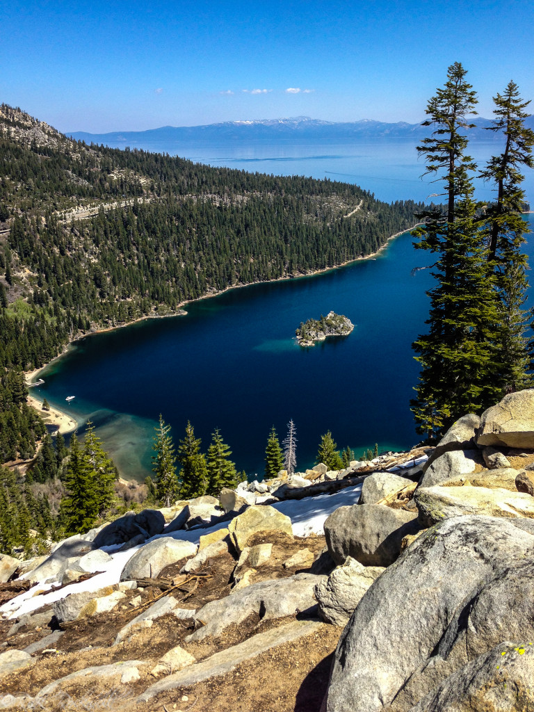
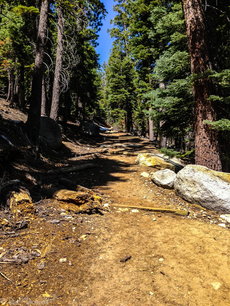
Cascade Falls: the short scenic destination favorite from Bayview, leading hikers to granite overlooks above private Cascade Lake and a seasonal waterfall.
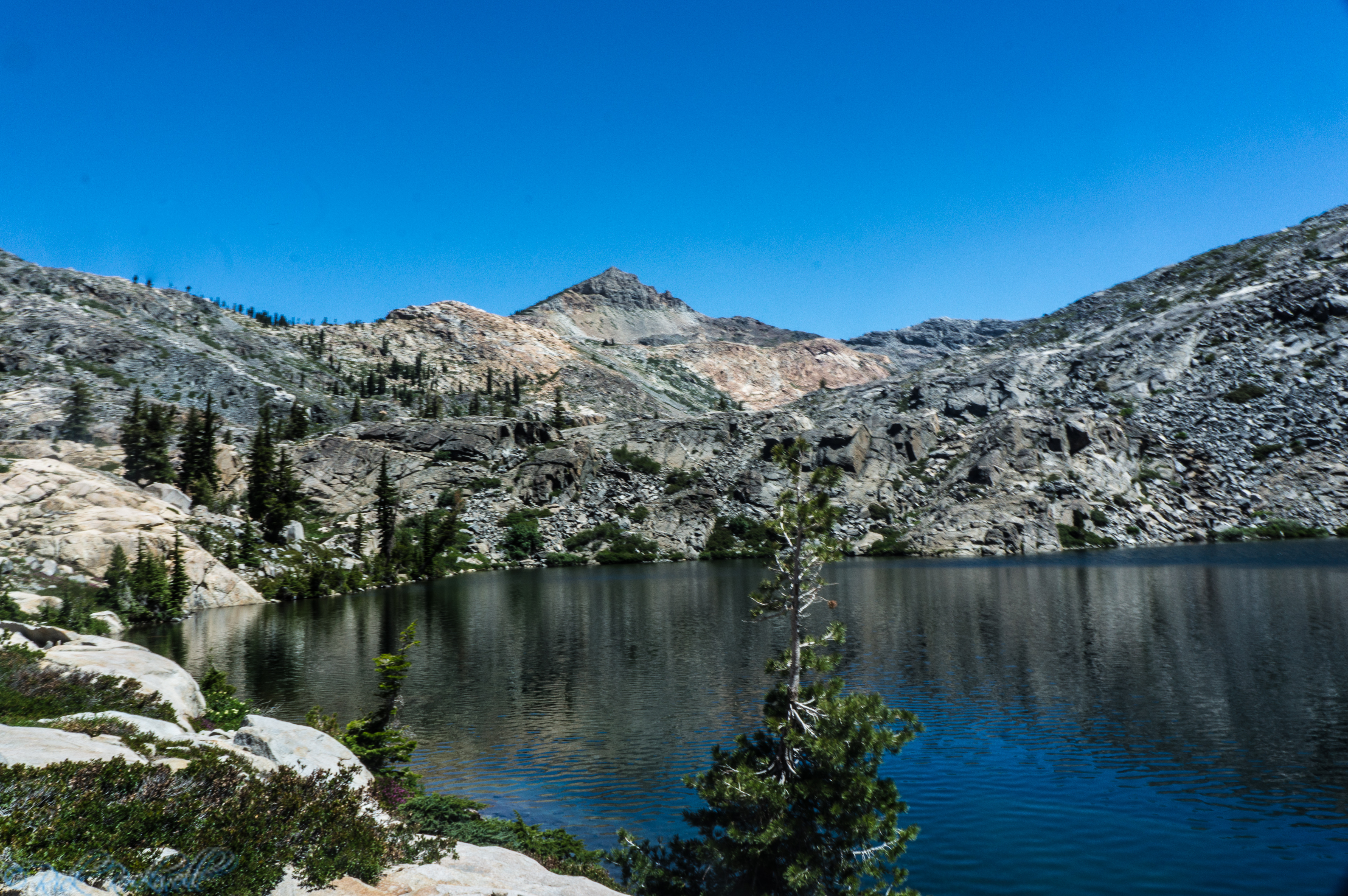
Granite Lake: a relatively short but steeper backcountry destination that gives Bayview hikers a quieter alpine lake option inside Desolation Wilderness.
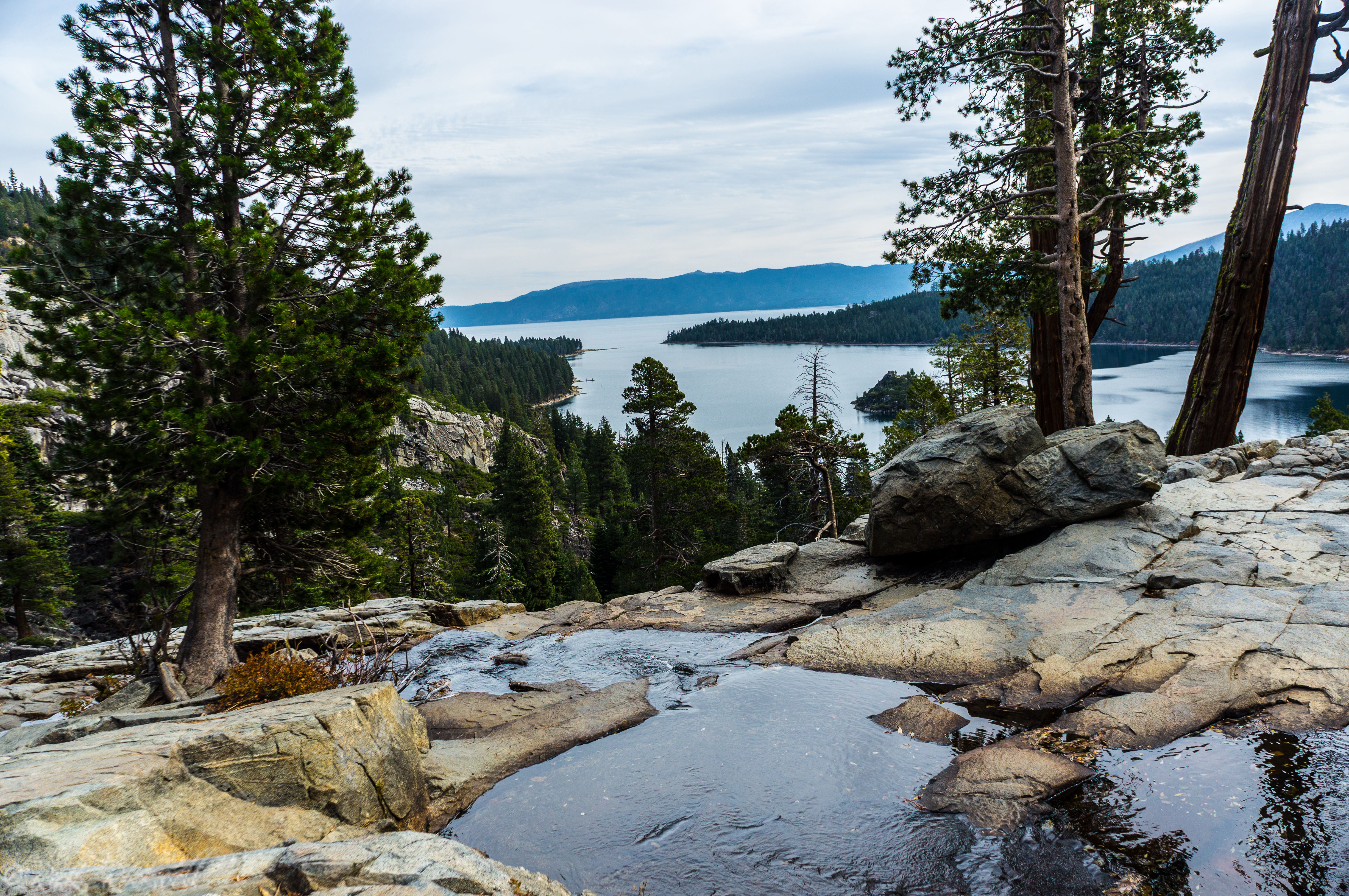
Maggie’s Peaks: a rewarding climb that provides sweeping views of Emerald Bay, Cascade Lake, Lake Tahoe, and Desolation Wilderness. Maggie’s Peaks brings together one of the best views in the entire basin.
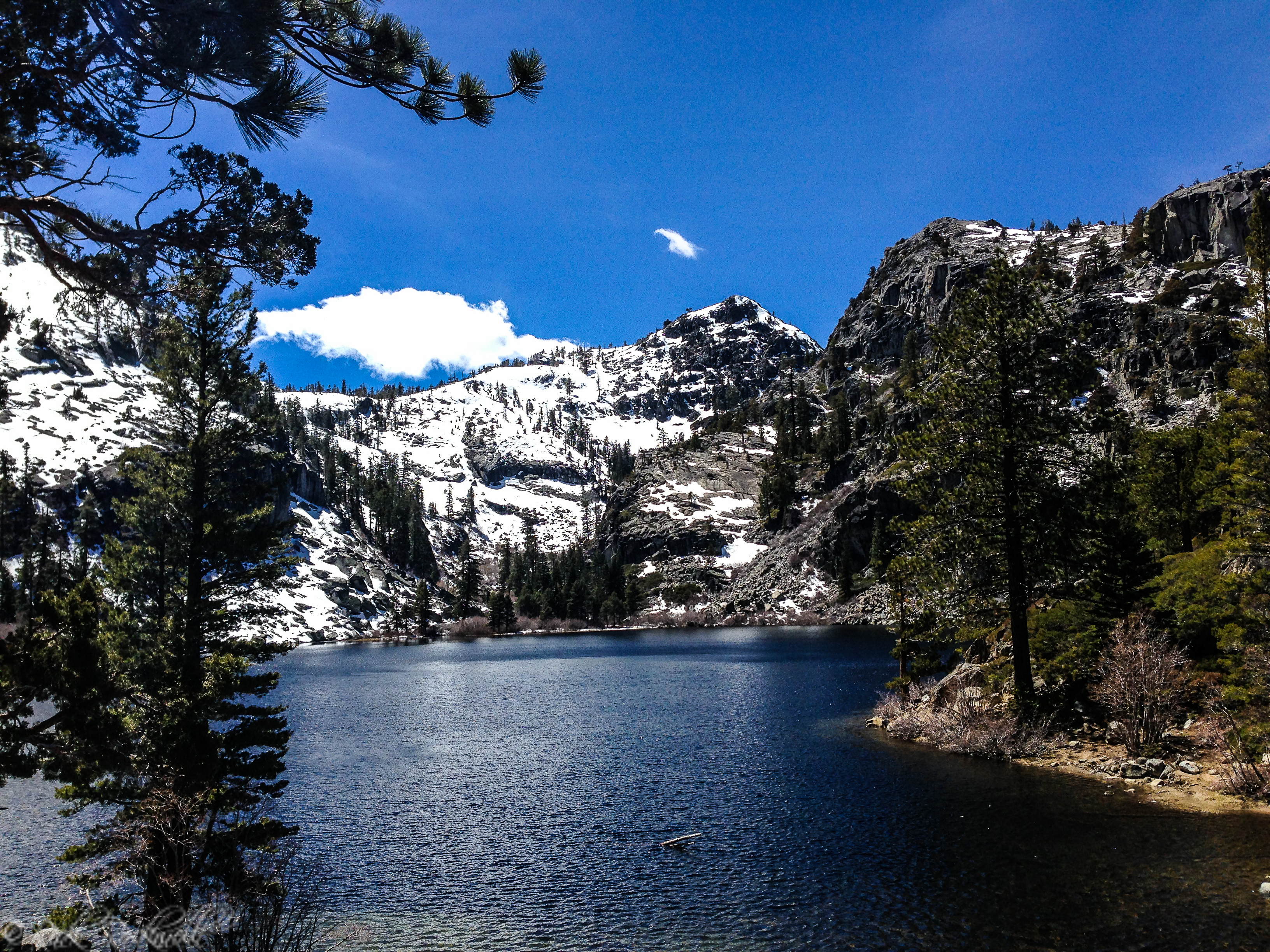
Dicks Lake: the longer, tougher Bayview destination for hikers heading deeper into Desolation Wilderness.
Bayview Trailhead to Cascade Falls
For casual visitors, Cascade Falls is still the star. The hike begins here, runs about 1 mile each way according to the Forest Service, and offers some of the best short-hike scenery near Emerald Bay. If your main goal is the waterfall, Bayview is the practical starting point rather than the destination itself.
Bayview Trailhead and Desolation Wilderness
Bayview Trailhead becomes even more important once you look beyond the short walk to Cascade Falls. It is one of the main access points into Desolation Wilderness, serving everyone from casual day hikers to backpackers heading deeper into the high country.
From here, hikers can continue past the front-country scenery toward destinations like Granite Lake at 1.3 miles one way and Dicks Lake at 5.3 miles one way, while more ambitious hikers often use Bayview as the starting point for routes to Maggie’s Peaks, a steep climb with wide-ranging views over Emerald Bay, Cascade Lake, and Lake Tahoe.
That broader role is what makes Bayview more than just a parking lot for Cascade Falls. It is a transition point between easy sightseeing and true wilderness travel. That dual role is exactly why Bayview requires a little planning.
Local Lore and Mystery Around Bayview Trail
Bayview Trail itself is not especially known for ghost stories or urban legends, but it does pass through a landscape rich with older Tahoe lore. The best-known bit of local legend belongs to Maggie’s Peaks, which many sources say were named for a curvy 19th-century barmaid at the Tahoe Tavern.
More Than a Trailhead, Bayview Is the Start of the Experience
Bayview Trailhead is easy to think of as just the place where the hike begins, but it is really part of what makes this corner of Tahoe so appealing. It gives you quick access to Cascade Falls, bigger routes into Desolation Wilderness, and some of the most memorable scenery along the southern Tahoe corridor, all from one compact starting point.
For avid hikers, this trail is must. For families or casual hikers, the trail is ideal because of the easy path to Cascade Falls.
So, whether you are here for a short scenic walk or a deeper backcountry outing, Bayview is one of those rare trailheads that feels like more than a parking area. It really is the start of a much bigger Tahoe experience.
FAQ About Bayview Trailhead
Is there parking at Bayview Trailhead?
Yes, but it fills quickly in peak season, especially on summer weekends.
Does Bayview Trailhead have bathrooms?
Yes. Vault restrooms are available when the area is open.
Is there potable water at Bayview Trailhead?
No. Potable water is not available.
Do you need a permit at Bayview Trailhead?
You need a permit to enter Desolation Wilderness, but not for the standard out-and-back hike to Cascade Falls.
Are dogs allowed at Bayview Trailhead?
Yes, but they should be kept on leash.
Can you camp at Bayview Trailhead?
No. Camping and overnighting at the trailhead are not permitted.
Sources
U.S. Forest Service, Bayview Trailhead and Day-Use Area: https://www.fs.usda.gov/r05/laketahoebasin/recreation/bayview-trailhead-and-day-use-area
U.S. Forest Service, Cascade Falls: https://www.fs.usda.gov/r05/laketahoebasin/recreation/cascade-falls
Tahoe Guide, Hike into History | Cascade Lake & Falls: https://yourtahoeguide.com/2017/08/hike-history-cascade-lake-falls/