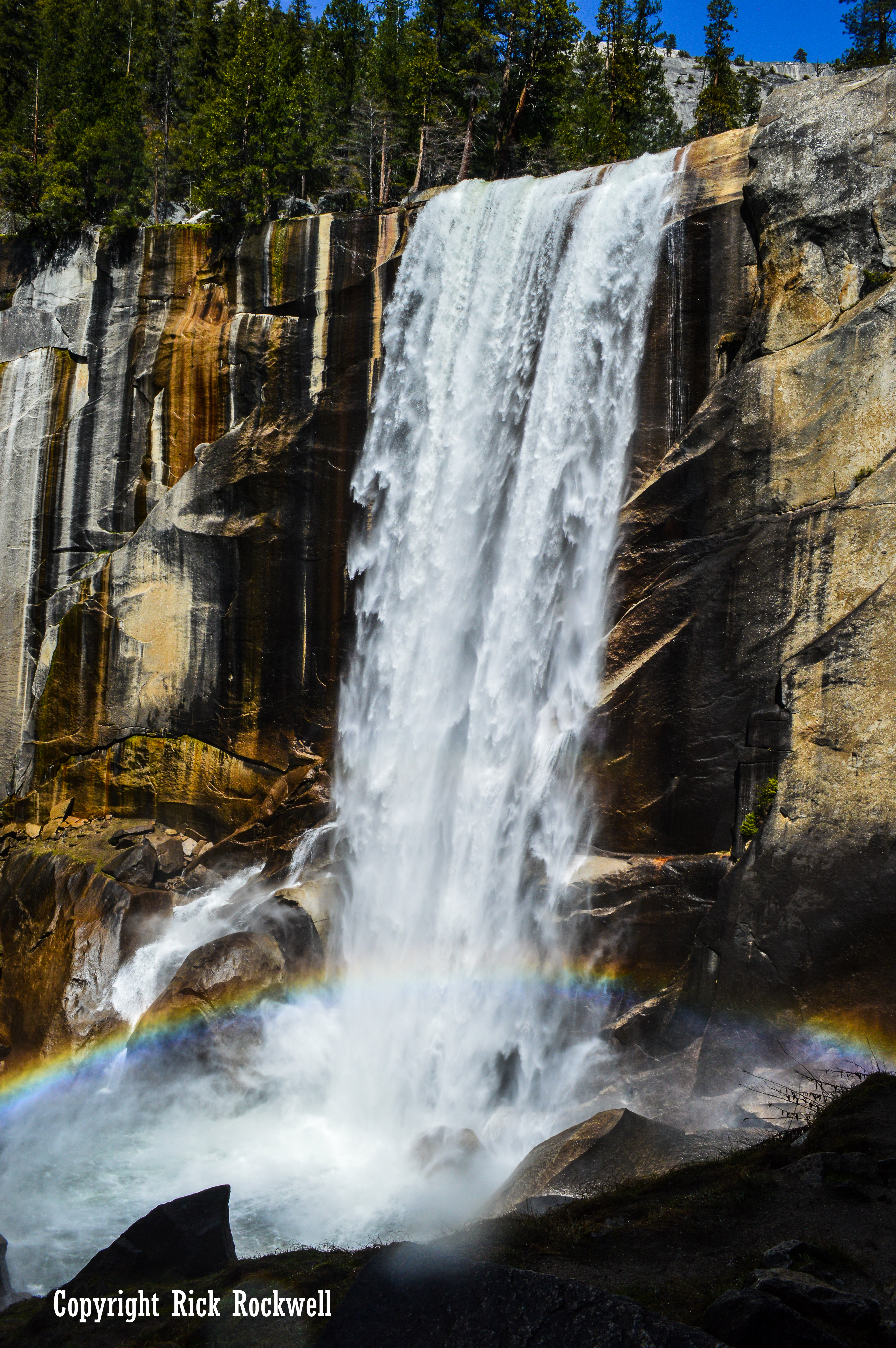
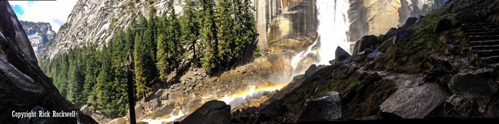
However, this mist provides photographers with some beautiful opportunities of capturing a rainbow nestled near the bottom of the waterfall.
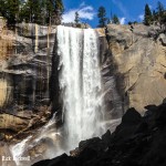
Vernal Fall flows all year long, but the best time to go is in the spring when the volume of water is at its best. Originally named Yan-o-pah by the locals, Vernal Fall received its current name in 1851.
During its peak season, Vernal Fall’s water flow, from the Merced River, can reach over 80 feet wide.
Trailhead
To get to Vernal Fall, begin your hike at the Happy Isles trailhead. You can take the shuttle and get off at stop #16 or you can park at the nearby parking lot. Unfortunately, the closest parking lot fills up quickly so most visitors, like I had to, have to park near Curry Village; which adds another 1.5 miles to your overall hike.
The trailhead is roughly 4000 feet in elevation. At the top of Vernal Fall, the elevation will reach 5,000 feet. This 1,000 foot gain in elevation is gradual and steady over 1.5 miles from the beginning to the top of the water fall, provided that you are taking The Mist Trail. Most people take The Mist Trail to get to Vernal Falls, but some hikers due take the longer John Muir trail for a different challenge.
Check out my article on The Mist Trail for more information and stunning photos.
Rest At The FootBridge
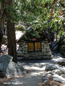
At the 0.8 mile mark, there’s a footbridge that has fresh drinking water and a bathroom. This area is typically crowded, so you will most likely have to wait to use the bathroom.
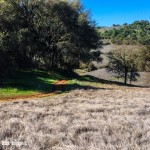
The first half of the hike is filled with switchbacks and a steady incline. It can take about 60 to 90 minutes to get to the footbridge depending on the crowd and your pace. Along the way, you will be able to take many great pictures of the Merced River and surrounding rock formations.
The most exciting part of the hike to Vernal Fall is after the footbridge. This is where things get intense and scary. However, this is also the portion where you can take the best pictures of Vernal Fall.
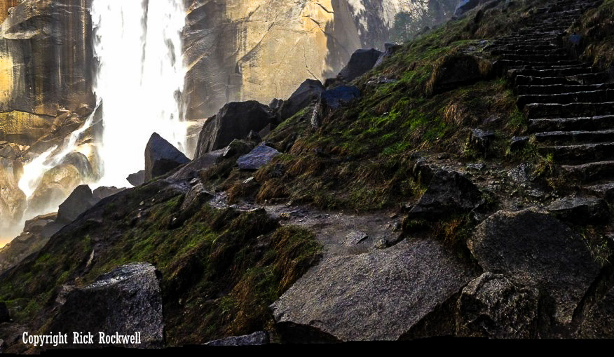
There are over 600 granite stone steps leading from a few hundred feet past the footbridge all the way up to the face of the wall that the water flows over. These steps are very slippery due to the spray that comes from Vernal Fall. It’s highly recommended that you wear sturdy shoes and bring raingear. Additionally, it’s imperative that you take your time and concentrate on each step to prevent slipping and falling.

It took me a little over 2 hours to get to the top of Vernal Fall. I stopped along the way to take many pictures of the Mist Trail, the waterfall and the river. Additionally, there were large crowds on that Saturday morning.
However, it was all worth it. The views of Vernal Fall were amazing. This is easily one of my favorite waterfalls. I would place it 3rd behind Niagara Falls and Burney Falls.
Distance:
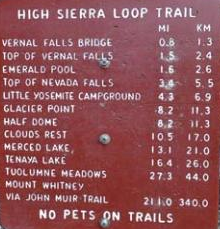
- 1.6 miles round trip to the Vernal Falls Bridge
- 3 miles round trip to the top of Vernal Falls
Elevation:
- 4000 feet elevation at trailhead
- 1000 foot gain in elevation to the top of Vernal Falls
Duration:
The hike can take anywhere from 2 to 3 hours depending on how far you go and your hiking pace.
Difficulty:
This hike increases in difficulty the further you go. It’s a medium hike up to the Vernal Fall footbridge but then becomes difficult the last 0.7 miles of the hike. This is the portion that you ascend up granite steps with a constant water spray from the Vernal Falls.
Amenities
- There are bathrooms at the Vernal Fall footbridge and at the top of both waterfalls
- Limited parking near the Happy Isles trailhead; Additional parking at Curry Village
- Drinking water at the Vernal Falls footbridge
Tips
- Bring raingear or layers of clothing
- Wear sturdy shoes
- Bring a camera (possibly waterproof)
- Bring sunscreen
- Observe all warning signs
- Best time to view is in the Spring
[mc4wp_form id="4451"]