Waterfalls
Eagle Falls: How to See Lower and Upper Eagle Falls at Lake Tahoe
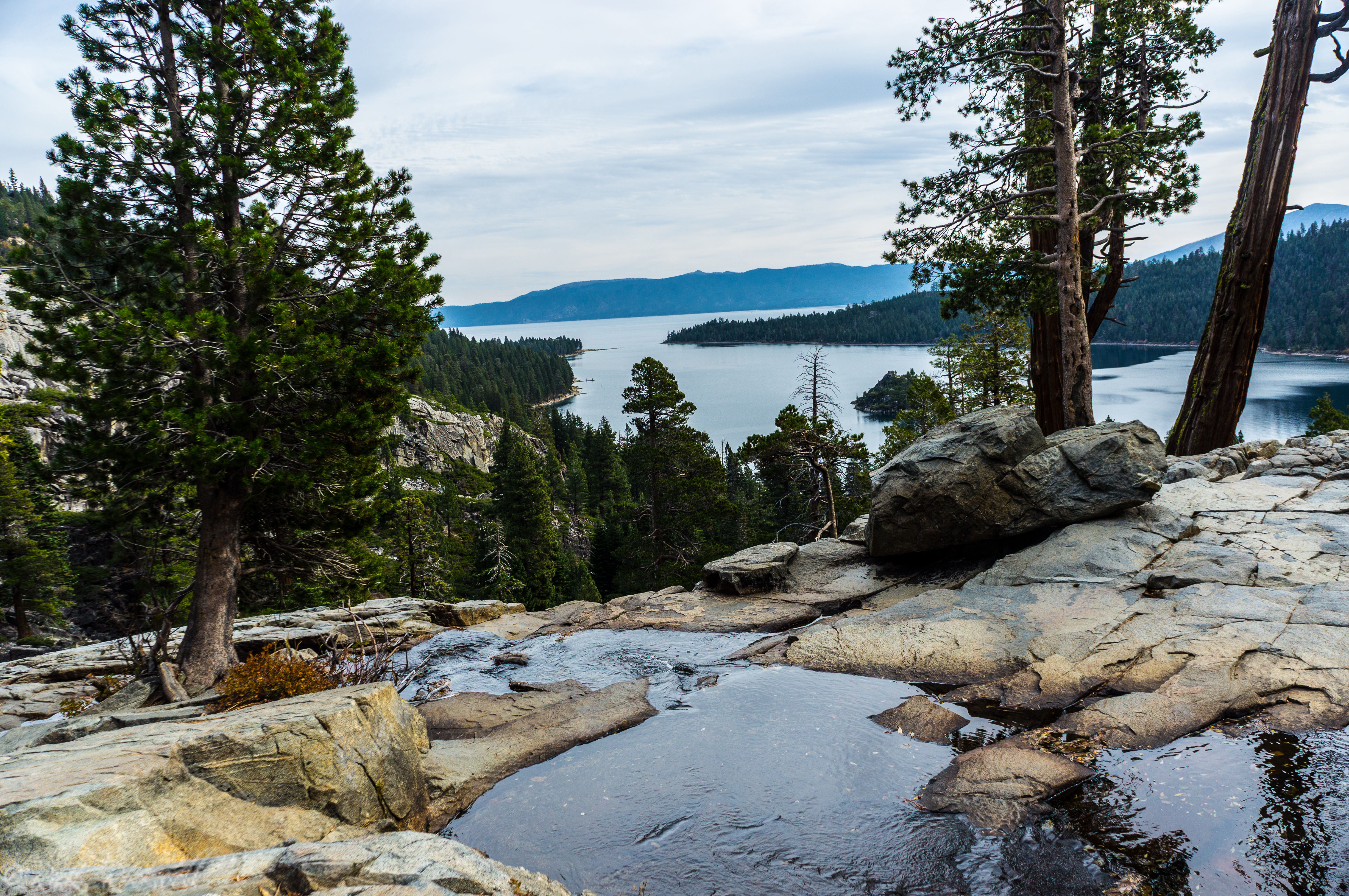
If there is one waterfall stop around Lake Tahoe that blends easy access with dramatic scenery, it is Eagle Falls in Emerald Bay. In fact, the Lower cascade might be easier to access than even Glen Alpine Falls near Fallen Leaf Lake. Set along one of the most beautiful stretches of Highway 89, Eagle Falls …...
Modjeska Falls in South Lake Tahoe: Hike, History, and What to Know
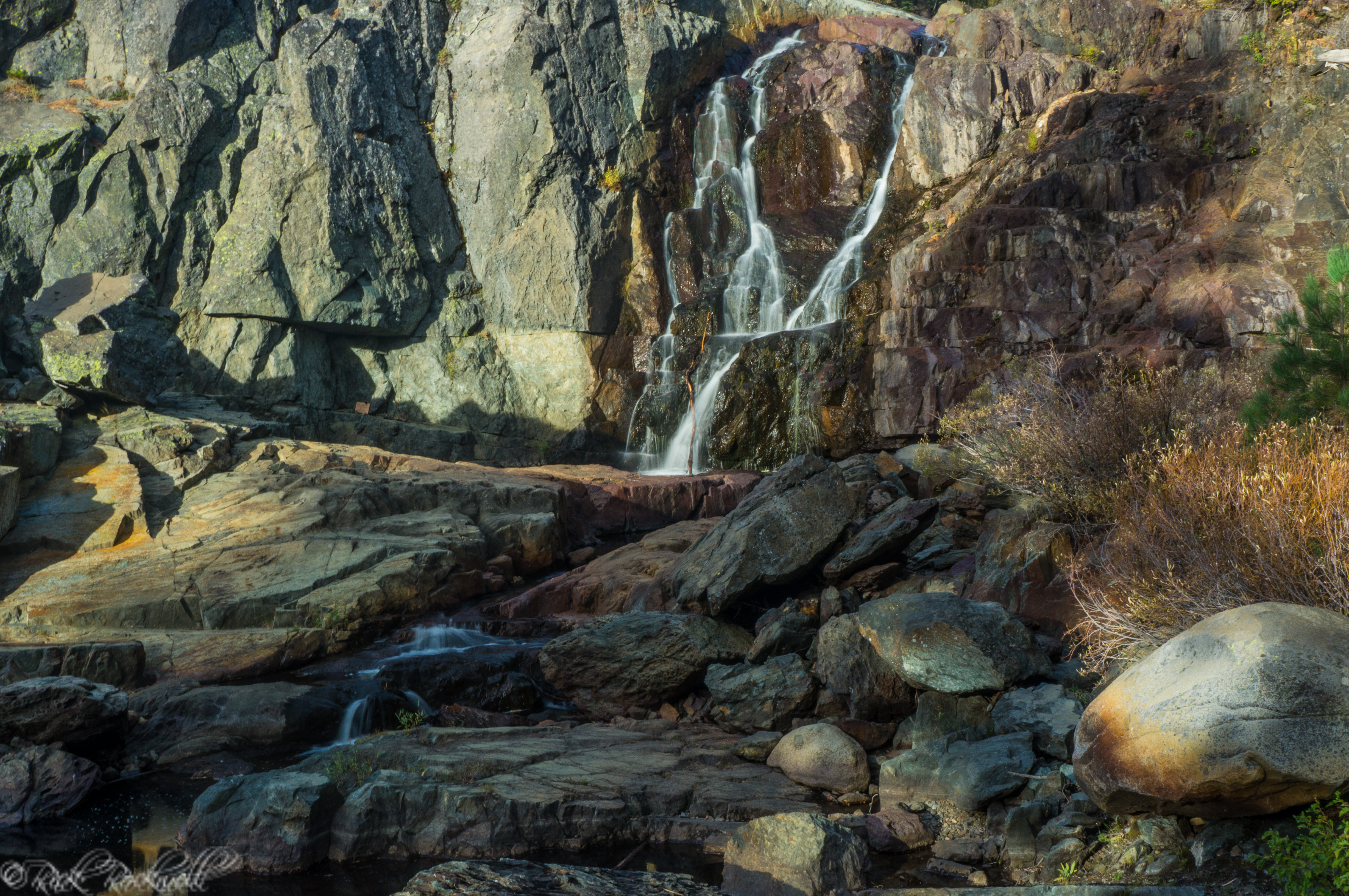
Modjeska Falls is one of those South Lake Tahoe waterfalls that can be easy to overlook if you only know the lower falls along Glen Alpine Creek. Positioned above the more frequently photographed Glen Alpine Falls, this upper waterfall sits near Lily Lake and the Glen Alpine Trailhead, where the road narrows, the forest closes …...
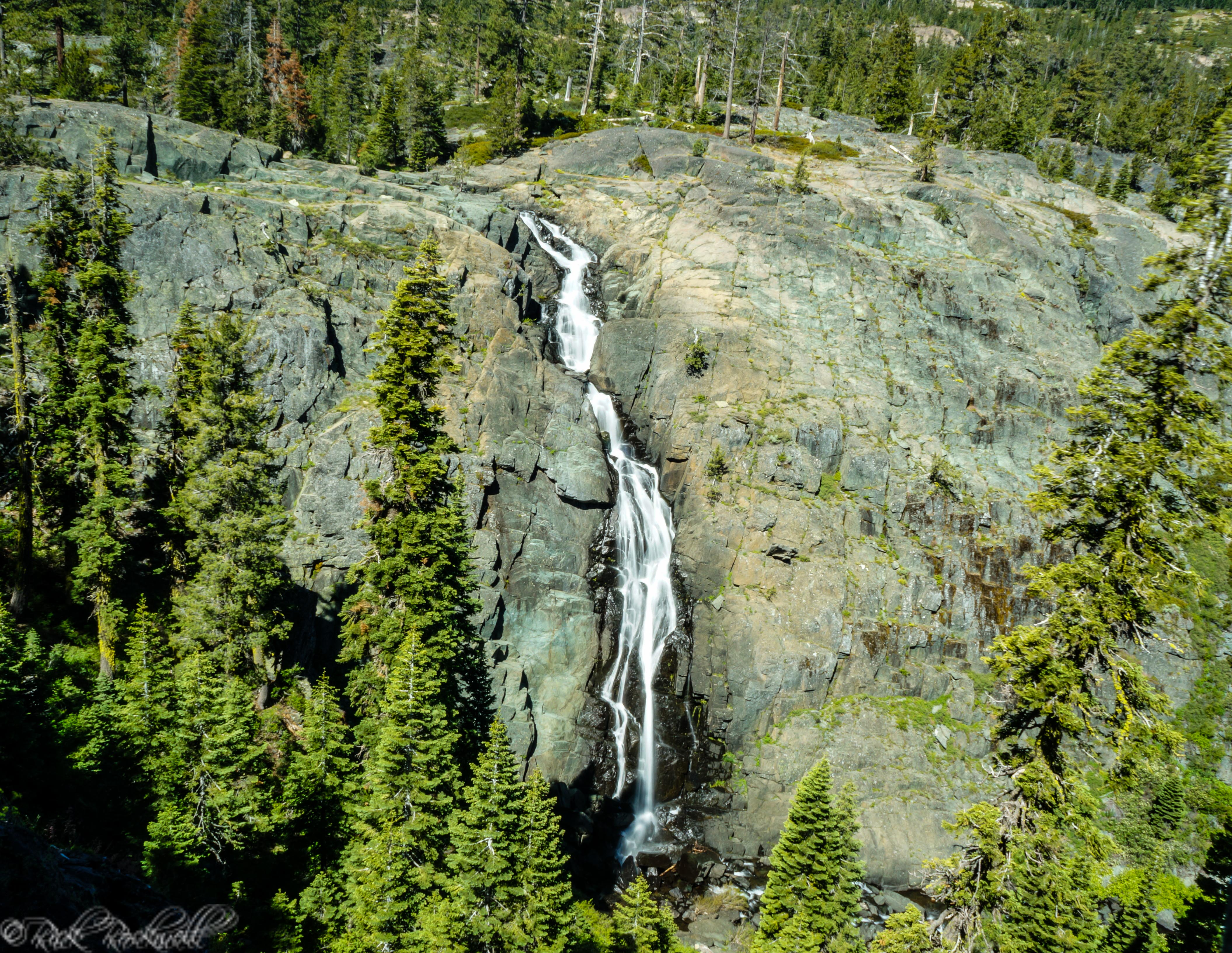
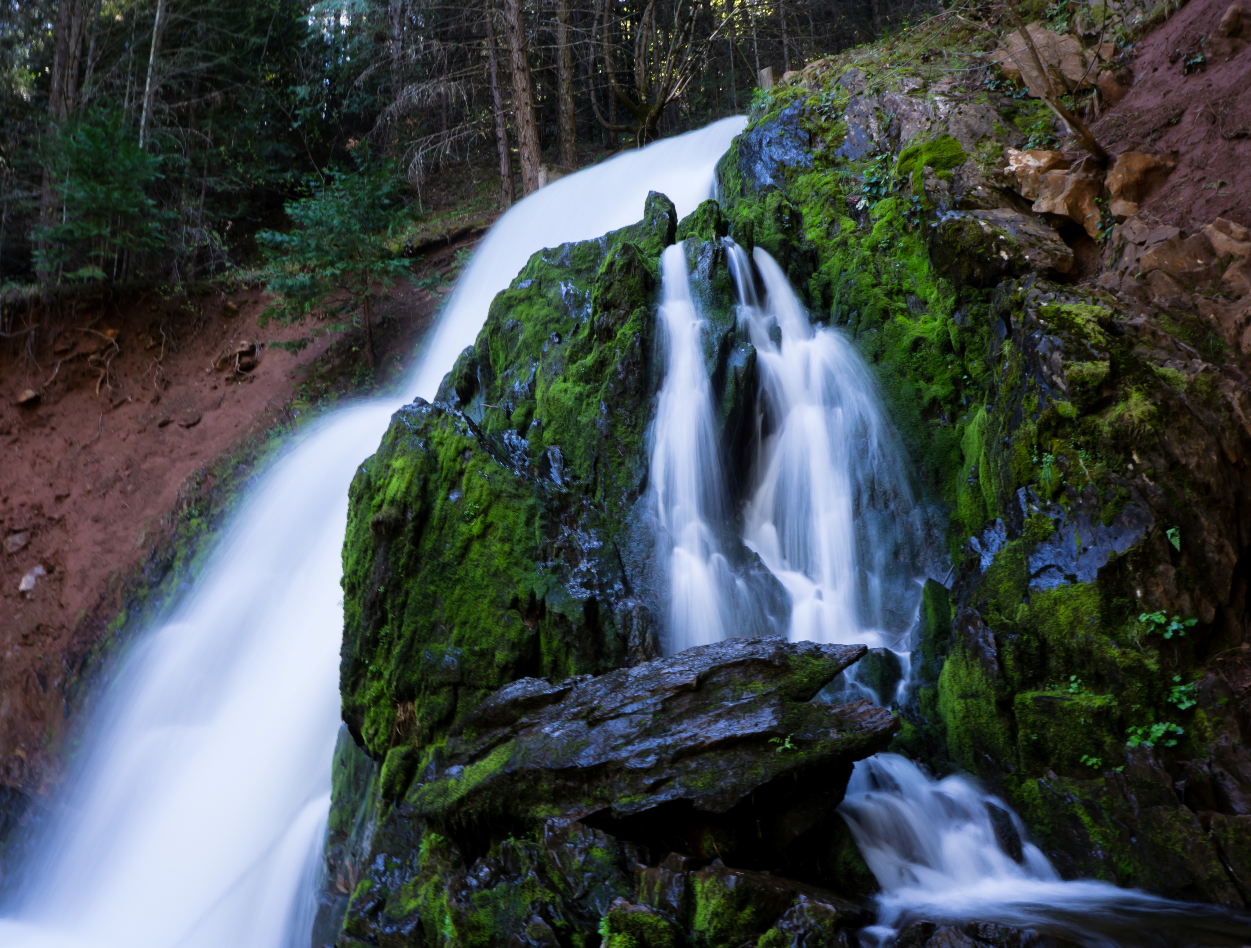
Glen Alpine Falls in South Lake Tahoe: How to Visit, What to Expect, and Why It’s Worth the Drive
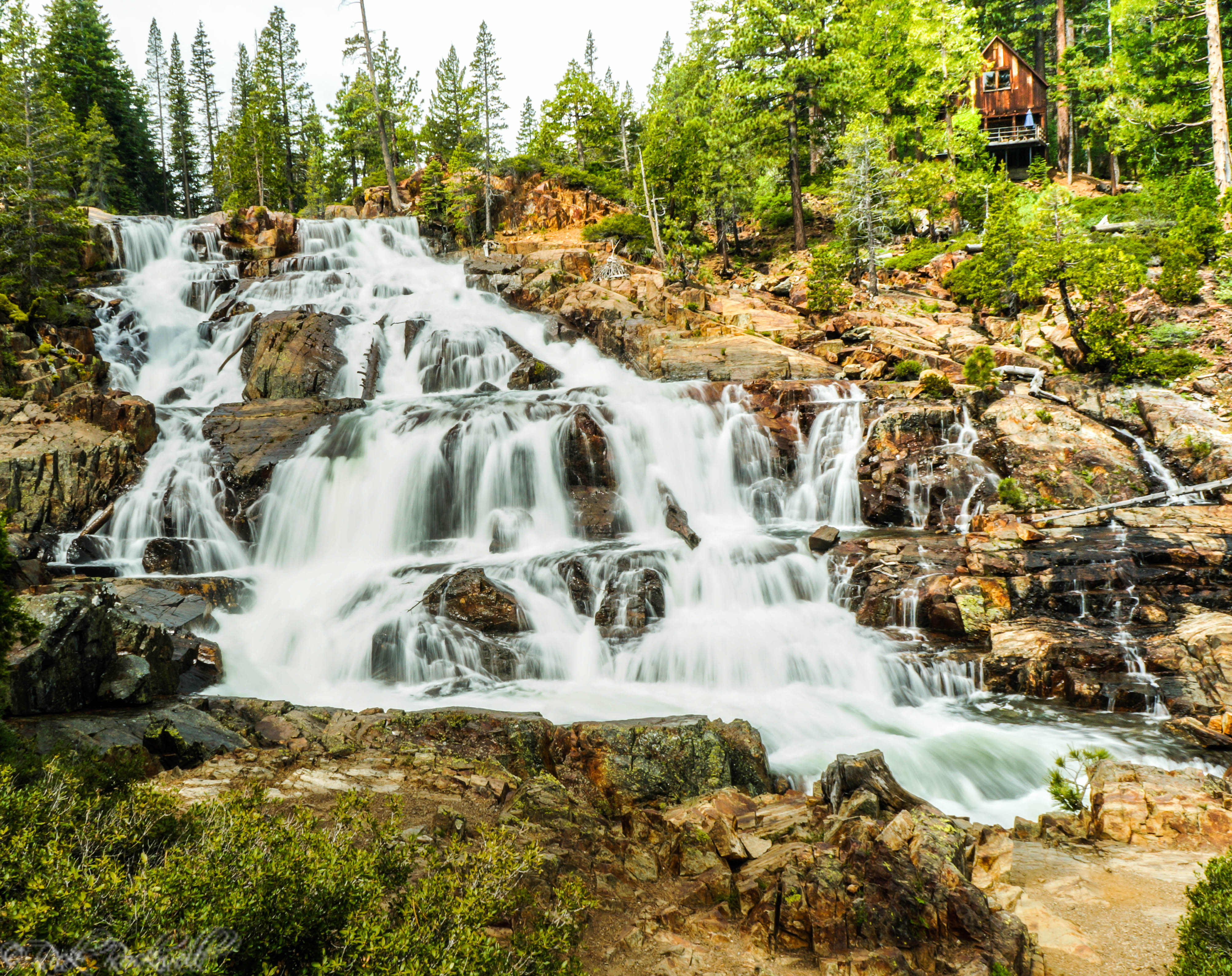
If you are looking for a South Lake Tahoe waterfall that feels dramatic without requiring a long hike, Glen Alpine Falls is one of the easiest waterfall-stops in the basin. Nestled near Fallen Leaf Lake at the edge of Desolation Wilderness, this wide, rushing cascade delivers granite scenery, spring runoff, and that classic Tahoe mix...
Bassi Falls Guide: When to Go, What to Expect, and How to Get There
Bassi Falls is a stunning seasonal 110 foot waterfall located in the El Dorado National Forest of El Dorado County. This waterfall requires some planning and preparation to truly maximize a visit. However, if you put in the prep work, your visit will be a memorable one. Who was Bassi? Giosue Bassi was born to Antonio …...
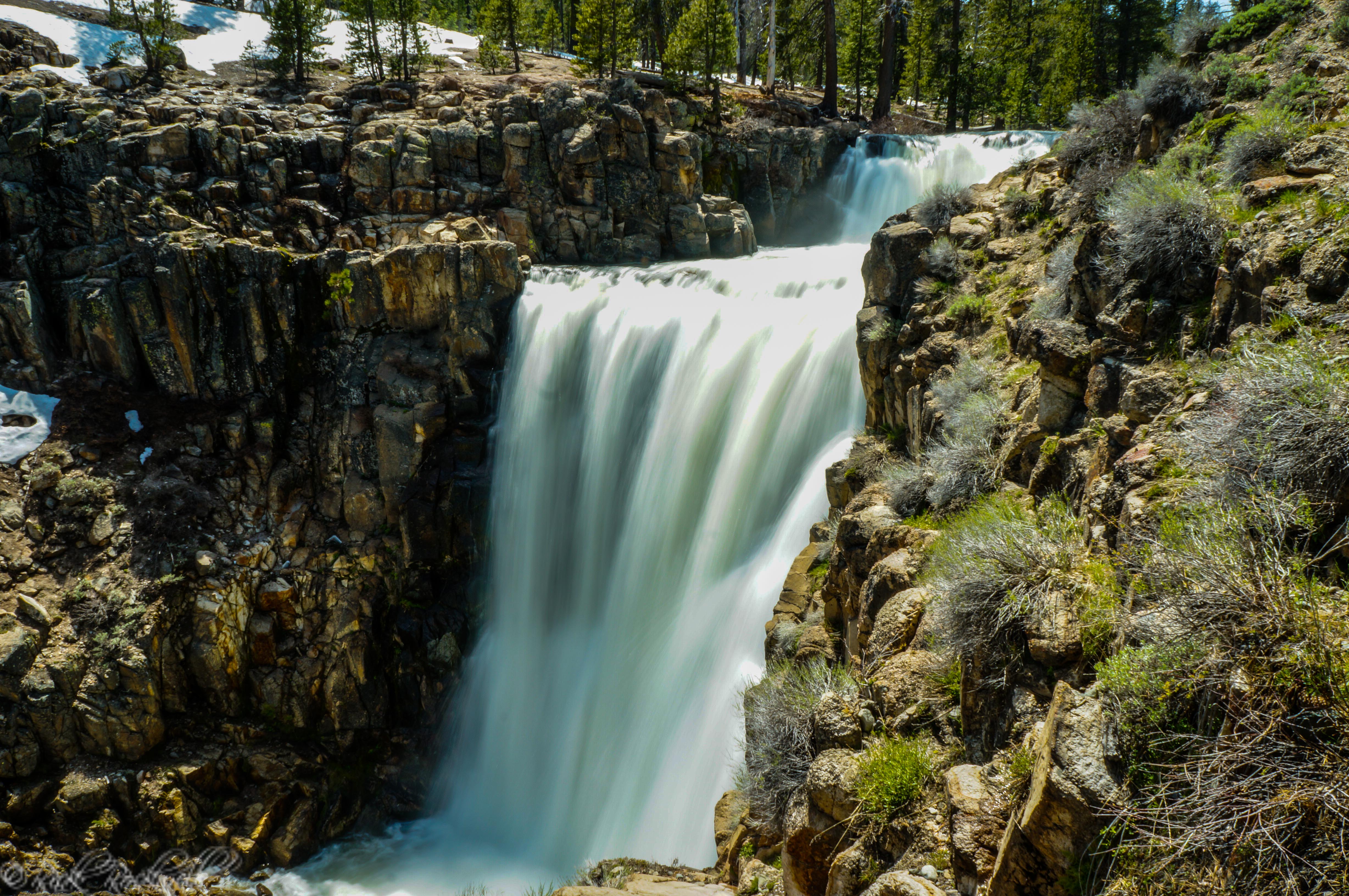
Frazier Falls: the premiere waterfall for Lakes Basin Recreation Area
The Lakes Basin Recreation Area is an outdoor paradise for anyone who enjoys fishing, hiking, camping, boating, scenic lookouts and memorable adventures. This rugged landscape has many points of interest with Frazier Falls, quite possibly, being the most popular of them all. Details About The Waterfall Frazier Falls is located in the...
Webber Falls: Sierra County’s Little Known Waterfall
Located roughly 30 minutes northwest of Truckee, sits one of the region’s most remarkable waterfalls. In fact, during peak season, Webber Falls roars along the Little Truckee River and is a must see destination for any waterfall enthusiast. Surprisingly, this impressive waterfall is one of the area’s best kept secrets to outsiders...
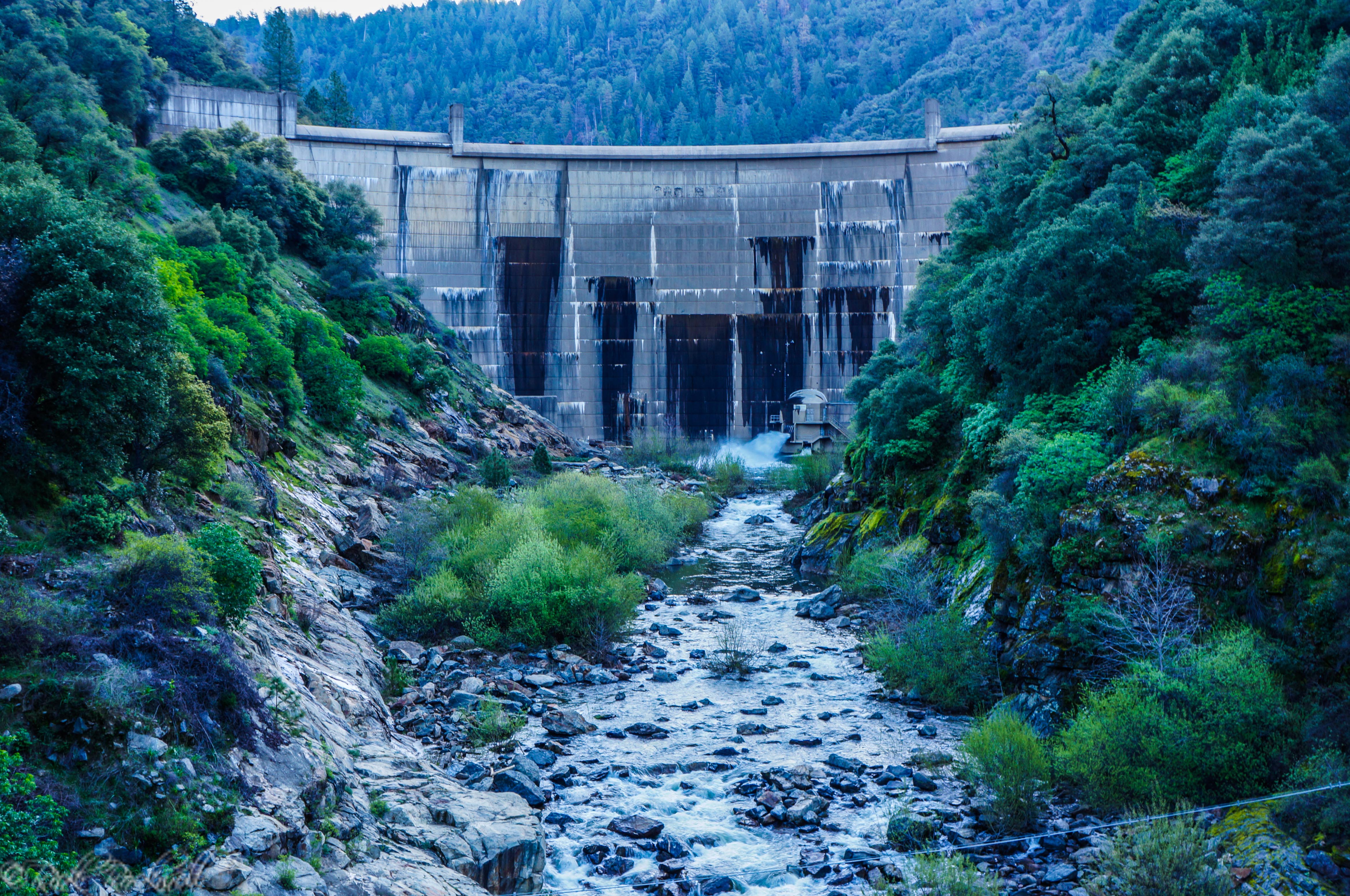
South Fork American River: From Iowa Canyon Waterfalls to Slab Creek Dam
Along the South Fork American River, in El Dorado County, sits the Slab Creek Dam which was built in 1967. This dammed portion of the river creates the Slab Creek Reservoir and just a little ways down from the reservoir is where the Iowa Canyon Creek flows into the American River. This creek spans roughly …...
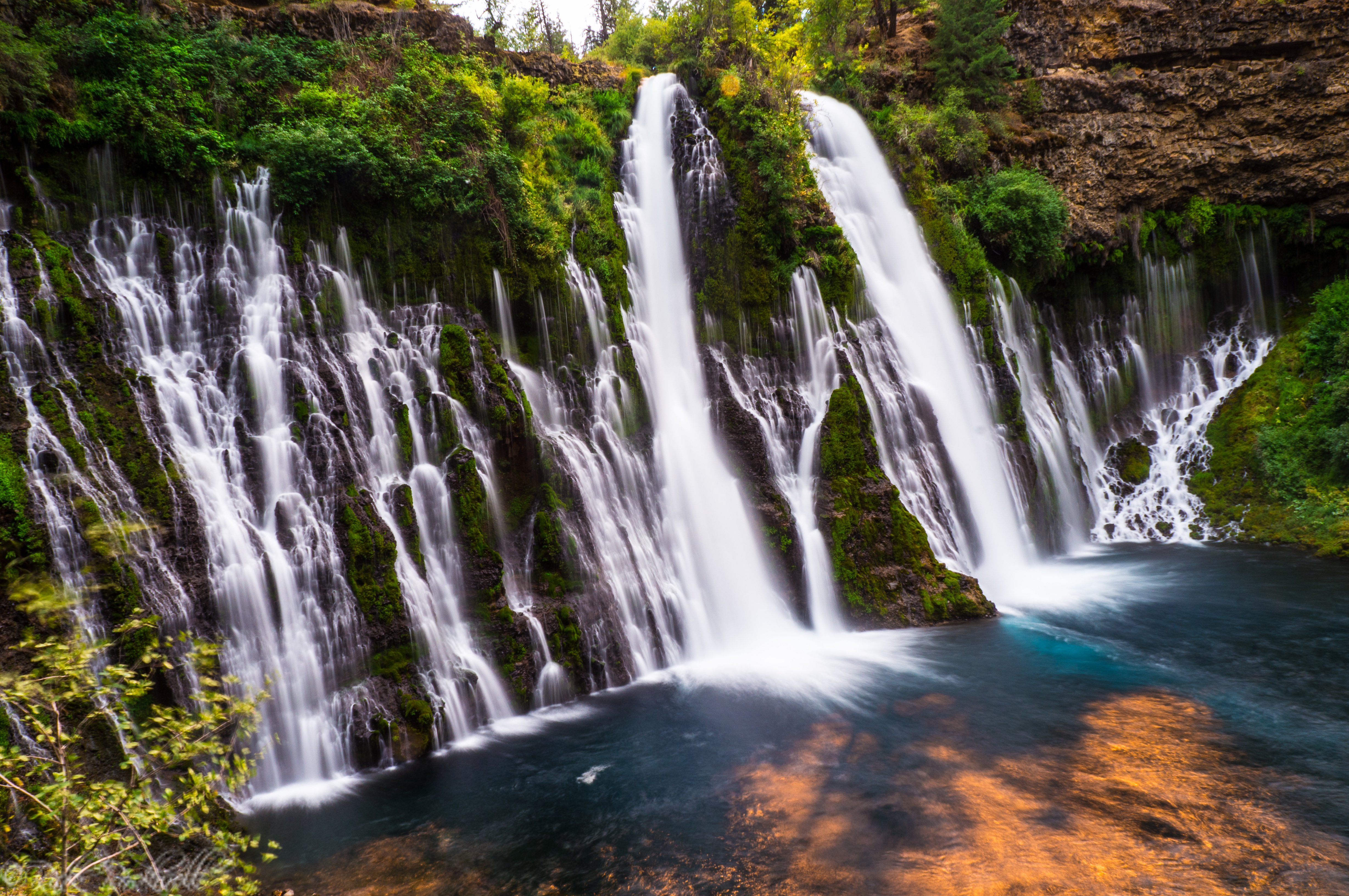
Burney Falls: California’s most incredible waterfall
Located in McArthur-Burney Falls Memorial State Park, this amazing 129 foot waterfall is one of the most exciting places to visit in all of California. As the centerpiece of 910 scenic acres, Burney Falls has a constant flow rate throughout the entire year, making it an enjoyable experience no matter the season. In 1984, Burney …...

Horsetail Falls: A challenging hike to an impressive waterfall
The trailhead begins at 6000 feet in elevation and climbs up to 7200 feet in elevation at the top of the waterfall. The trail is only 1.5 miles to the base of the waterfall. However, it’s easy to lose when traveling over the granite slabs. Additionally, the hike to the top of the waterfall requires …...
Park Creek Waterfall: a beautiful man made waterfall in Sly Park
Sly Park Falls, also known as Park Creek Waterfall, is a man made waterfall at the Northeast portion of Lake Jenkinson. This waterfall is roughly 33 feet high and drops down into a pool of water that flows down Sly Park Creek and eventually into Lake Jenkinson. Directions The easiest way to get to the …...
