Lake Clementine Trail is one of Placer County’s most rewarding hikes, leading from the North Fork American River canyon to the dramatic spillway of North Fork Dam. Along the way, the route passes beneath the towering Foresthill Bridge, follows a corridor tied to Gold Rush travel, and stops near Clark’s Hole before climbing toward the lake.
It is one of my favorite hikes in the Gold Rush region, along with being the best hike near Sacramento. It’s also the best trail throughout the Auburn State Recreation Area.
What makes this hike stand out is how much it delivers in just a few miles. It has river scenery, canyon walls, old road history, a famous Auburn bridge, and a manmade “waterfall” that feels like a rewarding payoff at the end of the trail.
Quick Facts: Lake Clementine Trail
- Location: Auburn State Recreation Area near Auburn, California
- Trailhead: Old Foresthill Road near green gate #139
- Route Type: Out and back
- Distance: About 4.4 to 4.6 miles round trip
- Difficulty: Easy to moderate; moderate in hot weather
- Main Highlights: Foresthill Bridge, Clark’s Hole, North Fork Dam spillway
- Best Time to Visit: Spring, fall, and cooler summer mornings
- Dogs: Not allowed at Lake Clementine
- Parking Fee: $10 Day-use fee may apply
Where Is Lake Clementine Trail?
Lake Clementine Trail is located in Auburn State Recreation Area near Auburn, California. The hike begins near Old Foresthill Road and follows the North Fork American River upstream toward Lake Clementine, Clark’s Hole, and the North Fork Dam spillway.
Directions to Lake Clementine Trail from Sacramento
From Sacramento, take I-80 east toward Auburn, then exit onto Highway 49 south / Grass Valley Highway toward the American River confluence. Turn onto Old Foresthill Road, cross the curved Old Foresthill Bridge, and look for the trailhead near green gate #139.
The drive usually takes about 40 to 50 minutes, depending on traffic.
Where to Park for Lake Clementine Trail
Lake Clementine Trail starts near Old Foresthill Road in Auburn State Recreation Area. Look for the trailhead near green gate #139, close to the Old Foresthill Road parking area.
From Auburn, take Highway 49 toward the American River confluence, turn onto Old Foresthill Road, cross the curved Old Foresthill Bridge, and park near the trailhead.
There is a $10 day-use fee may apply, and parking can fill quickly on weekends. Arrive early, especially in spring and summer.
Lake Clementine Trail vs. Upper Lake Clementine Access
It is important to separate the Lake Clementine Trail hike from driving directly to Upper Lake Clementine.
The trail described here starts from the lower canyon area and hikes toward the dam/reservoir area. Upper Lake Clementine has its own vehicle-access rules, seasonal schedule, and reservation requirements during busy periods.
If you are only hiking from Old Foresthill Road, you are not doing the same thing as driving into Upper Lake Clementine for beach or boat access. Still, many visitors combine these places in their head, so check the latest State Parks rules if your plan includes anything beyond hiking to the dam.
Is Lake Clementine Trail Hard?
Lake Clementine Trail is best described as easy to moderate for regular hikers and moderate for casual hikers, especially in warm weather. The first part of the hike follows the North Fork American River and feels fairly approachable, but the route becomes more demanding after Clark’s Hole as it climbs toward Lake Clementine Road and the North Fork Dam area.
The biggest challenge is not a technical difficulty like the off-trail of Bunch Canyon Falls. Instead, it’s the combination of uphill hiking, canyon heat, limited shade in places, poison oak along the trail edges, and the climb back after spending time near the water.
Start early, bring more water than you think you need, and avoid hiking the exposed sections during the hottest part of the day.
Safety Tips for Lake Clementine Trail
Lake Clementine Trail is a popular Auburn hike, but it still runs through a rugged river canyon with heat, poison oak, river hazards, and limited shade in places.
Keep these safety tips in mind before heading out:
- Start early, especially from late spring through early fall.
- Bring more water than expected, because the climb back can be hot.
- Wear sturdy shoes with good traction, especially if you plan to explore near rocks or water.
- Watch for poison oak along the trail edges.
- Do not climb around wet rocks near the dam spillway.
- Use caution near Clark’s Hole and the river.
- Check current State Parks alerts before visiting.
- Do not bring dogs into restricted Lake Clementine areas.
- Pack out your trash.
Dogs are allowed in many parts of Auburn State Recreation Area, but California State Parks says dogs are not allowed at Lake Clementine, so check current rules before bringing a dog on this route or make sure you turn around before the final leg up to the dam.
The trail is not remote wilderness, but it still deserves respect and preparation.
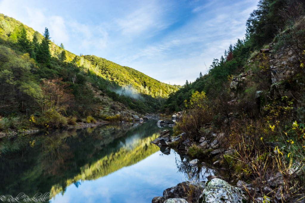
Views along the Lake Clementine Trail
Best Time to Hike Lake Clementine Trail
Lake Clementine Trail can be hiked most of the year, but spring and fall usually offer the best mix of comfortable weather, river scenery, and trail conditions.
Season | What to Expect |
Spring | Best overall season. Cooler weather, greener hillsides, possible wildflowers, and stronger flows over North Fork Dam. |
Summer | Popular but hot. Start early, bring extra water, and avoid the afternoon climb back. |
Fall | Comfortable hiking weather with fewer crowds than peak summer days. |
Winter | Possible in good weather, but check for storms, slick trail conditions, and park alerts before going. |
Hiking Lake Clementine Trail: What to Expect
Lake Clementine Trail is best understood in sections. The hike begins as a pleasant river walk, passes beneath one of California’s most dramatic bridges, continues by Clark’s Hole, and then climbs toward Lake Clementine and the North Fork Dam spillway.
The trail is not overly technical, but do not underestimate it. The canyon can get hot, the climb back can feel steeper than expected, and the final approach toward the dam/lake area takes more effort than the easy riverside beginning suggests.
Trailhead to Foresthill Bridge
The early part of Lake Clementine Trail follows the North Fork American River through a scenic canyon corridor. This section is one of the easiest and most enjoyable parts of the hike, with river sounds, tree cover, and canyon views opening up as you go. Occasionally, you will even see people camping near this part of the river.
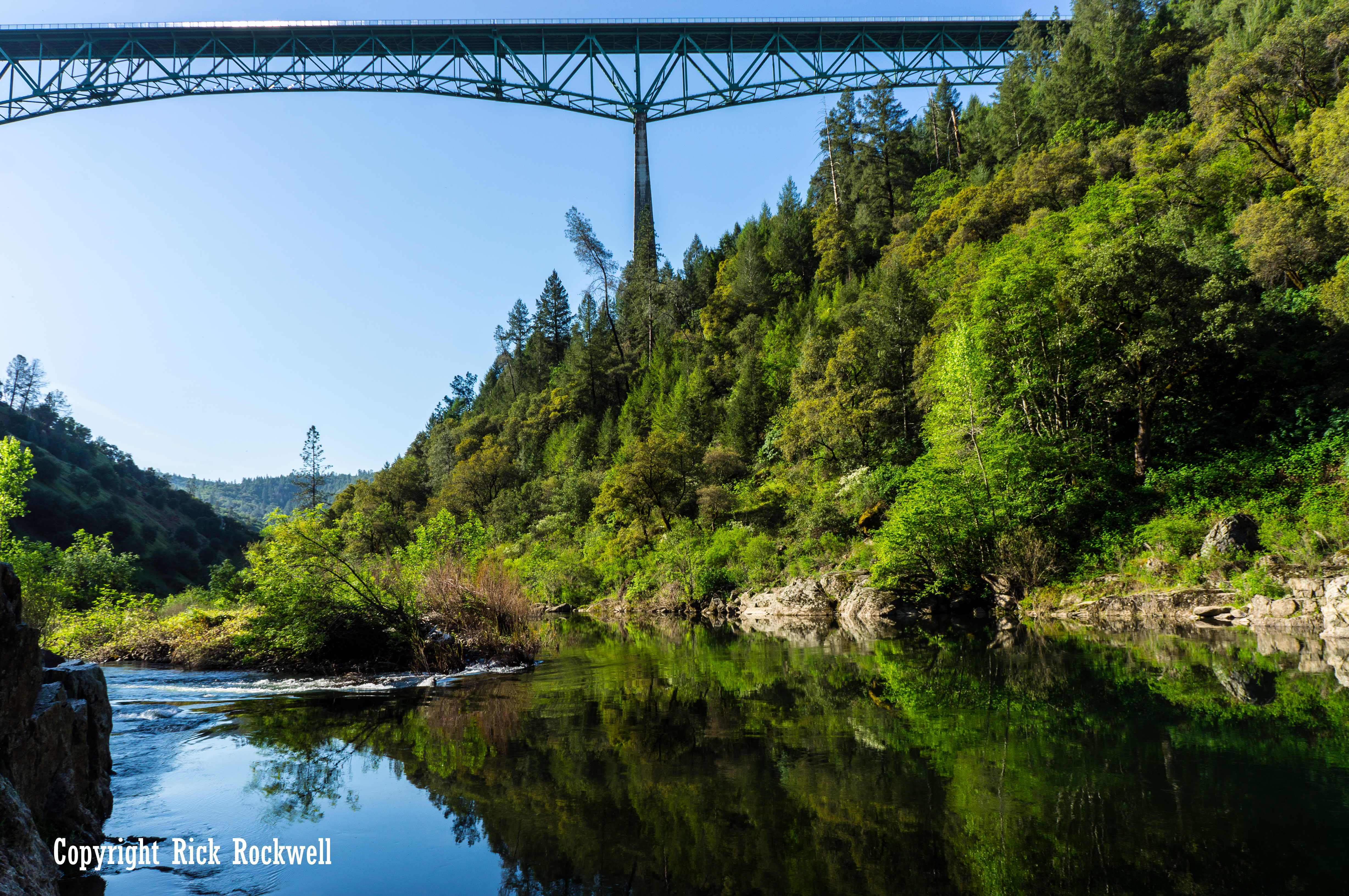
One of the trail’s first major highlights is the Foresthill Bridge, also known as the Auburn-Foresthill Bridge. From the trail, you get a completely different perspective of the bridge than you do when driving across it. Instead of seeing it as a road crossing, you see it as a massive steel structure stretched across the canyon far above the river.
The City of Auburn lists Foresthill Bridge at 730 feet high with an 862-foot span. It opened in 1973, took three years to construct, and cost $13 million. At the time it opened, it was one of the highest bridges in the world.
This is one of the best early photo stops on the hike. It also helps establish the scale of the canyon. You are not just walking a local riverside path. You are hiking through one of the most recognizable landscapes in the Auburn area.
I highly recommend taking pictures leading up to the bridge, underneath the bridge looking up, and on the way back. The contrast, reflections, and lighting make for great pictures of the bridge at the start and end of your hike.
The Gold Rush Road Hidden Along Lake Clementine Trail
Lake Clementine Trail is scenic on the surface, but part of its appeal comes from the older transportation history hidden along the route.
The Auburn State Recreation Area Canyon Keepers guide identifies this corridor with Yankee Jim’s Turnpike, an 1852 toll road later known as Old Stagecoach Road.
The old road crossed the North Fork American River just upriver from Clark’s Hole, then climbed toward the modern-day ghost towns of Yankee Jim’s and Iowa Hill. By the late 1800s, this was not just a recreational river canyon. It was a working travel route linking Auburn with mining camps across the Divide.
The tolls make the old road feel wonderfully specific. Canyon Keepers notes that in the 1870s, crossing the bridge could cost 6 cents for a cow, 50 cents for a horseman, or $1 for a wagon and two horses. Those numbers give the modern hike a very different texture.
Today, you pass under Foresthill Bridge with a backpack and camera; 150 years ago, this canyon corridor carried livestock, wagons, miners, and stage traffic through one of Placer County’s busy Gold Rush landscapes.
The bridge history is layered, too. Canyon Keepers notes that rock abutments from a wooden covered toll bridge, built in 1875 and used until 1911, can still be seen across the river around the one-mile mark. The guide also says evidence remains of three earlier bridges that existed between 1852 and 1875.
In 1859, the Daily Alta California listed the Auburn and Yankee Jim’s Turnpike Company among roads and bridges in the mines and described its road as crossing the North Fork near the junction of the North and Middle Forks of the American River.
That means Lake Clementine Trail is not just a hike to a dam waterfall. It is a walk through a canyon where Gold Rush travel, toll-road business, bridge-building, hydraulic mining debris, and modern recreation all overlap.
Foresthill Bridge to Clark’s Hole
After passing underneath the remarkable Foresthill bridge, the trail continues upstream along the North Fork American River. This stretch is scenic and relatively mellow, with river views, rocky banks, and the kind of foothill scenery that makes the Auburn area so easy to revisit throughout the year.
Eventually, you reach the area known as Clark’s Hole or Clark’s Pool, one of the better-known swimming spots in all of ASRA.
Reportedly, Clark’s Hole has been popular with locals for more than 100 years. On warm days, it is easy to see why this spot has become such a recognizable stop along the trail. The water, boulders, and canyon setting make it one of the more memorable places on the hike.
Although Clark’s Hole is a well-known swimming spot for locals, swimming should always be treated as conditions-dependent because water levels, current, slippery rocks, cold water, and seasonal water-quality advisories can all affect safety. Do not assume it is safe just because other people are in the water.
Clark’s Hole also makes a natural pause in the hike. If you are hiking with kids, casual hikers, or anyone who is unsure about the climb ahead, this is a good place to reassess. The trail becomes more of a workout after this point.
Clark’s Hole to Lake Clementine Road
Past Clark’s Hole, the hike starts to change. The trail leaves the easiest riverside walking behind and begins climbing through a warmer, more exposed section of the canyon. This is where Lake Clementine Trail starts to feel less like a casual stroll and more like a real hike.
This section follows a corridor associated with the old Yankee Jim’s Turnpike and Old Stagecoach Road history, which helps explain why the route has that old-road-grade feeling in places.
The trail’s historical texture is part of what makes it more than a simple river walk. You are moving through a canyon that once carried miners, animals, wagons, stage traffic, bridges, and toll-road business before it became a modern hiking route.
Take your time here, especially on hot days. The gradient is not brutal, but it can sneak up on you if you started the hike thinking it was completely flat. Bring more water than you think you need, and watch for poison oak along the trail edges.
Lake Clementine Road to the Dam Viewpoint
Eventually, the trail connects with the Lake Clementine Road area near the approach to the dam/lake section. Pay attention here because the route can feel less like a single obvious footpath and more like a transition between trail, road, and viewpoint access.
This is also where you need to watch for vehicles if you are near the road. Stay aware, keep kids close, and do not wander into blind spots around curves.
The payoff comes when you continue toward the dam viewpoint and hear the water before you fully see it. In high-flow conditions, the sound builds until the canyon opens to one of the most memorable scenes in Auburn State Recreation Area: water pouring over the curved face of North Fork Dam.
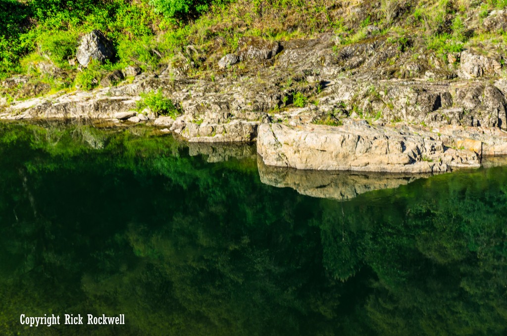
Clark’s Hole also known as Clark’s Pool
Lake Clementine Trail Photos: What You’ll See on the Hike
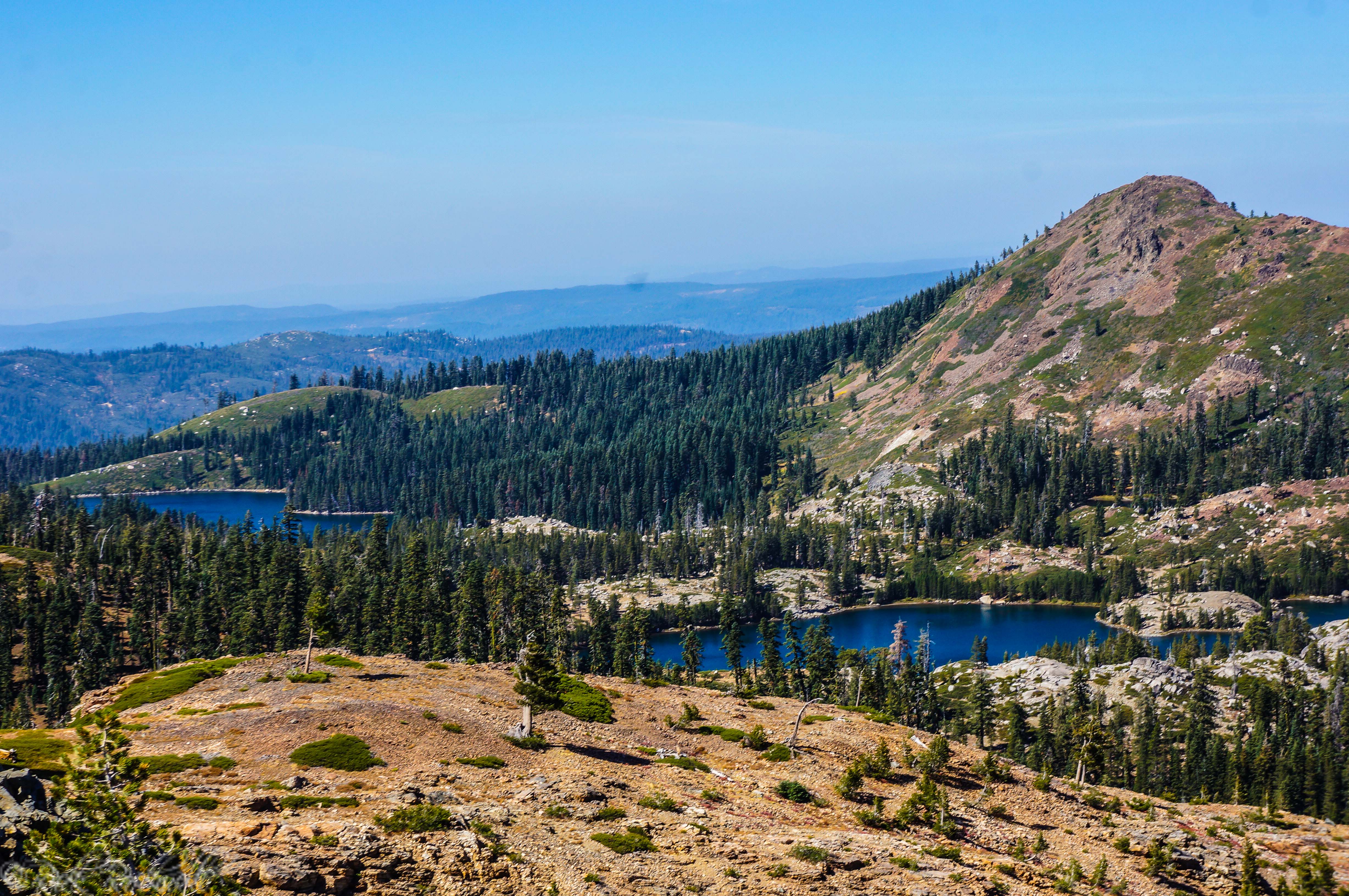
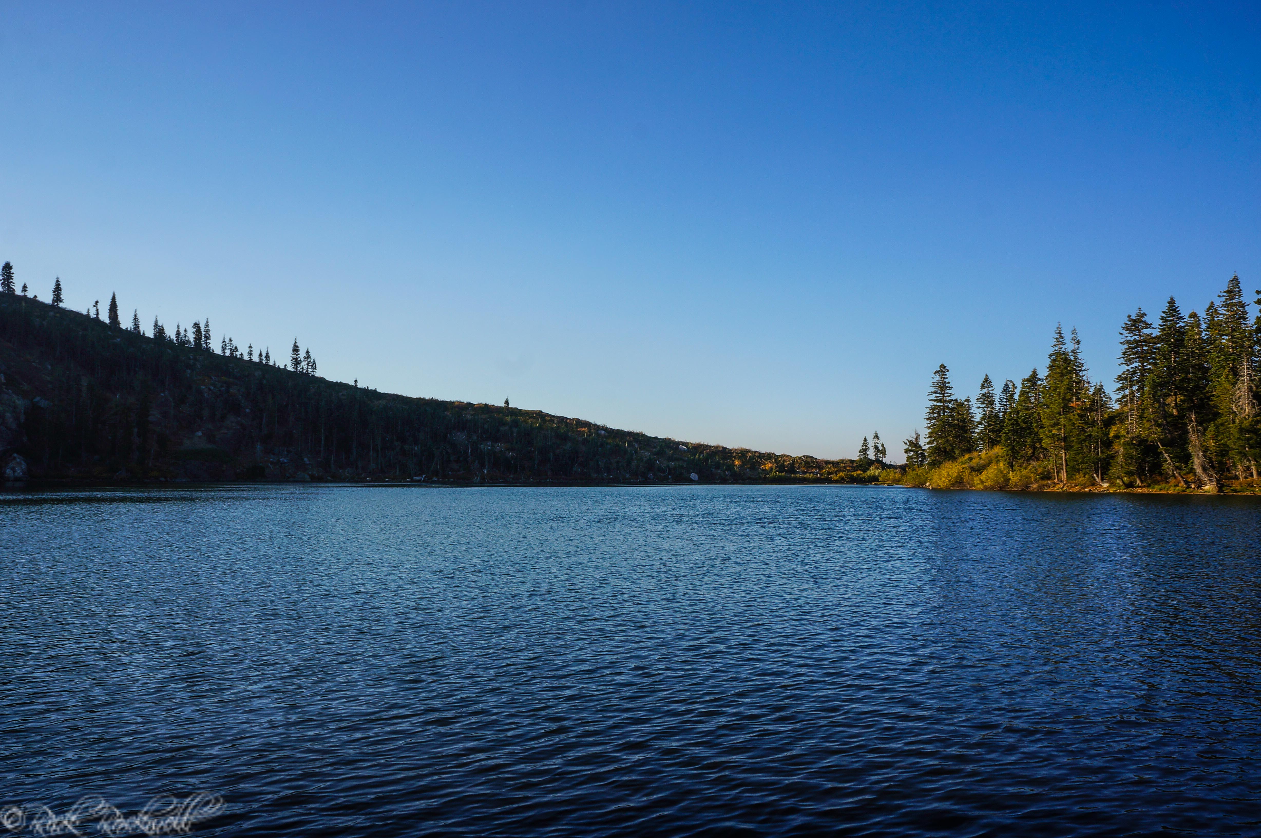
Lake Clementine Trail is one of the more photogenic hikes in Auburn State Recreation Area because the scenery changes several times along the route. Early on, you get North Fork American River views and the massive Foresthill Bridge overhead. Farther along, the trail passes Clark’s Hole before climbing toward the North Fork Dam spillway, where the water creates the dramatic “Lake Clementine waterfall” view many hikers come to see.
For photos, the best stops are usually the river corridor below Foresthill Bridge, the rocky pools near Clark’s Hole, and the dam spillway near the end of the hike. Spring is especially good for photos because the canyon is greener and the spillway often has stronger flow.
North Fork Dam: The Story Behind Lake Clementine’s “Waterfall”
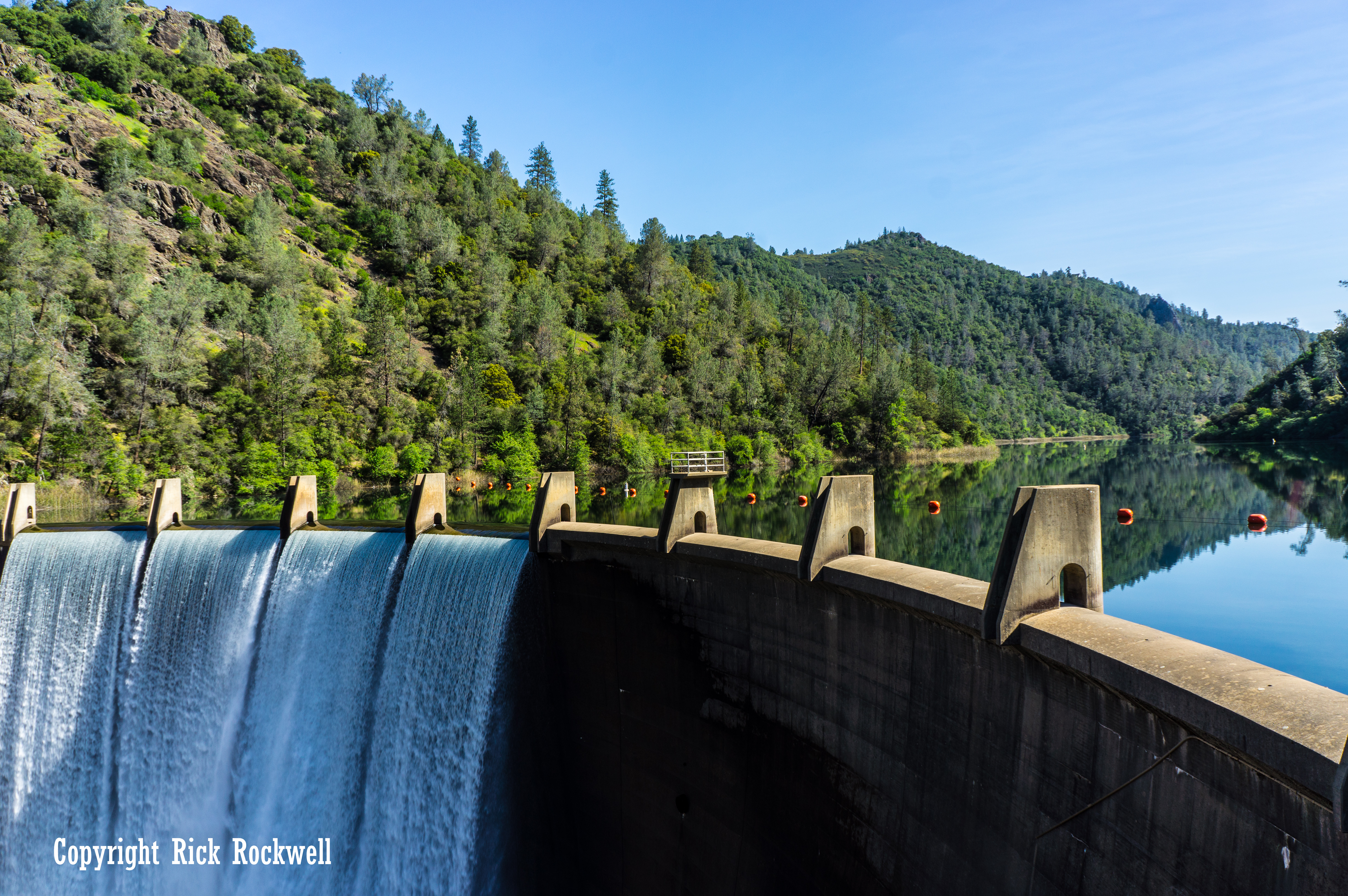
The dramatic “waterfall” at the end of Lake Clementine Trail is not a natural Auburn waterfall. It is the spillway of North Fork Dam, the debris-control dam that forms Lake Clementine on the North Fork American River near Auburn.
That detail makes the hike more interesting, not less. The water sheets over the curved concrete face of the dam and drops back into the North Fork American River canyon, creating the huge manmade waterfall effect that makes this one of Auburn State Recreation Area’s most photographed trail destinations.
Why North Fork Dam Was Built
Lake Clementine is not a natural lake. It is a reservoir created by North Fork Dam, which was built as part of the long effort to control mining debris in the American River watershed.
During the Gold Rush and the decades that followed, hydraulic mining blasted away hillsides in the Sierra Nevada and sent enormous amounts of sediment downstream. That debris created flooding, navigation, and farmland problems far beyond the mining camps themselves.
The U.S. Army Corps of Engineers’ history of the California Debris Commission identifies North Fork Dam and Reservoir, Lake Clementine as being about five miles northeast of Auburn. The same source lists the dam as 155 feet high and 620 feet long, with a reservoir debris-storage capacity of 26 million cubic yards.
When the Dam Became a Waterfall
The construction timeline gives the dam a great story. The first concrete for North Fork Dam was placed on September 26, 1938. The last concrete was placed by February 28, 1939. Then, at 11 p.m. on Sunday, April 1, 1939, water spilled over the dam for the first time.
That was the beginning of Lake Clementine’s artificial waterfall.
The U.S. Army Corps history even describes spring flows over debris dams as artificial waterfalls, with mist rising through the oaks and pines. That is exactly the kind of scene hikers hope to find at the end of Lake Clementine Trail, especially in spring or after strong runoff.
From Debris-Control Project to Auburn Recreation Landmark
North Fork Dam was not built as a scenic attraction. It was built for debris control. But over time, Lake Clementine became one of the Auburn area’s most popular recreation spots.
That contrast is what makes the hike more memorable. When you stand near the spillway, you are not just looking at a pretty cascade. You are looking at a structure connected to hydraulic mining, federal engineering, flood-control history, and the environmental consequences of California’s Gold Rush.
Today, that same structure creates one of the most dramatic views in Auburn State Recreation Area. Just be careful climbing on the boulders or walking near the dam due to the mist creating a very wet and slippery surface. Yet, if you exercise caution, then you can get close enough to feel the power of this waterfall and take some of the best photos in all of Placer County.
The Mystery Behind the Name Lake Clementine
The origin of the name Lake Clementine is unclear, as I have yet to find a historical source that confirms the story behind it.
The lake itself is easy to explain. It is the reservoir behind North Fork Dam on the North Fork American River near Auburn. The U.S. Army Corps of Engineers identifies the site as North Fork Dam and Reservoir, Lake Clementine, but that source does not explain where the name Clementine came from.
A common modern explanation connects the name to a miner’s daughter, which naturally echoes the famous folk-song image of “Clementine.” However, I could not verify a primary historical source proving whether the lake was named for a real woman, the song, a mining-era nickname, or another local reference.
Things to Do Near Lake Clementine Trail
Lake Clementine Trail sits close to several of Auburn’s best-known outdoor and historic landmarks, so it’s easy to turn the hike into a longer Auburn State Recreation Area day trip.
American River Confluence
The American River Confluence, where the North and Middle Forks meet, is one of the main hubs of Auburn State Recreation Area. It offers river views, roadside parking, and access to several trails, including routes toward Lake Clementine, Mammoth Bar, Stagecoach Trail, and the North Fork corridor.
Black Hole of Calcutta Falls
Black Hole of Calcutta Falls is a short seasonal waterfall hike along the Western States Trail near Auburn. The route is commonly listed at about 2.2 miles round trip and is best after rain or during stronger spring flows.
Mountain Quarries Bridge / No Hands Bridge
Mountain Quarries Bridge, better known as No Hands Bridge, is one of Auburn State Recreation Area’s most famous landmarks. The historic railroad bridge once served the limestone quarry railroad and now carries trail users across the American River near the Western States Trail.
Quarry Trail
Quarry Trail is another popular Auburn State Recreation Area route near the Confluence. It follows the Middle Fork American River corridor and works well for hikers who want an easier riverside walk with canyon and mining-era scenery.
Western States Trail
The Western States Trail is one of the signature long-distance routes through Auburn’s canyon country. Near Auburn State Recreation Area, it connects major landmarks such as No Hands Bridge and the route toward Calcutta Falls.
Robie Point
Robie Point is a popular Auburn trail access area with views into the American River canyon. It can be combined with nearby Western States Trail routes for a longer Auburn-area hike.
Old Town Auburn
Old Town Auburn is an easy post-hike stop for food, drinks, and Gold Rush history. The area sits at the heart of Auburn’s early mining story and is close enough to pair naturally with a Lake Clementine Trail hike.
Is Lake Clementine Trail Is Worth Hiking?
Absolutely! Lake Clementine Trail is one of my favorite hikes near Sacramento and in this region of Gold Country. It’s also one of the trails I always take friends and family for their first trip to the ASRA.
No other trail in the greater Sacramento area, and surrounding counties, matches the history, landscape and landmarks along the Lake Clementine Trail.
It starts as a river hike, turns into a bridge-view hike, becomes a swimming-hole hike, climbs like a foothill workout, and ends with a dam spillway that looks like a giant waterfall.
In just a few miles, you pass the North Fork American River, stand beneath Foresthill Bridge, visit Clark’s Hole, walk through an old Gold Rush travel corridor, climb through the canyon, and finish near the roaring spillway of North Fork Dam.
This trail has something for everyone, is family friendly, and one of the best trails in the area.
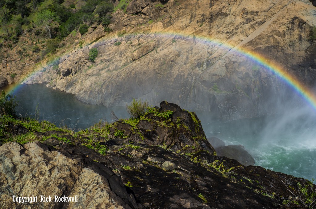
Rainbow near North Fork Dam
Lake Clementine Trail FAQ
How long is Lake Clementine Trail?
Lake Clementine Trail is commonly described as about 4.4 to 4.6 miles round trip when hiking from the Old Foresthill Road area toward the dam/lake viewpoint and back. Mileage can vary depending on exactly where you park and whether you take short side spurs.
Is Lake Clementine Trail hard?
Lake Clementine Trail is rated easy to moderate for regular hikers and moderate for casual hikers. The riverside portion is fairly pleasant, but the climb after Clark’s Hole and the final approach toward the dam/lake area make it more demanding than a flat river walk.
Where do you park for Lake Clementine Trail?
Most hikers park near the Old Foresthill Road trailhead area in Auburn State Recreation Area, near the North Fork American River corridor below Foresthill Bridge. The trailhead is commonly associated with green gate #139 near the Old Foresthill Road parking area.
Is there a fee for Lake Clementine Trail?
Plan for a $10 day-use parking fee in Auburn State Recreation Area.
Are dogs allowed on Lake Clementine Trail?
Dogs are allowed in many parts of Auburn State Recreation Area, but California State Parks says dogs are not allowed at Lake Clementine. Because this hike heads toward the Lake Clementine area, check the current rules before bringing a dog.
Is the Lake Clementine waterfall natural?
No. The famous Lake Clementine “waterfall” is actually the spillway of North Fork Dam.
When is the best time to hike Lake Clementine Trail?
Spring is usually the best time to hike Lake Clementine Trail because the canyon is green, temperatures are more comfortable, wildflowers may be blooming, and the North Fork Dam spillway can be especially impressive. Fall is another good option for cooler hiking weather.
Can you swim at Clark’s Hole?
Clark’s Hole is a known swimming spot along the North Fork American River, but swimming conditions vary. Water levels, current, slippery rocks, cold water, and seasonal water-quality advisories can all affect safety.
Can you drive to Lake Clementine instead of hiking?
You can drive to Upper Lake Clementine when the area is open, but that is different from hiking Lake Clementine Trail from the lower canyon area. Upper Lake Clementine has seasonal access rules and weekend/holiday reservation requirements during busy periods.
What was Yankee Jim’s Turnpike?
Yankee Jim’s Turnpike was an 1852 toll road later known as Old Stagecoach Road. According to the Auburn State Recreation Area Canyon Keepers guide, the route crossed the North Fork American River near Clark’s Hole and continued toward Yankee Jim’s and Iowa Hill.
How did Lake Clementine get its name?
The exact origin of the name Lake Clementine is uncertain.
Sources
California State Parks — Lake Clementine
https://www.parks.ca.gov/?page_id=1141
California State Parks — Auburn State Recreation Area
https://www.parks.ca.gov/?page_id=502
California State Parks — Auburn SRA Fees
https://www.parks.ca.gov/?page_id=26020
California State Parks — Auburn SRA Park Area Hours
https://www.parks.ca.gov/?page_id=1344
Visit Placer — Lake Clementine Trail
https://www.visitplacer.com/lake-clementine-trail/
Auburn State Recreation Area Canyon Keepers — Lake Clementine Trail Guide
https://www.canyonkeepers.org/tgclem.pdf
KCRA — Explore Outdoors: Lake Clementine Trail, Gold Rush history, and 6-cent cow crossing
https://www.kcra.com/article/explore-outdoors-lake-clementine-placer-county/34862746
Daily Alta California, “Roads and Bridges in the Mines,” Nov. 20, 1859
https://cdnc.ucr.edu/?a=d&d=DAC18591120.2.17
California Law Revision Commission — Condemnation / toll road historical context, citing People v. Auburn & Yankee Jim’s Turnpike Co., 122 Cal. 335, 55 P. 10 (1898)
https://clrc.ca.gov/pub/1970/M70-013.pdf
City of Auburn — The Foresthill Bridge
https://www.auburn.ca.gov/DocumentCenter/View/1652/The-Foresthill-Bridge
Bureau of Reclamation — Auburn-Foresthill Bridge / Auburn-Folsom South Unit
https://www.usbr.gov/projects/index.php?id=480
U.S. Army Corps of Engineers — The California Debris Commission History
https://www.spk.usace.army.mil/Portals/12/documents/history/California-Debris-Commission-History.pdf
California Division of Boating and Waterways — Lake Clementine–North Fork Dam Facilities
https://dbw.parks.ca.gov/BoatingFacilities/Body-of-Water/Lake%20Clementine-North%20Fork%20Dam