Tag: Hiking

Lake Clementine Trail: A Guide to Auburn’s Best Waterfall Hike
Lake Clementine Trail is one of Placer County’s most rewarding hikes, leading from the North Fork American River canyon to the dramatic spillway of North Fork Dam. Along the way, the route passes beneath the towering Foresthill Bridge, follows a corridor tied to Gold Rush travel, and stops near Clark’s Hole before climbing toward the...
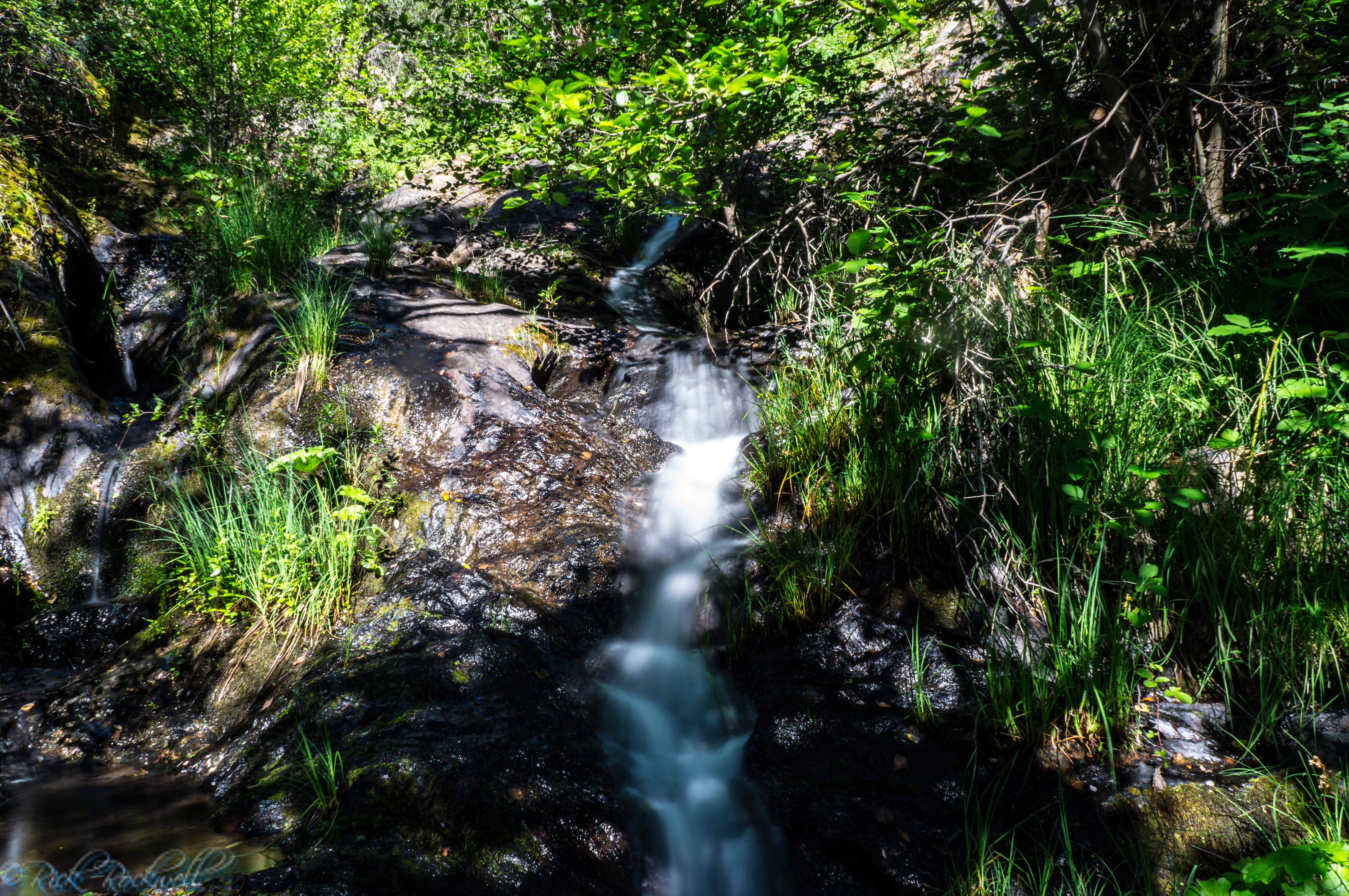
Pennyweight Falls Trail: Hiking to a Hidden Waterfall Near Colfax
Pennyweight Falls is one of those Placer County waterfalls that’s often overlooked for other falls nearby. Yet, Pennyweight Falls is a wonderful addition to any Auburn State Recreation Area visit. Tucked below Colfax, near Iowa Hill Road, Mineral Bar, and the North Fork American River, the trail gives you a quick dose of Gold Country...
Glen Alpine Trail: Guide to Hiking, Waterfalls and Wilderness Adventure
If you are looking for a South Lake Tahoe hike that gives you a little bit of everything, you would be hard-pressed to find an option better than the Glen Alpine Trail. This trail starts opposite of Fallen Leaf Lake near Lily Lake, quickly delivers waterfalls and serene creek scenery, passes through the historic Glen …...
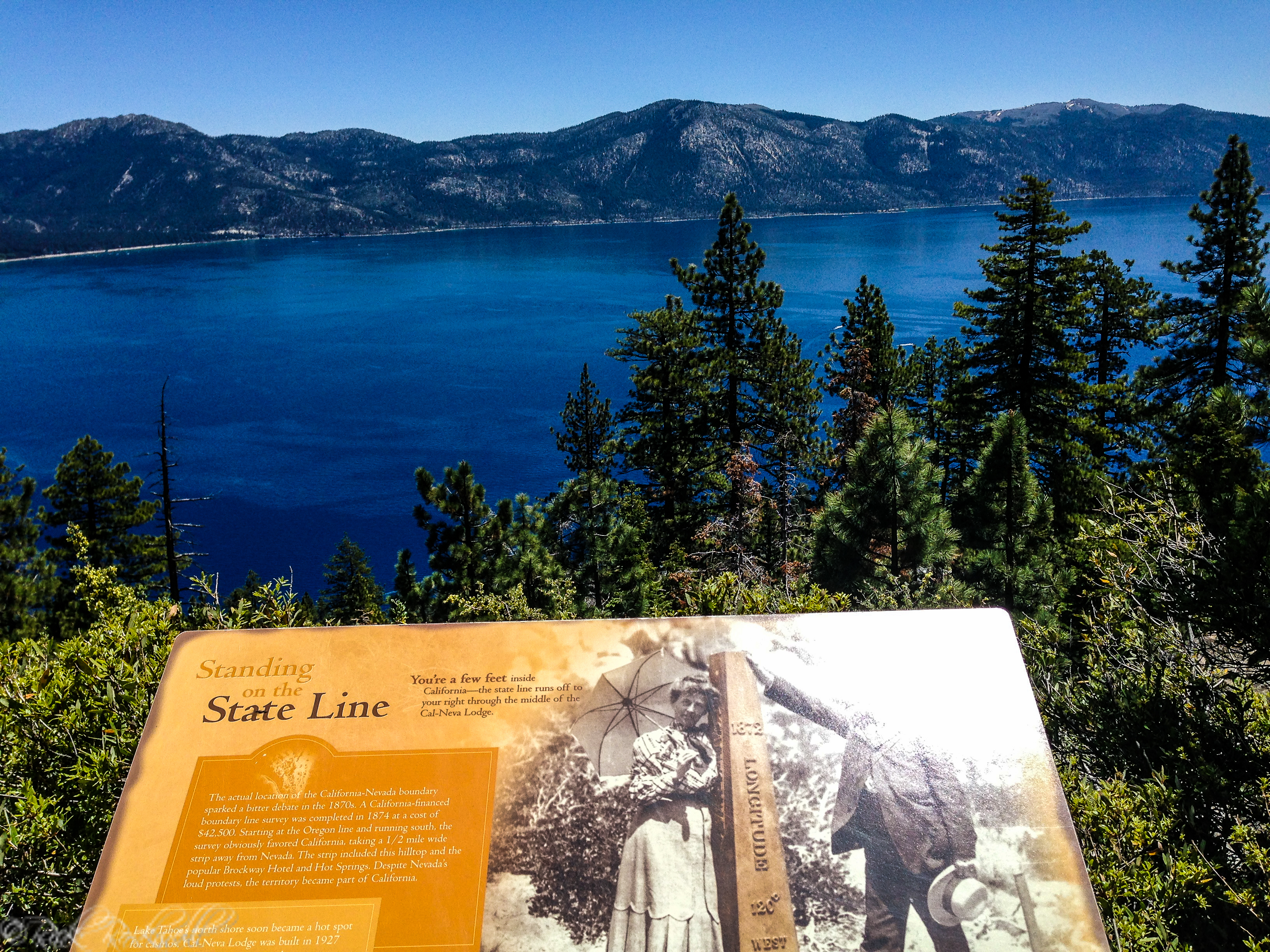
Stateline Lookout Trail: Easy Hike to a Historic North Lake Tahoe Viewpoint
Stateline Lookout Trail is one of the easiest scenic hikes in North Lake Tahoe. Starting near Crystal Bay on the Nevada side and climbing to the site of a former California fire lookout, this short uphill walk delivers wide-open lake views, interpretive stops, and a surprisingly big payoff for such a brief trail. For visitors …...
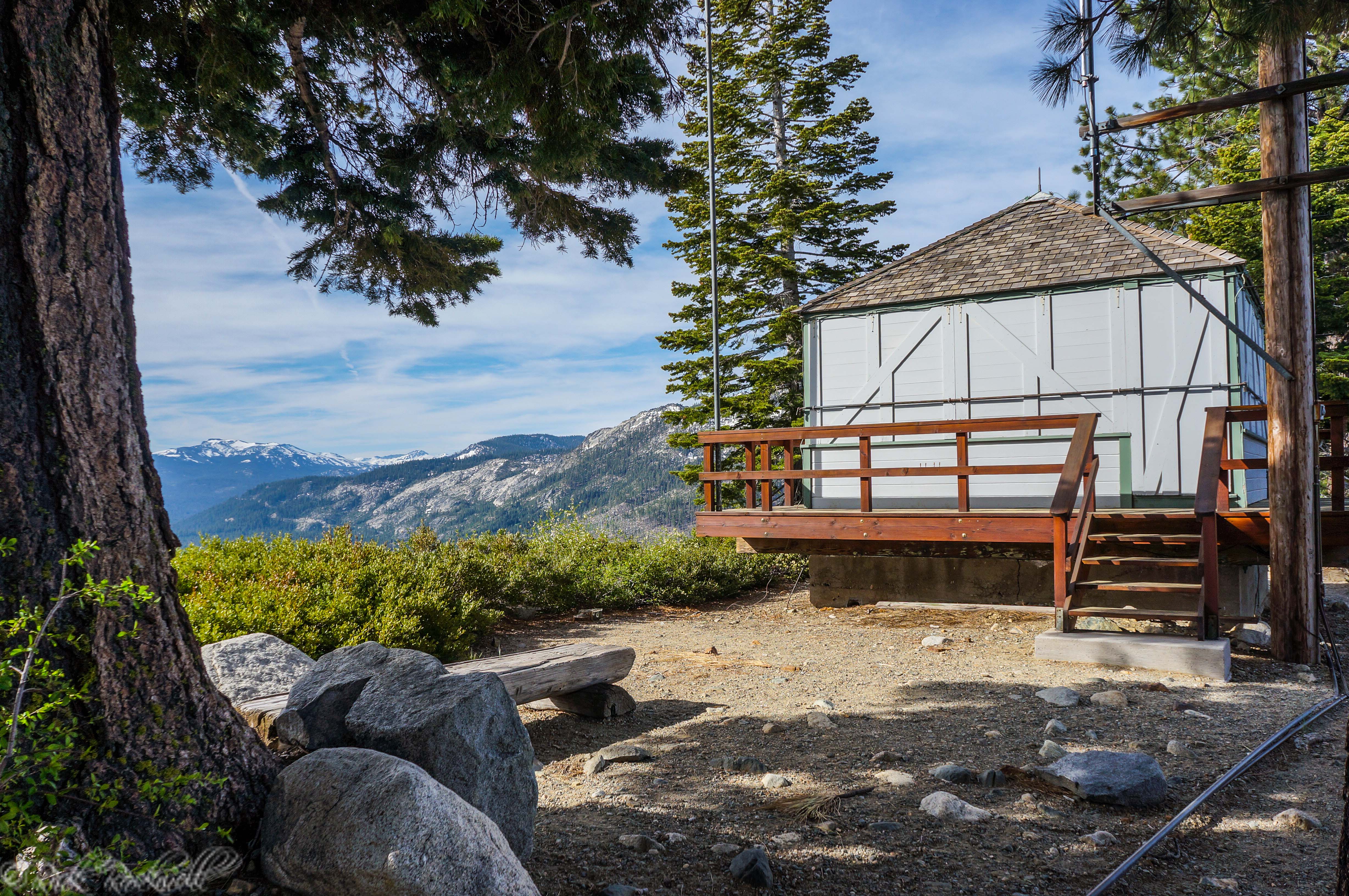
Angora Fire Lookout: History, Views, and How to Visit This Lake Tahoe Lookout
Angora Fire Lookout is one of the most interesting historic viewpoints near South Lake Tahoe. Perched high on Angora Ridge above Fallen Leaf Lake, this former fire lookout combines Tahoe history, wide-open basin views, and easy access to nearby outdoor stops like Angora Lakes. Also known as Angora Ridge Lookout, the site is no longer...
Angora Lakes California Travel Guide: Hiking, Kayaking, Camping, and When to Go
Above the busier stretches of South Lake Tahoe, Angora Lakes feels quieter, steeper, and more intimate than many first-time visitors expect. Reached by a punchy, uphill trail, these alpine lakes sit in a granite basin above Fallen Leaf Lake, where cold clear water, mountain views, and a tucked-away setting create one of the most...

Magnolia Ranch: A Peaceful Stroll Through the Coloma-Lotus Region
Tucked quietly along Highway 49 between Coloma and Lotus, Magnolia Ranch feels like one of those places you almost miss when driving down the highway — and that’s part of its charm. There’s no fanfare here. No crowded parking lots. No souvenir stands. Just rolling oak woodlands, golden foothill grass, and the steady presence...
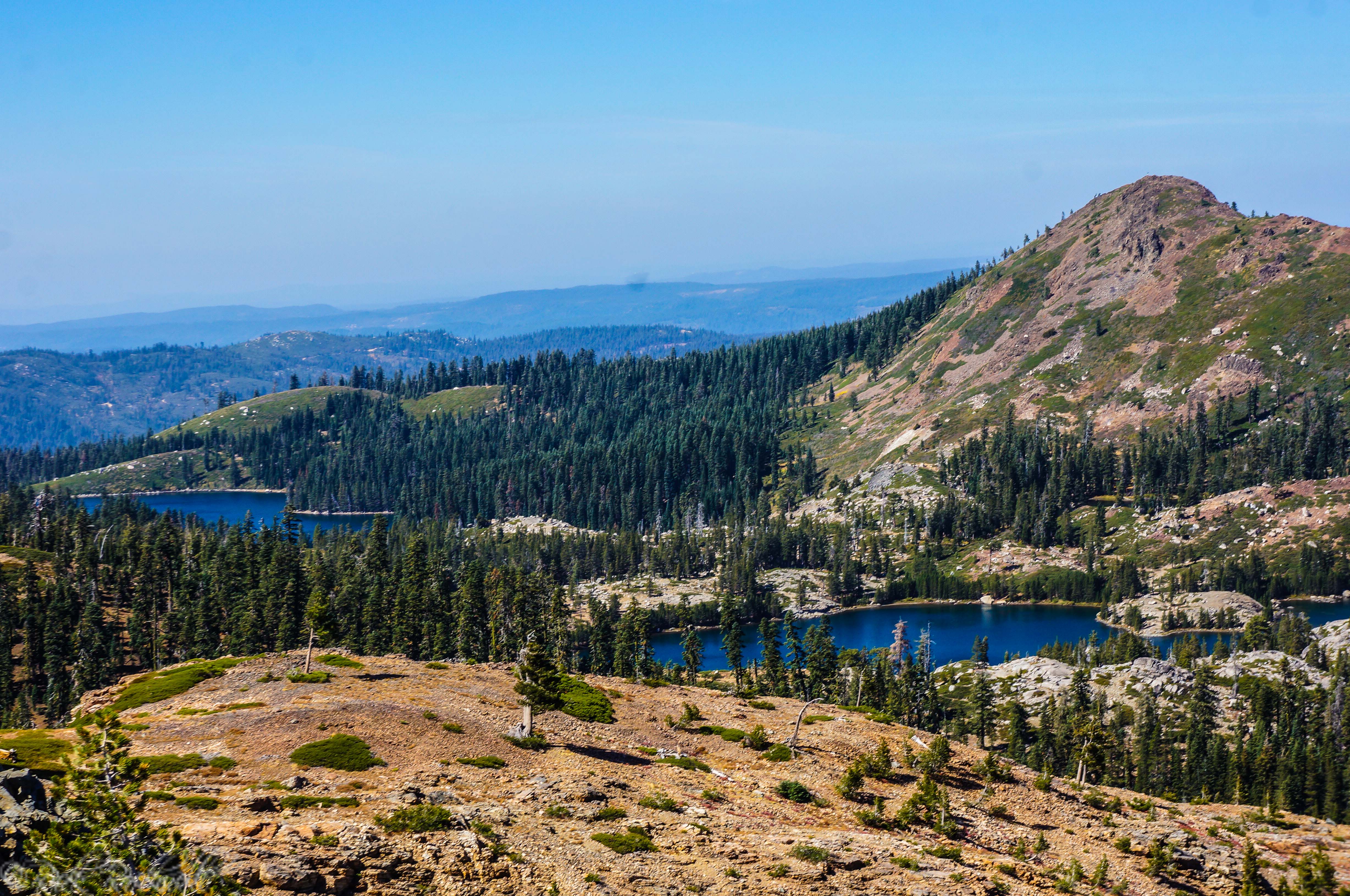
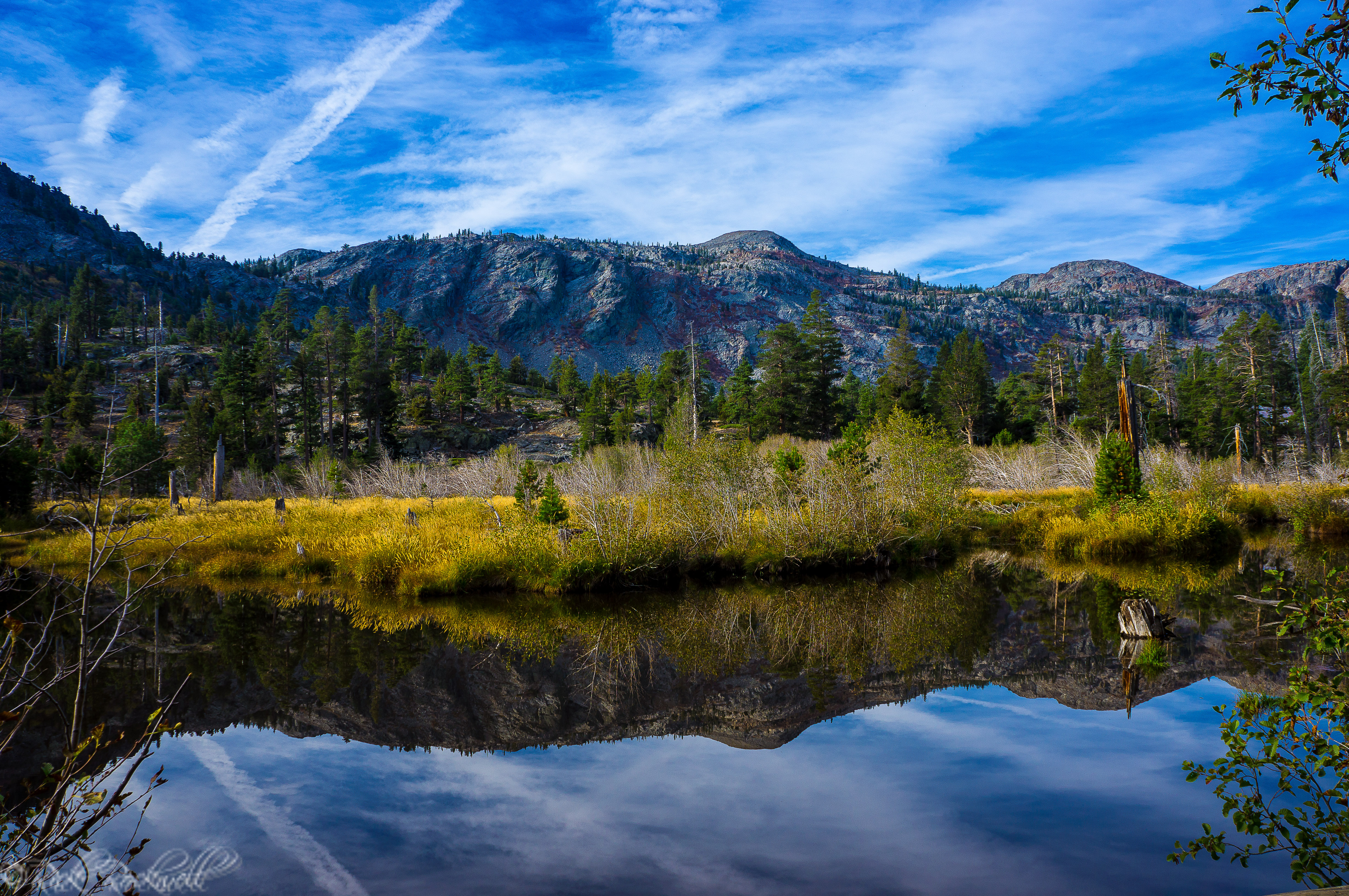
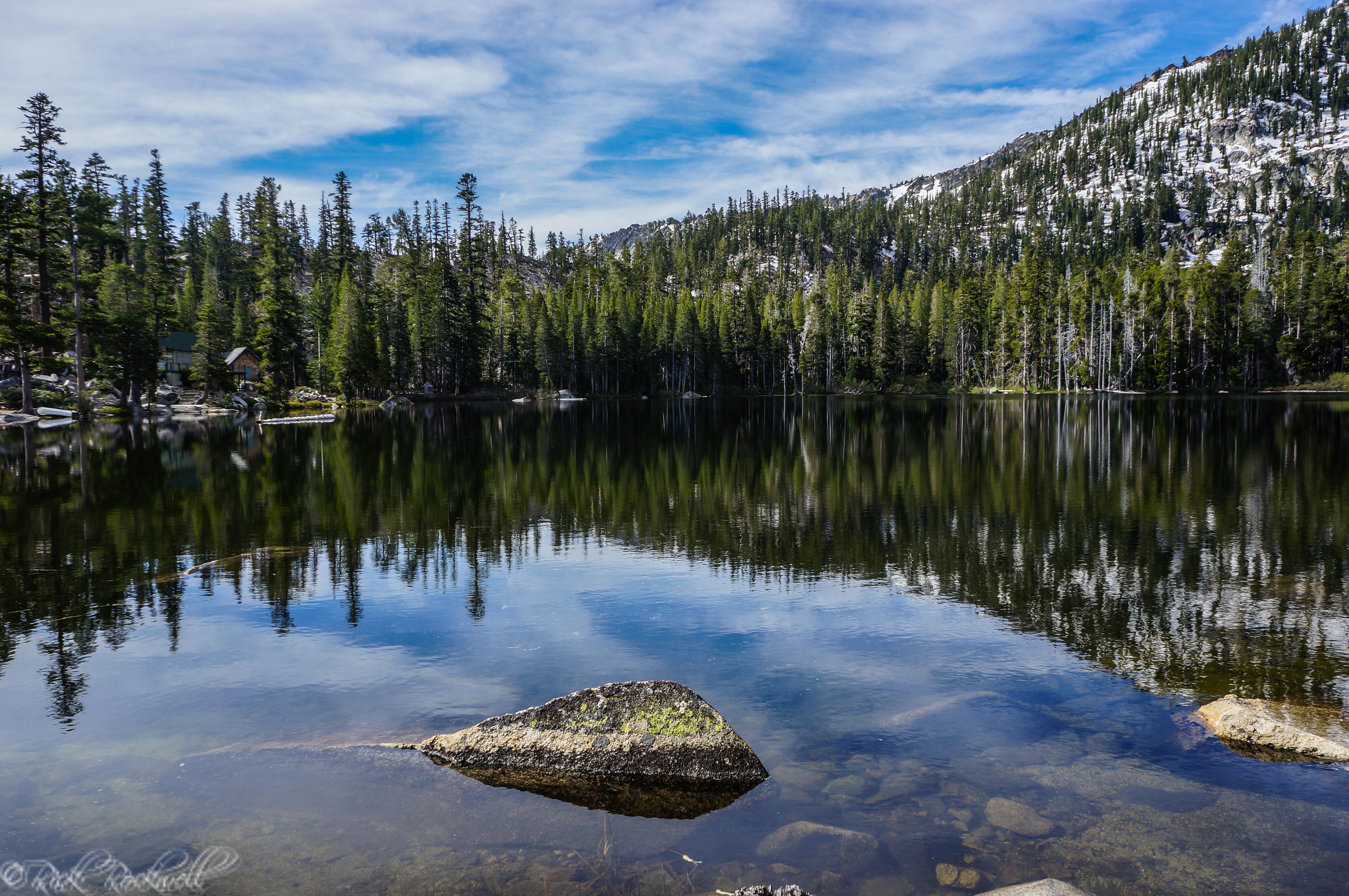
The Round Lake Trail: from Carr Lake to Island Lake and beyond
Located in the heart of the Tahoe National Forest is the Grouse Ridge non-motorized area, which is filled with wonderful hikes through various elevations of the Sierras. One of the more popular trails for hikers and campers in this region is the Round Lake Trail due to its access points, scenic alpine lakes, and because …...
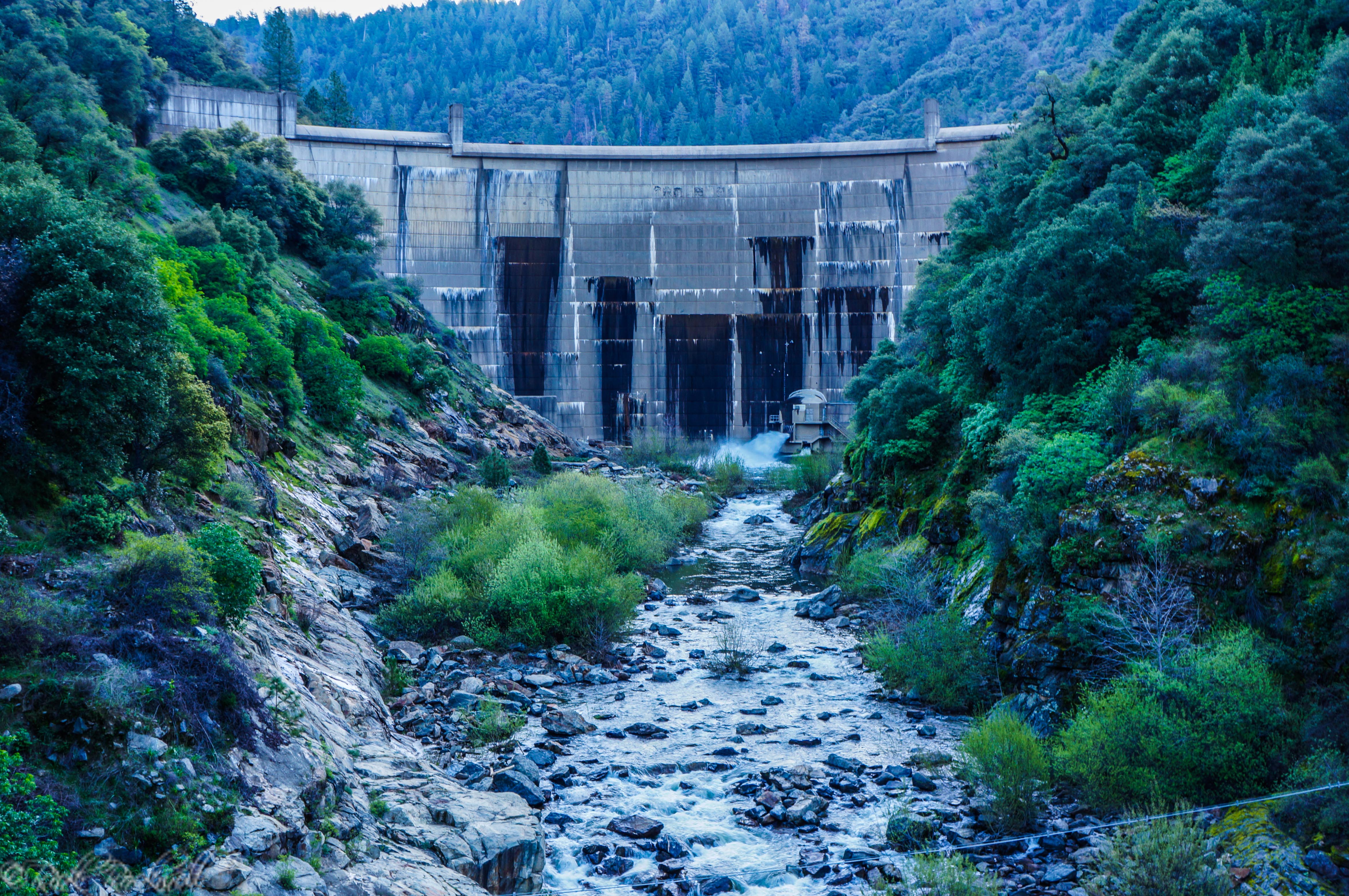
South Fork American River: From Iowa Canyon Waterfalls to Slab Creek Dam
Along the South Fork American River, in El Dorado County, sits the Slab Creek Dam which was built in 1967. This dammed portion of the river creates the Slab Creek Reservoir and just a little ways down from the reservoir is where the Iowa Canyon Creek flows into the American River. This creek spans roughly …...
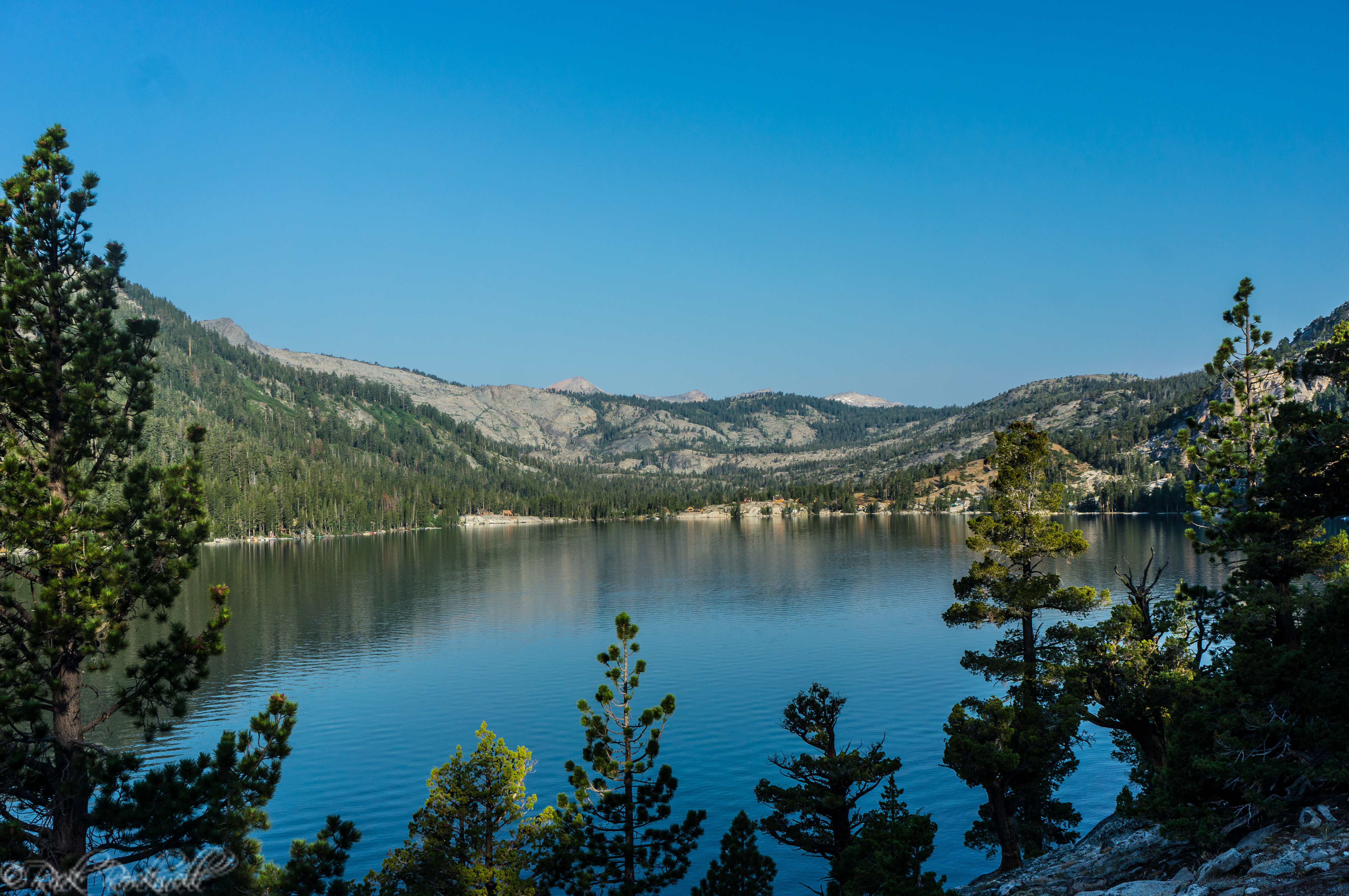
An exciting journey from Echo Lakes to Tamarack Lake and beyond
Echo Lake, also commonly referred to as Echo Lakes, is typically frozen during the winter due to its elevation of over 7,400 feet. The services located at Echo Lake are seasonal and are open from Memorial Day through Labor Day. These services include the popular Echo Chalet and the boat taxi. The trail from lower …...
