Devils Falls sits along one of Placer County’s old canyon routes, where Yankee Jims Road drops into the North Fork American River country between Colfax and Yankee Jims. The waterfall is not famous, heavily signed, or built around a formal trailhead. Its appeal has always been more unexpected than grand: water slipping down a dark rock face near the road, the old Yankee Jims Bridge nearby, and the surrounding canyon carrying the weight of Gold Rush history.
For years, it was the kind of stop people noticed almost by accident. After a wet winter or spring storm, Devils Falls could turn a remote backroad drive into a brief but memorable pause — the sound of falling water, the narrow road, the steep canyon, and the sense that this area has never been fully tamed.
And despite this waterfall being more of a roadside attraction than a destination, Devils Falls is still a memorable Auburn State Recreation Area experience due to its uniqueness, location, and cool-sounding name.
Quick Facts About Devils Falls
Location: Along Yankee Jims Road near Colfax and Foresthill, California
Region: Placer County, within the Auburn State Recreation Area area
Water Source: Devils Canyon Creek / Devils Canyon drainage
Nearby Landmark: Yankee Jims Bridge
Estimated Height: Commonly described around 40–60 feet, though published estimates vary
Best Season: Late winter through spring, especially after rain or snowmelt
Access Type: Roadside stop
Main Caution: Road closure, steep terrain, slick rock, poison oak, ticks, rattlesnakes and remote canyon conditions
Where Is Devils Falls?
Devils Falls sits in the American River canyon country south of Colfax, near the old Yankee Jims Road route between Colfax and Foresthill. The waterfall is closely associated with Yankee Jims Road, Yankee Jims Bridge, Devils Canyon, Shirttail Canyon, and the North Fork American River corridor.
Directions to Devils Falls
From Sacramento, take I-80 East toward Colfax and exit on Canyon Way (Colfax/Grass Valley). Turn right on Canyon Way and drive 2.2 miles before making a left onto Yankee Jims Road. From there, head down YJR for 5.6 miles and cross over the American River. Once you reach 0.5 miles on the other side of the river, keep an eye out for the waterfall located on the right. Park where the road begins to wind to the left, which keeps from blocking traffic.
Yankee Jims Road Closure as of 2026
As of this publishing, Yankee Jims Road is closed from near the intersection of Canyon Way and YJR, all the way down to Shirttail Canyon Road. This is due to the Yankee Jims Bridge Replacement Project which is expected to last until summer of 2028, when the new Yankee Jims Bridge will be open.
What Makes Devils Falls Worth Seeing?
At its best, Devils Falls is a compact, striking roadside waterfall where the water drops through a rocky chute beside Yankee Jims Road. The setting is one of surrounding canyon walls, mossy rock, and contrasting colors depending on the time of year. The adventurous drive to Devils Falls serves to make this visit even more memorable.
How Tall Is Devils Falls?
Devils Falls is estimated to be around 50 to 60 feet tall, depending on how the cascade is measured and whether the full stepped drop is included. Many sources have this waterfall ranging from 45 to 75 feet.
Devils Canyon Creek, Shirttail Canyon and the North Fork American River
The waterfall is tied to Devils Canyon and Devils Canyon Creek. A U.S. Geological Survey gazetteer from 1912 describes Devils Canyon Creek as rising in Placer County at about 2,900 feet and flowing northwest about 3.5 miles into Shirttail Canyon Creek, which ultimately drains through the North Fork American River system toward the Sacramento River.
The same USGS gazetteer describes Shirttail Canyon Creek as rising in Placer County at about 4,200 feet and flowing generally southwest about 15 miles to its junction with the North Fork American River.
In short, Devils Falls is part of a steep, short, fast-dropping canyon system feeding into one of Placer County’s most historic river corridors.
How Did Devils Falls Get Its Name?
The origin of this waterfall’s name has been lost in time. It’s clear that the falls joins the canyon and creek with the same name. Yet, it remains a mystery as to who or what came up with the name “Devils.”
A Placer Herald article published in December 1852 mentions “Devil’s Canyon” in connection with mining activity near Yankee Jim’s, saying miners were doing well there. An 1873 Placer Argus notice also referenced a route crossing Devils Canyon, which shows the canyon name was established in local use by the early 1870s.
By 1912, the USGS gazetteer formally listed Devils Canyon Creek in Placer County, describing its course into Shirttail Canyon Creek.
So, while there is no verified “origin story” for the waterfall, canyon or creek, we do know that the region was using the Devils name by the early 1850s, which also lines up with nearby mining camps like Yankee Jims rising to prominence.
“Devils” Is a Perfect Name for This Gold Country Location
The “devils” name seems to fit perfectly with this Gold Country landscape due to the rugged area along with the rough, dramatic, and ominous era. Other Gold Country names that align with “Devils” are: Hell Hole, Murderer’s Bar, Rattlesnake Bar, Shirt-tail Canyon, Deadwood, and Last Chance.
Some of the names came from humor, while others came from folklore, bad luck, accidents, or just the hard living of the mining camps found in this dangerous region.
Yankee Jims Road: The Rough Route That Made Devils Falls Reachable
Yankee Jims Road has long been part of any adventure through this part of the river canyon and Foresthill Divide. The drive historically connected Colfax and Foresthill by way of the North Fork American River canyon. It passed near old mining grounds, crossed the river at Yankee Jims Bridge, and continued through the kind of steep, twisting terrain that makes even a short distance feel like a real-life rollercoaster of peril and adventure.
The road was named the town of Yankee Jims, which rose to prominence in the mid-1800s after gold was discovered by the infamous Yankee Jims Robinson. The bandit would go on to become one of California’s most notable urban legends.
A Historic Canyon With a Dangerous Edge
Devils Falls and the surrounding Yankee Jims Road area should not be oversold as a casual roadside picnic spot. Even when access is open, this is remote canyon terrain.
Auburn State Recreation Area is beautiful, but it is also steep, hot, rugged and isolated in places. State Parks lists hazards and visitor concerns across the park, including remote terrain, river corridors, seasonal access issues and natural hazards.
There are also sobering modern reminders of the terrain. In 2016, KCRA reported that a vehicle went off Yankee Jims Road near Devils Canyon and plunged hundreds of feet into a creek, with crews facing steep slopes, high water and difficult recovery conditions.
That does not mean the area should be avoided forever, but it does mean that responsible planning, caution, and respect should be exercised at all times.
Best Time to See Devils Falls
The best time to see Devils Falls is generally in the spring, especially after rain or during the early snowmelt season. During a strong flow, the waterfall has enough volume to feel alive and photogenic.
For the best experience, look for a stretch of wet weather followed by a clear day. But avoid visiting during storms, high runoff, or any period when the road is unsafe, closed, or restricted.
Safety Tips for Devils Falls
Even though Devils Falls has historically been described as a roadside waterfall, treat the area with caution.
Slick rock is one of the biggest hazards around any waterfall. The surface near the cascade can be wet, mossy and unstable, especially after storms. Poison oak is also common in the lower Sierra foothills and American River canyon country. Ticks and rattlesnakes are possible, especially in warmer months.
The road itself can be part of the risk. Yankee Jims Road is narrow, winding and remote, with steep drop-offs in places. Cell service may be unreliable, and emergency access is one of the very reasons the bridge replacement project is happening.
Consider the following safety tips before visiting Devils Falls:
- Check current road closures before leaving.
- Do not enter closed construction areas.
- Avoid climbing wet rock near the falls.
- Watch for poison oak along the roadside and creek corridor.
- Bring water, especially in warm weather.
- Do not assume cell service will work.
- Keep dogs controlled and away from steep edges.
- Avoid visiting during storms, heavy runoff, or roadwork closures.
- Turn around if the road condition feels beyond your vehicle or comfort level.
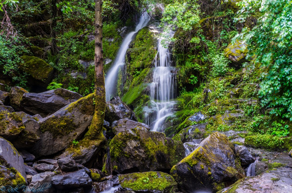
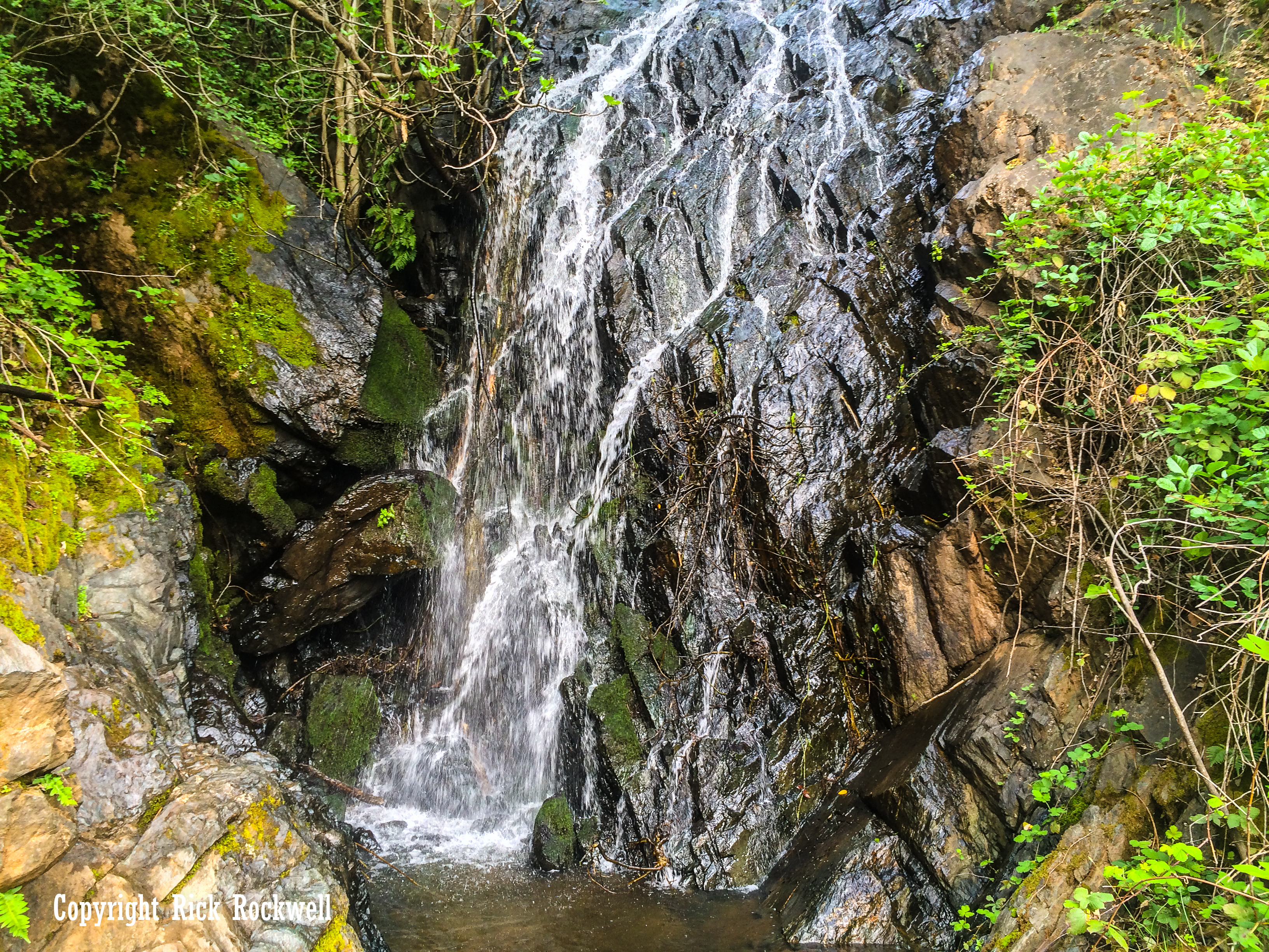
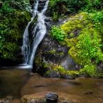
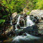
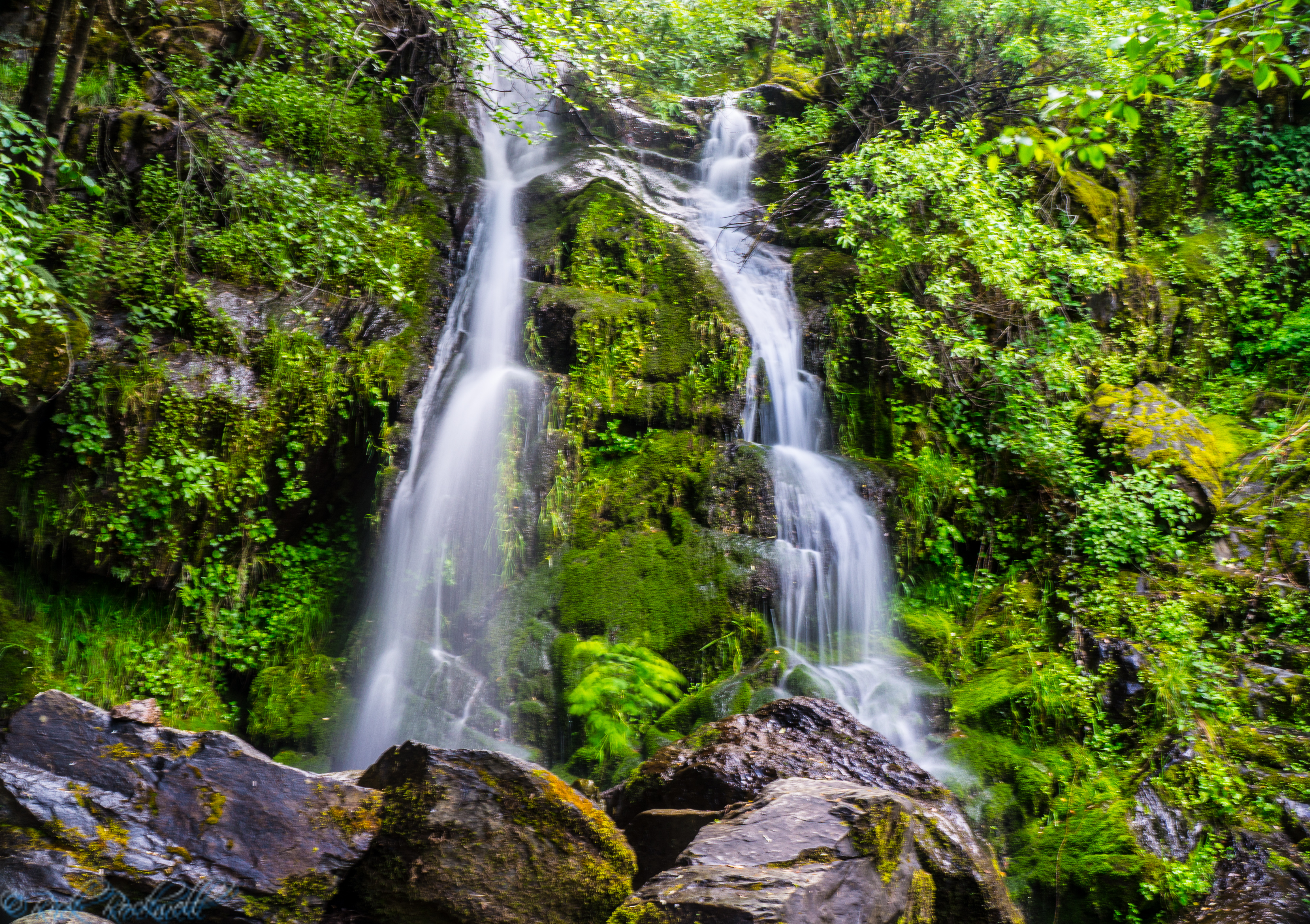
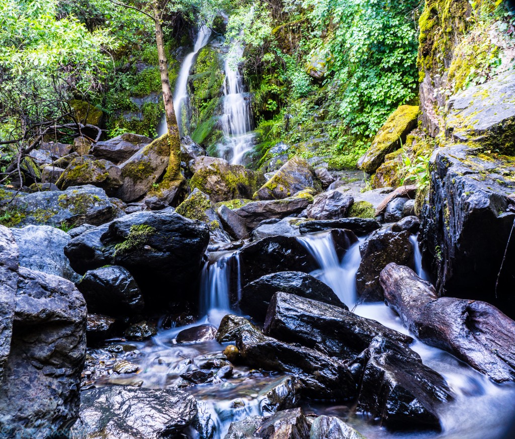
Devils Falls
Things to Do Near Devils Falls
Devils Falls can fit naturally into a broader Yankee Jims Road or Auburn State Recreation Area outing. These nearby stops also make great additions to any trip in this region:
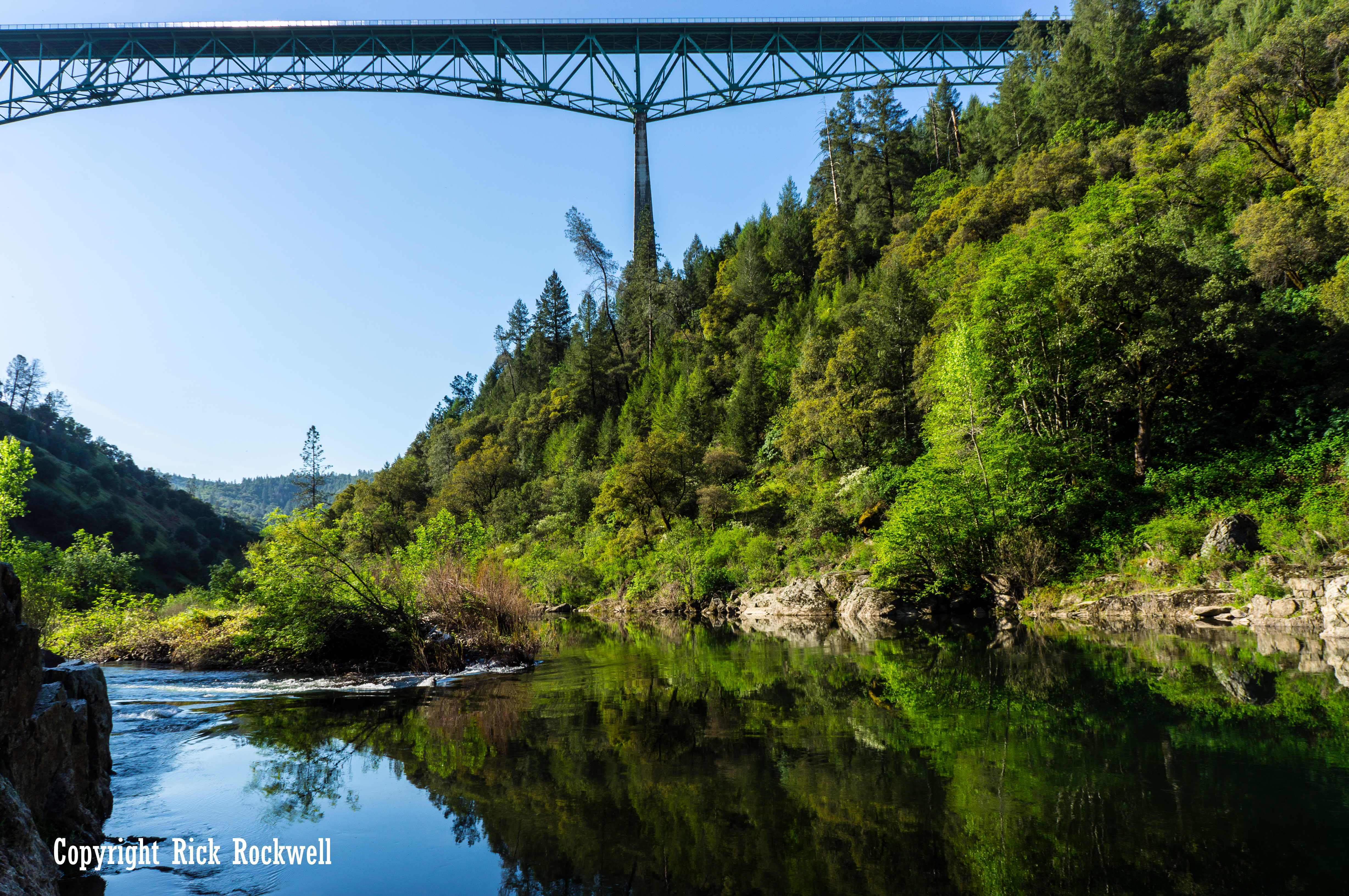
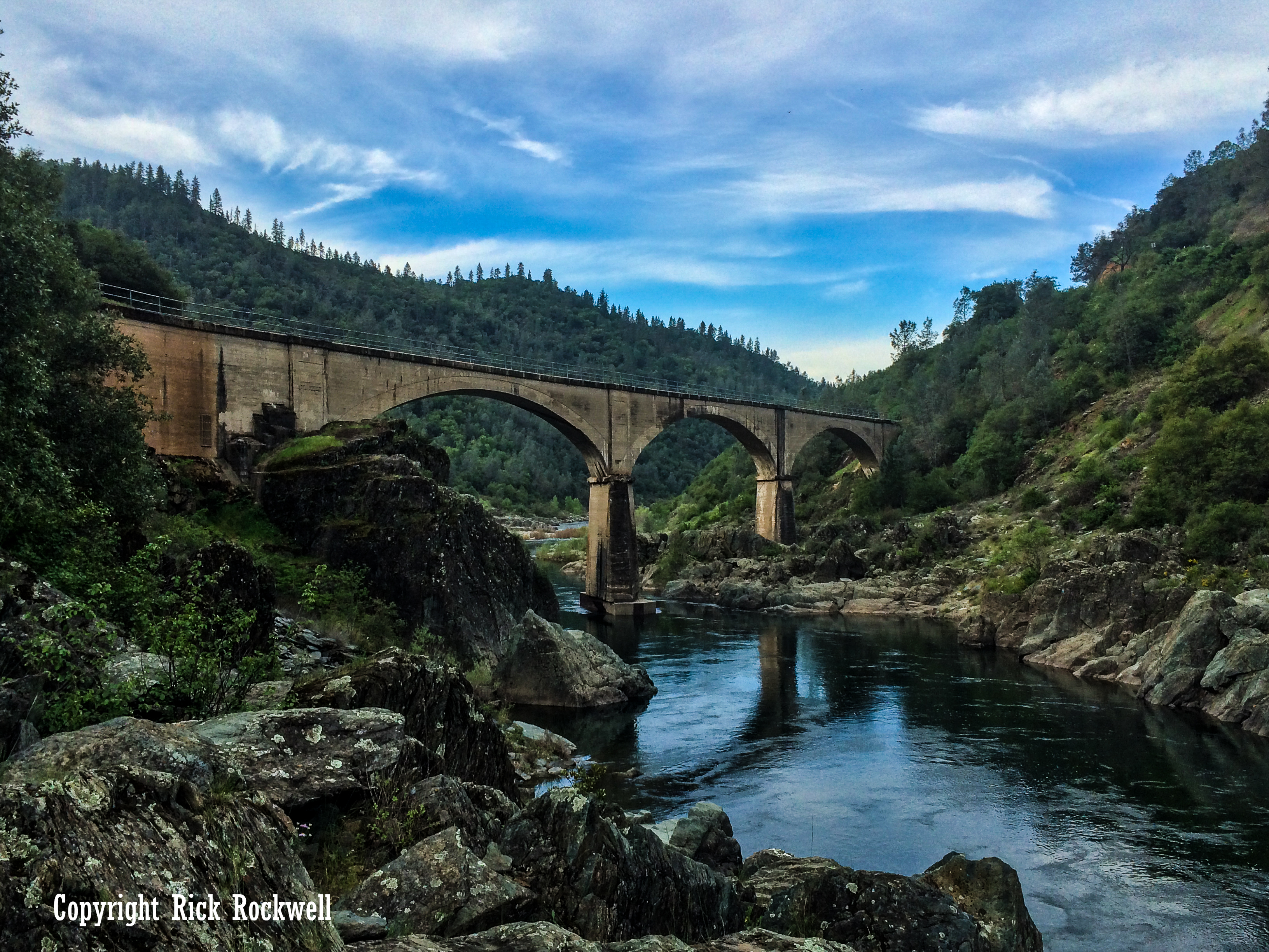
Yankee Jims Bridge
Yankee Jims Bridge is the signature historic structure in this portion of the canyon, and the current replacement project makes it one of Placer County’s most interesting infrastructure stories.
Yankee Jims Road
Yankee Jims Road is more than a connector between Colfax and Foresthill. It is an old canyon route tied to mining history, bridge crossings, remote river access and rugged scenery.
Bunch Canyon Falls
Bunch Canyon Falls is another one of Yankee Jims Road’s featured waterfalls. However, this one is harder to get to and requires even more caution than Devils and Mexican Gulch waterfalls located a few miles down the same road.
Mexican Gulch Waterfall
Mexican Gulch Waterfall is another seasonal waterfall in the Yankee Jims Road area, making it a natural companion piece to Devils Falls when the road and conditions allow access.
Auburn State Recreation Area
Auburn State Recreation Area offers hiking, river access, fishing, camping, gold panning, whitewater recreation and historic landscapes along the North and Middle Forks of the American River.
Codfish Falls
Codfish Falls is one of the better-known waterfall hikes in the Auburn State Recreation Area region and a strong nearby internal link for readers interested in Placer County waterfalls.
Pennyweight Falls
Pennyweight Falls adds another seasonal waterfall option in the broader American River canyon area and works well as a nearby waterfall article to cross-link.
Iowa Hill Road
Iowa Hill Road is another narrow, dramatic Placer County canyon road with history, scenery and a reputation that deserves respect from drivers. The road winds through ASRA and leads you to the California ghost town of Iowa Hill.
Iowa Hill Bridges
Just like with the Yankee Jims Road and Bridge, Iowa Hill Road also crosses over the Iowa Hill Bridge, which features the old bridge used for pedestrians and the newer bridge used for traffic.

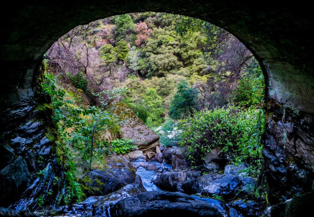
Looking up at Devils Falls from the tunnel.
Is Devils Falls Worth Visiting?
Yes, but with the right expectations and only when the road is open for safe passage. While I am very fond of my trips to Devils Falls, and the rich history behind this region, the waterfall is best served as an addition to any trip along Yankee Jims Road, YJR Bridges, the old Gold Rush town, or anywhere along this region of the North Fork American River.
Devils Falls is the kind of seasonal roadside attraction that not only provides us with a photogenic waterfall, but also reminds us of why Placer County’s backroads are so compelling in the first place.
Where other waterfalls along the YJR have their own unique feel and character, Devils Falls gives off more of the mining vibe with the “tunnel” that sits a few feet away from the waterfall. When you walk through this drainage, the short period of darkness leads to an opening where the landscape looks like a beautiful river canyon painting.
Devils Falls is one of my favorite Gold Country waterfalls due to its unique story, photogenic qualities during peak flow, and the drive getting there.
Devils Falls FAQ
Where is Devils Falls?
Devils Falls is along Yankee Jims Road in Placer County, near Colfax, Foresthill, Yankee Jims Bridge, Devils Canyon and the North Fork American River corridor.
Is Devils Falls open right now?
Access is currently complicated by the Yankee Jims Bridge replacement project. Placer County says Yankee Jims Road is closed between Gillis Hill Road and Shirttail Canyon Road and that recreational access in the area is restricted during construction.
How tall is Devils Falls?
Devils Falls is commonly estimated to be around 40 to 60 feet tall.
Is Devils Falls a hike?
Historically, Devils Falls has been considered a roadside waterfall along Yankee Jims Road.
What is the best time to see Devils Falls?
Late winter and spring are usually best, especially after rain or during snowmelt.
How did Devils Falls get its name?
No definitive naming source was found for the waterfall itself. The most likely explanation is that Devils Falls takes its name from Devils Canyon or Devils Canyon Creek.
Is Devils Falls in Auburn State Recreation Area?
Devils Falls is associated with the Auburn State Recreation Area region along Yankee Jims Road. Auburn SRA is administered by California State Parks and covers major recreation areas along the North and Middle Forks of the American River.

Looking out the tunnel down toward Shirttail creek
Sources
Placer County — Yankee Jims Bridge replacement work
https://www.placer.ca.gov/10695/Yankee-Jims-Progress
Yankee Jims Bridge Project
https://www.yankeejimsbridge.com/
California State Parks — Auburn State Recreation Area
https://www.parks.ca.gov/?page_id=502
California Office of Historic Preservation — Yankee Jim’s Historical Landmark No. 398. https://ohp.parks.ca.gov/ListedResources/Detail/398
U.S. Geological Survey — Gazetteer of Surface Waters of California, Water-Supply Paper 295. https://pubs.usgs.gov/wsp/0295/report.pdf
Placer Herald, Dec. 18, 1852. Used for early “Devil’s Canon” newspaper reference near Yankee Jim’s. https://cdnc.ucr.edu/?a=d&d=PH18521218.2.7
Placer Argus, April 26, 1873. Used for early Devils Canyon road/geographic reference. https://cdnc.ucr.edu/?a=d&d=PWA18730426.1.3
World of Waterfalls — Devils Falls / Devil’s Falls.
https://www.world-of-waterfalls.com/waterfalls/california-devils-falls/
Gold Mountain California News / Folsom Times archive result https://goldmountaincanews.com/news/174922/day-hiker-indian-creek-trail-has-its-beauty-a-few-obstacles-and-a-side-trip-youll-fall-for/
KCRA https://www.kcra.com/article/body-found-in-submerged-car-in-placer-county-creek/6427571