Mexican Gulch Waterfall feels like the kind of place you find by accident while chasing old roads and urban legends through Gold Country. One minute you’re winding through dry, rugged canyon country near Colfax, Yankee Jims and the American River; the next, the road reveals a pocket of shade, wet rock, moss, and falling water tucked into the folds of the hillside.
It’s not the biggest waterfall in Placer County, but that’s part of its charm. Mexican Gulch Falls feels less like a destination and more like a secret that the landscape briefly lets you in on. That’s the way I felt during my first visit to this waterfall.
When the water is at peak flow, this 30-foot Placer County waterfall is more interesting than its size suggests. Mexican Gulch Waterfall appears to drop in two tiers over dark rock into a small pool before continuing down through the gulch.
In spring, the whole scene changes. Moss, ferns, wet stone, and fresh foothill greenery give the spot a cool, almost hidden-garden feel in a region that can otherwise look dry, rugged, and starved of anything green.
That said, Mexican Gulch Waterfall is a pleasant surprise to those that accidentally gaze upon it during a backroad, Gold Country adventure and to those who are intentionally seeking out waterfalls within or near the Auburn State Recreation Area.
Quick Facts About Mexican Gulch Waterfall
- Location: Near Colfax in Placer County
- Road Corridor: Yankee Jims Road area
- Waterfall Type: Small seasonal roadside waterfall
- Approximate Height: Roughly 30 feet
- Best Season: Late winter through spring
- Hike Distance: Minimal when road access is open
- Difficulty: Easy viewing, but slippery near the rocks
- Best For: Short waterfall stop, photography, Gold Country backroad exploring
- Current Access Note: Check Yankee Jims Road closures before planning a visit
Where Is Mexican Gulch Waterfall?
Mexican Gulch Waterfall is near Colfax in Placer County, along the Yankee Jims Road corridor in the broader North Fork American River and Auburn State Recreation Area region. TopoZone lists Mexican Gulch itself as a Placer County valley in the Colfax USGS map area, with coordinates around 39.0418423, -120.8877157 and an approximate elevation of 1,325 feet.
Directions to Mexican Gulch Waterfall
From Sacramento, take I-80 east toward Colfax and exit at Canyon Way / Colfax / Grass Valley. Turn right onto Canyon Way and continue for about 2.2 miles, then turn left onto Yankee Jims Road.
From there, follow Yankee Jims Road for approximately 6.5 miles as it winds deeper into the canyon. Near the point where the road bends left, Mexican Gulch Waterfall appears on the right side of the road, near the small roadside parking area.
Important Access Update: Check Yankee Jims Road First
As of this publication, Yankee Jims Road remains closed to public traffic between Gillis Hill Road and Shirttail Canyon Road because of the Yankee Jims Bridge Replacement Project. This is pretty much the entire stretch of Yankee Jims Road just past Canyon Way spanning across the North Fork American River and up to Mexican Gulch Falls.
Currently, the closure of Yankee Jims Road is expected to last into 2028, after a three-year replacement project of the Yankee Jims Bridge began in May 2025.
What Is The Mexican Gulch Waterfall Like?
Mexican Gulch Waterfall is a small two-tiered cascade that becomes most impressive when seasonal runoff is moving through the gulch. The falls appear to drop roughly 30 feet in total, with water sliding through an upper section before spilling into a lower tier.
The location of this waterfall is the real draw. The surrounding canyon can feel dry, dusty, and rugged, but the waterfall creates a tropical little pocket of green. Ferns, moss, slick rock, and trickling water give it a lush feeling that contrasts the drier foothill landscape.
Best Time to Visit Mexican Gulch Waterfall
The best time to see Mexican Gulch Waterfall is usually late winter through spring, when rain and snowmelt provide the small drainage with peak water flow. By late summer, the flow becomes a trickle.
Spring also gives the area its best color. The hillsides are greener, the plants are fresher, and the waterfall has a better chance of looking like the lush little scene that inspired me to visit this waterfall in the first place.
Is Mexican Gulch Waterfall a Hike?
When Yankee Jims Road access is open, Mexican Gulch Waterfall functions more like a roadside attraction than a true hiking destination. Once parked along YJR, and you get out of your car, it requires a walk of roughly 10 to 12 feet over to the waterfall and climbing up some very slippery boulders. Be mindful of the surrounding wildlife including frogs, salamanders and large insects.

Looking at Mexican Gulch Falls from a distance
How Mexican Gulch Likely Got Its Name
Like many Gold Rush-era place names in California, Mexican Gulch probably began as a practical local description before it became a formal map name.
The origin of its name has not surfaced, but the most likely explanation is that Mexican, Sonoran, Californio, or other Spanish-speaking miners worked the gulch or nearby placer grounds during the early Gold Rush years.
That explanation fits the history of the region. Mexican and Latin American miners were among the earliest experienced gold seekers in California, and many came to the Sierra Nevada after the 1848 gold discovery.
The surrounding Yankee Jims and North Fork American River country was already active by the early 1850s. Gold was discovered at Yankee Jims in 1850, and by 1857 the town had become one of the important mining communities in Placer County. Mexican Gulch sits within that same rugged Gold Rush landscape, where ravines, canyons, bars, and roads often took their names from the people who worked them.
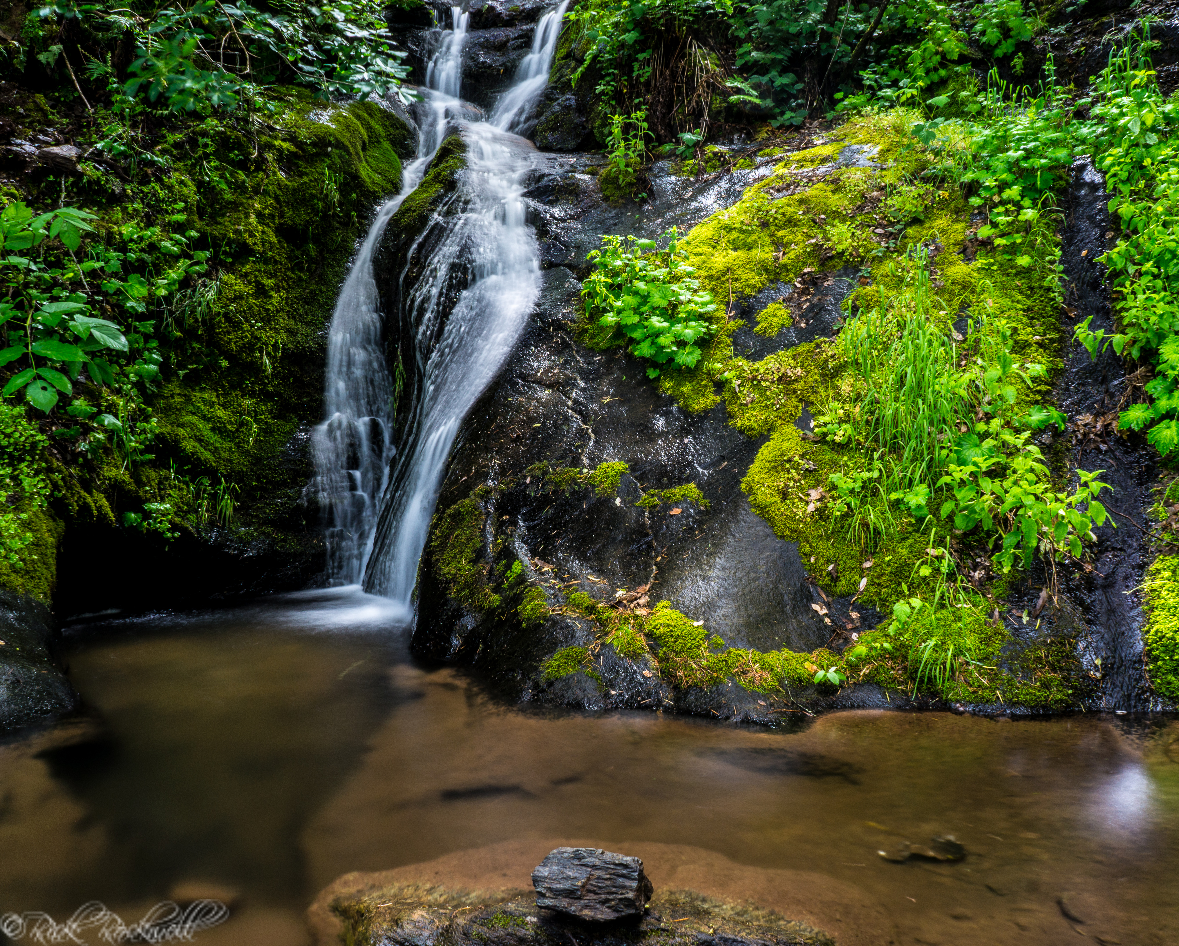
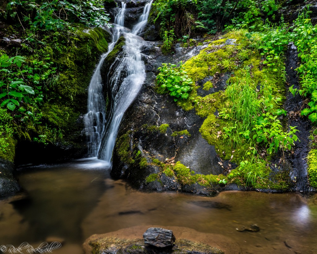
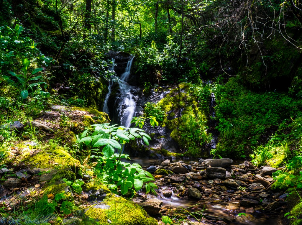
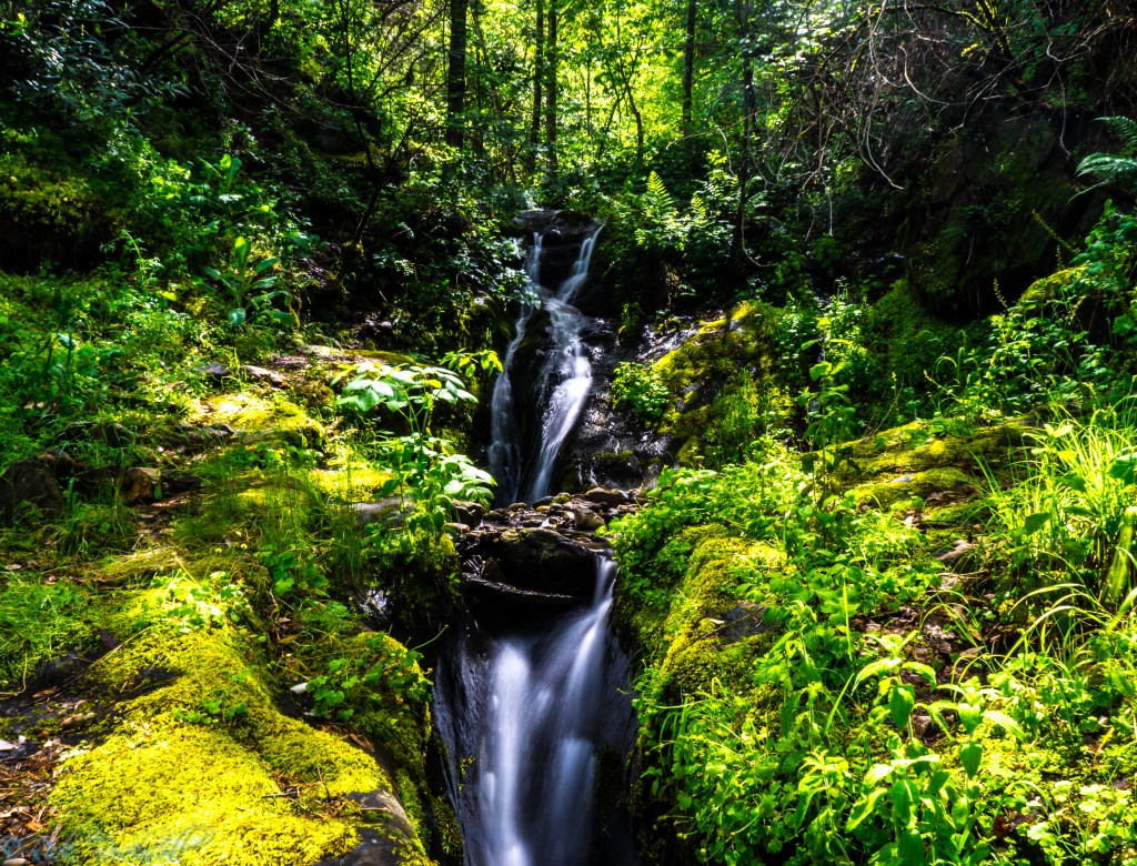
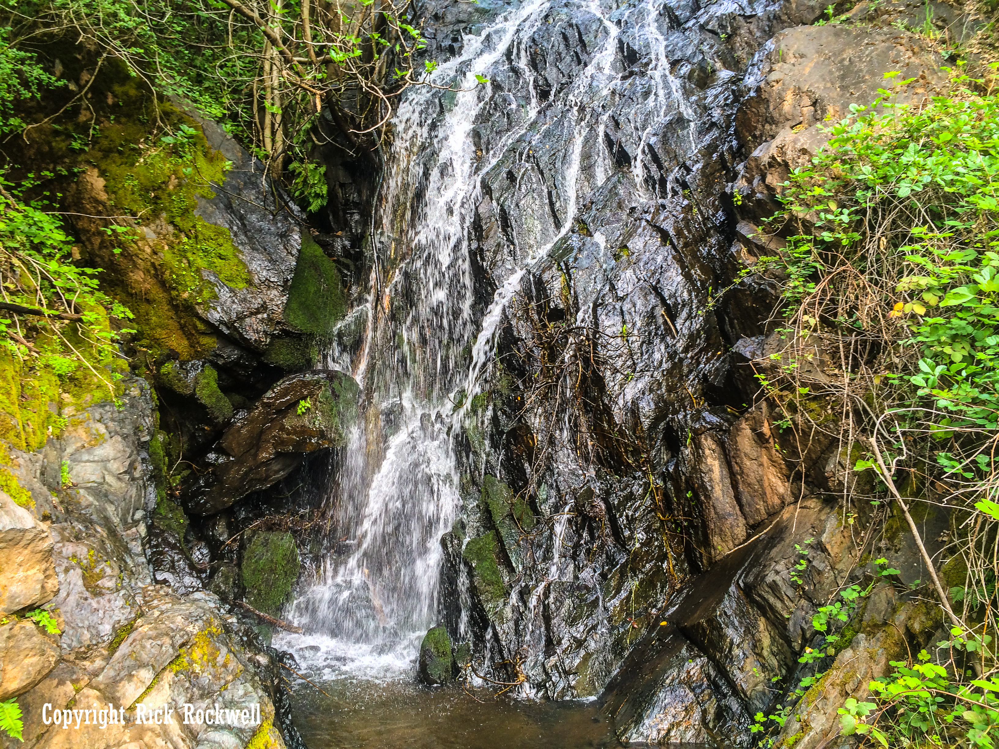
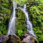
Safety Tips for Visiting Mexican Gulch Waterfall
Mexican Gulch Waterfall may sound like an easy stop, but it still deserves caution. The rocks around the falls can be slick, especially when wet or covered with moss. The terrain near the roadside can be uneven, and the broader Auburn State Recreation Area region includes steep canyon country, heat, poison oak, ticks, rattlesnakes, and limited services.
- Check Yankee Jims Road closure status before leaving.
- Do not climb wet rocks around the waterfall.
- Keep kids and pets away from slick ledges and roadside drop-offs.
- Watch for poison oak near the creek, rocks, and road shoulder.
- Bring drinking water, especially in warm weather.
- Avoid visiting during storms, heavy runoff, or poor road conditions.
- Pack out all trash.
- Do not remove rocks, plants, artifacts, or anything from the area.
Nearby Places to Visit
Mexican Gulch Waterfall works best as part of a larger Gold Country outing, especially if you want to explore more of the rugged roads, historic landmarks, river canyons, and waterfall stops around Colfax, Yankee Jims, and Auburn State Recreation Area.
Bunch Canyon Falls
Bunch Canyon Falls is another seasonal waterfall along Yankee Jims Road, offering a rugged roadside cascade that fits naturally into the same Placer County backroad, waterfall route as Mexican Gulch and Devils Falls.
Devils Falls
Devils Falls is the most natural nearby waterfall pairing because it sits along the same general Yankee Jims Road corridor.
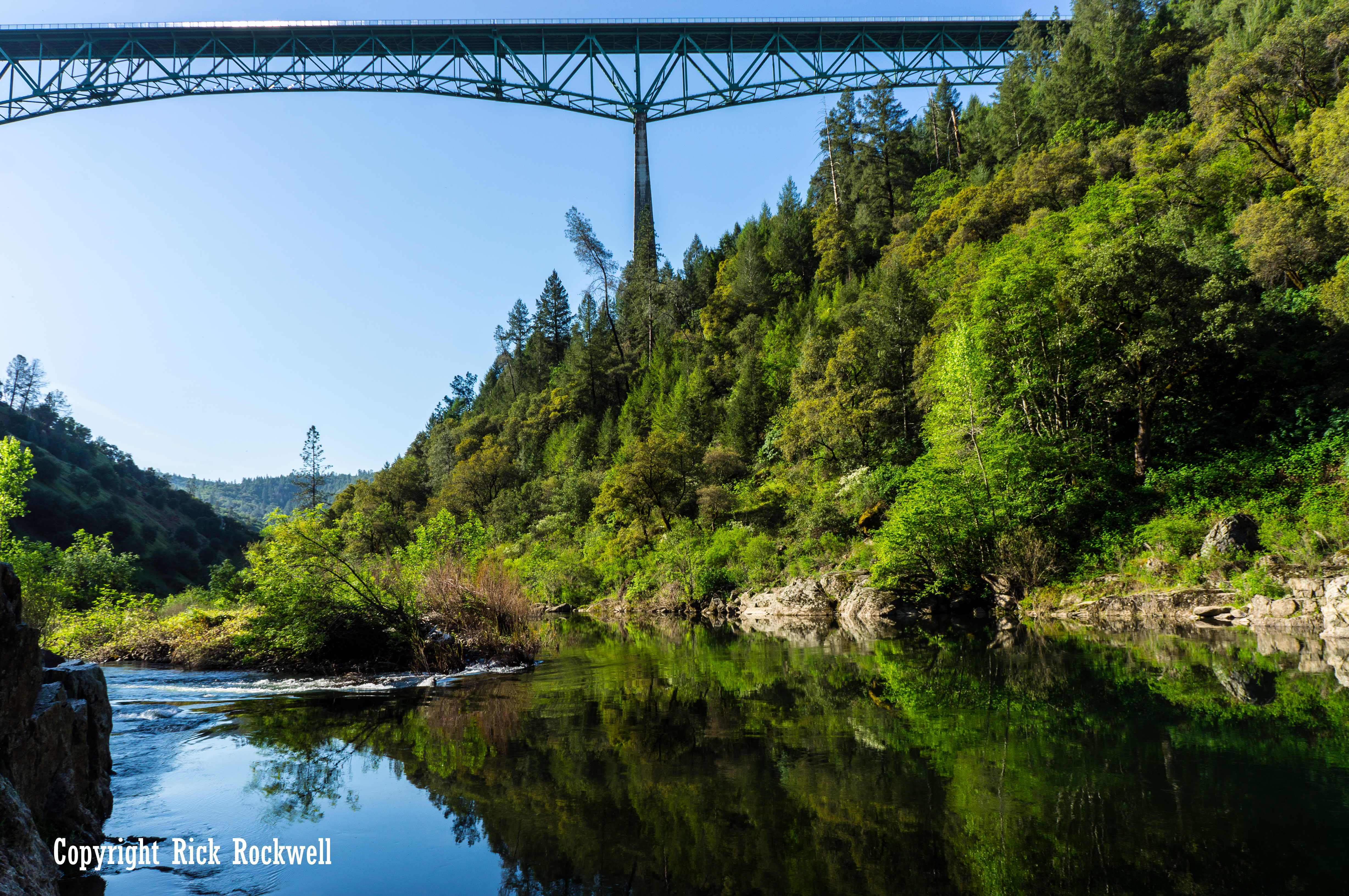
Yankee Jims Bridge
Yankee Jims Bridge is one of the best-known historic features in this part of Placer County. The area has long been associated with backroad exploring, swimming, river access, and Gold Country history. Just like the road and town, the bridge is named after the legendary bandit – Yankee Jims Robinson.
Auburn State Recreation Area
Auburn State Recreation Area (ASRA) provides the broader recreation context for the area around Yankee Jims, Colfax, and the American River canyons.
Codfish Falls
Codfish Falls is a better choice for visitors who want a more traditional waterfall hike in the Auburn State Recreation Area region.
Pennyweight Falls
Pennyweight Falls is another nearby waterfall-style destination within the ASRA, that fits well in a Placer County waterfalls adventure.
Iowa Hill Road
Iowa Hill Road is another rugged Placer County backroad with steep terrain, local history, and dramatic canyon scenery as it winds through ASRA all the way to the living California ghost town of Iowa Hill.
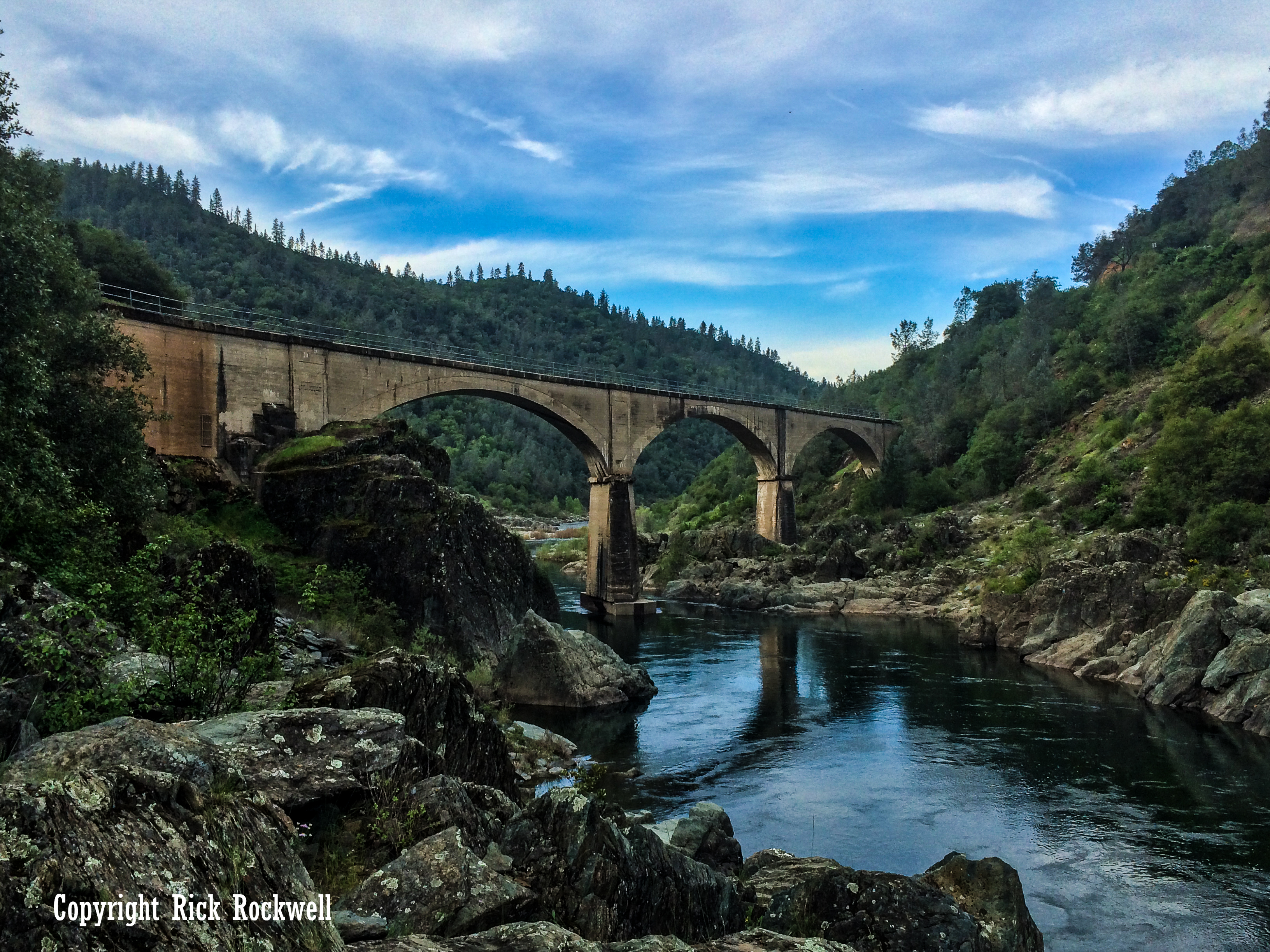
Iowa Hill Bridges
The Iowa Hill Bridges offer a dramatic look at Placer County’s rugged canyon history, with the old bridge and newer crossing showing how this remote Gold Country road has connected Iowa Hill to the outside world for generations.
Is Mexican Gulch Waterfall Worth Visiting?
Yes. However, the ideal Mexican Gulch Waterfall itinerary is one that should include stops along the way starting with Bunch Canyon Falls, Yankee Jims Bridge, and Devils Falls.
This waterfall isn’t a singled destination but more of an additional point of interest for anyone planning on driving along Yankee Jims Road and/or heading to Yankee Jims from Colfax. This region is rich in Gold Rush history and makes for a fantastic adventure.
Mexican Gulch Waterfall FAQ
Where is Mexican Gulch Waterfall?
Mexican Gulch Waterfall is in rural Placer County along the Yankee Jims Road corridor, southeast of Colfax and near the North Fork American River canyon.
Is Mexican Gulch Waterfall open?
Access may be affected by the Yankee Jims Bridge Replacement Project. Yankee Jims Road is closed to public traffic between Gillis Hill Road and Shirttail Canyon Road, so verify current access before attempting a visit.
How did Mexican Gulch get its name?
The most likely explanation is that Mexican, Sonoran, Californio, or other Spanish-speaking miners worked the gulch or nearby diggings during the Gold Rush.
How tall is Mexican Gulch Waterfall?
Mexican Gulch Waterfall is estimated to be roughly 30 feet tall and drops in two small tiers.
When is the best time to visit Mexican Gulch Waterfall?
Late winter through spring is usually best because the waterfall depends on seasonal runoff.
Is Mexican Gulch Waterfall a hike?
When road access is open, Mexican Gulch Waterfall is more of a roadside stop than a traditional hike.
Sources
California State Parks — Auburn State Recreation Area and Yankee Jims closure advisory: https://www.parks.ca.gov/?page_id=502
Placer County — Yankee Jims Bridge Replacement Project updates: https://www.placer.ca.gov/10695/Yankee-Jims-Progress
California Office of Historic Preservation — Yankee Jim’s Historical Landmark No. 398: https://ohp.parks.ca.gov/ListedResources/Detail/398
TopoZone — Mexican Gulch topo listing, Placer County
https://www.topozone.com/california/placer-ca/valley/mexican-gulch-3/
San José State University — Mexicans and the Gold Rush exhibit
https://exhibits.sjsu.edu/s/b4sv/item/3249
California Office of Historic Preservation — Chili Gulch Historical Landmark No. 265, comparison for GoldRush ethnic place-name pattern
https://ohp.parks.ca.gov/ListedResources/Detail/265
Waterfalls West — Placer County Waterfalls
https://www.waterfallswest.com/page.php?id=placercounty
The Sacramento Bee — Northern California Waterfalls Article
https://www.sacbee.com/entertainment/living/travel/article148640269.html