Tag: Auburn State Recreation Area
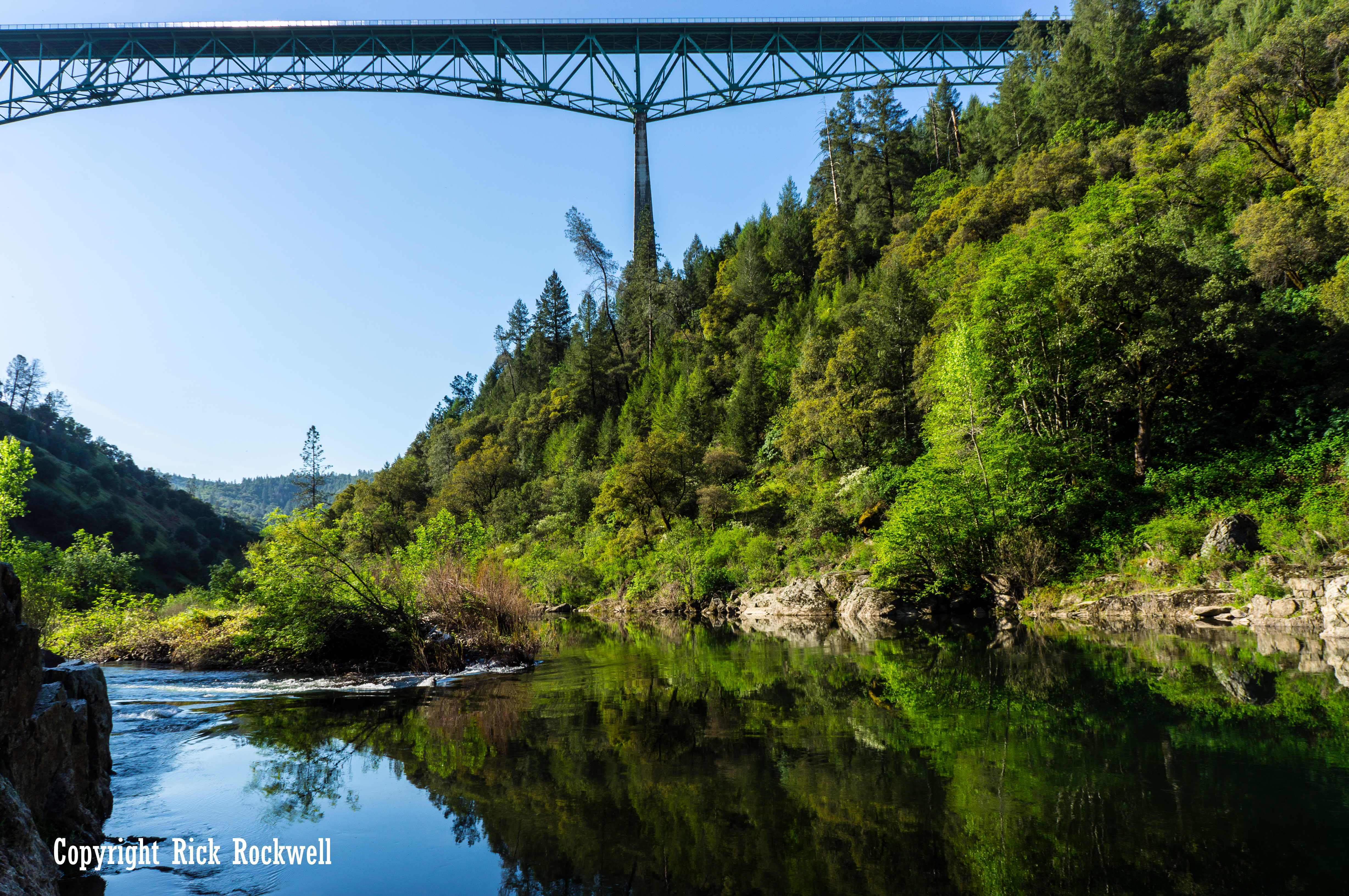
Foresthill Bridge: California’s Tallest Bridge Over the American River
Few landmarks in the foothills make you feel the scale of the American River canyon like Foresthill Bridge. One moment you are driving out of Auburn on Foresthill Road, and the next you are hundreds of feet above the North Fork American River, looking across one of the most dramatic bridge crossings in California. Also …...
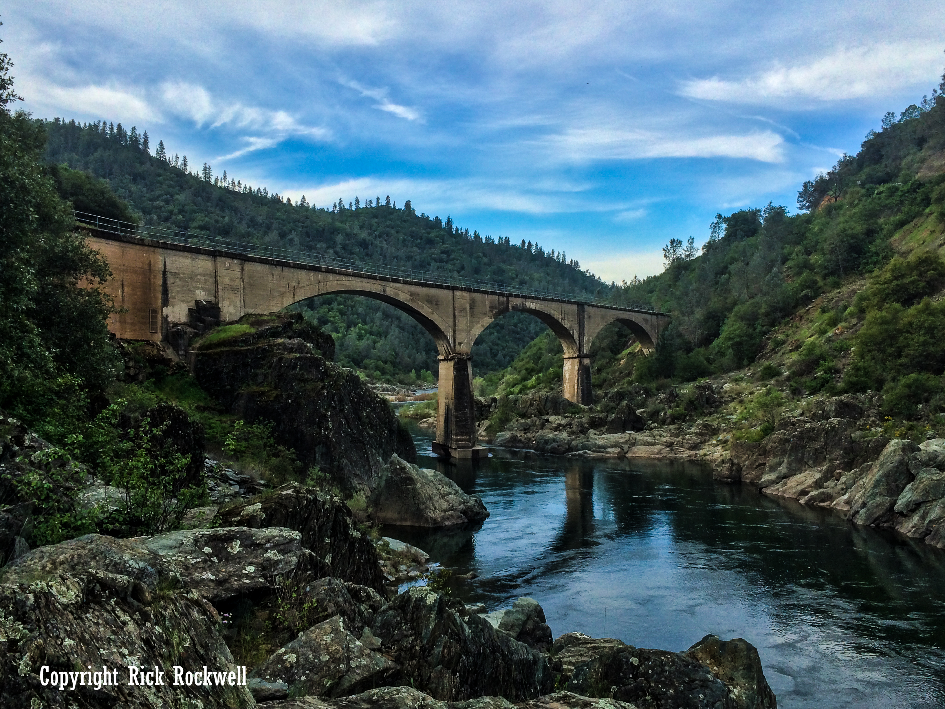
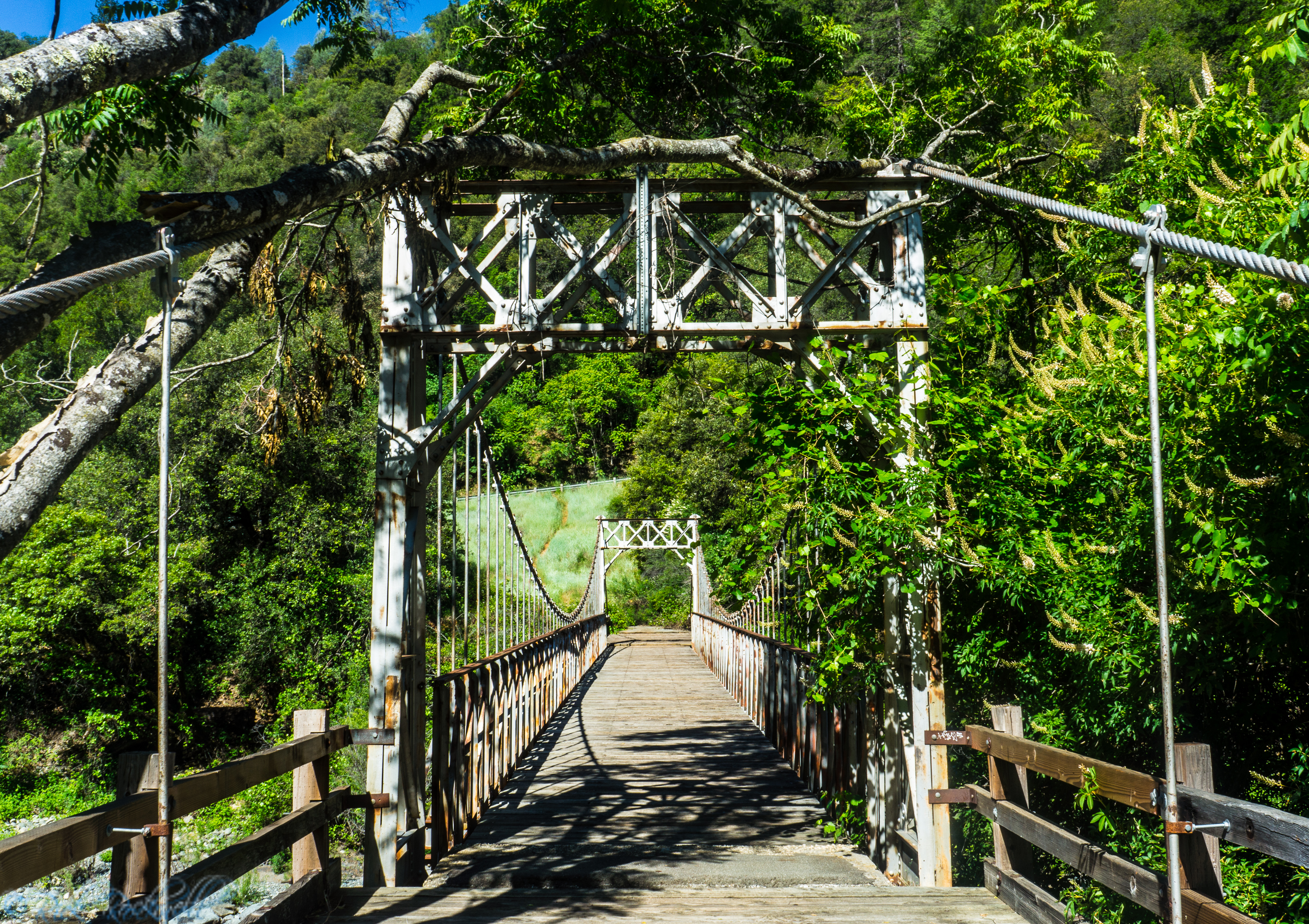
No Hands Bridge in Auburn: Visiting the Historic Mountain Quarries Bridge
No Hands Bridge is one of Auburn State Recreation Area’s most recognizable landmarks, a historic concrete railroad bridge turned scenic trail crossing in the American River canyon. Its official name is Mountain Quarries Bridge, and it was completed in 1912, for the Mountain Quarries Railroad, which hauled quarry material out of the...
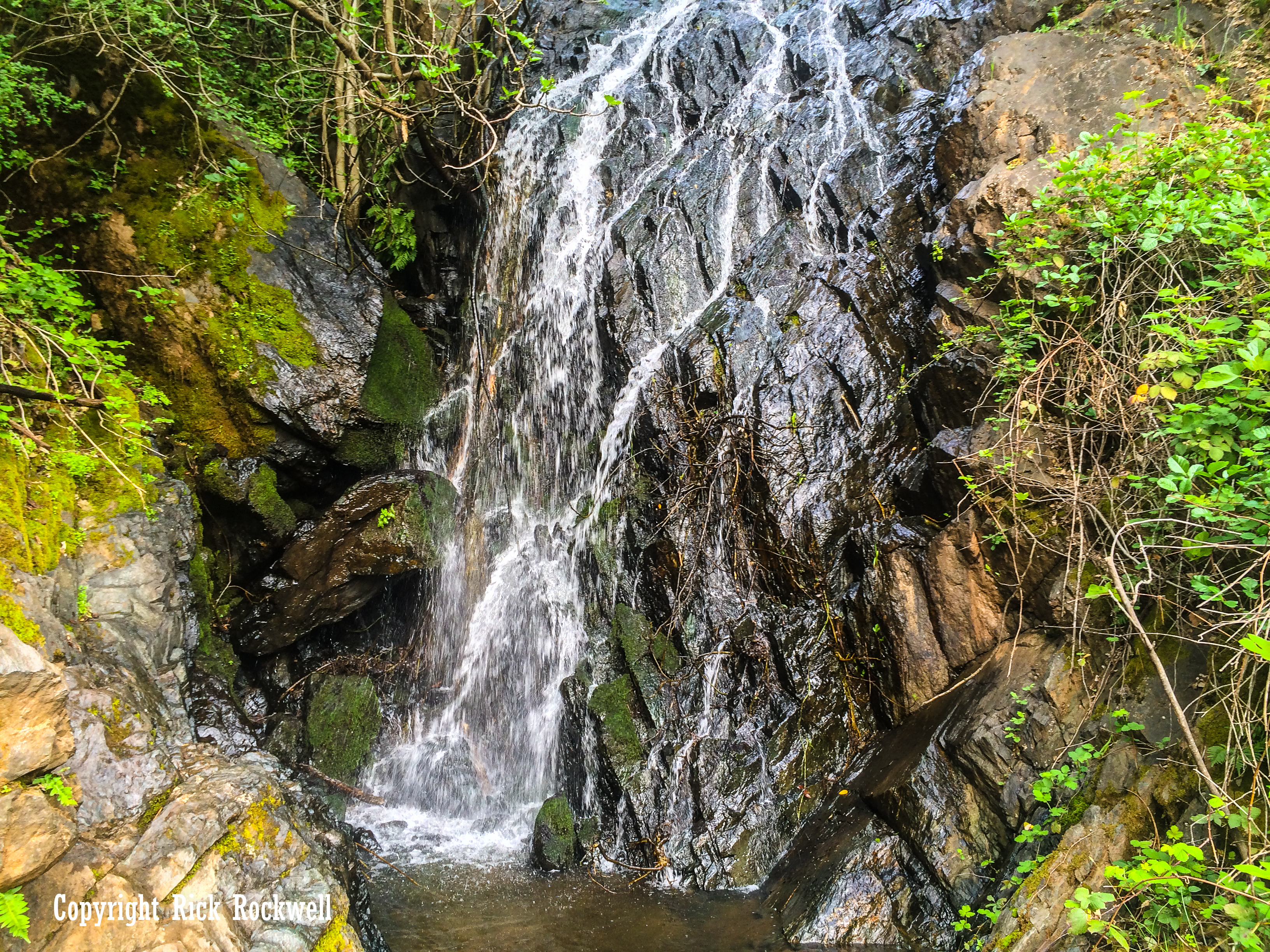
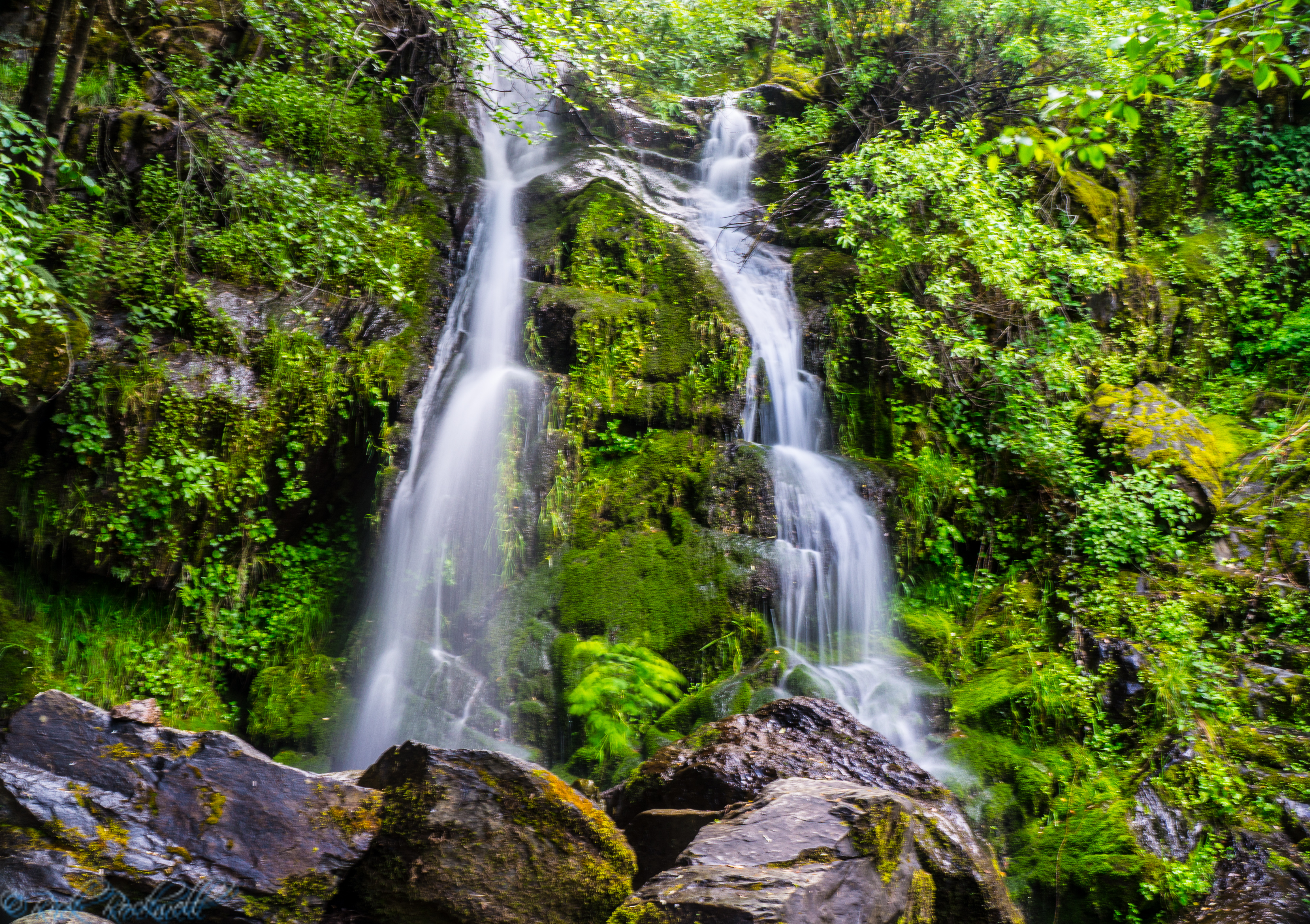
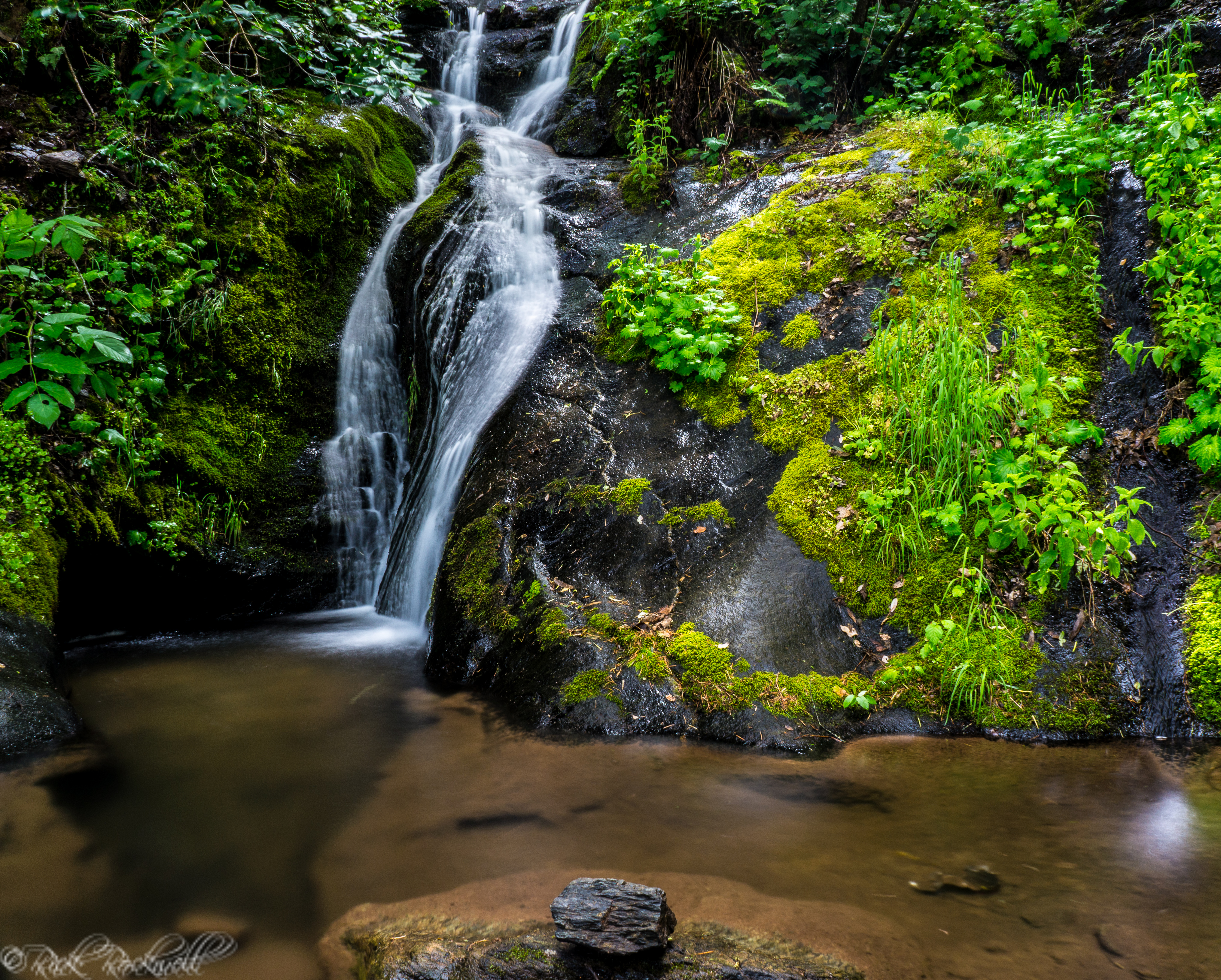
Black Hole of Calcutta Falls Guide: Auburn SRA Hike
Black Hole of Calcutta Falls is one of Auburn’s easiest waterfall hikes, but its unique name gives this short trail more character than you might expect. The route starts near the American River Confluence, crosses the historic No Hands Bridge, follows part of the Western States Trail, and leads to a seasonal waterfall hidden in...

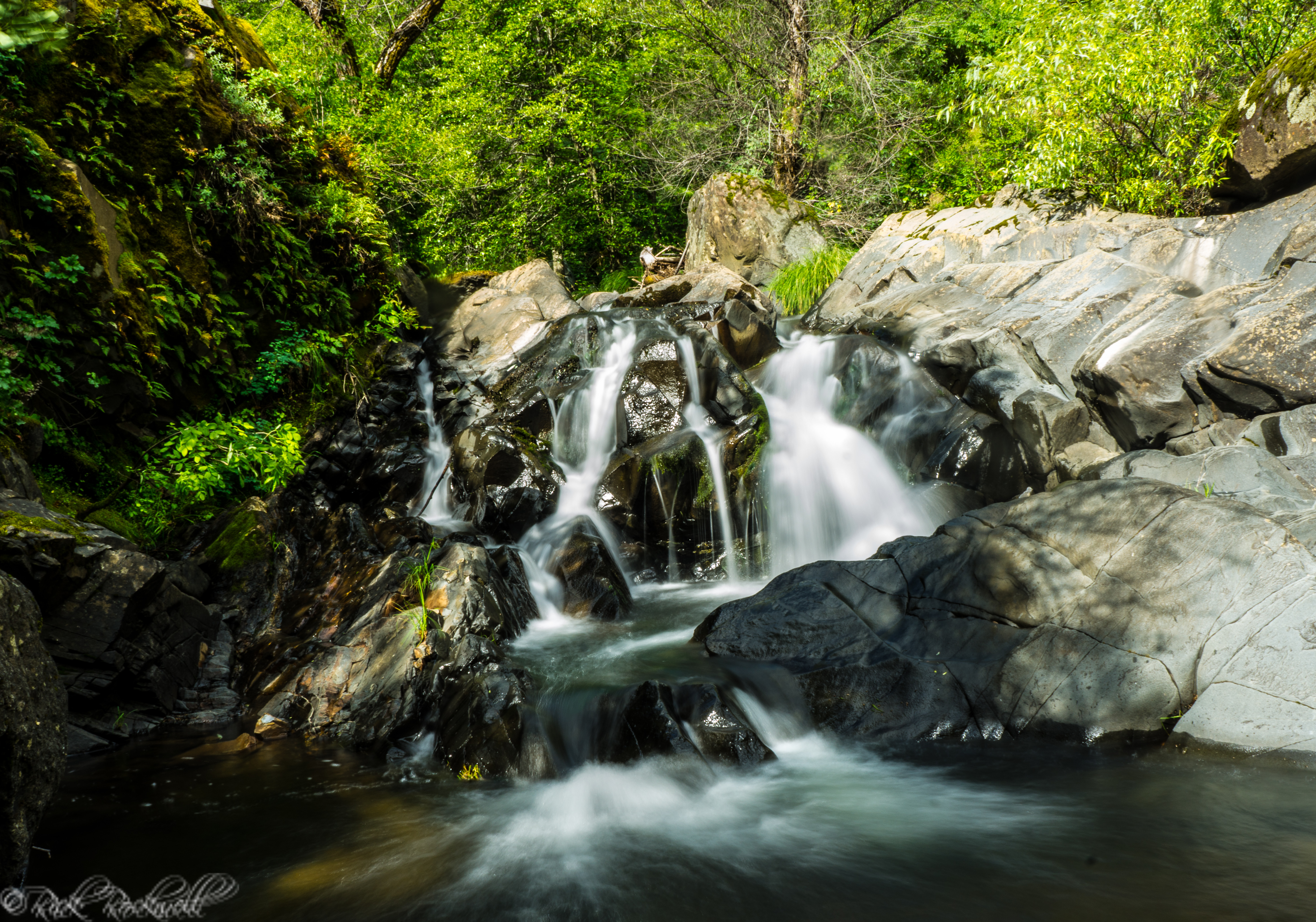
Lake Clementine Trail: A Guide to Auburn’s Best Waterfall Hike
Lake Clementine Trail is one of Placer County’s most rewarding hikes, leading from the North Fork American River canyon to the dramatic spillway of North Fork Dam. Along the way, the route passes beneath the towering Foresthill Bridge, follows a corridor tied to Gold Rush travel, and stops near Clark’s Hole before climbing toward the...
Bunch Canyon Falls: A Rugged Gold Rush Waterfall Near Colfax, California
Bunch Canyon Falls is not the biggest Auburn waterfall in Placer County, and it is definitely not the easiest one to reach. But that is also what makes it memorable. Hiding in the steep canyon country near Colfax, California, this small waterfall sits in the rugged Auburn State Recreation Area landscape around Yankee Jims Road,...
Devils Falls Near Yankee Jims: A Roadside Waterfall With a Name Straight Out of Gold Country
Devils Falls sits along one of Placer County’s old canyon routes, where Yankee Jims Road drops into the North Fork American River country, of the Auburn State Recreation Area, between Colfax and the old Yankee Jims area. The waterfall is not famous, heavily signed, or built around a formal trailhead. Its appeal has...
Mexican Gulch Waterfall: A Hidden Roadside Cascade Near Yankee Jims
Mexican Gulch Waterfall feels like the kind of place you find by accident while chasing old roads and urban legends through Gold Country. One minute you’re winding through dry, rugged canyon country near Colfax, Yankee Jims and the American River; the next, the road reveals a pocket of shade, wet rock, moss, and falling water …...
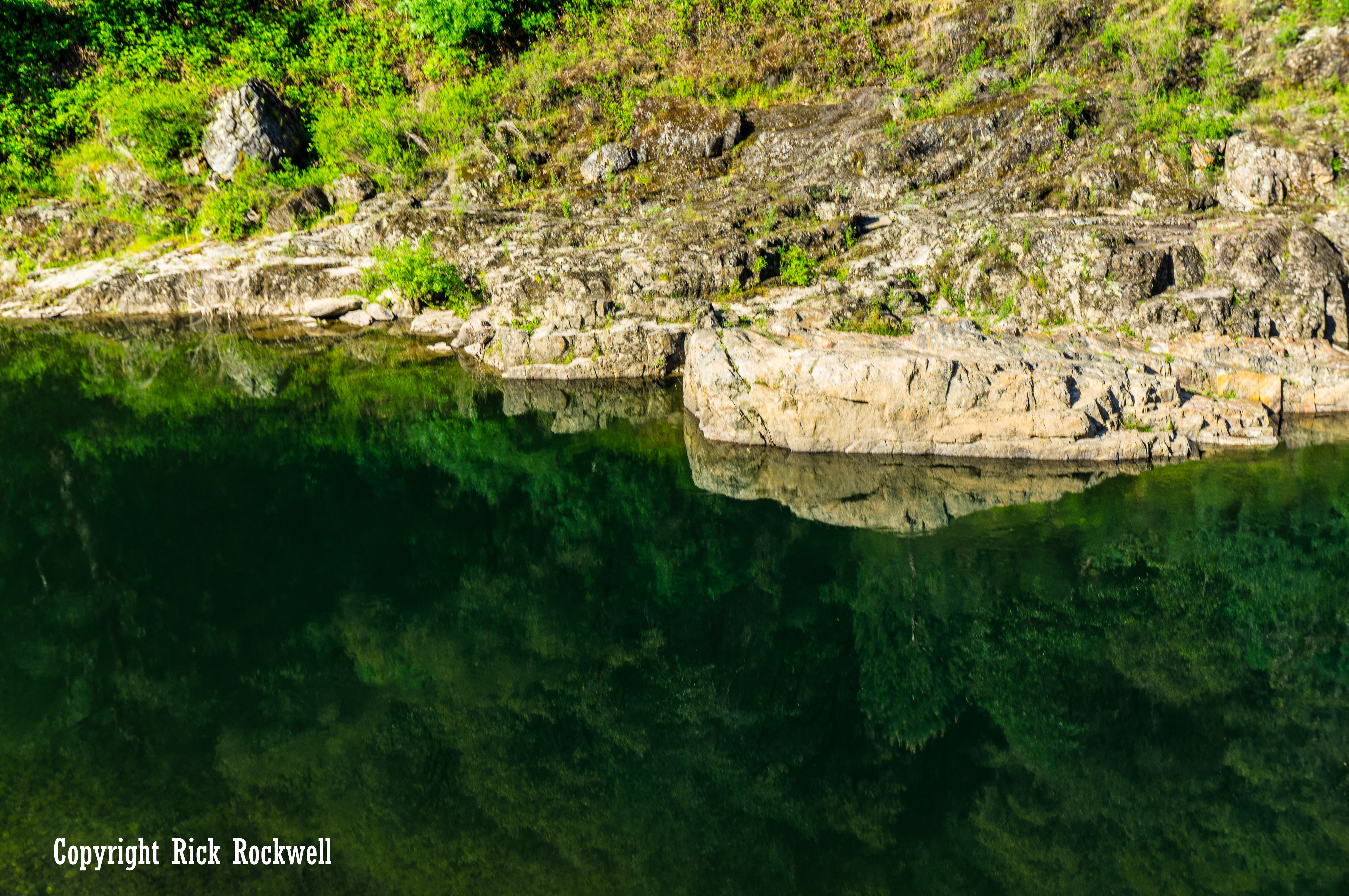
Clark’s Hole: A Historic American River Swimming Spot Near Auburn
Located along the North Fork American River, just upstream from the confluence in the Auburn State Recreation Area, Clark’s Hole is one of those spots that’s easy to overlook but unforgettable once you experience it. Also known as Clark’s Pool, this swimming hole has been part of Auburn’s outdoor life for more than a century....
Iowa Hill Road: A thrilling voyage from Colfax to Iowa Hill
Gold Country is well known for its historic mining towns, legendary tales of the Gold Rush and the meager beginnings of some of California’s most prominent figures. But, one thing that’s unknown to most visitors, is the adventure that’s experienced when actually driving on the winding roads that twist, turn and...
Iowa Hill Bridge: The Old and New Bridges Near Colfax, California
Iowa Hill Bridge is one of those Placer County points of interest where a simple river crossing turns into a wonderful piece of Gold Country history. Placed along Iowa Hill Road between Colfax and the ghost town of Iowa Hill, this crossing over the North Fork American River gives visitors a rare side-by-side look at …...


