Author: Rick Rockwell
Shasta County’s Afterthought Mine is fading away
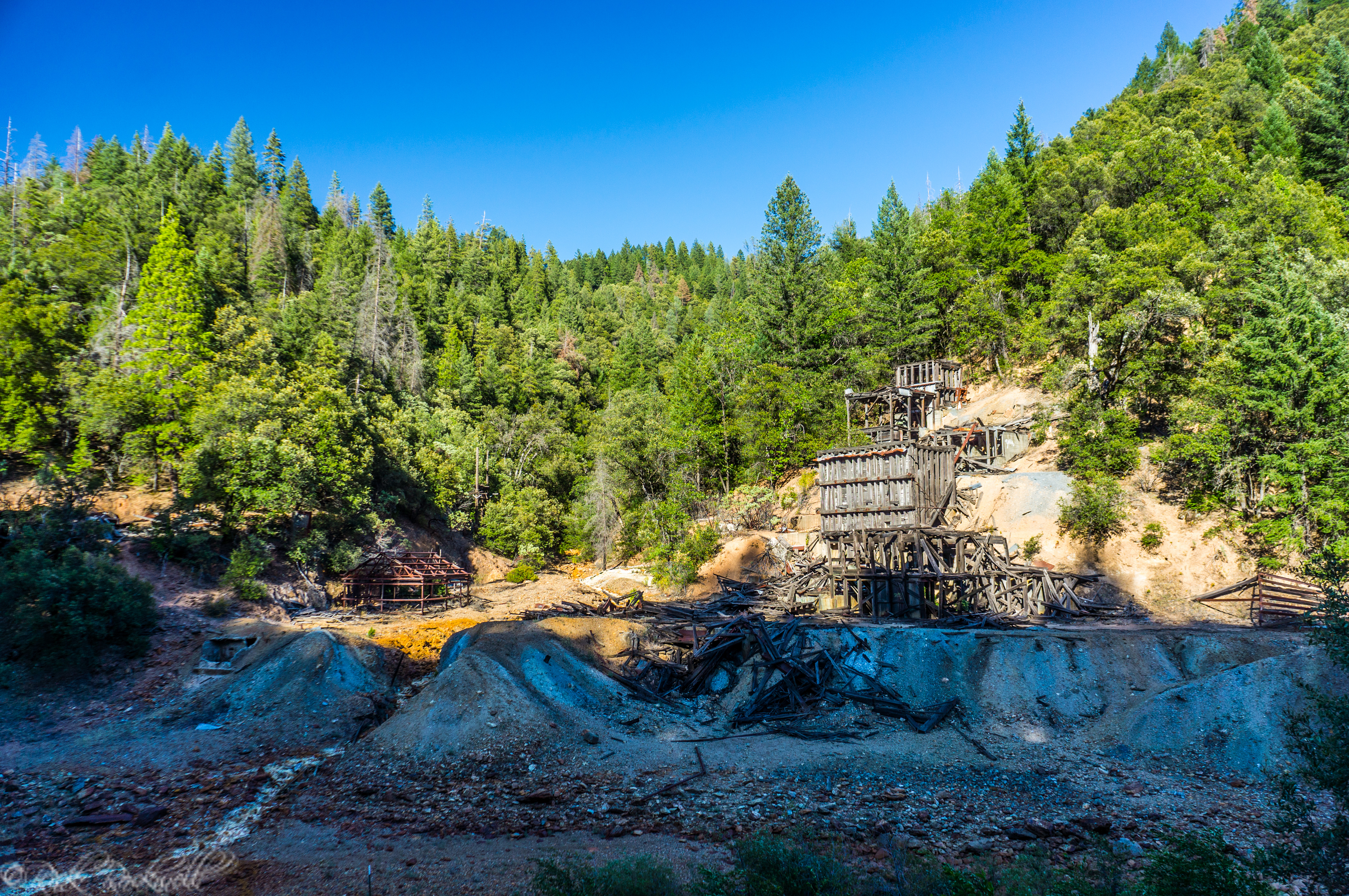
Located in the town of Ingot, less than 20 miles east of Redding along Highway 299, are the remains of an abandoned copper mine called the Afterthought Mine. What was once one of Shasta County’s most prosperous copper mines, is now nothing more than a dilapidated structure and a fleeting memory of a once thriving …...
Tamalpais Maiden: Greenbrae’s 17-Foot Nude Woman Statue
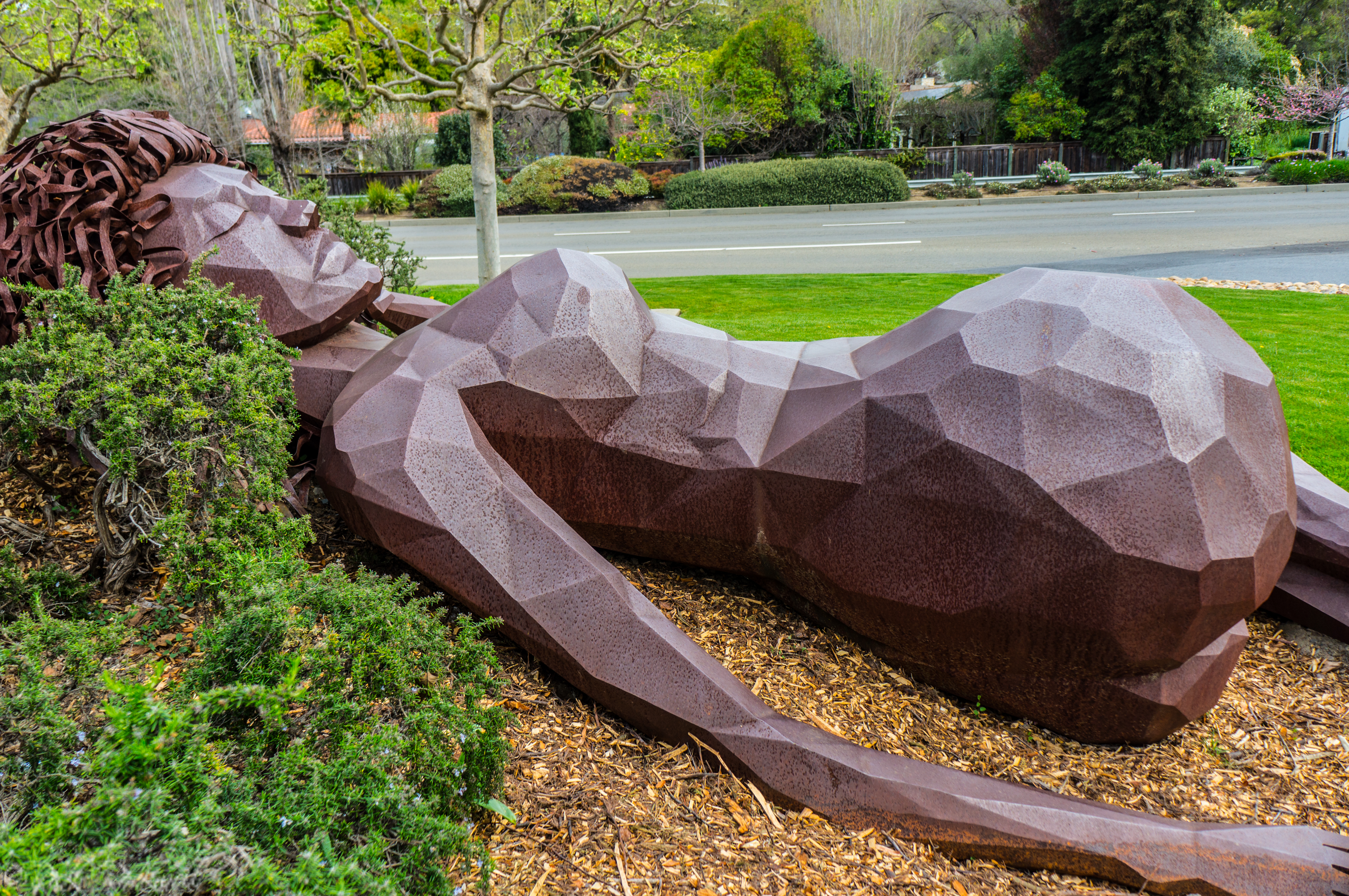
At the entrance to Bon Air Greenbrae, just off Sir Francis Drake Boulevard in Marin County, a giant reclining woman rests beside the shopping center like she is begging one obvious question: why is there a 17-foot nude statue here? That statue is the Tamalpais Maiden, a large public sculpture by Marin artist Dennis Patton. …...
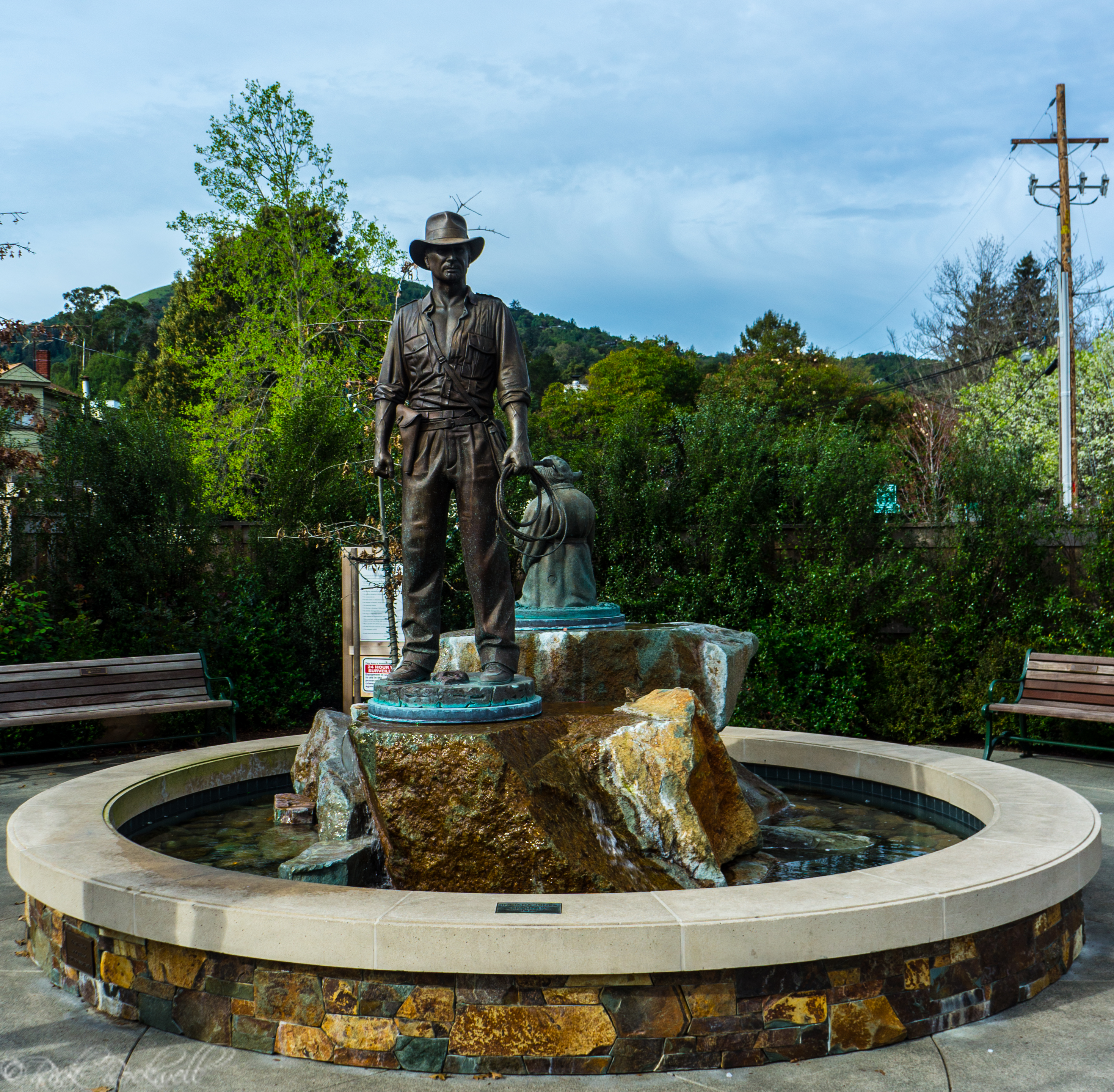
The force is strong at San Anselmo’s Imagination Park
For many, the Star Wars film franchise is more than just entertainment, it’s a way of life. And now, that way of life has just become a little bit more of a reality with Imagination Park. This 8,700 square foot park is where imagination comes to life with two statues that commemorate the incredible film …...
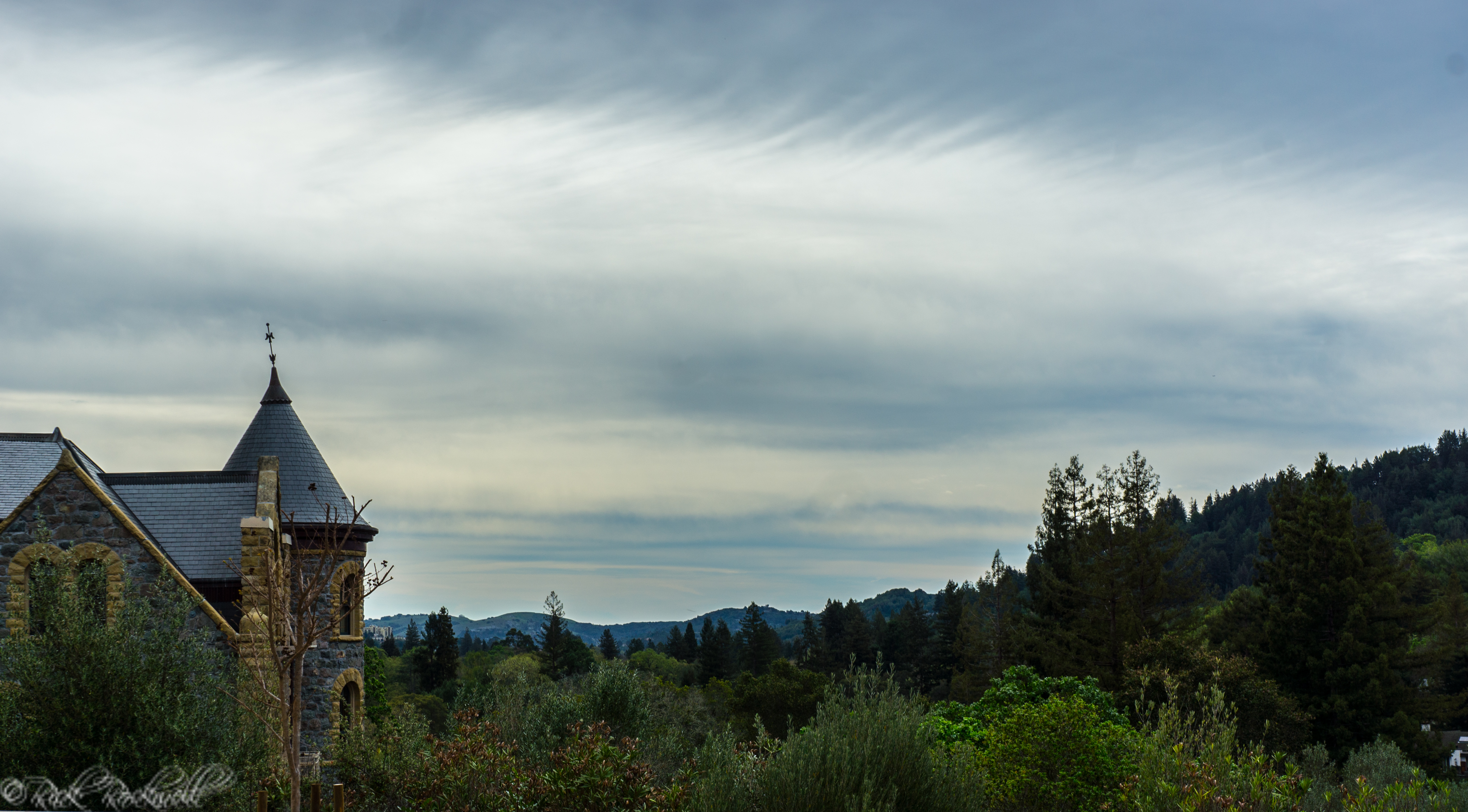
Castles on the Hill: the San Francisco Theological Seminary’s Montgomery and Scott Halls
On a knoll overlooking the town of San Anselmo, are two fairytale like castles positioned in the shadows of Mt. Tamalpais. These structures, which at one time flirted with a destructive fate, are the source of community pride and affectionately known as the “castles on the hill.” History In September of 1892, the San...
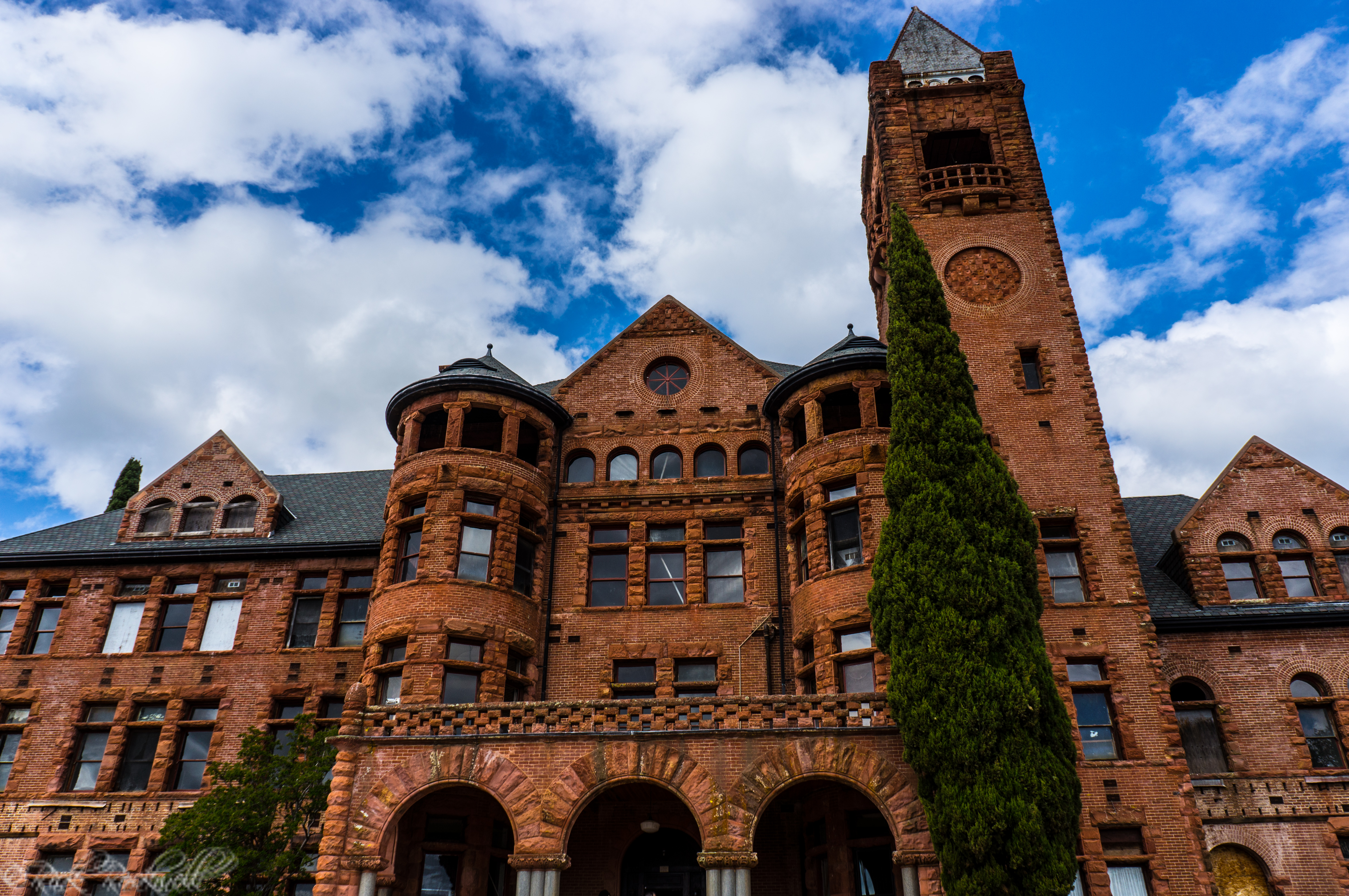
The Preston Castle: a tragic blend of mystery, history and horror
Perched on a hill overlooking the town of Ione, Ca, is an ominous presence that screams horror film and haunted encounters. Known as the Preston Castle, this menacing structure’s eerie appearance takes on a whole new level of frightening charm after one learns of its ghostly past. What had started out as a reform school …...
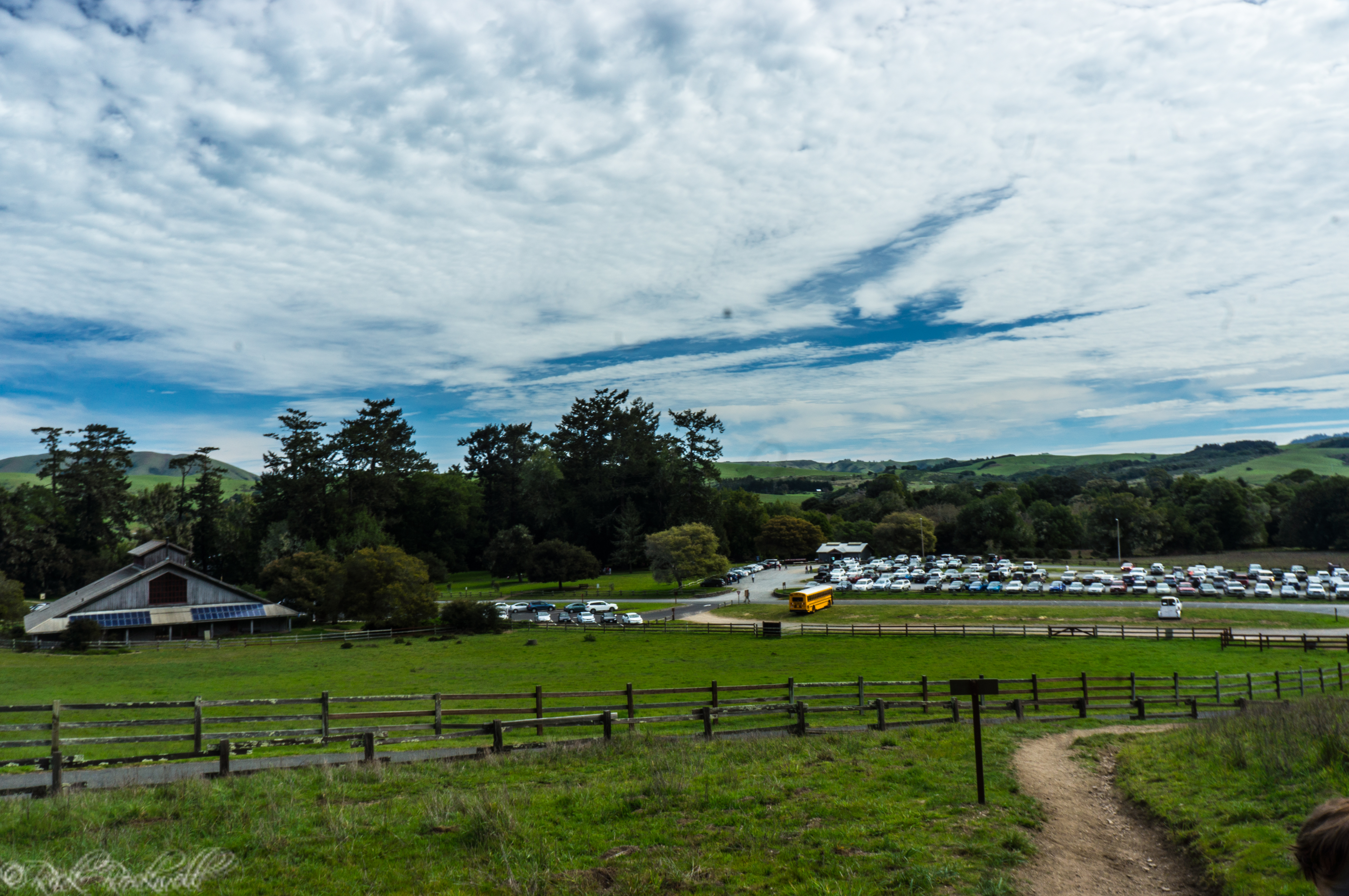
Bear Valley Visitor Center: start your Point Reyes National Seashore journey here
The 71,000 acre National Seashore has three visitor’s centers to help educate and guide the 2.5 million annual visitors. However, it’s the Bear Valley Visitor Center that’s considered the park’s headquarters and is my suggestion for the best place to start your Point Reyes National Seashore adventure. Start Here...
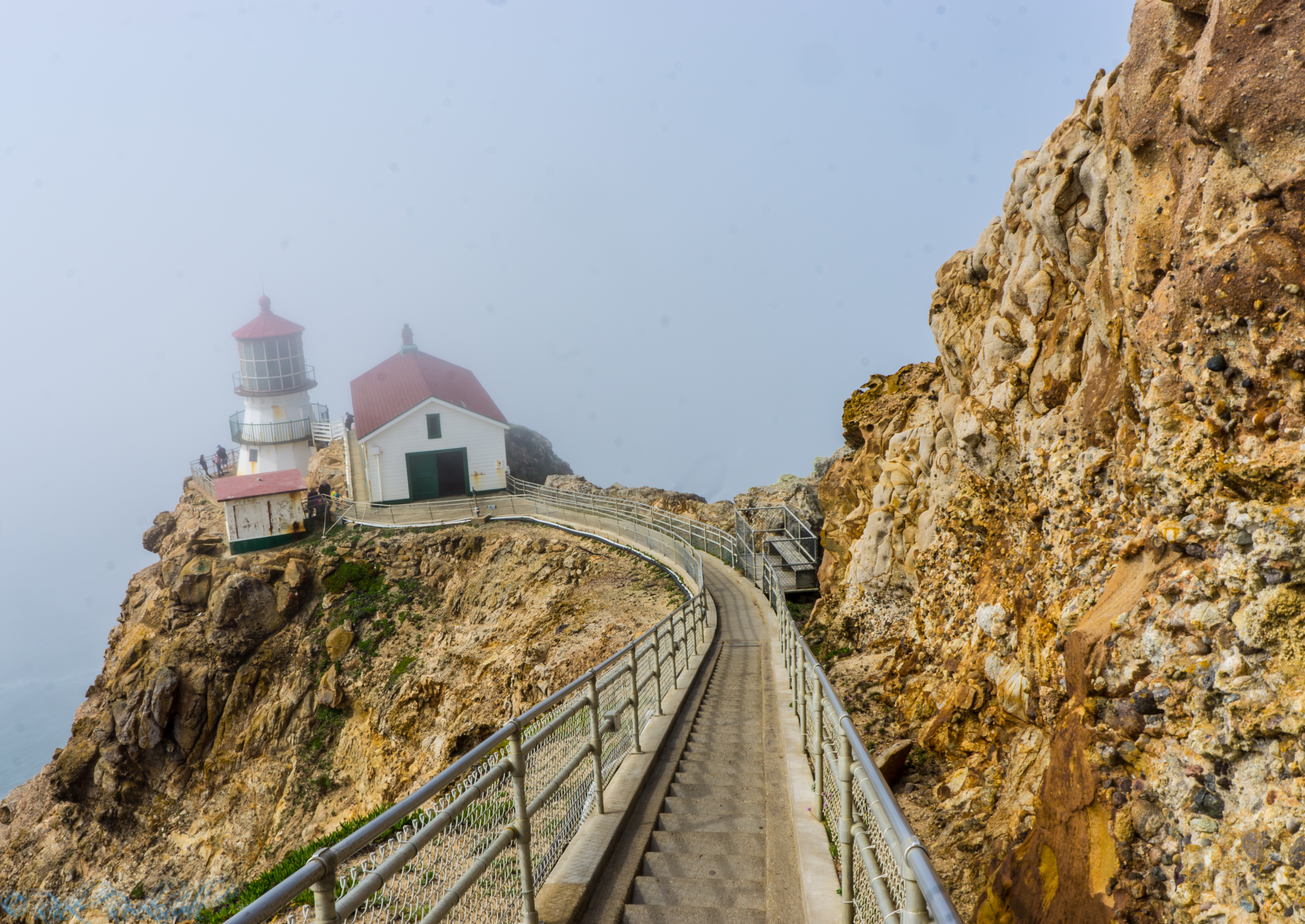
Point Reyes Lighthouse: 308 steps to the edge of a coastal abyss
Point Reyes is the second foggiest place in all of North America and the windiest place on the Pacific Coast. If you ever visit Point Reyes when the fog sets in, it’s as if this California lighthouse sits on the edge of a cliff that overlooks a lifeless grey abyss. This all-encompassing fog contributed to …...
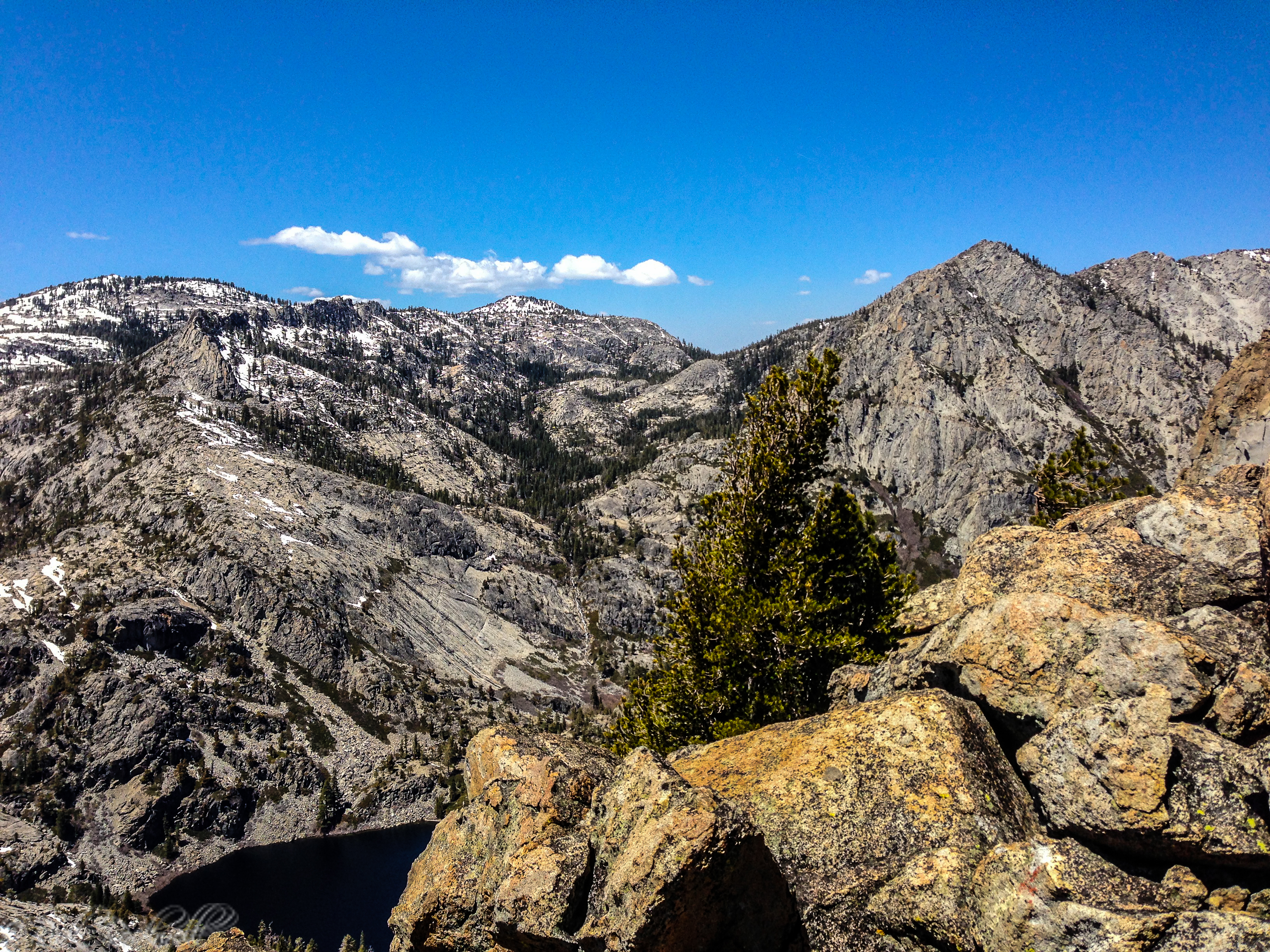
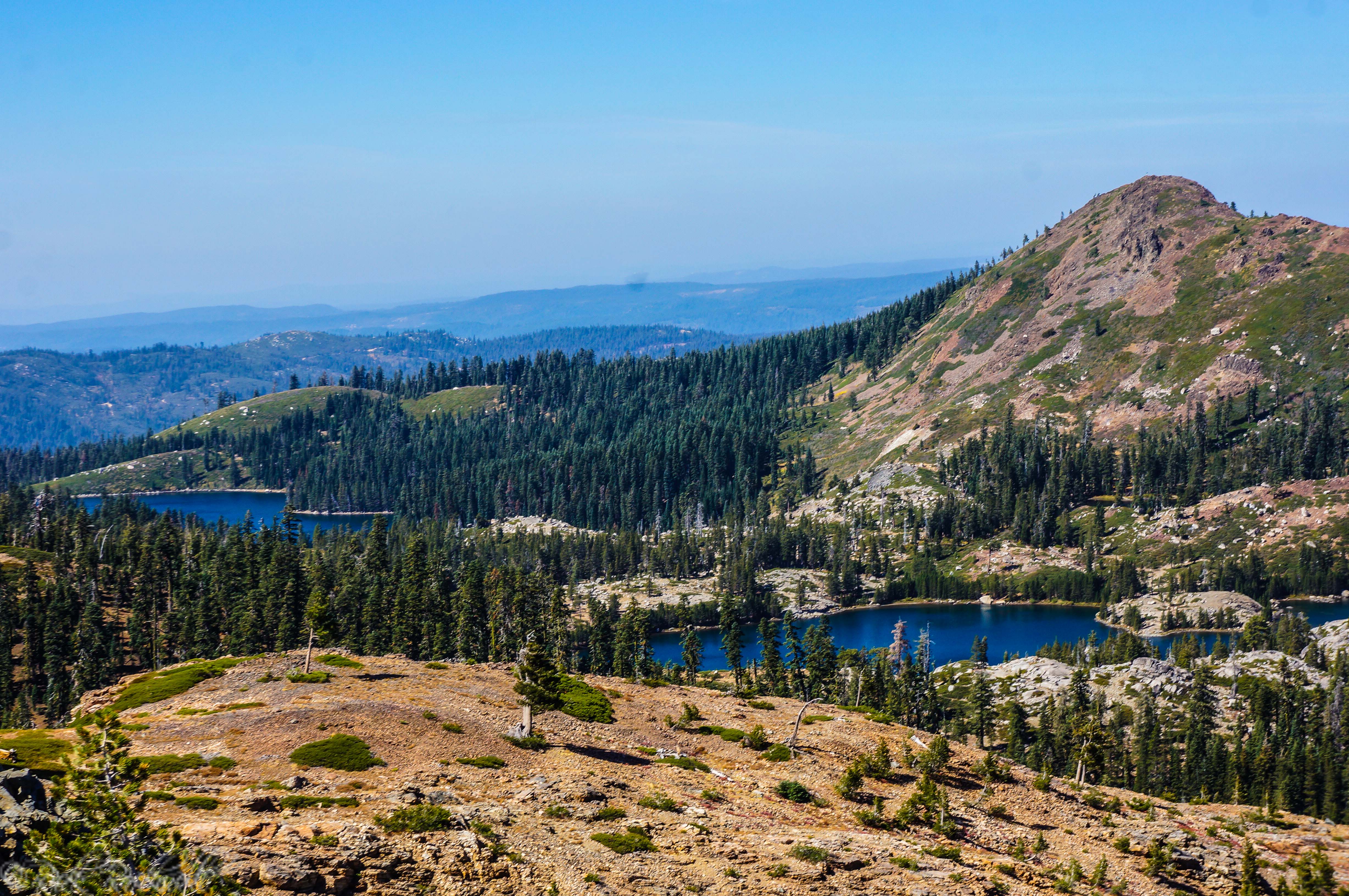
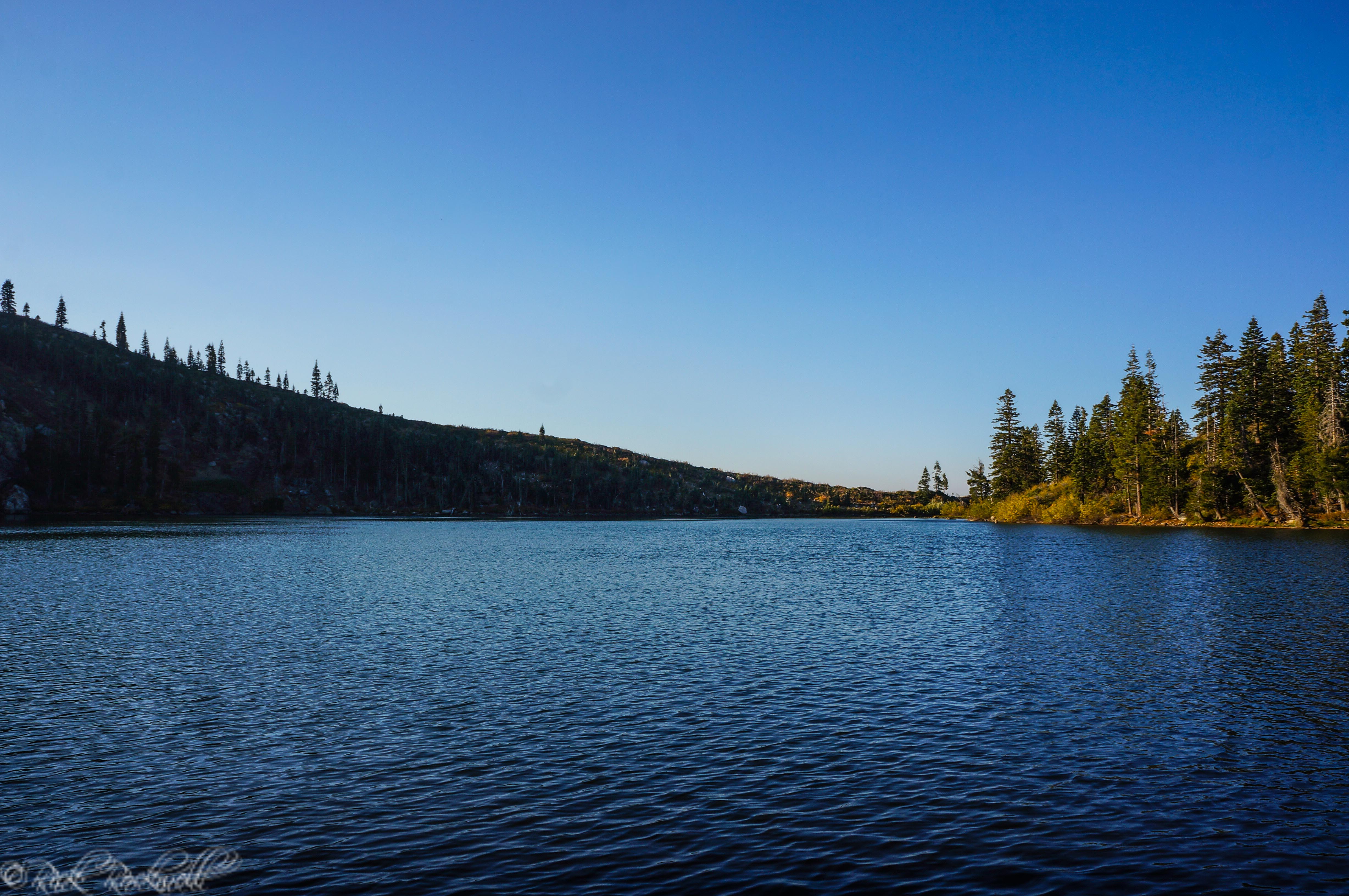
14 Tips for hiking in Desolation Wilderness
However, since Desolation Wilderness is filled with lakes, mountain peaks, changing weather and wildlife, it can also be a dangerous place for those who are inexperienced. The following is a list to better prepare you for your next Desolation Wilderness adventure: Plan Ahead – The best thing to do is to plan for your hike. …...

Victorian Village: the historical elegance and charm of Ferndale
Ferndale, where both charm and elegance resides, is a hidden treasure of California and one of the state’s most preserved villages. Finding Ferndale Getting to Ferndale requires a bit of patience. From Highway 101, take the Fernbridge/Ferndale exit. Immediately, turn onto Fernbridge Dr. which cuts through the tiny, historic town of...
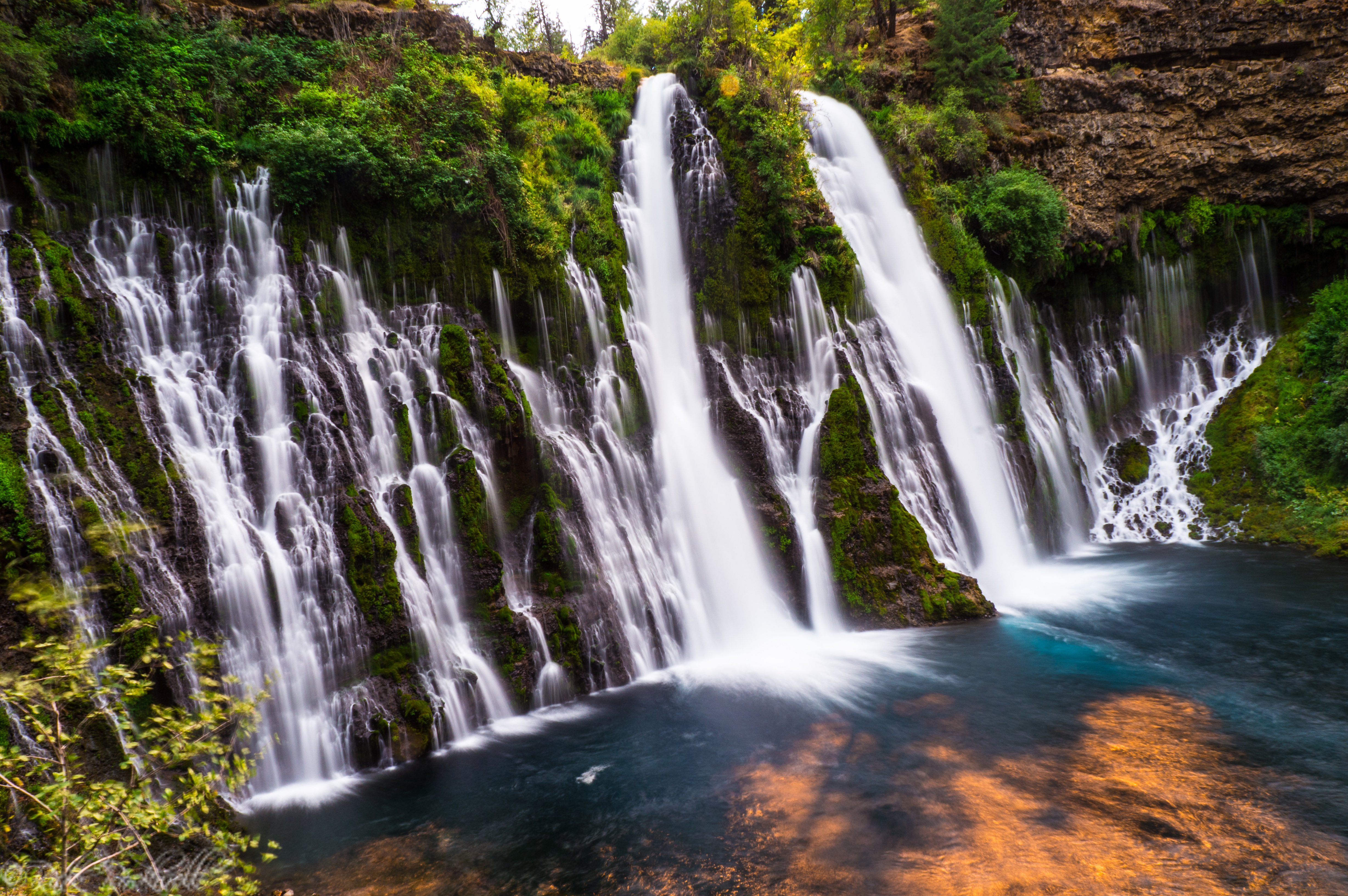
Burney Falls: California’s most incredible waterfall
Located in McArthur-Burney Falls Memorial State Park, this amazing 129 foot waterfall is one of the most exciting places to visit in all of California. As the centerpiece of 910 scenic acres, Burney Falls has a constant flow rate throughout the entire year, making it an enjoyable experience no matter the season. In 1984, Burney …...